Barn Wood

Wood, Forest in Gloucestershire Stroud

England

Barn Wood

Footpath near Whiteway
Footpath near Whiteway Credit: P Gaskell

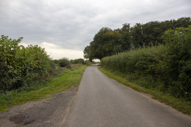
Barn Wood is a small village located in the county of Gloucestershire, England. Situated in the heart of the Forest of Dean, it is surrounded by beautiful woodlands and scenic landscapes, making it a popular destination for nature lovers and outdoor enthusiasts.

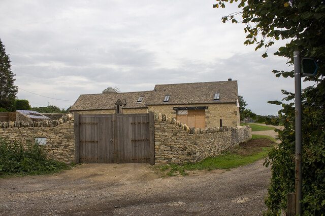
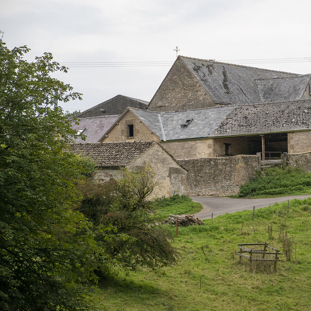
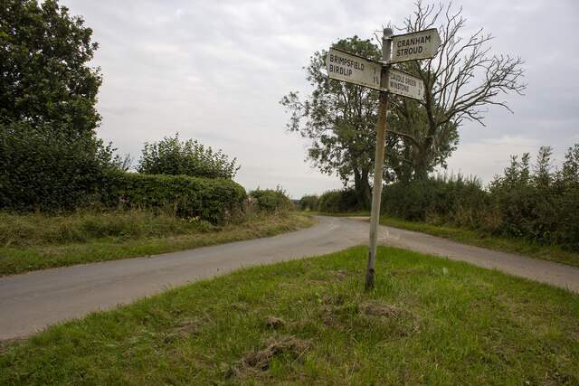
The village itself is quaint and picturesque, with a charming mix of traditional stone cottages and modern houses. It has a close-knit community, and residents often participate in various local events and activities. The village is well-connected to nearby towns and cities, with good transport links and easy access to major roads.

The main attraction of Barn Wood is undoubtedly its proximity to the vast forest that envelops the area. The Forest of Dean is one of the largest remaining ancient woodlands in England, spanning over 110 square kilometers. It is home to a diverse range of flora and fauna, including rare species such as the goshawk and the lesser horseshoe bat.

Visitors to Barn Wood can enjoy a plethora of outdoor activities, such as hiking, cycling, and horseback riding through the forest trails. The area is also popular for wildlife spotting, with opportunities to see deer, wild boar, and various bird species.

Overall, Barn Wood offers a peaceful retreat for those seeking a break from the hustle and bustle of city life. With its stunning natural surroundings and welcoming community, it is a place that truly embodies the beauty of the Gloucestershire countryside.

If you have any feedback on the listing, please let us know in the comments section below.
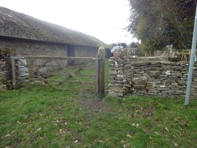
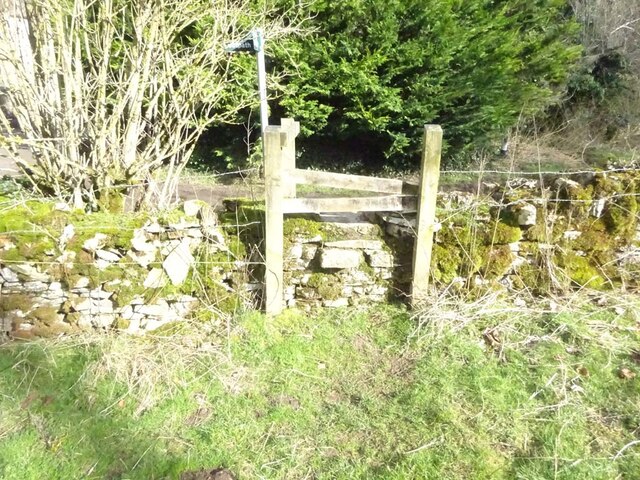
Barn Wood Images

Images are sourced within 2km of 51.796124/-2.1072407 or Grid Reference SO9210. Thanks to Geograph Open Source API. All images are credited.

Footpath near Whiteway
Whiteway Village
Whiteway Village
Wateredge Farm Converted farm building at Wateredge Farm
Wateredge Farm
Converted farm building at Wateredge Farm
Climperwell Farm
Climperwell Farm
Crossroads and signpost
Crossroad and woodland Crossroad and woodland near Longdole Polo Club
Crossroad and woodland
Crossroad and woodland near Longdole Polo Club
Stone Stile, Caudle Green Looking SW towards the village.
Stone Stile, Caudle Green
Looking SW towards the village.
Stone Stile, Caudle Green A step stile on the Northern side of the road approaching the village. On Gloucestershire footpath BBR28. The view from the road side is <a href="https://www.geograph.org.uk/photo/7061298">SO9410 : Stone Stile, Caudle Green</a>.
Stone Stile, Caudle Green
A step stile on the Northern side of the road approaching the village. On Gloucestershire footpath BBR28. The view from the road side is SO9410 : Stone Stile, Caudle Green.
Stone Stile, Caudle Green A step stile on the Northern side of the road approaching the village. On Gloucestershire footpath BBR28. The view from the appreciable drop on the other side is <a href="https://www.geograph.org.uk/photo/7061296">SO9410 : Stone Stile, Caudle Green</a>.
Stone Stile, Caudle Green
A step stile on the Northern side of the road approaching the village. On Gloucestershire footpath BBR28. The view from the appreciable drop on the other side is SO9410 : Stone Stile, Caudle Green.
Stone Stile, Caudle Green Looking into a field at the junction of Gloucestershire footpaths MMN23 & BBR38 where the paths transition from woodland to a field sparsely populated with "meadow flowers". The soil in the field is heavily laden with stones. The view towards the woodland is <a href="https://www.geograph.org.uk/photo/7104960">SO9310 : Stone Stile, Caudle Green</a>.
Stone Stile, Caudle Green
Looking into a field at the junction of Gloucestershire footpaths MMN23 & BBR38 where the paths transition from woodland to a field sparsely populated with "meadow flowers". The soil in the field is heavily laden with stones. The view towards the woodland is SO9310 : Stone Stile, Caudle Green.
Stone Stile, Caudle Green Looking from a field at the junction of Gloucestershire footpaths MMN23 & BBR38 where the paths transition from woodland to a field sparsely populated with "meadow flowers". The soil in the field is heavily laden with stones. The view from the woodland is <a href="https://www.geograph.org.uk/photo/7104958">SO9310 : Stone Stile, Caudle Green</a>.
Stone Stile, Caudle Green
Looking from a field at the junction of Gloucestershire footpaths MMN23 & BBR38 where the paths transition from woodland to a field sparsely populated with "meadow flowers". The soil in the field is heavily laden with stones. The view from the woodland is SO9310 : Stone Stile, Caudle Green.
Stone Stile, Caudle Green Due South of the village green at the junction of Gloucestershire footpaths MMN23 & BBR25 in woodland. This point is also on the boundaries of: county constituency, civil parishes of Miserden and Brimsfield, and the county district. This is the view looking NE, the view SW is <a href="https://www.geograph.org.uk/photo/7104970">SO9410 : Stone Stile, Caudle Green</a>.
Stone Stile, Caudle Green
Due South of the village green at the junction of Gloucestershire footpaths MMN23 & BBR25 in woodland. This point is also on the boundaries of: county constituency, civil parishes of Miserden and Brimsfield, and the county district. This is the view looking NE, the view SW is SO9410 : Stone Stile, Caudle Green.
Stone Stile, Caudle Green Due South of the village green at the junction of Gloucestershire footpaths MMN23 & BBR25 in woodland. This point is also on the boundaries of: county constituency, civil parishes of Miserden and Brimsfield, and the county district. This is the view looking SW, the view NE is <a href="https://www.geograph.org.uk/photo/7104969">SO9410 : Stone Stile, Caudle Green</a>.
Stone Stile, Caudle Green
Due South of the village green at the junction of Gloucestershire footpaths MMN23 & BBR25 in woodland. This point is also on the boundaries of: county constituency, civil parishes of Miserden and Brimsfield, and the county district. This is the view looking SW, the view NE is SO9410 : Stone Stile, Caudle Green.
Stone Stile, Caudle Green From a small field into a grazing field at the SE corner of the garden walls of 'Calley House'. This is looking SW away from the village, the view towards the village is <a href="https://www.geograph.org.uk/photo/7104983">SO9410 : Stone Stile, Caudle Green</a>.
Stone Stile, Caudle Green
From a small field into a grazing field at the SE corner of the garden walls of 'Calley House'. This is looking SW away from the village, the view towards the village is SO9410 : Stone Stile, Caudle Green.
Stone Stile, Caudle Green From a small field in to a grazing field at the SE corner of the garden wals of 'Calley House'. This is looking NE towards the village, the view towards the larger field is <a href="https://www.geograph.org.uk/photo/7104981">SO9410 : Stone Stile, Caudle Green</a>.
Stone Stile, Caudle Green
From a small field in to a grazing field at the SE corner of the garden wals of 'Calley House'. This is looking NE towards the village, the view towards the larger field is SO9410 : Stone Stile, Caudle Green.
Stone Stile, Caudle Green A step Stile off the Southern side of the village green on Gloucestershire footpath BBR25. This is looking to the village green, the view from the green is <a href="https://www.geograph.org.uk/photo/7104992">SO9410 : Stone Stile, Caudle Green</a>.
Stone Stile, Caudle Green
A step Stile off the Southern side of the village green on Gloucestershire footpath BBR25. This is looking to the village green, the view from the green is SO9410 : Stone Stile, Caudle Green.
Stone Stile, Caudle Green A step Stile off the Southern side of the village green on Gloucestershire footpath BBR25. This is looking from the village green, the view toward the green is <a href="https://www.geograph.org.uk/photo/7104990">SO9410 : Stone Stile, Caudle Green</a>.
Stone Stile, Caudle Green
A step Stile off the Southern side of the village green on Gloucestershire footpath BBR25. This is looking from the village green, the view toward the green is SO9410 : Stone Stile, Caudle Green.
Stone Stile, Caudle Green A step stile. Looking out of the field on Gloucestershire footpath BBR28 to the road. The view from the road is <a href="https://www.geograph.org.uk/photo/7041359">SO9410 : Stone Stile, Caudle Green</a>.
Stone Stile, Caudle Green
A step stile. Looking out of the field on Gloucestershire footpath BBR28 to the road. The view from the road is SO9410 : Stone Stile, Caudle Green.
Show me another place!

Barn Wood is located at Grid Ref: SO9210 (Lat: 51.796124, Lng: -2.1072407)

Administrative County: Gloucestershire

District: Stroud

Police Authority: Gloucestershire

What 3 Words

///bullion.picture.suspend. Near Painswick, Gloucestershire

Nearby Locations

Barn Wood

Related Wikis

Brimpsfield

Brimpsfield is a village in Gloucestershire, England. The village is recorded in Domesday Book as Brimesfelde. Brimpsfield Castle was built in the village...

Whiteway Colony

Whiteway Colony is a residential community in the Cotswolds in the parish of Miserden near Stroud, Gloucestershire, United Kingdom. The community was founded...

Miserden

Miserden is a village and civil parish in Stroud District, Gloucestershire, England, 4 miles north east of Stroud. The parish includes Whiteway Colony...

The Camp, Gloucestershire

The Camp is a hamlet in the south of Gloucestershire, approximately 10 miles south of Cheltenham and 5 miles north-east of Stroud. It is in the parish...

Miserden War Memorial

Miserden War Memorial is a First World War memorial in the village of Miserden, near Stroud, in Gloucestershire, south-western England. The memorial, designed...

Church of St Mary the Virgin, Syde

The Anglican Church of St Mary the Virgin at Syde in the Cotswold District of Gloucestershire, England was built in the early 12th century. It is a grade...

Syde

Syde, often in the past spelt Side, is a small village and civil parish in Gloucestershire, England. It lies in the Cotswolds, near the source of the River...

Miserden Castle

Miserden Castle was a castle near the village of Miserden in Gloucestershire, England. The castle is a large motte and bailey Norman castle, built before...

Nearby Amenities

Located within 500m of 51.796124,-2.1072407
Archaeological Site: tumulus
Historic: archaeological_site
Source: NPE
Lat/Long: 51.7921248/-2.1055232
The data included in this document is from www.openstreetmap.org. The data is made available under ODbL.

Have you been to Barn Wood?

Leave your review of Barn Wood below (or comments, questions and feedback).