Cropston

Settlement in Leicestershire Charnwood

England

Cropston

Anstey Lane, Thurcaston
Anstey Lane, Thurcaston Credit: David Howard

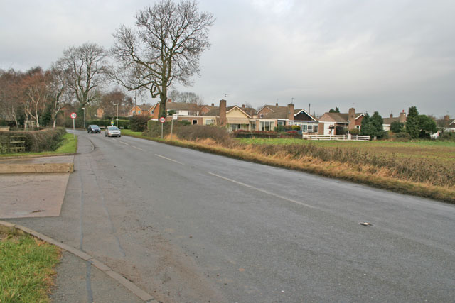
Cropston is a charming village located in the county of Leicestershire, England. Situated on the eastern fringes of Charnwood Forest, it is nestled amidst picturesque countryside and offers a tranquil retreat for residents and visitors alike.

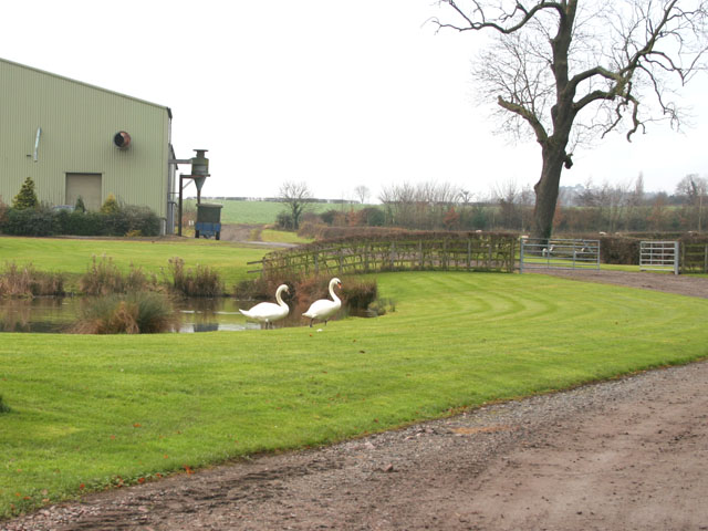
With a population of around 700 residents, Cropston exudes a close-knit community spirit. The village is characterized by its stunning natural surroundings, with rolling hills, lush green fields, and ancient woodlands providing a scenic backdrop. It is no surprise that the village is a popular destination for outdoor enthusiasts, offering an abundance of walking and cycling trails to explore.

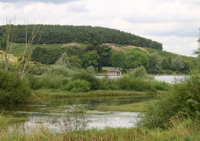
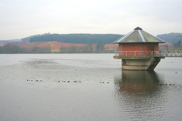
At the heart of Cropston lies the picturesque Cropston Reservoir, a man-made lake that serves as a local nature reserve and a haven for wildlife. The reservoir attracts an array of birds, making it a paradise for birdwatchers. Boating and fishing activities are also available for those seeking a leisurely day on the water.

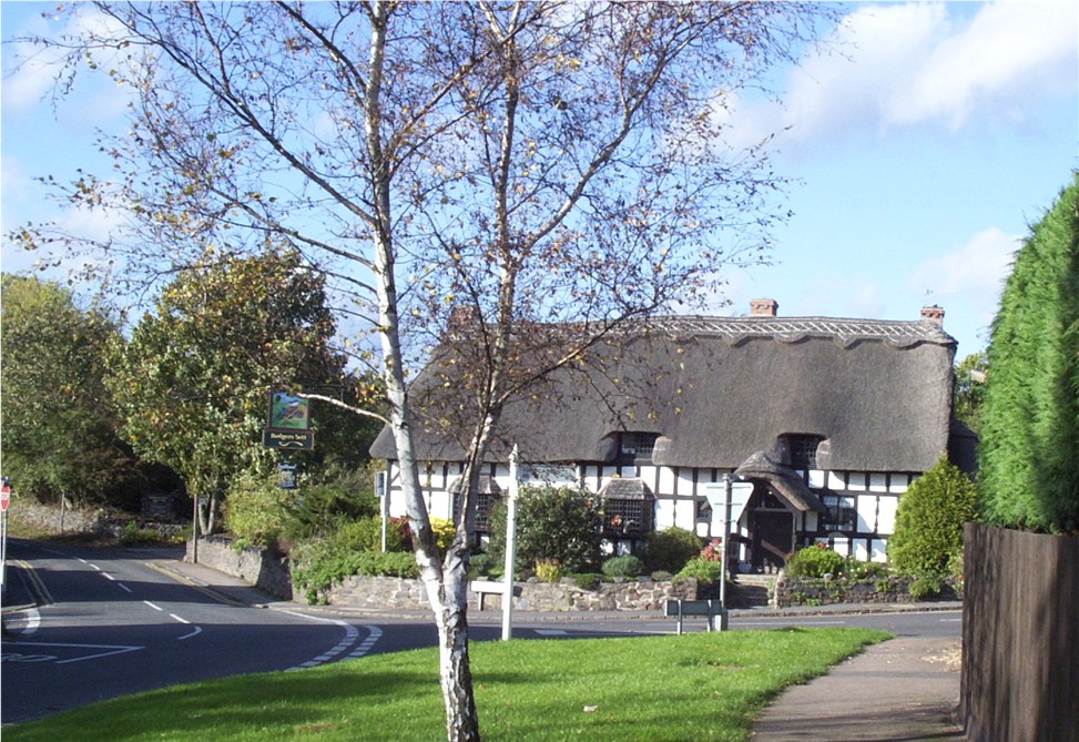
The village itself boasts a historic charm, with a number of traditional cottages and buildings that have retained their character. The local pub, The Bradgate Arms, is a popular gathering spot for locals and visitors, offering a warm and friendly atmosphere.

Cropston is also fortunate to be in close proximity to the neighboring villages of Anstey and Newtown Linford, as well as the renowned Bradgate Park, which is famous for its association with Lady Jane Grey, the "Nine Days' Queen" of England.

In conclusion, Cropston is a delightful village that offers a harmonious blend of natural beauty, community spirit, and historical significance. Its idyllic setting and warm atmosphere make it a truly special place to visit or call home.

If you have any feedback on the listing, please let us know in the comments section below.

Cropston Images

Images are sourced within 2km of 52.695967/-1.178729 or Grid Reference SK5511. Thanks to Geograph Open Source API. All images are credited.

Anstey Lane, Thurcaston
Castle Hill Country Park, Anstey
Castle Hill Country Park, Anstey After a previous day of heavy rain.
Castle Hill Country Park, Anstey
After a previous day of heavy rain.
Castle Hill Country Park, Anstey After a day of heavy rain. I wasn't going any further.
Castle Hill Country Park, Anstey
After a day of heavy rain. I wasn't going any further.
Flood at the entrance to Castle Hill Country Park, Anstey
Large puddle on Anstey Lane By Castle Hill Park which was also flooded.
Large puddle on Anstey Lane
By Castle Hill Park which was also flooded.
Large puddle on Anstey Lane By Castle Hill Park
Large puddle on Anstey Lane
By Castle Hill Park
Anstey Lane towards Thurcaston
New houses on Cropston Road, Anstey I have read there are now no minimum sizes for windows on new houses so many are being made as small as possible to cut costs. <span class="nowrap"><a title="https://www.fromthemurkydepths.co.uk/2021/01/26/smaller-windows-coming-to-new-build-homes-government-consultation-raises-possibility/" rel="nofollow ugc noopener" href="https://www.fromthemurkydepths.co.uk/2021/01/26/smaller-windows-coming-to-new-build-homes-government-consultation-raises-possibility/">Link</a><img style="margin-left:2px;" alt="External link" title="External link - shift click to open in new window" src="https://s1.geograph.org.uk/img/external.png" width="10" height="10"/></span>
New houses on Cropston Road, Anstey
I have read there are now no minimum sizes for windows on new houses so many are being made as small as possible to cut costs. LinkExternal link
St Leonards, Swithland
Boathouse and Cropston Reservoir The paths in Bradgate park lead round this reservoir.
Boathouse and Cropston Reservoir
The paths in Bradgate park lead round this reservoir.
Rothley Station Rothley Station on the preserved Great Central Railway.
Rothley Station
Rothley Station on the preserved Great Central Railway.
All Saints Church, Thurcaston near Leicester
Station Road, Cropston, near Leicester Station Road meets Reservoir Road, Cropston Road and Causeway Lane at this crossroad in the centre of the old village.
Station Road, Cropston, near Leicester
Station Road meets Reservoir Road, Cropston Road and Causeway Lane at this crossroad in the centre of the old village.
Cropston House Farm This farm is on the southern edge of the village
Cropston House Farm
This farm is on the southern edge of the village
Cropston Road, Cropston near Leicester Cropston has grown into a substantial village. These houses are on Waterfield Road.
Cropston Road, Cropston near Leicester
Cropston has grown into a substantial village. These houses are on Waterfield Road.
Cropston Reservoir, near Leicester To the east of Bradgate Park, this Severn Trent reservoir was constructed in 1866 to supply water to Leicester. It is important for wildlife and has an Education Centre. Taken from Reservoir Road on the embankment.
Cropston Reservoir, near Leicester
To the east of Bradgate Park, this Severn Trent reservoir was constructed in 1866 to supply water to Leicester. It is important for wildlife and has an Education Centre. Taken from Reservoir Road on the embankment.
Cropston Reservoir, near Leicester This semi-circular weir in the south east corner is the emergency overflow for the reservoir. It appears that it hasn't been needed for a long time. See <a href="https://www.geograph.org.uk/photo/93663">SK5511 : Reservoir Spillway, Cropston</a>.
Cropston Reservoir, near Leicester
This semi-circular weir in the south east corner is the emergency overflow for the reservoir. It appears that it hasn't been needed for a long time. See SK5511 : Reservoir Spillway, Cropston.
Show me another place!

Cropston is located at Grid Ref: SK5511 (Lat: 52.695967, Lng: -1.178729)

Administrative County: Leicestershire

District: Charnwood

Police Authority: Leicestershire

What 3 Words

///treat.skins.piles. Near Anstey, Leicestershire

Nearby Locations

Exning Spinney Cropston

Related Wikis

Cropston

Cropston is a village and former civil parish, now in the parish of Thurcaston and Cropston, part of the Borough of Charnwood in Leicestershire, England...

Thurcaston and Cropston

Thurcaston and Cropston is a civil parish in Leicestershire, England. As its name suggests, it consists of the villages of Thurcaston and Cropston. The...
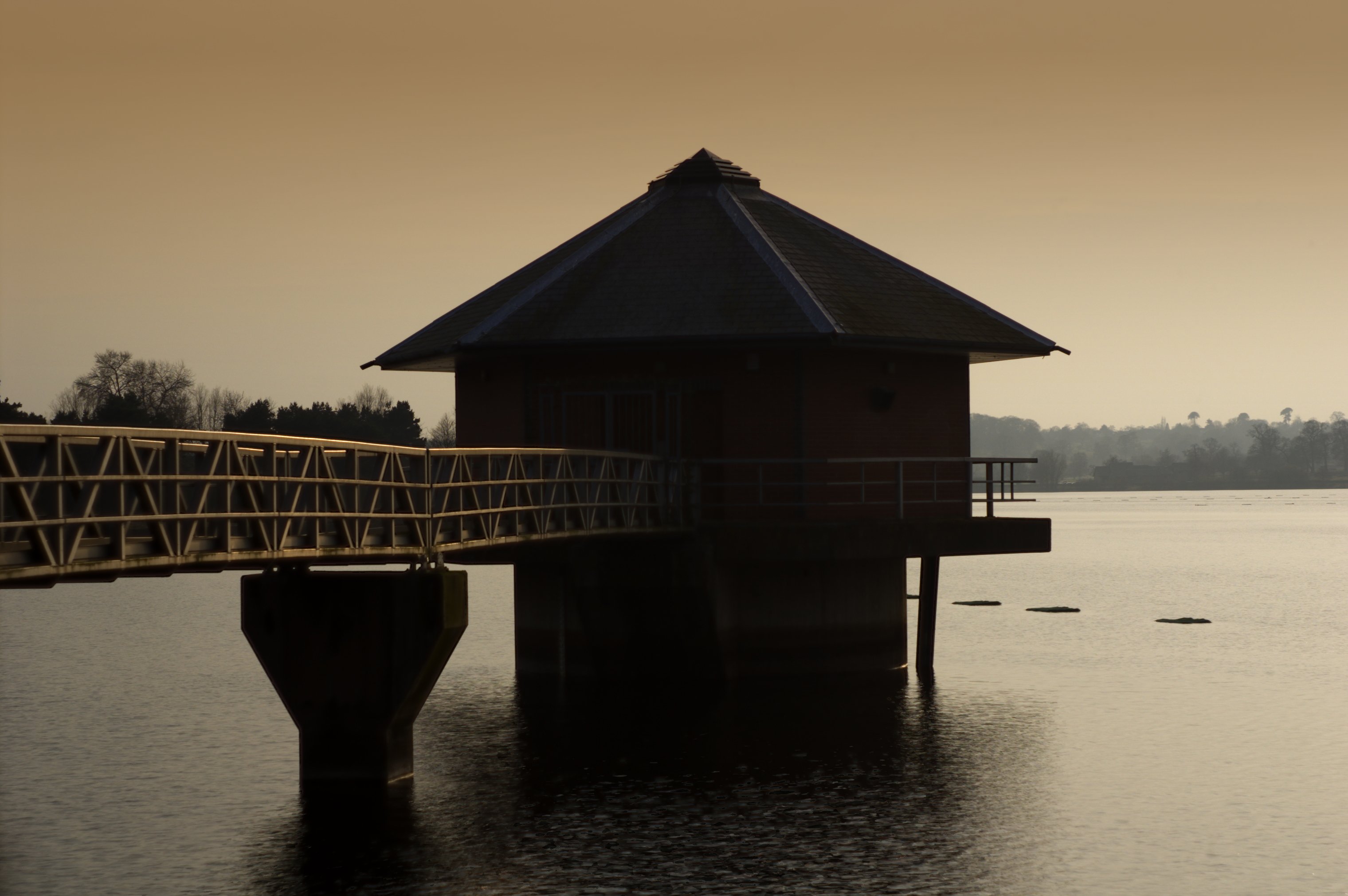
Cropston Reservoir

Cropston Reservoir (originally known as Bradgate Reservoir) lies in Charnwood Forest in Leicestershire, England. The dam and associated water works are...

Mountsorrel Cross

The Mountsorrel Cross is a market cross that dates from the Middle Ages. It originally stood on Main Street in the village of Mountsorrel, Leicestershire...

Nearby Amenities

Located within 500m of 52.695967,-1.178729
Reservoir Crossroads
Lat/Long: 52.692711/-1.1825773
Cropston
Is In Country: UK
Is In County: Leicestershire
Is In District: Charnwood
Place: village
Wikidata: Q5187997
Lat/Long: 52.6926689/-1.1816586
Pub
Bradgate Arms
Website: https://www.bradgatearmscropstonleicestershire.co.uk/
Lat/Long: 52.6929284/-1.1809622
Post Box
Lat/Long: 52.6980871/-1.1724885
Pub
Badger's Sett
Brand: Vintage Inns
Brand Wikidata: Q87067899
Contact Website: https://www.vintageinn.co.uk/restaurants/midlands/thebadgerssettcropston
Lat/Long: 52.6934128/-1.1831375
Post Box
Post Box Type: pillar
Lat/Long: 52.6933873/-1.1802915
Bus Stop
Tour Bus Stop
Bus: yes
Naptan AtcoCode: 260000T15
Naptan Bearing: W
Naptan BusStopType: CUS
Naptan CommonName: Tour Bus Stop
Naptan Indicator: adj
Naptan Landmark: Bradgate Arms
Naptan NaptanCode: leiwtwta
Naptan Notes: Created for Charnwood Tour 2007
Naptan Street: Station Road
Naptan Verified: no
Public Transport: platform
Source: naptan_import
Lat/Long: 52.6930211/-1.1810669
Bus Stop
Causeway Lane
Bus: yes
Naptan AtcoCode: 260009001
Naptan Bearing: W
Naptan CommonName: Causeway Lane
Naptan Indicator: 50m after
Naptan Landmark: junction Causeway Lane
Naptan NaptanCode: leidwpap
Naptan Notes: Hourly - County
Naptan Street: Reservoir Road
Naptan Verified: no
Public Transport: platform
Source: naptan_import
Lat/Long: 52.6928145/-1.1834898
Bus Stop
Bradgate Arms
Alt Name: Cropston - Station Road
Bus: yes
Naptan AltCommonName: Cropston - Station Road
Naptan AtcoCode: 260009004
Naptan Bearing: E
Naptan CommonName: Bradgate Arms
Naptan Indicator: adj
Naptan Landmark: 20 Station Road
Naptan NaptanCode: leidwpda
Naptan Notes: Hourly - County
Naptan Street: Station Road
Naptan Verified: no
Public Transport: platform
Source: naptan_import
Lat/Long: 52.6929995/-1.1816368
Bus Stop
Guild Close
Bus: yes
Naptan AtcoCode: 260009005
Naptan Bearing: N
Naptan CommonName: Guild Close
Naptan Indicator: adjacent
Naptan Landmark: Guild Close
Naptan NaptanCode: leidwpdg
Naptan Notes: Hourly - County
Naptan Street: Station Road
Naptan Verified: no
Public Transport: platform
Source: naptan_import
Lat/Long: 52.6948854/-1.1774435
Bus Stop
Sandham Bridge Road
Bus: yes
Naptan AtcoCode: 260009006
Naptan NaptanCode: leidwpdj
Public Transport: platform
Shelter: yes
Source: Manual - Previous Naptan import wrong
Lat/Long: 52.6962031/-1.1755986
Bus Stop
Bradgate Road
Bus: yes
Naptan AtcoCode: 260009009
Naptan Bearing: SW
Naptan CommonName: Bradgate Road
Naptan Indicator: opposite
Naptan Landmark: Bradgate Road
Naptan NaptanCode: leidwpdt
Naptan Notes: Hourly - County
Naptan Street: Station Road
Naptan Verified: no
Public Transport: platform
Source: naptan_import
Lat/Long: 52.6979634/-1.1727538
Bus Stop
opp TCB
Bus: yes
Naptan AtcoCode: 260009011
Naptan Bearing: S
Naptan CommonName: opp TCB
Naptan Indicator: opposite
Naptan Landmark: TCB
Naptan NaptanCode: leidwpga
Naptan Notes: Hourly - County
Naptan Street: Station Road
Naptan Verified: no
Public Transport: platform
Source: naptan_import
Lat/Long: 52.6945285/-1.1778349
Bus Stop
Bradgate Arms
Alt Name: Cropston - Station Road
Bus: yes
Naptan AltCommonName: Cropston - Station Road
Naptan AtcoCode: 260009012
Naptan Bearing: SW
Naptan CommonName: Bradgate Arms
Naptan Indicator: outside
Naptan Landmark: Bradgate Arms
Naptan NaptanCode: leidwpgd
Naptan Notes: Hourly - County
Naptan Street: Station Road
Naptan Verified: no
Public Transport: platform
Source: naptan_import
Lat/Long: 52.6931642/-1.1807396
Bus Stop
Causeway Lane
Bus: yes
Naptan AtcoCode: 260009025
Naptan Bearing: SE
Naptan CommonName: Causeway Lane
Naptan Indicator: 50m before
Naptan Landmark: junction Causeway Lane
Naptan NaptanCode: leidwpma
Naptan Notes: Hourly - County
Naptan Street: Reservoir Road
Naptan Verified: no
Public Transport: platform
Source: naptan_import
Lat/Long: 52.6928556/-1.1830011
Barrier: kissing_gate
Lat/Long: 52.6949655/-1.1724137
Generator Method: photovoltaic
Generator Output Electricity: yes
Generator Source: solar
Generator Type: solar_photovoltaic_panel
Location: roof
Power: generator
Lat/Long: 52.6946152/-1.1758938
Generator Method: photovoltaic
Generator Output Electricity: yes
Generator Source: solar
Generator Type: solar_photovoltaic_panel
Location: roof
Power: generator
Lat/Long: 52.6949501/-1.1734021
Generator Method: photovoltaic
Generator Output Electricity: yes
Generator Source: solar
Generator Type: solar_photovoltaic_panel
Location: roof
Power: generator
Lat/Long: 52.6963814/-1.1747552
Generator Method: photovoltaic
Generator Output Electricity: yes
Generator Source: solar
Generator Type: solar_photovoltaic_panel
Location: roof
Power: generator
Lat/Long: 52.6919557/-1.1807165
Generator Method: photovoltaic
Generator Output Electricity: yes
Generator Source: solar
Generator Type: solar_photovoltaic_panel
Location: roof
Power: generator
Lat/Long: 52.696405/-1.1748277
Defibrillator
Booth: KX100
Covered: booth
Defibrillator Location: inside old phone box, Station Road, Cropston
Disused Amenity: telephone
Emergency: defibrillator
Man Made: telephone_box
Lat/Long: 52.6946746/-1.1777894
Bench
Lat/Long: 52.6938322/-1.179543
Public Bookcase
Public Bookcase Type: wooden_cabinet
Lat/Long: 52.6937195/-1.1799685
The data included in this document is from www.openstreetmap.org. The data is made available under ODbL.

Have you been to Cropston?

Leave your review of Cropston below (or comments, questions and feedback).