Barns Wood
Wood, Forest in Northumberland
England
Barns Wood

Barns Wood is a picturesque woodland located in the county of Northumberland, in the northeast region of England. Covering an area of approximately 100 acres, this enchanting forest is a haven for nature enthusiasts and offers a peaceful retreat from the bustling urban areas nearby.
The wood is characterized by its diverse range of indigenous tree species, including oak, beech, birch, and ash, which create a rich tapestry of colors throughout the year. These towering trees provide a dense canopy, allowing only dappled sunlight to filter through to the forest floor, creating an ethereal atmosphere.
Walking through Barns Wood, visitors are greeted by a symphony of bird songs and the occasional rustling of small woodland creatures. The forest is a sanctuary for a variety of wildlife, including deer, foxes, squirrels, and a plethora of bird species, making it a fantastic location for birdwatching and wildlife photography.
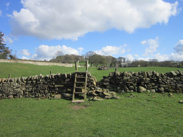
Tranquil pathways wind their way through the wood, allowing visitors to explore its hidden corners and discover its many charms. There are several well-marked trails that cater to both casual walkers and more adventurous hikers, offering a range of difficulty levels.
Barns Wood is a popular destination for nature walks, picnics, and family outings. The serene atmosphere and natural beauty make it an ideal spot for escaping the stresses of everyday life and reconnecting with nature. Whether it's immersing oneself in the vibrant autumn foliage or enjoying a leisurely stroll in the springtime, Barns Wood offers a delightful experience for all nature lovers.
If you have any feedback on the listing, please let us know in the comments section below.
Barns Wood Images
Images are sourced within 2km of 55.004912/-2.1214939 or Grid Reference NY9267. Thanks to Geograph Open Source API. All images are credited.


Barns Wood is located at Grid Ref: NY9267 (Lat: 55.004912, Lng: -2.1214939)
Unitary Authority: Northumberland
Police Authority: Northumbria
What 3 Words
///rebounded.green.goodbyes. Near Wall, Northumberland
Nearby Locations
Related Wikis

Wall railway station
Wall railway station served the village of Wall, Northumberland, England from 1858 to 1955 on the Border Counties Railway. == History == The station opened...

Wall, Northumberland
Wall is a village in Northumberland, England situated to the north of Hexham close by the River North Tyne and Hadrian's Wall. The Battle of Heavenfield...

Warden, Northumberland
Warden is a village in Northumberland, England about 2 miles (3 km) west of Hexham. The North and South Tyne meet near the village of Warden. There is...

Bridge End, Northumberland
Bridge End is a village in Northumberland, England. It is situated to the west of Hexham, on the north bank of the River South Tyne. The North and South...
Acomb, Northumberland
Acomb is a village in the south of Northumberland, England. The population at the 2001 Census was 1,184 increasing to 1,268 at the 2011 Census. It is situated...
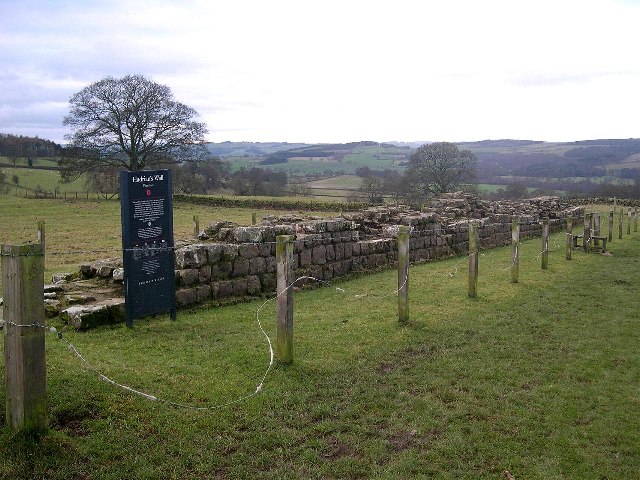
Planetrees (Hadrian's Wall section)
Planetrees is an extant section of Hadrian's Wall named after the farm located around 250 metres (270 yd) to the west. The surviving section is 35 metres...

Milecastle 26
Milecastle 26 (Planetrees) was a milecastle of the Roman Hadrian's Wall. Its position is slightly to the south of, but mostly covered by the B6318 Military...

Walwick Grange
Walwick Grange is a privately owned 18th-century country house ( now a farmhouse) situated on the bank of the River North Tyne close to Hadrian's Wall...
Nearby Amenities
Located within 500m of 55.004912,-2.1214939Have you been to Barns Wood?
Leave your review of Barns Wood below (or comments, questions and feedback).