Crookston

Settlement in Renfrewshire

Scotland

Crookston

Barshaw Park, Paisley
Barshaw Park, Paisley Credit: G McK

Crookston is a small village located in Renfrewshire, Scotland. Situated just 6 miles southwest of Glasgow city center, it is part of the Greater Glasgow urban area. The village is bordered by the M8 motorway to the north, making it easily accessible for commuters and visitors alike.

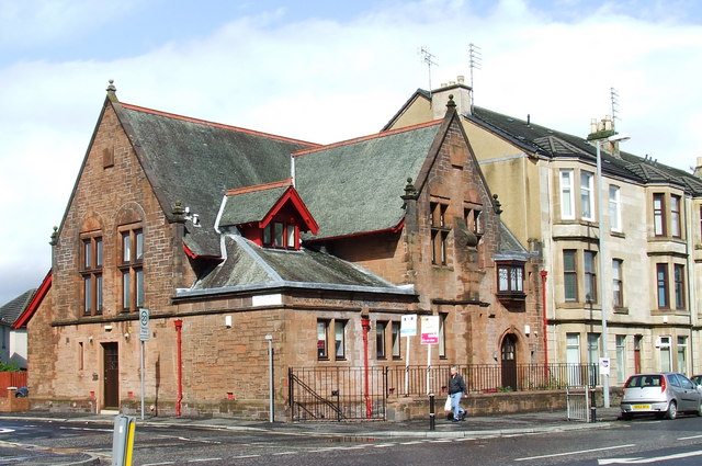
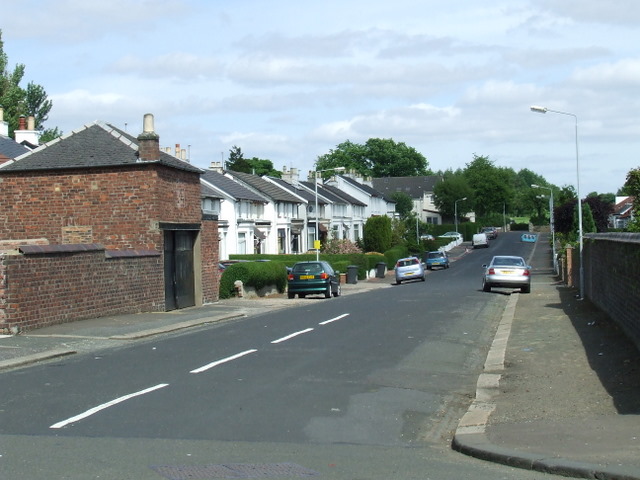
Crookston is primarily a residential area, characterized by well-maintained homes and a peaceful atmosphere. The village offers a range of housing options, from detached houses to apartments, catering to various needs and preferences. The community is known for its friendly and close-knit nature, with residents often engaging in local activities and events.

Despite its small size, Crookston benefits from its proximity to Glasgow, providing residents with easy access to a wide range of amenities and services. The city center offers a plethora of shopping centers, restaurants, and entertainment options, ensuring that residents have everything they need within a short distance.

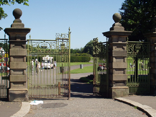
For those seeking outdoor activities, Crookston offers several parks and green spaces nearby. Bellahouston Park, located just a short drive away, is a popular destination, featuring extensive walking paths, sports facilities, and beautiful gardens. Additionally, the village is surrounded by picturesque countryside, making it an ideal location for nature lovers and those who enjoy outdoor pursuits.

In conclusion, Crookston is a tranquil residential village situated near Glasgow. With its friendly community, easy access to amenities, and proximity to stunning natural surroundings, it offers a balanced and desirable living environment.

If you have any feedback on the listing, please let us know in the comments section below.

Crookston Images

Images are sourced within 2km of 55.844915/-4.3727883 or Grid Reference NS5163. Thanks to Geograph Open Source API. All images are credited.

Barshaw Park, Paisley
Hawkhead Station, Paisley
The Arthur Allison Memorial Hall On Glasgow Road at Whitehaugh Drive. Appears to have been converted to flats.
The Arthur Allison Memorial Hall
On Glasgow Road at Whitehaugh Drive. Appears to have been converted to flats.
Regent Street Red sandstone block of flats with front gardens.
Regent Street
Red sandstone block of flats with front gardens.
Glasgow Road Paisley Looking east towards Barshaw Park.
Glasgow Road Paisley
Looking east towards Barshaw Park.
Harvies Bar On Glasgow Road at East Lane.
Harvies Bar
On Glasgow Road at East Lane.
Balgair Drive At the junction with Arkleston Road.
Balgair Drive
At the junction with Arkleston Road.
Arkleston railway bridge Crosses the Glasgow-Paisley Gilmour Street line at Arkleston Road.
Arkleston railway bridge
Crosses the Glasgow-Paisley Gilmour Street line at Arkleston Road.
Hawkhead Road, Paisley At night, looking north towards Glasgow Road.
Hawkhead Road, Paisley
At night, looking north towards Glasgow Road.
Gartmore Road, Williamsburgh From Hawkhead Road.
Gartmore Road, Williamsburgh
From Hawkhead Road.
Housing on Hawkhead Road At the corner of Gartmore Road.
Housing on Hawkhead Road
At the corner of Gartmore Road.
Glasgow Road houses Beautiful houses on the road into .
Glasgow Road houses
Beautiful houses on the road into .
Glasgow Road at Hawkhead Road Road junction in the east of Paisley.
Glasgow Road at Hawkhead Road
Road junction in the east of Paisley.
Grandiose tenement design in Paisley Turret-like towers in the face of this tenement on Glasgow Road.
Grandiose tenement design in Paisley
Turret-like towers in the face of this tenement on Glasgow Road.
Hawkhead Station Railway station serving Hawkhead and Seedhill in the east of Paisley.
Hawkhead Station
Railway station serving Hawkhead and Seedhill in the east of Paisley.
Single track at Hawkhead Station On the Paisley Canal line.
Single track at Hawkhead Station
On the Paisley Canal line.
Seedhill from Hawkhead Station Looking towards Auchentorlie Quadrant.
Seedhill from Hawkhead Station
Looking towards Auchentorlie Quadrant.
Hawkhead railway station The train has just left for the end of the line at Paisley Canal Street.
Hawkhead railway station
The train has just left for the end of the line at Paisley Canal Street.
Show me another place!

Crookston is located at Grid Ref: NS5163 (Lat: 55.844915, Lng: -4.3727883)

Unitary Authority: Renfrewshire

Police Authority: Renfrewshire and Inverclyde

What 3 Words

///united.next.bolt. Near Renfrew, Renfrewshire

Nearby Locations

Rosshall Crookston

Related Wikis

Ralston Training Complex

Ralston, officially the St Mirren Training Ground, is St Mirren F.C.'s training centre, located at Ralston, Paisley, in Scotland. The complex houses the...

Crookston, Glasgow

Crookston (Scottish Gaelic: Baile Cruic, Scots: Cruixtoun) is a residential suburb on the southwestern edge of the city of Glasgow, Scotland.Two distinct...

Ralston, Renfrewshire

Ralston (Baile Raghnaill in Scottish Gaelic) is a small, middle-class, suburban settlement in Renfrewshire, Scotland, being part of the greater town of...

Crookston railway station

Crookston railway station is a railway station in Crookston, a district of Glasgow, Scotland. The station is managed by ScotRail and lies on the Paisley...

Nearby Amenities

Located within 500m of 55.844915,-4.3727883
Traffic Signals
Lat/Long: 55.8464543/-4.3800456
Turning Circle
Lat/Long: 55.8472603/-4.3702522
Post Box
Created By: Potlatch 0.4a
Lat/Long: 55.848038/-4.3698762
Traffic Signals
Lat/Long: 55.8463653/-4.3800502
Post Box
Lat/Long: 55.843161/-4.3702985
Bus Stop
Paisley Road West / Sandwood Road
Bench: yes
Naptan AtcoCode: 60903051
Naptan Bearing: W
Naptan CommonName: Crookston Road
Naptan Indicator: after
Naptan Landmark: Sandwood Road
Naptan NaptanCode: 45242496
Naptan Street: Paisley Road West
Ref: 60903051
Shelter: yes
Lat/Long: 55.84526/-4.36498
Power: tower
Source: yahoo imagery
Lat/Long: 55.8472208/-4.3711367
Shop: convenience
Lat/Long: 55.845404/-4.371586
Post Box
Ref: PA1 174
Lat/Long: 55.8455694/-4.3714488
Power: tower
Lat/Long: 55.8451857/-4.3716417
Power: tower
Lat/Long: 55.8404533/-4.3728621
Power: tower
Lat/Long: 55.8427984/-4.3722539
Post Box
Ref: PA1 162
Lat/Long: 55.848605/-4.3760496
Post Box
Postal Code: PA1
Ref: PA1 163
Lat/Long: 55.846623/-4.3801546
Bus Stop
Crookston Drive
Bench: yes
Loc Name: City Boundary
Naptan AtcoCode: 60903532
Naptan NaptanCode: 45232623
Shelter: yes
Lat/Long: 55.845202/-4.3683583
Bus Stop
Killearn Drive
Naptan AtcoCode: 6140197
Naptan NaptanCode: 73923594
Ref: City Boundary
Lat/Long: 55.8454791/-4.3689993
Bus Stop
Penilee Road
Naptan AtcoCode: 6140203
Naptan NaptanCode: 73923498
Lat/Long: 55.846482/-4.379393
Bus Stop
Bathgo Avenue
Bench: no
Naptan AtcoCode: 6140202
Naptan NaptanCode: 73925675
Shelter: yes
Lat/Long: 55.8461814/-4.3767108
Bus Stop
Buchlyvie Road
Naptan AtcoCode: 6140201
Naptan NaptanCode: 73924872
Lat/Long: 55.8462456/-4.3750826
Bus Stop
Duchray Drive
Bench: yes
Naptan AtcoCode: 6140200
Naptan NaptanCode: 73925263
Shelter: yes
Lat/Long: 55.8457366/-4.372851
Bus Stop
Dalfoil Court
Lat/Long: 55.8457388/-4.3713328
Ralston
Is In: Paisley
Place: suburb
Wikidata: Q2594166
Lat/Long: 55.844473/-4.380303
Addr Housenumber: 45
Addr Street: Kelhead Path
Entrance: main
Lat/Long: 55.8468462/-4.3667661
Addr Housenumber: 33
Addr Street: Kelhead Path
Entrance: main
Lat/Long: 55.8468825/-4.3660186
The data included in this document is from www.openstreetmap.org. The data is made available under ODbL.

Have you been to Crookston?

Leave your review of Crookston below (or comments, questions and feedback).