White Mead Wood

Wood, Forest in Wiltshire

England

White Mead Wood

Ruddlemoor Farm Almost completely surrounded by forest
Ruddlemoor Farm Credit: Chris Heaton

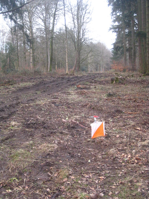
White Mead Wood is a picturesque woodland located in the county of Wiltshire, England. Situated near the village of Chirton, this woodland covers an area of approximately 50 acres and is a popular destination for nature lovers and outdoor enthusiasts.

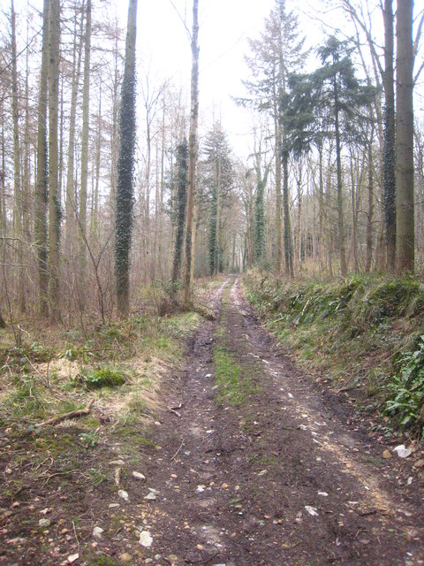
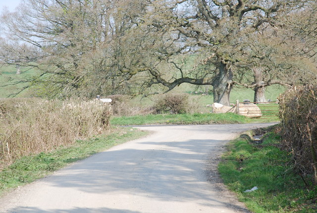
The wood is predominantly composed of native broadleaf trees, including oak, ash, and beech, which create a dense canopy and provide a habitat for a variety of wildlife. The forest floor is adorned with a diverse range of wildflowers, such as bluebells and primroses, which bloom during the spring months, adding a vibrant touch to the landscape.

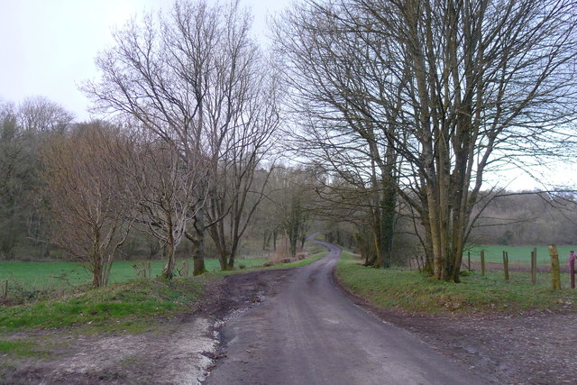
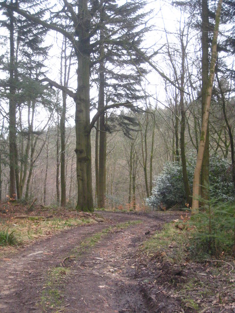
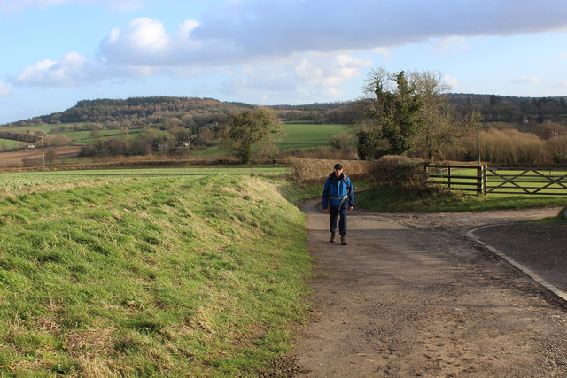
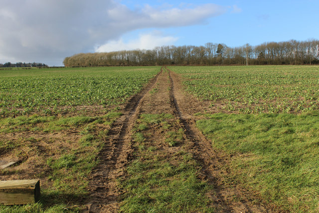
Traversing through White Mead Wood, visitors can explore a network of well-marked footpaths and trails that wind their way through the trees. These pathways offer a tranquil and peaceful setting for walkers, joggers, and dog walkers, providing an opportunity to escape the hustle and bustle of daily life and immerse oneself in the natural beauty of the surroundings.

The woodland is also a haven for birdwatchers, with numerous bird species inhabiting the area. Visitors may catch a glimpse of woodpeckers, owls, and various songbirds, as well as spot squirrels and rabbits darting through the undergrowth.

White Mead Wood is managed by the Forestry Commission, ensuring its preservation and sustainability. The organization maintains the wood, ensuring that it remains accessible to the public while conserving its ecological importance.

Overall, White Mead Wood offers a tranquil retreat for nature enthusiasts, providing a serene environment to appreciate the beauty of Wiltshire's natural landscape.

If you have any feedback on the listing, please let us know in the comments section below.

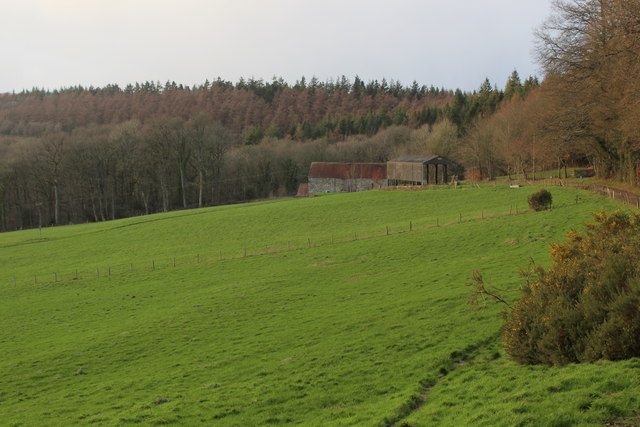
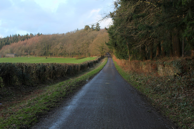
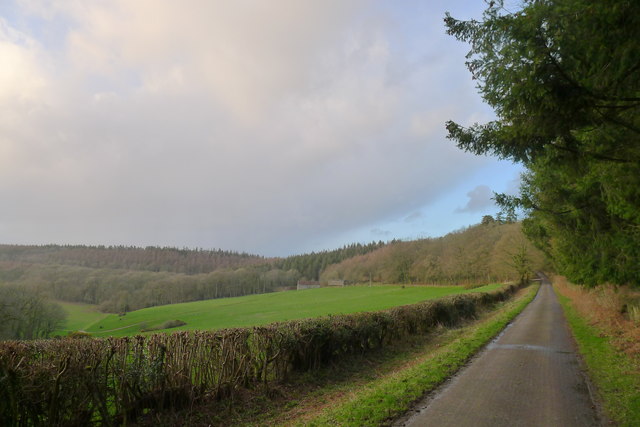
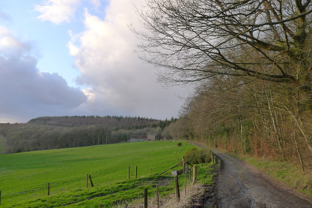
White Mead Wood Images

Images are sourced within 2km of 51.065471/-2.1231926 or Grid Reference ST9129. Thanks to Geograph Open Source API. All images are credited.

Ruddlemoor Farm Almost completely surrounded by forest
Ruddlemoor Farm
Almost completely surrounded by forest
Minor Road between Newtown and Hindon For most of its length this quiet lane runs through shady woodland
Minor Road between Newtown and Hindon
For most of its length this quiet lane runs through shady woodland
Heading North towards Hindon Section of the woodland road between Newtown and Hindon
Heading North towards Hindon
Section of the woodland road between Newtown and Hindon
Minor road around the west flank of Beacon Hill Looking towards Ruddlemoor farm in the middle distance.
Minor road around the west flank of Beacon Hill
Looking towards Ruddlemoor farm in the middle distance.
Track to Ruddlemoor Farm
Newclose Hanging The road to Hindon crossing a dry valley separating Fonthill Abbey Wood (behind) and Terrace Wood (ahead).
Newclose Hanging
The road to Hindon crossing a dry valley separating Fonthill Abbey Wood (behind) and Terrace Wood (ahead).
West Hatch Houses at West Hatch.
West Hatch
Houses at West Hatch.
Road Junction Near East Hatch.
Road Junction
Near East Hatch.
Dog Rose (Rosa canina) The rose is common and widespread in this country.  It makes dense mounds of slender stems.  The flowers are pink or whitish, often solitary but sometimes in small groups.

The plant is growing in the hedge by the bridleway near Weaveland Farm.
Dog Rose (Rosa canina)
The rose is common and widespread in this country. It makes dense mounds of slender stems. The flowers are pink or whitish, often solitary but sometimes in small groups. The plant is growing in the hedge by the bridleway near Weaveland Farm.
Bridleway to Lawn The bridleway takes riders and walkers from the Weaveland area of Tisbury to Lawn.
Bridleway to Lawn
The bridleway takes riders and walkers from the Weaveland area of Tisbury to Lawn.
A forest track in Fonthill Abbey Wood
Orienteering control site beside a forest track in Fonthill Abbey Wood During a SARUM orienteering club event.
Orienteering control site beside a forest track in Fonthill Abbey Wood
During a SARUM orienteering club event.
Bend in a forest track in Fonthill Abbey Wood
A timber shed in a clearing in Fonthill Abbey Wood
Newtown: a hidden phone box This telephone box has been rather overcome by the adjacent foliage in the 8 years since it was photographed here: <a href="https://www.geograph.org.uk/photo/1201067">ST9128 : Telephone box, Newtown</a>

The ivy has also made its way into the box from the far corner, not via the door which seems to be jammed half-open.

A notice in the box, saying that BT propose to remove it as it isn't sufficiently used, is dated 2009 although the phone apparatus is still in the box.

A postbox in a pillar can be seen to the far left.
Newtown: a hidden phone box
This telephone box has been rather overcome by the adjacent foliage in the 8 years since it was photographed here: ST9128 : Telephone box, Newtown The ivy has also made its way into the box from the far corner, not via the door which seems to be jammed half-open. A notice in the box, saying that BT propose to remove it as it isn't sufficiently used, is dated 2009 although the phone apparatus is still in the box. A postbox in a pillar can be seen to the far left.
Across the valley of the Oddford Brook The path back to Tisbury here invisibly descended a steep, uneven field of shoulder-high nettles and was deemed impassable: maybe try another time of year?
Across the valley of the Oddford Brook
The path back to Tisbury here invisibly descended a steep, uneven field of shoulder-high nettles and was deemed impassable: maybe try another time of year?
Wessex Ridgeway descending towards West Hatch The long distance footpath outside New Barn
Wessex Ridgeway descending towards West Hatch
The long distance footpath outside New Barn
Wessex Ridgeway heading towards Bottom Copse The long distance footpath on a northward track from New Barn
Wessex Ridgeway heading towards Bottom Copse
The long distance footpath on a northward track from New Barn
Show me another place!

White Mead Wood is located at Grid Ref: ST9129 (Lat: 51.065471, Lng: -2.1231926)

Unitary Authority: Wiltshire

Police Authority: Wiltshire

What 3 Words

///stutter.series.judge. Near Tisbury, Wiltshire

Related Wikis

West Tisbury, Wiltshire

West Tisbury is a civil parish in southwest Wiltshire, England. The parish takes in the southwestern quarter of the village of Tisbury and extends about...

Pythouse

Pythouse, sometimes spelled Pyt House and pronounced pit-house, is a country house in southwest Wiltshire, in the west of England. It is about 2+1⁄2 miles...
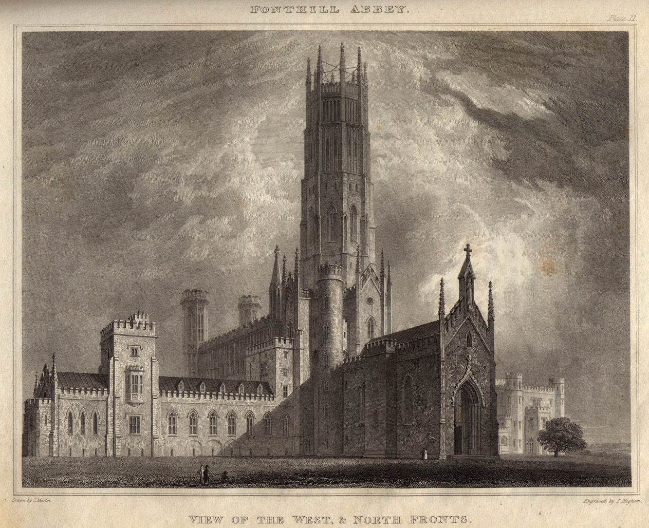
Fonthill Abbey

Fonthill Abbey—also known as Beckford's Folly—was a large Gothic Revival country house built between 1796 and 1813 at Fonthill Gifford in Wiltshire, England...

Fonthill Gifford

Fonthill Gifford is a village and civil parish in Wiltshire, England, to the north of the Nadder valley, 14 miles (23 km) west of Salisbury. == History... ==

Wardour, Wiltshire

Wardour is a settlement in the civil parish of Tisbury, in Wiltshire, England, about 13 miles (21 km) west of Salisbury and 4 miles (6 km) south of Hindon...

Tisbury, Wiltshire

Tisbury is a large village and civil parish approximately 13 miles (21 km) west of Salisbury in the English county of Wiltshire. With a population at the...

Tisbury railway station

Tisbury railway station serves the village of Tisbury in Wiltshire, England. It is currently managed by South Western Railway and is on the West of England...

Fonthill Lake

Fonthill Lake (grid reference ST933319) is a lake in southwest Wiltshire, England. It lies just to the south of the village of Fonthill Bishop, east of...

Nearby Amenities

Located within 500m of 51.065471,-2.1231926
The data included in this document is from www.openstreetmap.org. The data is made available under ODbL.

Have you been to White Mead Wood?

Leave your review of White Mead Wood below (or comments, questions and feedback).