Ashen Coppice

Wood, Forest in Staffordshire

England

Ashen Coppice

The Old Stag's Head by Penn Common near Wolverhampton The Old Stag's Head is in Pennwood Lane at the junction with Sedgley Road and Church Hill. The pub is closed and looking ever more dilapidated as planning schemes for its development are refused. It is seen here just before sunset, as the light fades.
The Old Stag's Head by Penn Common near Wolverhampton Credit: Roger D Kidd

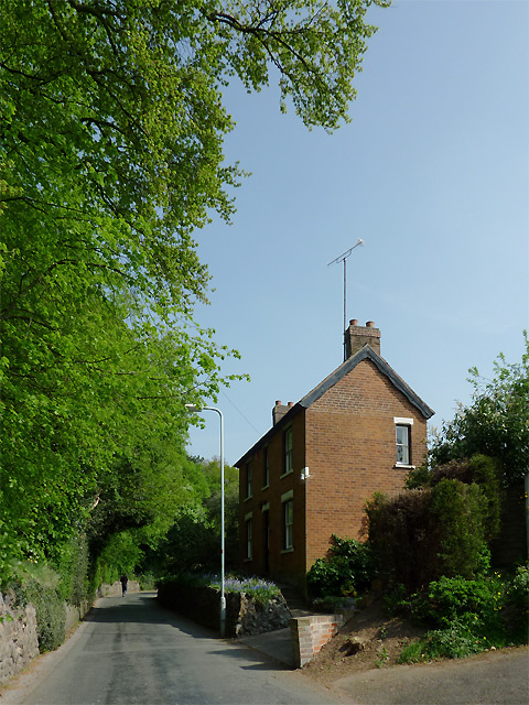
Ashen Coppice is a picturesque woodland located in the county of Staffordshire, England. Situated near the town of Stone, it covers an area of approximately 100 acres and is known for its natural beauty and diverse range of flora and fauna.

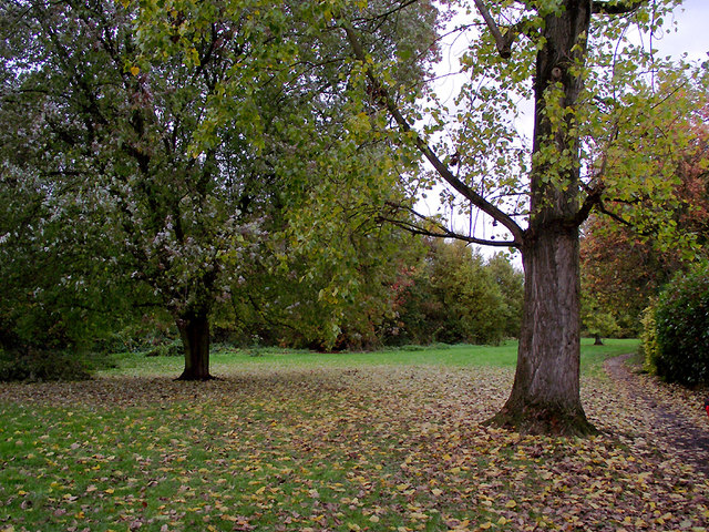
The woodland is predominantly made up of deciduous trees, such as oak, beech, and birch, which create a stunning canopy of greenery during the summer months. In autumn, the forest transforms into a kaleidoscope of vibrant colors as the leaves change, attracting photographers and nature enthusiasts alike.

Ashen Coppice is home to a variety of wildlife, including deer, foxes, and a wide range of bird species. Birdwatchers can often spot woodpeckers, owls, and jays among the treetops, while the forest floor provides a habitat for small mammals and insects.

The woodland offers several walking trails and footpaths, allowing visitors to explore its natural wonders at their own pace. These paths wind through ancient trees and lead to hidden clearings, providing opportunities for peaceful contemplation and relaxation.

Ashen Coppice is also a popular destination for outdoor activities such as picnicking, camping, and nature walks. The tranquil atmosphere and breathtaking scenery make it an ideal spot for families, couples, and individuals seeking a break from the hustle and bustle of everyday life.

Overall, Ashen Coppice is a cherished natural gem in Staffordshire, offering a serene escape into the heart of nature for those who visit.

If you have any feedback on the listing, please let us know in the comments section below.

Ashen Coppice Images

Images are sourced within 2km of 52.555416/-2.1288953 or Grid Reference SO9195. Thanks to Geograph Open Source API. All images are credited.

The Old Stag's Head by Penn Common near Wolverhampton The Old Stag's Head is in Pennwood Lane at the junction with Sedgley Road and Church Hill. The pub is closed and looking ever more dilapidated as planning schemes for its development are refused. It is seen here just before sunset, as the light fades.
The Old Stag's Head by Penn Common near Wolverhampton
The Old Stag's Head is in Pennwood Lane at the junction with Sedgley Road and Church Hill. The pub is closed and looking ever more dilapidated as planning schemes for its development are refused. It is seen here just before sunset, as the light fades.
Manor Road in Penn, Wolverhampton The austere looking house on the right is The Hollies. Muchall Park is behind the mature trees on the left. The single track lane links the A449 Penn Road with Mount Road by Penn Cricket Club.
Manor Road in Penn, Wolverhampton
The austere looking house on the right is The Hollies. Muchall Park is behind the mature trees on the left. The single track lane links the A449 Penn Road with Mount Road by Penn Cricket Club.
The green at Penn Bowling Club, Wolverhampton Penn Bowling and Social Club is a well run club for local people. In addition to the bowling, activities include darts, dominoes, poker, bingo, crib, pool, salsa dancing and (of course) large screen TV to watch football. Oh, nearly forgot! It has a bar too, which serves Banks's Bitter and Mild, plus three guest real ales - all superbly kept.

update August 2018 - There is a defibrillator stationed here by the main entrance to the club.

<a href="https://www.geograph.org.uk/photo/2733190">SO8995 : The Penn Bowling Club  handpumps, Wolverhampton</a> 

I think they sell lager, too. ;-)
The green at Penn Bowling Club, Wolverhampton
Penn Bowling and Social Club is a well run club for local people. In addition to the bowling, activities include darts, dominoes, poker, bingo, crib, pool, salsa dancing and (of course) large screen TV to watch football. Oh, nearly forgot! It has a bar too, which serves Banks's Bitter and Mild, plus three guest real ales - all superbly kept. update August 2018 - There is a defibrillator stationed here by the main entrance to the club. SO8995 : The Penn Bowling Club handpumps, Wolverhampton I think they sell lager, too. ;-)
Penn Bowling Club, Wolverhampton The image shows part of the green and club buildings, with the mature deciduous trees of Muchall Park as the backdrop.

Penn Bowling and Social Club is a well run club for local people. In addition to the bowling, regular activities include darts, dominoes, poker, crib, pool, bingo, salsa dancing and (of course) large screen TV to watch football. Oh, nearly forgot! It has a good bar too, which serves Banks's Bitter and Mild, plus three hand-pulled guest real ales - all superbly kept. People occasionally drink lager, I'm told. ;-)

update August 2018 - There is a defibrillator stationed here by the main entrance to the club.
Penn Bowling Club, Wolverhampton
The image shows part of the green and club buildings, with the mature deciduous trees of Muchall Park as the backdrop. Penn Bowling and Social Club is a well run club for local people. In addition to the bowling, regular activities include darts, dominoes, poker, crib, pool, bingo, salsa dancing and (of course) large screen TV to watch football. Oh, nearly forgot! It has a good bar too, which serves Banks's Bitter and Mild, plus three hand-pulled guest real ales - all superbly kept. People occasionally drink lager, I'm told. ;-) update August 2018 - There is a defibrillator stationed here by the main entrance to the club.
A449 Dual Carriageway, Penn Where the Tesco store is over the road, the site used to be a Petrol Station until a few years ago.
A449 Dual Carriageway, Penn
Where the Tesco store is over the road, the site used to be a Petrol Station until a few years ago.
Woodlands Walk in Penn, Wolverhampton This is a surprisingly secluded strip of open grass and woodland just off the busy A449 dual carriageway of Penn Road and enclosed between Lancaster Gardens and Wells Road. To find it, follow the footpath alongside the Roebuck public house.
Woodlands Walk in Penn, Wolverhampton
This is a surprisingly secluded strip of open grass and woodland just off the busy A449 dual carriageway of Penn Road and enclosed between Lancaster Gardens and Wells Road. To find it, follow the footpath alongside the Roebuck public house.
Trees in Muchall Park, Penn, Wolverhampton The park has an abundance of mature trees as well as open grass, children's play areas, and public exercise equipment.
Trees in Muchall Park, Penn, Wolverhampton
The park has an abundance of mature trees as well as open grass, children's play areas, and public exercise equipment.
Tree avenue in Muchall Park, Wolverhampton This is a telephoto assisted image from near Penn Road 150 metres away.
These very mature trees have a children's hummocky grass play area by them. Lovely to roll, crawl and grovel and thrutch, especially through the tunnel.

So I am told. <a href="https://www.geograph.org.uk/photo/2194386">SO8995 : Play area tunnel in Muchall Park, Wolverhampton</a>
Tree avenue in Muchall Park, Wolverhampton
This is a telephoto assisted image from near Penn Road 150 metres away. These very mature trees have a children's hummocky grass play area by them. Lovely to roll, crawl and grovel and thrutch, especially through the tunnel. So I am told. SO8995 : Play area tunnel in Muchall Park, Wolverhampton
Antique shop in Penn, Wolverhampton There is a short row of small shops between the Roebuck and (former) Fox and Goose public houses. The Jet service station has long been demolished and replaced by a Tesco Express store which has been allowed to encroach on the Fox and Goose's car park, probably destroying that establishment's chances of re-opening as a public house. The Tesco store has done no favours to local small shopkeepers, but Tesco's wouldn't admit (or care about) that, would they.
Antique shop in Penn, Wolverhampton
There is a short row of small shops between the Roebuck and (former) Fox and Goose public houses. The Jet service station has long been demolished and replaced by a Tesco Express store which has been allowed to encroach on the Fox and Goose's car park, probably destroying that establishment's chances of re-opening as a public house. The Tesco store has done no favours to local small shopkeepers, but Tesco's wouldn't admit (or care about) that, would they.
Woodlands Walk in Penn, Wolverhampton This is a surprisingly secluded strip of open grass and woodland just off the busy A449 dual carriageway of Penn Road and enclosed between housing in Lancaster Gardens and Wells Road. To find it, follow the footpath alongside the Roebuck public house.
Woodlands Walk in Penn, Wolverhampton
This is a surprisingly secluded strip of open grass and woodland just off the busy A449 dual carriageway of Penn Road and enclosed between housing in Lancaster Gardens and Wells Road. To find it, follow the footpath alongside the Roebuck public house.
Woodlands Walk in Penn, Wolverhampton This is a surprisingly secluded strip of open grass and woodland just off the busy A449 dual carriageway of Penn Road and enclosed between Lancaster Gardens and Wells Road. To find it, follow the footpath alongside the Roebuck public house.
Woodlands Walk in Penn, Wolverhampton
This is a surprisingly secluded strip of open grass and woodland just off the busy A449 dual carriageway of Penn Road and enclosed between Lancaster Gardens and Wells Road. To find it, follow the footpath alongside the Roebuck public house.
Woodlands Walk in Penn, Wolverhampton This is a surprisingly secluded three hundred metre strip of open grass and woodland just off the busy A449 dual carriageway of Penn Road and enclosed between Lancaster Gardens and Wells Road. To find it, follow the footpath alongside the Roebuck public house.
Woodlands Walk in Penn, Wolverhampton
This is a surprisingly secluded three hundred metre strip of open grass and woodland just off the busy A449 dual carriageway of Penn Road and enclosed between Lancaster Gardens and Wells Road. To find it, follow the footpath alongside the Roebuck public house.
Park and woodland in Penn, Wolverhampton The dark tunnel-like entrance through the shrubbery opens out to a pleasant track through the patch of woodland in Woodlands Walk. It comes out here: <a title="https://www.geograph.org.uk/photo/2689573" href="https://www.geograph.org.uk/photo/2689573">Link</a>

This is a surprisingly secluded three hundred metre strip of open grass and woodland just off the busy A449 dual carriageway of Penn Road and enclosed between Lancaster Gardens and Wells Road. To find it, follow the footpath alongside the Roebuck public house.
Park and woodland in Penn, Wolverhampton
The dark tunnel-like entrance through the shrubbery opens out to a pleasant track through the patch of woodland in Woodlands Walk. It comes out here: Link This is a surprisingly secluded three hundred metre strip of open grass and woodland just off the busy A449 dual carriageway of Penn Road and enclosed between Lancaster Gardens and Wells Road. To find it, follow the footpath alongside the Roebuck public house.
Woodlands Walk in Penn, Wolverhampton This is a surprisingly secluded three hundred metre strip of open grass and woodland just off the busy A449 dual carriageway of Penn Road and enclosed between Lancaster Gardens and Wells Road. To find it, follow the footpath (visible in this image) alongside the Roebuck public house.
Woodlands Walk in Penn, Wolverhampton
This is a surprisingly secluded three hundred metre strip of open grass and woodland just off the busy A449 dual carriageway of Penn Road and enclosed between Lancaster Gardens and Wells Road. To find it, follow the footpath (visible in this image) alongside the Roebuck public house.
Track  towards the Penn Road, Wolverhampton This track passes through Woodlands Walk, a surprisingly secluded three hundred metre strip of open grass and woodland just off the busy A449 dual carriageway of Penn Road and enclosed between Lancaster Gardens and Wells Road. To find it, follow the footpath alongside the Roebuck public house or the north end from Ashley Road.
Track towards the Penn Road, Wolverhampton
This track passes through Woodlands Walk, a surprisingly secluded three hundred metre strip of open grass and woodland just off the busy A449 dual carriageway of Penn Road and enclosed between Lancaster Gardens and Wells Road. To find it, follow the footpath alongside the Roebuck public house or the north end from Ashley Road.
Park footpath to the Penn Road, Wolverhampton This track passes through Woodlands Walk, a surprisingly secluded three hundred metre strip of open grass and woodland just off the busy A449 dual carriageway of Penn Road and enclosed between Lancaster Gardens and Wells Road. To find it, follow the footpath alongside the Roebuck public house or the north end from Ashley Road.
Park footpath to the Penn Road, Wolverhampton
This track passes through Woodlands Walk, a surprisingly secluded three hundred metre strip of open grass and woodland just off the busy A449 dual carriageway of Penn Road and enclosed between Lancaster Gardens and Wells Road. To find it, follow the footpath alongside the Roebuck public house or the north end from Ashley Road.
The Penn Bowling Club  handpumps, Wolverhampton Penn Bowling and Social Club is a well run club for local people. In addition to the bowling, activities include darts, dominoes, poker, bingo, crib, pool, salsa dancing and (of course) large screen TV to watch football. Oh, nearly forgot! It has a bar too, which serves Banks's Bitter and Mild, plus three guest real ales - all superbly kept (Roger, the steward has retired, but the current one keeps the ale perfectly too).

Note the ale on offer on the centre pump. Alan Brough has just resumed brewing his bitter and pale ales in his new set-up at the former Springfield brewery in Wolverhampton.

Update December 2023: There are now four  handpumps; the ales remain excellent, and the club is in the CAMRA Good Beer Guide.

update August 2018 - There is a defibrillator stationed here by the main entrance to the club.

another note: Andy Brough has ceased brewing!

<a href="https://www.geograph.org.uk/photo/1230064">SO9199 : Springfield Brewery, Wolverhampton</a>
The Penn Bowling Club handpumps, Wolverhampton
Penn Bowling and Social Club is a well run club for local people. In addition to the bowling, activities include darts, dominoes, poker, bingo, crib, pool, salsa dancing and (of course) large screen TV to watch football. Oh, nearly forgot! It has a bar too, which serves Banks's Bitter and Mild, plus three guest real ales - all superbly kept (Roger, the steward has retired, but the current one keeps the ale perfectly too). Note the ale on offer on the centre pump. Alan Brough has just resumed brewing his bitter and pale ales in his new set-up at the former Springfield brewery in Wolverhampton. Update December 2023: There are now four handpumps; the ales remain excellent, and the club is in the CAMRA Good Beer Guide. update August 2018 - There is a defibrillator stationed here by the main entrance to the club. another note: Andy Brough has ceased brewing! SO9199 : Springfield Brewery, Wolverhampton
Show me another place!

Ashen Coppice is located at Grid Ref: SO9195 (Lat: 52.555416, Lng: -2.1288953)

Unitary Authority: Wolverhampton

Police Authority: West Midlands

What 3 Words

///rises.jaws.filer. Near Wolverhampton, West Midlands

Related Wikis

Alder Coppice

Alder Coppice is a local nature reserve in West Midlands, England. It is near Sedgley, next to the Northway Estate, in the Metropolitan Borough of Dudley...

Sedgley Park School, Wolverhampton

Sedgley Park School was a Roman Catholic Academy located on the outskirts of Wolverhampton, then part of Staffordshire. The school was founded by William...

Colton Hills Community School

Colton Hills Community School is a mixed secondary school and sixth form situated in the Goldthorn Park area of Wolverhampton, West Midlands, England....

Goldthorn Park

Goldthorn Park is a suburb of Wolverhampton, West Midlands. It is situated 1½ miles south of the city centre within the Blakenhall ward. It mostly consists...

Nearby Amenities

Located within 500m of 52.555416,-2.1288953
Bus Stop
Northway / Alderdale Avenue
Bus: yes
Naptan AtcoCode: 43000850101
Naptan Bearing: NE
Naptan BusStopType: MKD
Naptan CommonName: Alderdale Avenue
Naptan Indicator: adj
Naptan NaptanCode: nwmjwjad
Naptan PlusbusZoneRef: BHAMNWS
Naptan Status: ACT
Naptan StopType: BCT
Naptan Street: NORTHWAY
Naptan Towards: Wolverhampton
Naptan Verified: no
Public Transport: platform
Route Ref: 27;27A
Source: WMCA
Lat/Long: 52.5531373/-2.1290134
Bus Stop
Northway / Alderdale Avenue
NaPTANAreaCode: 43000850102
Bus: yes
Naptan AtcoCode: 43000850102
Naptan Bearing: S
Naptan BusStopType: MKD
Naptan CommonName: Alderdale Avenue
Naptan Indicator: opp
Naptan NaptanCode: nwmjwjag
Naptan PlusbusZoneRef: BHAMNWS
Naptan Status: ACT
Naptan StopType: BCT
Naptan Street: NORTHWAY
Naptan Towards: Sedgley
Naptan Verified: no
Public Transport: platform
Route Ref: 27;27A
Shelter: yes
Shelter Ref: 404101
Source: WMCA
Lat/Long: 52.5529355/-2.1289699
Bus Stop
Northway / Otterstone Close
Bus: yes
Naptan AtcoCode: 43000850201
Naptan Bearing: N
Naptan BusStopType: MKD
Naptan CommonName: Otterstone Close
Naptan Indicator: opp
Naptan Landmark: NUL
Naptan NaptanCode: nwmjwjaj
Naptan PlusbusZoneRef: BHAMNWS
Naptan Status: ACT
Naptan StopType: BCT
Naptan Street: NORTHWAY
Naptan Towards: Wolverhampton
Public Transport: platform
Route Ref: 27;27A
Shelter: no
Source: WMCA
Towards: Wolverhampton
Lat/Long: 52.5509794/-2.1282255
Bus Stop
Wolverhampton Road E / Beacon Centre
NaPTANAreaCode: 43000851101
Bus: yes
Naptan AtcoCode: 43000851101
Naptan Bearing: NE
Naptan BusStopType: MKD
Naptan CommonName: Beacon Centre
Naptan Indicator: adj
Naptan NaptanCode: nwmjwjgd
Naptan PlusbusZoneRef: BHAMNWS
Naptan Status: ACT
Naptan StopType: BCT
Naptan Street: WOLVERHAMPTON ROAD E
Naptan Towards: Wolverhampton
Naptan Verified: no
Public Transport: platform
Route Ref: 1;27;27A
Shelter: yes
Shelter Ref: 404201
Source: WMCA
Lat/Long: 52.5567164/-2.1219544
Bus Stop
Northway / Wolverhampton Rd
Bus: yes
Naptan AtcoCode: 43000851201
Naptan Bearing: W
Naptan BusStopType: MKD
Naptan CommonName: Wolverhampton Rd
Naptan Indicator: after
Naptan NaptanCode: nwmjwjgm
Naptan PlusbusZoneRef: BHAMNWS
Naptan Status: ACT
Naptan StopType: BCT
Naptan Street: NORTHWAY
Naptan Towards: Sedgley
Naptan Verified: no
Public Transport: platform
Route Ref: 27;27A
Source: WMCA
Lat/Long: 52.555142/-2.1252018
Bus Stop
Northway / Wolverhampton Rd
Bus: yes
Naptan AtcoCode: 43000851202
Naptan Bearing: NE
Naptan BusStopType: MKD
Naptan CommonName: Wolverhampton Rd
Naptan Indicator: before
Naptan NaptanCode: nwmtgajd
Naptan PlusbusZoneRef: BHAMNWS
Naptan Status: ACT
Naptan StopType: BCT
Naptan Street: NORTHWAY
Naptan Towards: Wolverhampton
Naptan Verified: no
Public Transport: platform
Route Ref: 27;27A
Source: WMCA
Lat/Long: 52.5552135/-2.1255707
Bus Stop
Wolverhampton Road / Greenleighs
Bus: yes
Naptan AtcoCode: 43000851301
Naptan Bearing: S
Naptan BusStopType: MKD
Naptan CommonName: Greenleighs
Naptan Indicator: opp
Naptan NaptanCode: nwmjwjgp
Naptan PlusbusZoneRef: BHAMNWS
Naptan Status: ACT
Naptan StopType: BCT
Naptan Street: WOLVERHAMPTON ROAD
Naptan Towards: Sedgley
Naptan Verified: no
Public Transport: platform
Route Ref: 1
Source: WMCA
Lat/Long: 52.5530562/-2.1243641
Bus Stop
Wolverhampton Road / Greenleighs
Bus: yes
Naptan AtcoCode: 43000851302
Naptan Bearing: N
Naptan BusStopType: MKD
Naptan CommonName: Greenleighs
Naptan Indicator: adj
Naptan NaptanCode: nwmjwjgt
Naptan PlusbusZoneRef: BHAMNWS
Naptan Status: ACT
Naptan StopType: BCT
Naptan Street: WOLVERHAMPTON ROAD
Naptan Towards: Wolverhampton
Naptan Verified: no
Public Transport: platform
Route Ref: 1
Source: WMCA
Lat/Long: 52.5543073/-2.1245118
Incline: down
Note: 12%
Source: survey
Lat/Long: 52.5540769/-2.1279051
Fuel
BP
Brand: BP
Brand Wikidata: Q152057
Brand Wikipedia: en:BP
Operator: BP
Lat/Long: 52.5554061/-2.1234432
Barrier: bollard
Source: survey
Lat/Long: 52.5523501/-2.1316784
Power: tower
Source: survey
Lat/Long: 52.5536112/-2.1314281
Power: tower
Source: visual survey;estimate
Lat/Long: 52.5550935/-2.1273242
Beacon Centre for the Blind
Building: yes
Source: survey
Lat/Long: 52.5568424/-2.1232113
Power: tower
Source: visual survey;estimate
Lat/Long: 52.5563148/-2.1240359
Generator Method: photovoltaic
Generator Output Electricity: yes
Generator Source: solar
Generator Type: solar_photovoltaic_panel
Location: roof
Power: generator
Lat/Long: 52.5536416/-2.1301433
Generator Method: photovoltaic
Generator Output Electricity: yes
Generator Source: solar
Generator Type: solar_photovoltaic_panel
Location: roof
Power: generator
Lat/Long: 52.5539302/-2.1314281
Generator Method: photovoltaic
Generator Output Electricity: yes
Generator Source: solar
Generator Type: solar_photovoltaic_panel
Location: roof
Power: generator
Lat/Long: 52.5539417/-2.1318734
Generator Method: photovoltaic
Generator Output Electricity: yes
Generator Source: solar
Generator Type: solar_photovoltaic_panel
Location: roof
Power: generator
Lat/Long: 52.553242/-2.1325171
Generator Method: photovoltaic
Generator Output Electricity: yes
Generator Source: solar
Generator Type: solar_photovoltaic_panel
Location: roof
Power: generator
Lat/Long: 52.5526712/-2.1295023
Natural: spring
Source: OS
Lat/Long: 52.5546082/-2.1240049
Natural: spring
Source: OS
Lat/Long: 52.5546005/-2.1238735
The data included in this document is from www.openstreetmap.org. The data is made available under ODbL.

Have you been to Ashen Coppice?

Leave your review of Ashen Coppice below (or comments, questions and feedback).