Turner's Hill Wood

Wood, Forest in Staffordshire

England

Turner's Hill Wood

Pond in Barrow Hill Local Nature Reserve
Pond in Barrow Hill Local Nature Reserve Credit: Alex McGregor

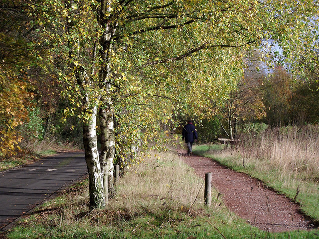
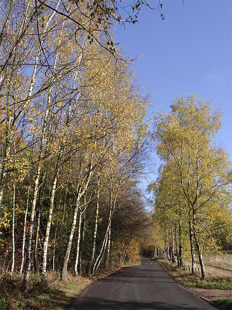
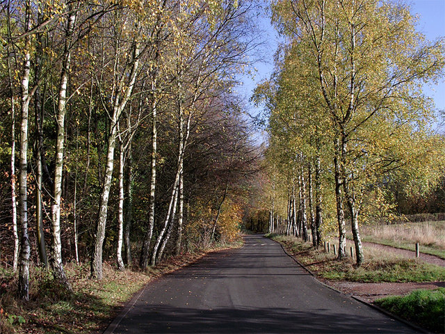
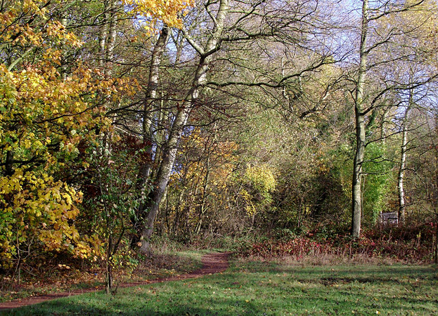
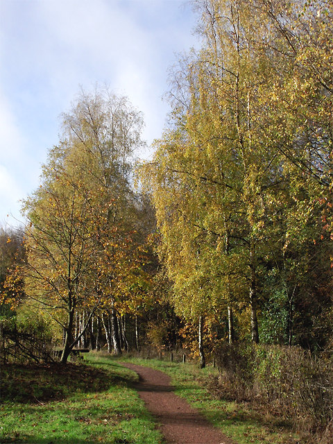
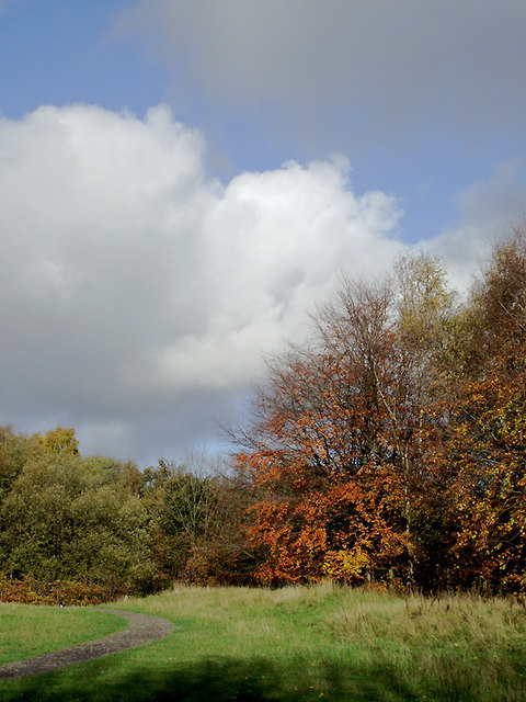
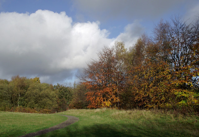
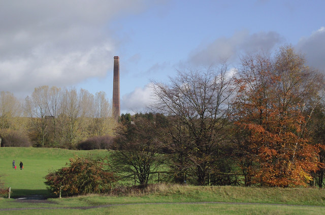
Turner's Hill Wood is a picturesque woodland area located in Staffordshire, England. Covering an expansive area, this enchanting forest is renowned for its natural beauty and diverse range of flora and fauna. The wood is located on Turner's Hill, a prominent hill in the region, which offers stunning panoramic views of the surrounding landscape.

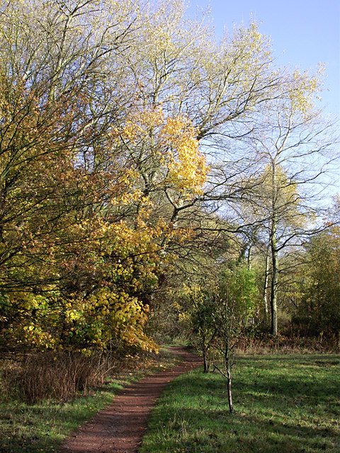
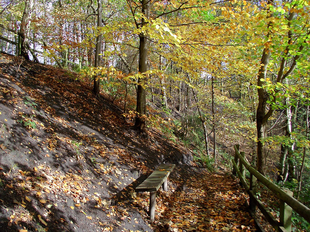
The woodland is characterized by its dense canopy of mature trees including oak, beech, and birch, which provide a habitat for a variety of bird species such as woodpeckers and owls. The forest floor is adorned with a rich carpet of bluebells, wild garlic, and other native wildflowers during the spring season, creating a magical atmosphere for visitors.

The wood is intersected by a network of well-maintained walking trails, allowing visitors to explore its natural wonders at their own pace. The trails offer opportunities for leisurely strolls, wildlife spotting, and even picnicking in designated areas. Nature enthusiasts can also observe a diverse range of wildlife, including deer, foxes, and squirrels, in their natural habitat.

Turner's Hill Wood is a popular destination for both locals and tourists seeking a tranquil retreat from the hustle and bustle of everyday life. Its serene ambiance, coupled with its natural beauty, make it an ideal location for nature walks, photography, and even outdoor yoga sessions.

Overall, Turner's Hill Wood is a captivating woodland that provides a haven for nature lovers and offers a peaceful escape into the heart of Staffordshire's natural beauty.

If you have any feedback on the listing, please let us know in the comments section below.

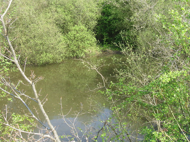
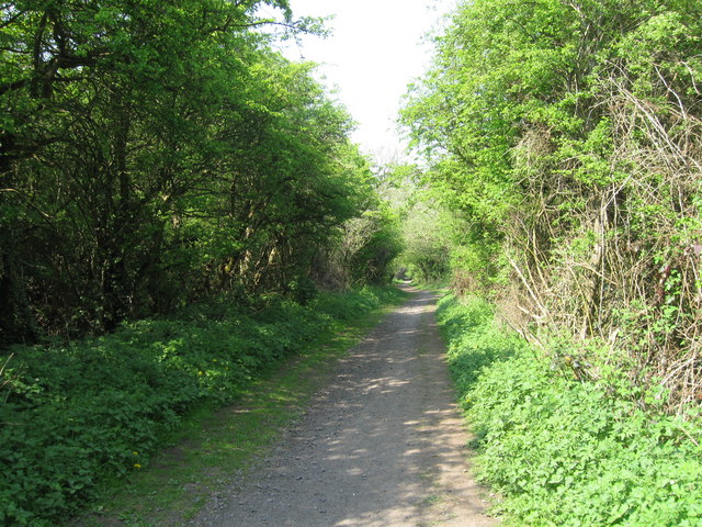
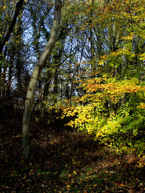
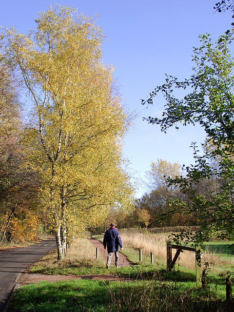
Turner's Hill Wood Images

Images are sourced within 2km of 52.522668/-2.1348272 or Grid Reference SO9091. Thanks to Geograph Open Source API. All images are credited.

Pond in Barrow Hill Local Nature Reserve
Dismantled Railway, Barrow Hill
Barton's Meadow, Barrow Hill Local Nature Reserve
Woodland in Baggeridge Country Park, near Sedgley These woods are by the road north of the visitor centre near Gospel End. 
Baggeridge Country Park is an attractive area of countryside near Dudley and Wolverhampton. It was formerly the Baggeridge Colliery. Together with part of the original Himley Estate of the Earls of Dudley, the whole site has been transformed into 150 acres of attractive country park, including woodland, lakes, and open grassed areas.
Woodland in Baggeridge Country Park, near Sedgley
These woods are by the road north of the visitor centre near Gospel End. Baggeridge Country Park is an attractive area of countryside near Dudley and Wolverhampton. It was formerly the Baggeridge Colliery. Together with part of the original Himley Estate of the Earls of Dudley, the whole site has been transformed into 150 acres of attractive country park, including woodland, lakes, and open grassed areas.
 Baggeridge Country Park, near Sedgley The road links the car parks to Woodhouse Lane (A463) near Gospel End. The Upper Meadow is on the right.

Baggeridge Country Park is an attractive area of countryside near Dudley and Wolverhampton. It was formerly the Baggeridge Colliery. Together with part of the original Himley Estate of the Earls of Dudley, the whole site has been transformed into 150 acres of attractive country park, including woodland, lakes, and open grassed areas. <span class="nowrap"><a title="http://www.sstaffs.gov.uk/default.aspx?page=12695" rel="nofollow ugc noopener" href="http://www.sstaffs.gov.uk/default.aspx?page=12695">Link</a><img style="margin-left:2px;" alt="External link" title="External link - shift click to open in new window" src="https://s1.geograph.org.uk/img/external.png" width="10" height="10"/></span>
Baggeridge Country Park, near Sedgley
The road links the car parks to Woodhouse Lane (A463) near Gospel End. The Upper Meadow is on the right. Baggeridge Country Park is an attractive area of countryside near Dudley and Wolverhampton. It was formerly the Baggeridge Colliery. Together with part of the original Himley Estate of the Earls of Dudley, the whole site has been transformed into 150 acres of attractive country park, including woodland, lakes, and open grassed areas. LinkExternal link
 Baggeridge Country Park, near Sedgley The road links the car parks to Woodhouse Lane (A463) near Gospel End. The Upper Meadow is off to the right.
Baggeridge Country Park, near Sedgley
The road links the car parks to Woodhouse Lane (A463) near Gospel End. The Upper Meadow is off to the right.
The Road to Gospel End near Sedgley The private road is in Baggeridge Country Park and links the car parks to Woodhouse Lane (A463) near Gospel End.
The Road to Gospel End near Sedgley
The private road is in Baggeridge Country Park and links the car parks to Woodhouse Lane (A463) near Gospel End.
The Road to Gospel End near Sedgley The private road is in Baggeridge Country Park and links the car parks to Woodhouse Lane (A463) near Gospel End.
The Road to Gospel End near Sedgley
The private road is in Baggeridge Country Park and links the car parks to Woodhouse Lane (A463) near Gospel End.
Pathway in Baggeridge Country Park near Sedgley This is at the north end of Upper Meadow, looking towards Gospel End.
Pathway in Baggeridge Country Park near Sedgley
This is at the north end of Upper Meadow, looking towards Gospel End.
Pathway in Baggeridge Country Park near Sedgley This is at the north end of Upper Meadow, looking towards Gospel End.
Pathway in Baggeridge Country Park near Sedgley
This is at the north end of Upper Meadow, looking towards Gospel End.
Pathway in Baggeridge Country Park near Sedgley This is at the north end of Upper Meadow, looking away from Gospel End. The driveway from the A453 Wodehouse Road passes through the birch trees on the right.
Pathway in Baggeridge Country Park near Sedgley
This is at the north end of Upper Meadow, looking away from Gospel End. The driveway from the A453 Wodehouse Road passes through the birch trees on the right.
Woodland in Baggeridge Country Park near Sedgley This is by the Events Field south of the tea rooms.
Woodland in Baggeridge Country Park near Sedgley
This is by the Events Field south of the tea rooms.
Woodland in Baggeridge Country Park near Sedgley This is by the Events Field south of the tea rooms.
Woodland in Baggeridge Country Park near Sedgley
This is by the Events Field south of the tea rooms.
Baggeridge Country Park near Sedgley Looking across the Events Field towards the chimney of the Baggeridge Brickworks.
Baggeridge Country Park near Sedgley
Looking across the Events Field towards the chimney of the Baggeridge Brickworks.
Woodland bench in Baggeridge Country Park near Sedgley This is on the waymarked route down Jake's Ladder, a very steep (and precarious in wet autumn weather) stepped route down to the pools. That this land was formerly a coal mine is evident from the high amount of coal dust in the soil on the bank.
Woodland bench in Baggeridge Country Park near Sedgley
This is on the waymarked route down Jake's Ladder, a very steep (and precarious in wet autumn weather) stepped route down to the pools. That this land was formerly a coal mine is evident from the high amount of coal dust in the soil on the bank.
Woodland bench in Baggeridge Country Park near Sedgley This is on the waymarked route down Jake's Ladder, a very steep (and precarious in wet autumn weather, never mind ice and snow!) stepped route down to the pools. That this land was formerly a coal mine is evident from the high amount of coal dust in the soil on the bank. It is much steeper behind the camera. :-)
Woodland bench in Baggeridge Country Park near Sedgley
This is on the waymarked route down Jake's Ladder, a very steep (and precarious in wet autumn weather, never mind ice and snow!) stepped route down to the pools. That this land was formerly a coal mine is evident from the high amount of coal dust in the soil on the bank. It is much steeper behind the camera. :-)
Stepped trail in Baggeridge Country Park near Sedgley The waymarked climb from the pools is up Jake's Ladder, and is particularly steep below this section. The trees and bushes seem to be growing in coal dust, which is hardly surprising as the park is on the site of a former mine.
Stepped trail in Baggeridge Country Park near Sedgley
The waymarked climb from the pools is up Jake's Ladder, and is particularly steep below this section. The trees and bushes seem to be growing in coal dust, which is hardly surprising as the park is on the site of a former mine.
Show me another place!

Turner's Hill Wood is located at Grid Ref: SO9091 (Lat: 52.522668, Lng: -2.1348272)

Unitary Authority: Dudley

Police Authority: West Midlands

What 3 Words

///frames.organ.wipes. Near Wombourn, Staffordshire

Nearby Locations

Turner's Hill Wood

Related Wikis

Ellowes Hall Sports College

Ellowes Hall Sports College (formerly Ellowes Hall School) is a comprehensive secondary school and sixth form situated on Stickley Lane in Lower Gornal...

Ellowes Hall

Ellowes Hall was a stately home located in Sedgley, Staffordshire (now West Midlands). It was built in 1821 in parkland near Lower Gornal village as the...

Gornal, West Midlands

Gornal is a village and electoral ward in the Dudley Metropolitan Borough, in the West Midlands of England. It encompasses the three historical villages...

Straits Estate

Straits Estate is a housing estate located near Sedgley, West Midlands, England, to the north-west of Gornal Ward, and was built for homeowners during...

Church of St James the Great, Sedgley

The Church of St. James the Great is an Anglican church in the Lower Gornal area of Sedgley in the West Midlands, England. The church is Grade II listed...

Gornal Athletic F.C.

Gornal Athletic Football Club is a football club based in Lower Gornal, Dudley, in the West Midlands county in England. They are currently members of the...

Cotwall End Valley

Cotwall End Valley is a local nature reserve in West Midlands, England. It is about a mile south of Sedgley, in the Metropolitan Borough of Dudley. It...

Milking Bank

Milking Bank is a residential area of Dudley, West Midlands, England. It is a modern development which began in about 1984 with the construction of new...

Nearby Amenities

Located within 500m of 52.522668,-2.1348272
Bus Stop
The Straits / Straits Green
Bus: yes
Naptan AtcoCode: 43000853901
Naptan Bearing: SE
Naptan BusStopType: MKD
Naptan CommonName: Straits Green
Naptan Indicator: adj
Naptan Landmark: Miners Welfare
Naptan NaptanCode: nwmjwmad
Naptan PlusbusZoneRef: BHAMNWS
Naptan Status: ACT
Naptan StopType: BCT
Naptan Street: THE STRAITS
Naptan Towards: Gornal Wood
Naptan Verified: no
Public Transport: platform
Route Ref: 27;27A
Source: WMCA
Lat/Long: 52.5207863/-2.1401303
Bus Stop
The Straits / Straits Green
Bus: yes
Naptan AtcoCode: 43000853902
Naptan Bearing: NW
Naptan BusStopType: MKD
Naptan CommonName: Straits Green
Naptan Indicator: opp
Naptan Landmark: Miners Welfare
Naptan NaptanCode: nwmjwmag
Naptan PlusbusZoneRef: BHAMNWS
Naptan Status: ACT
Naptan StopType: BCT
Naptan Street: THE STRAITS
Naptan Towards: Sedgley
Naptan Verified: no
Public Transport: platform
Route Ref: 27;27A
Source: WMCA
Lat/Long: 52.5206605/-2.1401152
Bus Stop
Wood Rd / Ellowes Rd
Bus: yes
Naptan AtcoCode: 43000855001
Naptan Bearing: SE
Naptan BusStopType: MKD
Naptan CommonName: Ellowes Rd
Naptan Indicator: after
Naptan NaptanCode: nwmtwmap
Naptan PlusbusZoneRef: BHAMNWS
Naptan Status: ACT
Naptan StopType: BCT
Naptan Street: WOOD RD
Naptan Towards: Gornal Wood
Naptan Verified: no
Public Transport: platform
Route Ref: 257
Source: WMCA
Lat/Long: 52.5219291/-2.1313793
Bus Stop
Ellowes Rd / Park Rd
Bus: yes
Naptan AtcoCode: 43000855301
Naptan Bearing: SW
Naptan BusStopType: MKD
Naptan CommonName: Park Rd
Naptan Indicator: opp
Naptan NaptanCode: nwmjwmdw
Naptan PlusbusZoneRef: BHAMNWS
Naptan Status: ACT
Naptan StopType: BCT
Naptan Street: ELLOWES RD
Naptan Towards: Gornal Wood
Naptan Verified: no
Public Transport: platform
Route Ref: 257
Source: WMCA
Lat/Long: 52.5241879/-2.1293815
Bus Stop
Ellowes Rd / Park Rd
Bus: yes
Naptan AtcoCode: 43000855302
Naptan Bearing: NE
Naptan BusStopType: MKD
Naptan CommonName: Park Rd
Naptan Indicator: adj
Naptan NaptanCode: nwmjwmga
Naptan PlusbusZoneRef: BHAMNWS
Naptan Status: ACT
Naptan StopType: BCT
Naptan Street: ELLOWES RD
Naptan Towards: Dudley
Naptan Verified: no
Public Transport: platform
Route Ref: 257
Source: WMCA
Lat/Long: 52.5242327/-2.1294995
Bus Stop
Ellowes Rd / Ellowes Rd
Bus: yes
Naptan AtcoCode: 43000855401
Naptan Bearing: NE
Naptan BusStopType: MKD
Naptan CommonName: Ellowes Rd
Naptan Indicator: adj
Naptan NaptanCode: nwmjwmgd
Naptan PlusbusZoneRef: BHAMNWS
Naptan Status: ACT
Naptan StopType: BCT
Naptan Street: ELLOWES RD
Naptan Towards: Dudley
Naptan Verified: no
Public Transport: platform
Route Ref: 257
Source: WMCA
Lat/Long: 52.5214416/-2.1332349
Bus Stop
Wood Rd / Bird St
Bus: yes
Naptan AtcoCode: 43000855501
Naptan Bearing: SW
Naptan BusStopType: MKD
Naptan CommonName: Bird St
Naptan Indicator: adj
Naptan NaptanCode: nwmjwmgj
Naptan Status: ACT
Naptan StopType: BCT
Naptan Street: WOOD RD
Naptan Towards: Dudley
Naptan Verified: no
Public Transport: platform
Route Ref: 257
Source: WMCA
Lat/Long: 52.5206779/-2.1327904
Bus Stop
Wood Rd / Bird St
Bus: yes
Naptan AtcoCode: 43000855502
Naptan Bearing: SW
Naptan BusStopType: MKD
Naptan CommonName: Bird St
Naptan Indicator: adj
Naptan NaptanCode: nwmjwmgm
Naptan PlusbusZoneRef: BHAMNWS
Naptan Status: ACT
Naptan StopType: BCT
Naptan Street: WOOD RD
Naptan Towards: Gornal Wood
Naptan Verified: no
Public Transport: platform
Route Ref: 257
Source: WMCA
Lat/Long: 52.5210386/-2.1318335
Bus Stop
Bird St / Brookdale
Bus: yes
Naptan AtcoCode: 43000855601
Naptan Bearing: N
Naptan BusStopType: MKD
Naptan CommonName: Brookdale
Naptan Indicator: opp
Naptan NaptanCode: nwmjwmgp
Naptan PlusbusZoneRef: BHAMNWS
Naptan Status: ACT
Naptan StopType: BCT
Naptan Street: BIRD ST
Naptan Towards: Dudley
Naptan Verified: no
Public Transport: platform
Route Ref: 257
Source: WMCA
Lat/Long: 52.5188438/-2.1328733
Bus Stop
Bird St / Brookdale
Bus: yes
Naptan AtcoCode: 43000855602
Naptan Bearing: S
Naptan BusStopType: MKD
Naptan CommonName: Brookdale
Naptan Indicator: adj
Naptan NaptanCode: nwmjwmgt
Naptan PlusbusZoneRef: BHAMNWS
Naptan Status: ACT
Naptan StopType: BCT
Naptan Street: BIRD ST
Naptan Towards: Gornal Wood
Naptan Verified: no
Public Transport: platform
Route Ref: 257
Source: WMCA
Lat/Long: 52.5187835/-2.132774
Bus Stop
Ellowes Rd / Turners Hill Rd
Bus: yes
Naptan AtcoCode: 43000855702
Naptan Bearing: NE
Naptan BusStopType: MKD
Naptan CommonName: Turners Hill Rd
Naptan Indicator: adj
Naptan NaptanCode: nwmjwmgw
Naptan PlusbusZoneRef: BHAMNWS
Naptan Status: ACT
Naptan StopType: BCT
Naptan Street: ELLOWES RD
Naptan Towards: Dudley
Naptan Verified: no
Public Transport: platform
Route Ref: 257
Source: WMCA
Lat/Long: 52.5233416/-2.1304402
Bus Stop
Ellowes Rd / Turners Hill Rd
Bus: yes
Naptan AtcoCode: 43000855703
Naptan Bearing: SW
Naptan BusStopType: MKD
Naptan CommonName: Turners Hill Rd
Naptan Indicator: opp
Naptan NaptanCode: nwmtwmam
Naptan PlusbusZoneRef: BHAMNWS
Naptan Status: ACT
Naptan StopType: BCT
Naptan Street: ELLOWES RD
Naptan Towards: Gornal Wood
Naptan Verified: no
Public Transport: platform
Route Ref: 257
Source: WMCA
Lat/Long: 52.5225947/-2.1310865
Bus Stop
The Straits / Acton Drive
Bench: no
Bus: yes
Naptan AtcoCode: 43000856901
Naptan Bearing: W
Naptan BusStopType: MKD
Naptan CommonName: Acton Drive
Naptan Indicator: opp
Naptan NaptanCode: nwmjwmpd
Naptan PlusbusZoneRef: BHAMNWS
Naptan Status: ACT
Naptan StopType: BCT
Naptan Street: THE STRAITS
Naptan Towards: Sedgley
Public Transport: platform
Route Ref: 27;27A
Shelter: no
Source: WMCA
Tactile Paving: no
Lat/Long: 52.5193896/-2.1380165
Bus Stop
The Straits / Acton Drive
Bench: no
Bus: yes
Naptan AtcoCode: 43000856902
Naptan Bearing: E
Naptan BusStopType: MKD
Naptan CommonName: Acton Drive
Naptan Indicator: adj
Naptan NaptanCode: nwmjwmpg
Naptan PlusbusZoneRef: BHAMNWS
Naptan Status: ACT
Naptan StopType: BCT
Naptan Street: THE STRAITS
Naptan Towards: Gornal Wood
Public Transport: platform
Route Ref: 27;27A
Shelter: no
Source: WMCA
Tactile Paving: no
Lat/Long: 52.5194394/-2.1376344
Ford: yes
Surface: concrete
Lat/Long: 52.5217651/-2.1376385
Barrier: cycle_barrier
Lat/Long: 52.5209797/-2.1376558
Ford: yes
Surface: mud
Lat/Long: 52.5225749/-2.1381679
Lower Gornal
Place: suburb
Source: OS_OpenData_StreetView
Lat/Long: 52.5219364/-2.1278752
Barrier: bollard
Lat/Long: 52.520281/-2.134301
Barrier: bollard
Lat/Long: 52.5204115/-2.1394461
Bus Stop
Ellowes Rd / Wood Rd
Bus: yes
Naptan AtcoCode: 43001750001
Naptan Bearing: NE
Naptan BusStopType: MKD
Naptan CommonName: Wood Rd
Naptan Indicator: adj
Naptan NaptanCode: nwmwdtjt
Naptan Status: ACT
Naptan StopType: BCT
Naptan Street: ELLOWES RD
Naptan Towards: Dudley
Public Transport: platform
Route Ref: 257
Source: WMCA
Lat/Long: 52.522332/-2.1314806
Generator Method: photovoltaic
Generator Output Electricity: yes
Generator Source: solar
Generator Type: solar_photovoltaic_panel
Location: roof
Power: generator
Lat/Long: 52.524954/-2.1304303
Generator Method: photovoltaic
Generator Output Electricity: yes
Generator Source: solar
Generator Type: solar_photovoltaic_panel
Location: roof
Power: generator
Lat/Long: 52.5248512/-2.1301863
Generator Method: photovoltaic
Generator Output Electricity: yes
Generator Source: solar
Generator Type: solar_photovoltaic_panel
Location: roof
Power: generator
Lat/Long: 52.5250536/-2.1311948
Generator Method: photovoltaic
Generator Output Electricity: yes
Generator Source: solar
Generator Type: solar_photovoltaic_panel
Location: roof
Power: generator
Lat/Long: 52.5254338/-2.1314228
Generator Method: photovoltaic
Generator Output Electricity: yes
Generator Source: solar
Generator Type: solar_photovoltaic_panel
Location: roof
Power: generator
Lat/Long: 52.525442/-2.1315569
Generator Method: photovoltaic
Generator Output Electricity: yes
Generator Source: solar
Generator Type: solar_photovoltaic_panel
Location: roof
Power: generator
Lat/Long: 52.5254893/-2.1318761
Generator Method: photovoltaic
Generator Output Electricity: yes
Generator Source: solar
Generator Type: solar_photovoltaic_panel
Location: roof
Power: generator
Lat/Long: 52.5254974/-2.1320102
Generator Method: photovoltaic
Generator Output Electricity: yes
Generator Source: solar
Generator Type: solar_photovoltaic_panel
Location: roof
Power: generator
Lat/Long: 52.5257553/-2.1321631
Generator Method: photovoltaic
Generator Output Electricity: yes
Generator Source: solar
Generator Type: solar_photovoltaic_panel
Location: roof
Power: generator
Lat/Long: 52.5257651/-2.1322757
Generator Method: photovoltaic
Generator Output Electricity: yes
Generator Source: solar
Generator Type: solar_photovoltaic_panel
Location: roof
Power: generator
Lat/Long: 52.5257732/-2.1324259
Generator Method: photovoltaic
Generator Output Electricity: yes
Generator Source: solar
Generator Type: solar_photovoltaic_panel
Location: roof
Power: generator
Lat/Long: 52.5255774/-2.1328148
Generator Method: photovoltaic
Generator Output Electricity: yes
Generator Source: solar
Generator Type: solar_photovoltaic_panel
Location: roof
Power: generator
Lat/Long: 52.5251874/-2.1323562
Generator Method: photovoltaic
Generator Output Electricity: yes
Generator Source: solar
Generator Type: solar_photovoltaic_panel
Location: roof
Power: generator
Lat/Long: 52.5252265/-2.1329838
Generator Method: photovoltaic
Generator Output Electricity: yes
Generator Source: solar
Generator Type: solar_photovoltaic_panel
Location: roof
Power: generator
Lat/Long: 52.5246684/-2.1332225
Generator Method: photovoltaic
Generator Output Electricity: yes
Generator Source: solar
Generator Type: solar_photovoltaic_panel
Location: roof
Power: generator
Lat/Long: 52.5237758/-2.1342874
Generator Method: photovoltaic
Generator Output Electricity: yes
Generator Source: solar
Generator Type: solar_photovoltaic_panel
Location: roof
Power: generator
Lat/Long: 52.5238068/-2.1343812
Generator Method: photovoltaic
Generator Output Electricity: yes
Generator Source: solar
Generator Type: solar_photovoltaic_panel
Location: roof
Power: generator
Lat/Long: 52.5237905/-2.133303
Generator Method: photovoltaic
Generator Output Electricity: yes
Generator Source: solar
Generator Type: solar_photovoltaic_panel
Location: roof
Power: generator
Lat/Long: 52.5237121/-2.1330026
Generator Method: photovoltaic
Generator Output Electricity: yes
Generator Source: solar
Generator Type: solar_photovoltaic_panel
Location: roof
Power: generator
Lat/Long: 52.5224604/-2.1328685
Generator Method: photovoltaic
Generator Output Electricity: yes
Generator Source: solar
Generator Type: solar_photovoltaic_panel
Location: roof
Power: generator
Lat/Long: 52.5224294/-2.1327934
Generator Method: photovoltaic
Generator Output Electricity: yes
Generator Source: solar
Generator Type: solar_photovoltaic_panel
Location: roof
Power: generator
Lat/Long: 52.5228978/-2.1318734
Generator Method: photovoltaic
Generator Output Electricity: yes
Generator Source: solar
Generator Type: solar_photovoltaic_panel
Location: roof
Power: generator
Lat/Long: 52.5229272/-2.1318117
Generator Method: photovoltaic
Generator Output Electricity: yes
Generator Source: solar
Generator Type: solar_photovoltaic_panel
Location: roof
Power: generator
Lat/Long: 52.5216754/-2.1321175
Generator Method: photovoltaic
Generator Output Electricity: yes
Generator Source: solar
Generator Type: solar_photovoltaic_panel
Location: roof
Power: generator
Lat/Long: 52.5208643/-2.1411967
Generator Method: photovoltaic
Generator Output Electricity: yes
Generator Source: solar
Generator Type: solar_photovoltaic_panel
Location: roof
Power: generator
Lat/Long: 52.5209018/-2.1411753
Generator Method: photovoltaic
Generator Output Electricity: yes
Generator Source: solar
Generator Type: solar_photovoltaic_panel
Location: roof
Power: generator
Lat/Long: 52.5230185/-2.1414113
Generator Method: photovoltaic
Generator Output Electricity: yes
Generator Source: solar
Generator Type: solar_photovoltaic_panel
Location: roof
Power: generator
Lat/Long: 52.5252151/-2.1396169
Barrier: kissing_gate
Material: metal
Lat/Long: 52.5261331/-2.1308287
Barrier: cycle_barrier
Lat/Long: 52.5187243/-2.1349807
Barrier: kissing_gate
Lat/Long: 52.5200686/-2.1358744
Ford: yes
Lat/Long: 52.5230121/-2.1380041
The data included in this document is from www.openstreetmap.org. The data is made available under ODbL.

Have you been to Turner's Hill Wood?

Leave your review of Turner's Hill Wood below (or comments, questions and feedback).