Crombie

Settlement in Fife

Scotland

Crombie

A985 eastbound
A985 eastbound Credit: Alpin Stewart

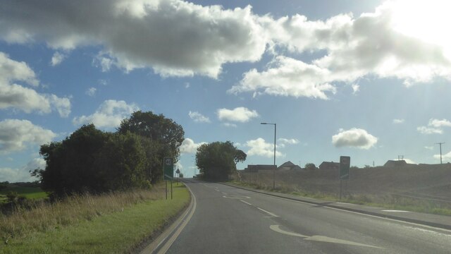
Crombie is a small village located in the county of Fife, Scotland. Situated on the northern shore of the Firth of Forth, this coastal settlement offers picturesque views and a tranquil atmosphere. The village is part of the parish of Torryburn and lies approximately 3 miles west of Dunfermline, one of the largest towns in Fife.

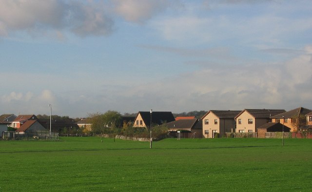
Crombie is primarily a residential area with a population of around 500 people. The village is known for its close-knit community and friendly atmosphere. The architecture in Crombie is a mix of traditional stone cottages and modern houses, giving the area a charming appeal.

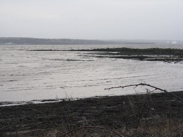
A highlight of Crombie is its beautiful beach, which stretches along the coastline and offers stunning vistas across the Firth of Forth. The beach is a popular spot for locals and visitors alike, with opportunities for seaside walks, picnics, and even water sports such as kayaking and windsurfing.

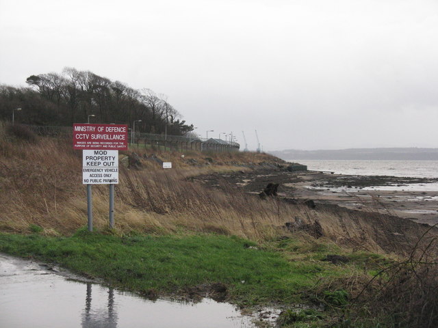
Crombie also boasts a small harbor, which adds to the village's maritime character. The harbor is home to a number of fishing boats and provides a pleasant backdrop for leisurely strolls along the waterfront.

Despite its small size, Crombie has a strong sense of community and offers basic amenities such as a local convenience store and a primary school. For more extensive shopping and entertainment options, residents can easily access nearby towns like Dunfermline or explore the wider attractions of Fife.

Overall, Crombie is a charming coastal village that offers a peaceful and idyllic setting, making it an attractive place to live or visit for those seeking a quiet retreat by the sea.

If you have any feedback on the listing, please let us know in the comments section below.
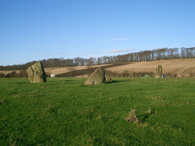
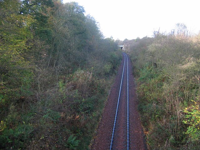
Crombie Images

Images are sourced within 2km of 56.047979/-3.528004 or Grid Reference NT0484. Thanks to Geograph Open Source API. All images are credited.

A985 eastbound
A985 eastbound
A985 at Waukmill, Fife
A985 approaching Crombie, Fife
DMC Crombie
DMC Crombie
Cranes on the pier at Defence Munitions, Crombie The Ochil Hills rise behind. Seen from the northern terrace at Hopetoun House.
Cranes on the pier at Defence Munitions, Crombie
The Ochil Hills rise behind. Seen from the northern terrace at Hopetoun House.
DMC Crombie A Royal Navy Fleet Auxiliary loading berth.
DMC Crombie
A Royal Navy Fleet Auxiliary loading berth.
Rocks Road, Charlestown
Old Lime Kiln, Charlestown
Railway Bridge, Broomhall Estate From this angle you are hard-put to make out a bridge of any description.
Railway Bridge, Broomhall Estate
From this angle you are hard-put to make out a bridge of any description.
Railway Bridge, Charlestown Line Bridge over the disused Charlestown railway line.
Railway Bridge, Charlestown Line
Bridge over the disused Charlestown railway line.
Old Railway Sidings You can just make out the remains of a railway platform in the undergrowth, possibly a loading stage for the whinstone quarry that used to be worked near here.
Old Railway Sidings
You can just make out the remains of a railway platform in the undergrowth, possibly a loading stage for the whinstone quarry that used to be worked near here.
Entrance to Pitliver Estate
Old Bit of Road At some point the A985 was straightened out a bit and this bit of road got left behind.
Old Bit of Road
At some point the A985 was straightened out a bit and this bit of road got left behind.
Old Railway Crossing One of the access roads to Broomhall estate crosses the former Charlestown railway line. Last operations on the line date from around 1993, by which time operations into the military depot at Crombie were more important than hauling lime from the kilns at Charlestown.
Old Railway Crossing
One of the access roads to Broomhall estate crosses the former Charlestown railway line. Last operations on the line date from around 1993, by which time operations into the military depot at Crombie were more important than hauling lime from the kilns at Charlestown.
Another Old Bit of Road A bit of the old road left behind when the A985 was straightened out some years ago.
Another Old Bit of Road
A bit of the old road left behind when the A985 was straightened out some years ago.
Footpath to Crombie
Footpath to Crombie
Fore shore at Crombie Point The western boundary of the Defence Munitions Depot at Crombie on the north shore of the Firth of Forth.
Fore shore at Crombie Point
The western boundary of the Defence Munitions Depot at Crombie on the north shore of the Firth of Forth.
Crombie Point Looking across the Firth of Forth to Bo'ness and Grangemouth. A grey day - storm Gertrude was still passing through, although the water seemed relatively undisturbed.
Crombie Point
Looking across the Firth of Forth to Bo'ness and Grangemouth. A grey day - storm Gertrude was still passing through, although the water seemed relatively undisturbed.
Show me another place!

Crombie is located at Grid Ref: NT0484 (Lat: 56.047979, Lng: -3.528004)

Unitary Authority: Fife

Police Authority: Fife

What 3 Words

///retaliate.newsprint.living. Near Cairneyhill, Fife

Related Wikis

DM Crombie

Defence Munitions Crombie is a military munitions depot on the upper Firth of Forth in West Fife, Scotland. The depot is located on the north shore of...

Cairneyhill

Cairneyhill is a village in West Fife, Scotland. It is 3 miles west of Dunfermline, on the A994, and has a population of around 2,510 (mid-2020 est.)...

Torryburn

Torryburn (previously called Torry/ Torrie) is a village and parish in Fife, Scotland, lying on the north shore of the Firth of Forth. It is one of a number...

Cairneyhill railway station

Cairneyhill railway station served the village of Cairneyhill, Fife, Scotland from 1906 to 1930 on the Kincardine Line. == History == The station opened...

Nearby Amenities

Located within 500m of 56.047979,-3.528004
Crombie
Place: village
Wikidata: Q3698316
Lat/Long: 56.0484981/-3.5285027
Post Box
Ref: KY12 103
Lat/Long: 56.0478837/-3.5282396
Bus Stop
Ordnance Road
Bench: no
Bin: no
Bus: yes
Check Date Shelter: 2024-02-11
Lit: no
Passenger Information Display: no
Public Transport: platform
Shelter: no
Tactile Paving: no
Lat/Long: 56.0490717/-3.5270417
Bus Stop
Ordnance Road
Bench: no
Bin: no
Bus: yes
Check Date Shelter: 2024-01-21
Lit: no
Passenger Information Display: no
Public Transport: platform
Shelter: no
Tactile Paving: no
Lat/Long: 56.0490507/-3.5266235
Bus Stop
Central Road
Bench: yes
Bus: yes
Lit: no
Passenger Information Display: no
Public Transport: platform
Shelter: yes
Lat/Long: 56.048782/-3.5277992
Bus Stop
Central Road
Bench: no
Bus: yes
Lit: no
Naptan AtcoCode: 6500D0596
Naptan NaptanCode: 34323768
Passenger Information Display: no
Public Transport: platform
Shelter: no
Lat/Long: 56.0486229/-3.5276699
Bus Stop
Ordnance Road Turning Circle
Bus: yes
Naptan AtcoCode: 6500D0598
Naptan NaptanCode: 34323748
Public Transport: platform
Lat/Long: 56.0450896/-3.527025
Generator Method: photovoltaic
Generator Output Electricity: yes
Generator Source: solar
Generator Type: solar_photovoltaic_panel
Power: generator
Lat/Long: 56.0480604/-3.525822
Material: wood
Power: pole
Lat/Long: 56.0502723/-3.5342484
Material: wood
Power: pole
Lat/Long: 56.0498517/-3.5332925
Power: pole
Lat/Long: 56.0494378/-3.5323726
Generator Method: photovoltaic
Generator Output Electricity: yes
Generator Source: solar
Generator Type: solar_photovoltaic_panel
Power: generator
Lat/Long: 56.0483772/-3.5289185
Generator Method: photovoltaic
Generator Output Electricity: yes
Generator Source: solar
Generator Type: solar_photovoltaic_panel
Power: generator
Lat/Long: 56.0483722/-3.5288493
Generator Method: photovoltaic
Generator Output Electricity: yes
Generator Source: solar
Generator Type: solar_photovoltaic_panel
Power: generator
Lat/Long: 56.0479898/-3.5271103
Generator Method: photovoltaic
Generator Output Electricity: yes
Generator Source: solar
Generator Type: solar_photovoltaic_panel
Power: generator
Lat/Long: 56.0479684/-3.5268142
Barrier: lift_gate
Lat/Long: 56.0438811/-3.5256373
Barrier: lift_gate
Lat/Long: 56.0438621/-3.5255466
Power: pole
Lat/Long: 56.0443766/-3.5267846
Power: pole
Lat/Long: 56.0453079/-3.5274991
Power: pole
Lat/Long: 56.0455567/-3.5276273
Power: pole
Lat/Long: 56.0461434/-3.5281185
Power: pole
Lat/Long: 56.0467411/-3.5284364
Power: pole
Lat/Long: 56.0473135/-3.5288677
Power: pole
Lat/Long: 56.0477245/-3.5291486
The data included in this document is from www.openstreetmap.org. The data is made available under ODbL.

Have you been to Crombie?

Leave your review of Crombie below (or comments, questions and feedback).