Aberdaron

Settlement in Caernarfonshire

Wales

Aberdaron

The beach at Aberdaron The Tŷ Newydd Hotel is on the left.
The beach at Aberdaron Credit: Steve Daniels

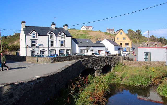
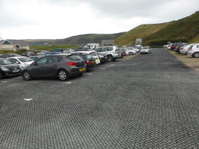
Aberdaron is a picturesque coastal village located on the westernmost tip of the Llŷn Peninsula in Caernarfonshire, Wales. Situated about 20 miles southwest of Pwllheli, this charming village offers stunning panoramic views of the Irish Sea and is a popular destination for tourists and locals alike.

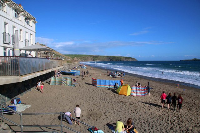
The village is known for its beautiful sandy beach, which stretches out along the coastline and provides a perfect spot for sunbathing, swimming, and picnicking. The crystal-clear waters are also ideal for water sports such as sailing, kayaking, and windsurfing. Fishing enthusiasts can try their luck from the rocky shores or join one of the local charter boats for a deep-sea fishing experience.

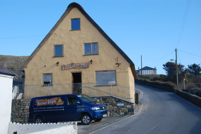
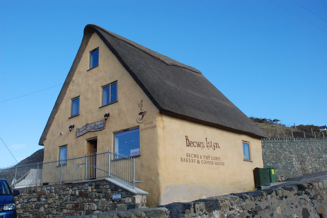
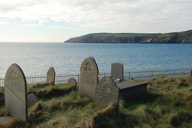
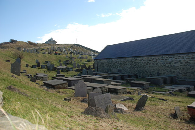
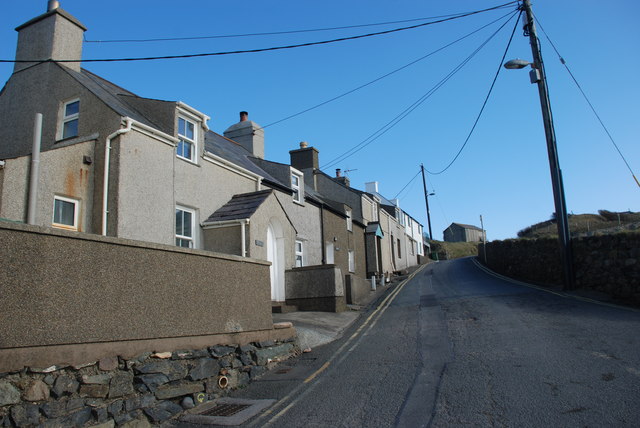
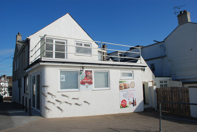
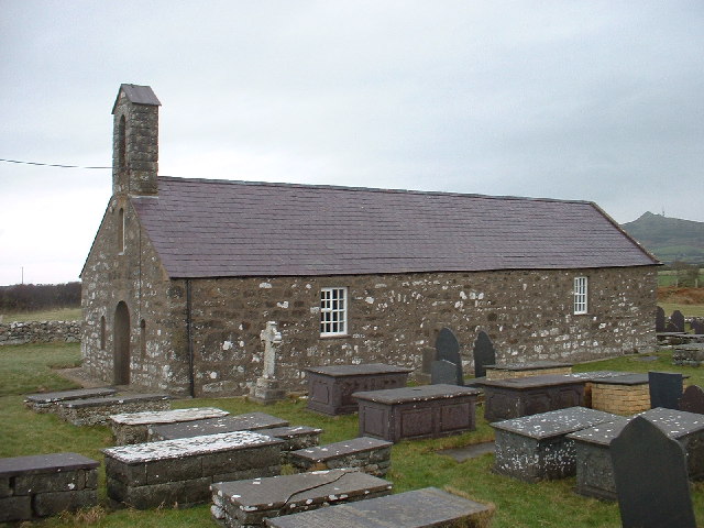
Aberdaron is steeped in history and boasts several historical landmarks. The most notable is the Saint Hywyn's Church, which dates back to the 12th century and offers stunning views of the village and the surrounding countryside from its hilltop location. The village also features traditional whitewashed cottages, a quaint harbor, and a range of locally-owned shops, cafes, and restaurants.

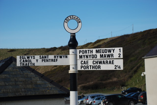
For nature lovers, Aberdaron is a gateway to the stunning scenery of the Llŷn Peninsula. The area is home to a variety of wildlife and offers numerous walking trails along the dramatic coastline and through the rolling hills. Visitors can explore the nearby Bardsey Island, a National Nature Reserve, which is inhabited by seals, puffins, and other seabirds.

Overall, Aberdaron is a charming and idyllic coastal village that offers a perfect blend of natural beauty, history, and outdoor activities for visitors to enjoy.

If you have any feedback on the listing, please let us know in the comments section below.
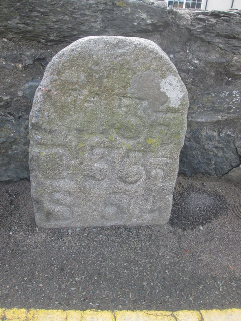
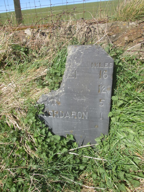
Aberdaron Images

Images are sourced within 2km of 52.810567/-4.707423 or Grid Reference SH1727. Thanks to Geograph Open Source API. All images are credited.

The beach at Aberdaron The Tŷ Newydd Hotel is on the left.
The beach at Aberdaron
The Tŷ Newydd Hotel is on the left.
Bridge over Afon Cyllyfelin (Pont Fach) Photographed from the bridge over the Afon Daron (Pont Fawr).
Bridge over Afon Cyllyfelin (Pont Fach)
Photographed from the bridge over the Afon Daron (Pont Fawr).
Resurfaced car park at Porth y Swnt
Porth y Swnt Interpretation Centre Owned by the National Trust. Its prize exhibit is the old [redundant] optic from the lighthouse on Ynys Enlli.
Porth y Swnt Interpretation Centre
Owned by the National Trust. Its prize exhibit is the old [redundant] optic from the lighthouse on Ynys Enlli.
The lighthouse optic in Porth y Swnt The part-figure gives the scale. Some of the glass lens sections have damage which are allegedly bullet chips from World War II attempts by German planes to extinguish the light.
The lighthouse optic in Porth y Swnt
The part-figure gives the scale. Some of the glass lens sections have damage which are allegedly bullet chips from World War II attempts by German planes to extinguish the light.
Becws Islyn The former corrugated iron <a href="https://www.geograph.org.uk/photo/357618">SH1726 : Becws Islyn Bakery Aberdaron</a> was demolished in 2015 and replaced by a newly built bakery, shop and coffee house. It is an impressive building and a great addition to Aberdaron, though the colour-washed walls and thatched roof are very much out of character with the otherwise white and grey grittiness of this windswept village.
Becws Islyn
The former corrugated iron SH1726 : Becws Islyn Bakery Aberdaron was demolished in 2015 and replaced by a newly built bakery, shop and coffee house. It is an impressive building and a great addition to Aberdaron, though the colour-washed walls and thatched roof are very much out of character with the otherwise white and grey grittiness of this windswept village.
Porth y Swnt For information about the National Trust centre opened in 2014 see <span class="nowrap"><a title="http://www.nationaltrust.org.uk/porth-y-swnt" rel="nofollow ugc noopener" href="http://www.nationaltrust.org.uk/porth-y-swnt">Link</a><img style="margin-left:2px;" alt="External link" title="External link - shift click to open in new window" src="https://s1.geograph.org.uk/img/external.png" width="10" height="10"/></span>
Porth y Swnt
For information about the National Trust centre opened in 2014 see LinkExternal link
Arwyddbost yng nghanol y pentref - Signpost in the centre of the village
Mynwent Eglwys Hywyn Sant - St Hywyn's Church graveyard
Y ffordd i'r Rhiw - The road to Rhiw The row of cottages opposite the church are now mostly holiday lets.
Y ffordd i'r Rhiw - The road to Rhiw
The row of cottages opposite the church are now mostly holiday lets.
Bagét ar y Traeth - Baguette on the Beach A seasonal takeaway facing the beach.
Bagét ar y Traeth - Baguette on the Beach
A seasonal takeaway facing the beach.
Bwydlen ddwyiethog Bilingual menu Fare on offer at <a href="https://www.geograph.org.uk/photo/4845125">SH1726 : Bagét ar y Traeth - Baguette on the Beach</a>
Bwydlen ddwyiethog Bilingual menu
Ordnance Survey Cut Mark This OS cut mark can be found on the NE face of St Hywyn's Church. It marks a point 9.826m above mean sea level.
Ordnance Survey Cut Mark
This OS cut mark can be found on the NE face of St Hywyn's Church. It marks a point 9.826m above mean sea level.
Milestone
Milestone
Ordnance Survey Cut Mark This OS cut mark can be found on the SW face of the Church. It marks a point 47.742m above mean sea level.
Ordnance Survey Cut Mark
This OS cut mark can be found on the SW face of the Church. It marks a point 47.742m above mean sea level.
Milestone - Pwllheli 16
Show me another place!

Aberdaron is located at Grid Ref: SH1727 (Lat: 52.810567, Lng: -4.707423)

Unitary Authority: Gwynedd

Police Authority: North Wales

What 3 Words

///tabs.washable.rests. Near Nefyn, Gwynedd

Nearby Locations

Aberdaron

Related Wikis

Aberdaron

Aberdaron is a community, electoral ward and former fishing village at the western tip of the Llŷn Peninsula in the Welsh county of Gwynedd. It lies 14...

St Hywyn's Church, Aberdaron

The Church of St Hywyn, Aberdaron, Gwynedd, Wales, is a parish church dating from the 12th century. Its origins are earlier, as a clas church from the...

Llanfaelrhys

Llanfaelrhys is a village and former civil parish in the Welsh county of Gwynedd, located on the Llŷn Peninsula. The parish was abolished in 1934 and...

Bodferin

Bodferin is a former civil parish in the Welsh county of Gwynedd. It was abolished in 1934, and incorporated into Aberdaron. == References ==
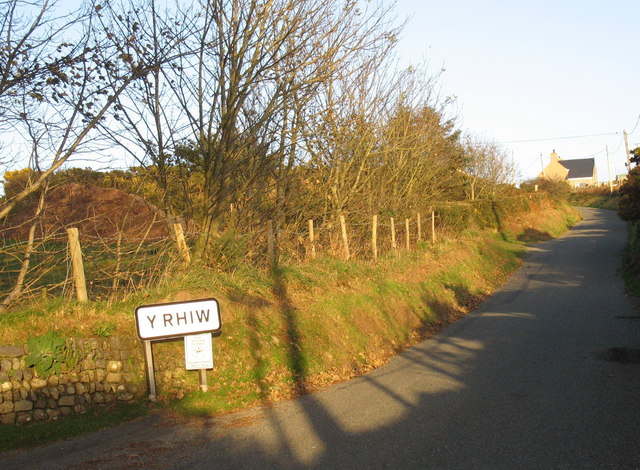
Y Rhiw

Y Rhiw () is a small village on the south west tip of the Llŷn Peninsula in Gwynedd, Wales. The village forms part of the community of Aberdaron. From...

Bryncroes

Bryncroes is a hamlet and former civil parish in Gwynedd in Wales, and lies on the Llŷn Peninsula approximately 2 km west of Sarn Meyllteyrn. The parish...

Llangwnnadl

Llangwnnadl is a village and former civil parish in the Welsh county of Gwynedd. The parish was abolished in 1934, and incorporated into Tudweiliog....

Bardsey Bird and Field Observatory

Bardsey Bird and Field Observatory is a bird observatory on Bardsey Island, off the Welsh coast. It was founded in 1953 by a group of ornithologists from...

Nearby Amenities

Located within 500m of 52.810567,-4.707423
Barrier: cattle_grid
Lat/Long: 52.8137067/-4.7033137
Power: pole
Source: Bing
Lat/Long: 52.8099961/-4.7143151
Power: pole
Source: Bing
Lat/Long: 52.8091433/-4.7143849
Addr Housenumber: 1
Addr Street: Bro Hywyn
Lat/Long: 52.8134024/-4.7048883
Addr Housenumber: 10
Addr Street: Bro Hywyn
Lat/Long: 52.8131798/-4.7060662
Addr Housenumber: 3
Addr Street: Bro Hywyn
Lat/Long: 52.8133797/-4.7050616
Addr Housename: Awelfor
Lat/Long: 52.8132295/-4.7057787
Addr Housename: Glanfa
Lat/Long: 52.8132998/-4.7054916
Addr Housenumber: 2
Addr Street: Bro Hywyn
Lat/Long: 52.8133915/-4.7049782
Addr Housename: Argraig
Lat/Long: 52.8132022/-4.7059646
Addr Housenumber: 4
Addr Street: Bro Hywyn
Lat/Long: 52.8133597/-4.7051496
Morawel Caravan & Camp Site
Tourism: camp_site
Lat/Long: 52.8139821/-4.7050416
Addr Housename: Erddig
Lat/Long: 52.8132431/-4.7056627
Post Box
Lat/Long: 52.8135015/-4.7035652
Barrier: kissing_gate
Lat/Long: 52.8102773/-4.7009602
Entrance: yes
Lat/Long: 52.8118281/-4.7090124
Direction: SSE
Generator Method: photovoltaic
Generator Output Electricity: yes
Generator Solar Modules: 12
Generator Source: solar
Generator Type: solar_photovoltaic_panel
Location: roof
Power: generator
Lat/Long: 52.8136894/-4.7029324
Direction: SE
Generator Method: photovoltaic
Generator Output Electricity: yes
Generator Solar Modules: 6
Generator Source: solar
Generator Type: solar_photovoltaic_panel
Location: roof
Power: generator
Lat/Long: 52.8098057/-4.7088821
Direction: SE
Generator Method: photovoltaic
Generator Output Electricity: yes
Generator Solar Modules: 6
Generator Source: solar
Generator Type: solar_photovoltaic_panel
Location: roof
Power: generator
Lat/Long: 52.8097587/-4.7089921
Direction: SE
Generator Method: photovoltaic
Generator Output Electricity: yes
Generator Solar Modules: 6
Generator Source: solar
Generator Type: solar_photovoltaic_panel
Location: roof
Power: generator
Lat/Long: 52.809646/-4.7091839
Direction: SE
Generator Method: photovoltaic
Generator Output Electricity: yes
Generator Solar Modules: 6
Generator Source: solar
Generator Type: solar_photovoltaic_panel
Location: roof
Power: generator
Lat/Long: 52.8095893/-4.7093166
Direction: 195
Generator Method: photovoltaic
Generator Output Electricity: yes
Generator Solar Modules: 17
Generator Source: solar
Generator Type: solar_photovoltaic_panel
Location: roof
Power: generator
Lat/Long: 52.8088645/-4.7084999
Direction: 280
Generator Method: photovoltaic
Generator Output Electricity: yes
Generator Solar Modules: 8
Generator Source: solar
Generator Type: solar_photovoltaic_panel
Location: roof
Power: generator
Lat/Long: 52.8084981/-4.7095272
Direction: 175
Generator Method: photovoltaic
Generator Output Electricity: yes
Generator Solar Modules: 16
Generator Source: solar
Generator Type: solar_photovoltaic_panel
Location: roof
Power: generator
Lat/Long: 52.8074377/-4.710415
Direction: 170
Generator Method: photovoltaic
Generator Output Electricity: yes
Generator Solar Modules: 10
Generator Source: solar
Generator Type: solar_photovoltaic_panel
Location: roof
Power: generator
Lat/Long: 52.8066854/-4.7102031
Direction: 170
Generator Method: photovoltaic
Generator Output Electricity: yes
Generator Solar Modules: 6
Generator Source: solar
Generator Type: solar_photovoltaic_panel
Location: roof
Power: generator
Lat/Long: 52.8066805/-4.7104177
Direction: 170
Generator Method: photovoltaic
Generator Output Electricity: yes
Generator Solar Modules: 10
Generator Source: solar
Generator Type: solar_photovoltaic_panel
Location: roof
Power: generator
Lat/Long: 52.8068881/-4.7102246
Direction: 170
Generator Method: photovoltaic
Generator Output Electricity: yes
Generator Solar Modules: 6
Generator Source: solar
Generator Type: solar_photovoltaic_panel
Location: roof
Power: generator
Lat/Long: 52.8068784/-4.7104177
Power: pole
Source: Bing
Lat/Long: 52.809201/-4.7127023
Power: pole
Source: Bing
Lat/Long: 52.8089642/-4.7117575
Power: pole
Source: Bing
Lat/Long: 52.810147/-4.7104231
Power: pole
Source: Bing
Lat/Long: 52.8095893/-4.7135103
The data included in this document is from www.openstreetmap.org. The data is made available under ODbL.

Have you been to Aberdaron?

Leave your review of Aberdaron below (or comments, questions and feedback).