Brownheath Common
Wood, Forest in Worcestershire Wychavon
England
Brownheath Common

Brownheath Common is a picturesque woodland area located in the county of Worcestershire, England. Covering an expanse of approximately 100 acres, it is situated near the village of Chaddesley Corbett. The common is predominantly composed of woodlands and forests, making it a haven for nature enthusiasts and outdoor lovers.
The common is characterized by its diverse range of flora and fauna, with a variety of tree species dominating the landscape. Ancient oaks, birches, and beeches can be found scattered throughout the area, providing a rich and vibrant habitat for numerous wildlife species. The woodland floor is adorned with carpets of bluebells during the springtime, creating a stunning display of color.
Traversing through Brownheath Common, visitors can enjoy a network of well-maintained footpaths and trails that wind their way through the woodland. These paths offer opportunities for leisurely strolls, peaceful picnics, and even long hikes, allowing visitors to fully immerse themselves in the natural beauty of the area.
The common is also home to a variety of bird species, making it a popular destination for birdwatchers. Visitors may spot woodpeckers, owls, and various other songbirds as they explore the woods. Additionally, the common supports a diverse range of small mammals, such as foxes, badgers, and deer, further enhancing its appeal to wildlife enthusiasts.
Overall, Brownheath Common is a tranquil and idyllic woodland area, offering visitors a peaceful escape from the hustle and bustle of everyday life. With its stunning natural beauty and abundant wildlife, it serves as a testament to the importance of preserving and appreciating the natural world.
If you have any feedback on the listing, please let us know in the comments section below.
Brownheath Common Images
Images are sourced within 2km of 52.237731/-2.1529388 or Grid Reference SO8959. Thanks to Geograph Open Source API. All images are credited.


Brownheath Common is located at Grid Ref: SO8959 (Lat: 52.237731, Lng: -2.1529388)
Administrative County: Worcestershire
District: Wychavon
Police Authority: West Mercia
What 3 Words
///flaking.looked.recorders. Near Fernhill Heath, Worcestershire
Nearby Locations
Related Wikis

Oddingley
Oddingley is a village and civil parish in the English county of Worcestershire, approximately 9 km (5.6 mi) north-east of the county town of Worcester...
Martin Hussingtree
Martin Hussingtree is a small village situated between Droitwich Spa and Worcester in the county of Worcestershire, England. It is north of another village...
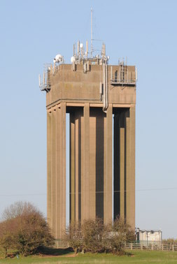
Droitwich Water Tower
The Droitwich Water Tower, also known as Yew Tree Hill Water Tower, is a structure on Yew Tree Hill in Droitwich, England, owned and operated by Severn...
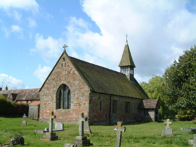
Church of St Michael and All Angels, Martin Hussingtree
The Church of St Michael and All Angels is a Grade I listed church in Martin Hussingtree, Worcestershire.The west wall is probably of 12th century origin...
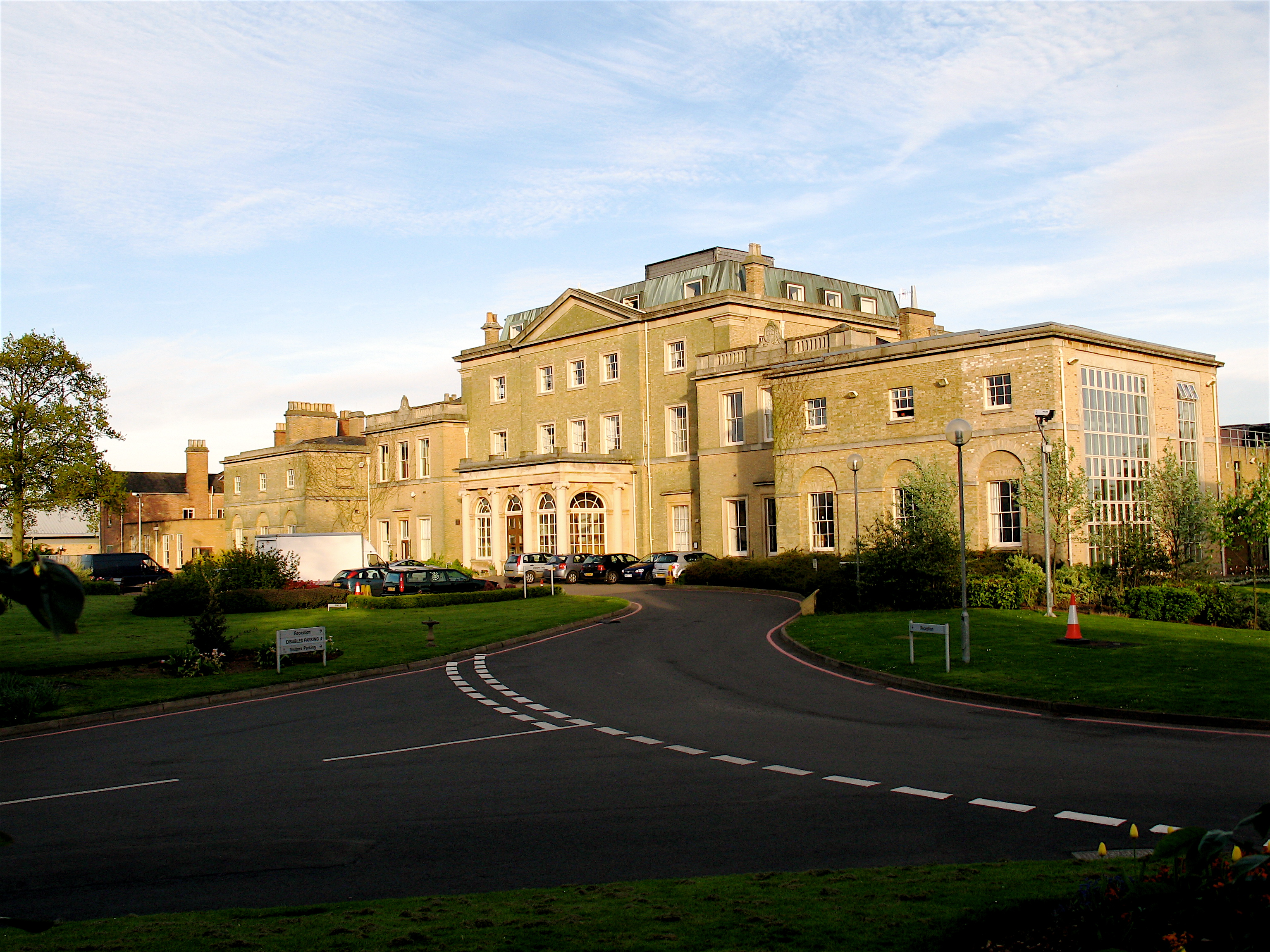
Hindlip Hall
Hindlip Hall is a stately home in Hindlip, Worcestershire, England. The first major hall was built before 1575, and it played a significant role in both...

Dunhampstead
Dunhampstead is a small village in the English county of Worcestershire. It is located about 6 miles to the north-east of Worcester and around half a...
Hindlip
Hindlip or Hinlip is a village and civil parish 3 miles (4.8 km) north east of Worcester, in the Wychavon district, in the county of Worcestershire, England...

Church of the Sacred Heart and St Catherine of Alexandria
The Church of the Sacred Heart and St Catherine of Alexandria is a Catholic church situated in Droitwich Spa, Worcestershire, England, noted for its remarkable...
Nearby Amenities
Located within 500m of 52.237731,-2.1529388Have you been to Brownheath Common?
Leave your review of Brownheath Common below (or comments, questions and feedback).