Brewood Park Gorse

Wood, Forest in Staffordshire South Staffordshire

England

Brewood Park Gorse

River Penk - upstream at Pendeford Hall Lane
River Penk - upstream at Pendeford Hall Lane Credit: John M

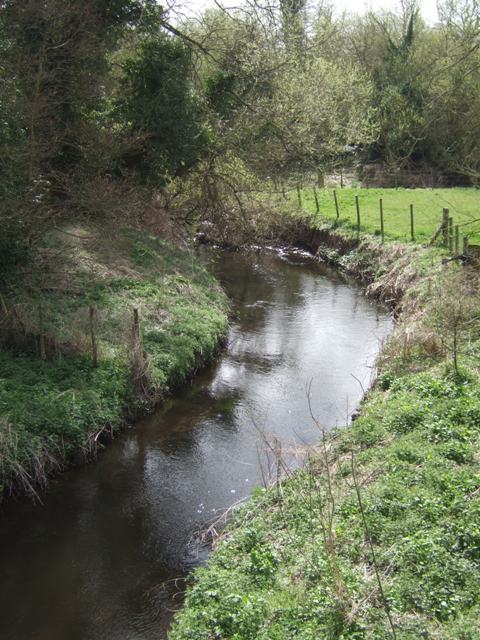
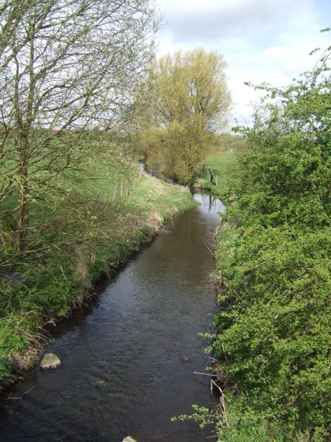
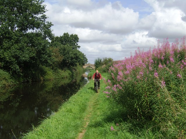
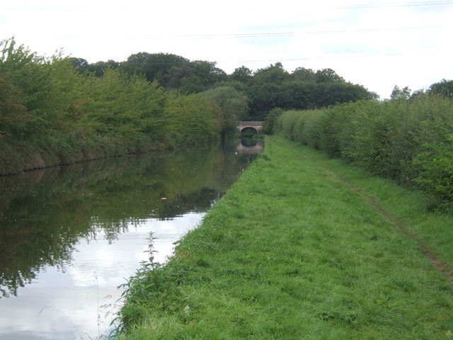
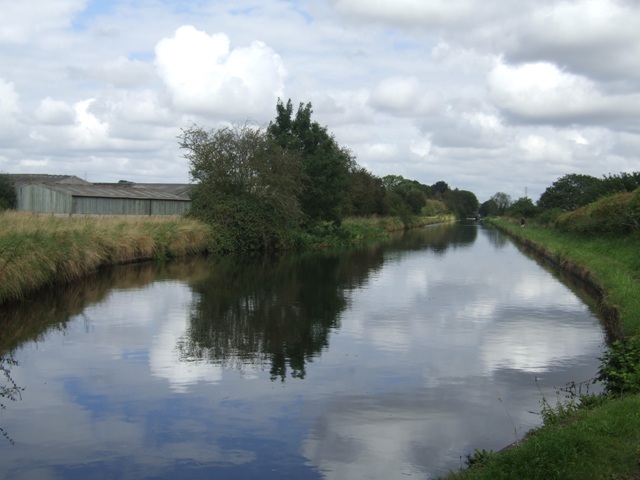
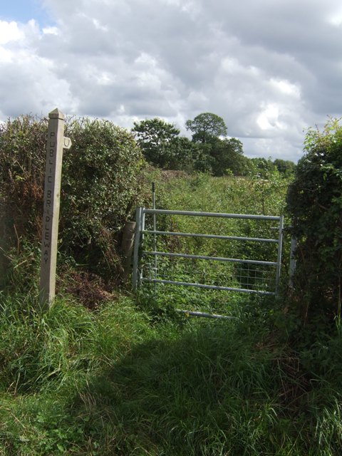
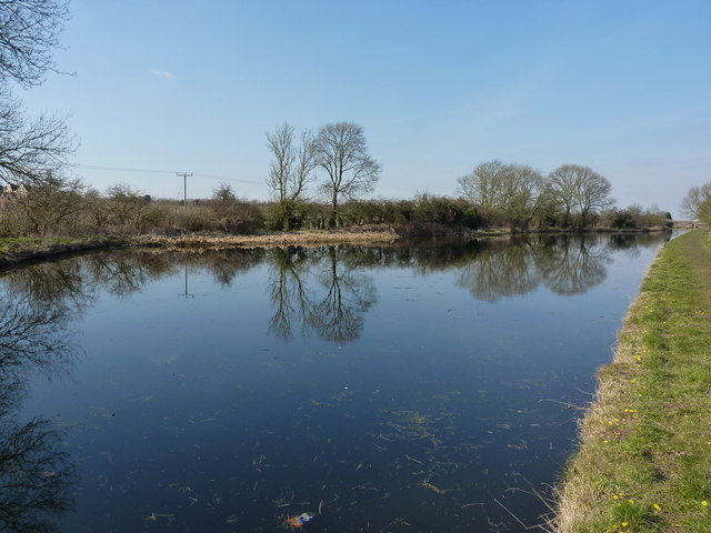
Brewood Park Gorse is a picturesque woodland located in Staffordshire, England. Covering an area of approximately 20 hectares, it is renowned for its diverse range of flora and fauna, making it a popular destination for nature enthusiasts and hikers alike.

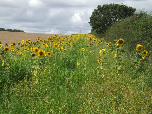
The gorse, a spiny evergreen shrub, dominates the landscape with its vibrant yellow flowers that bloom from late winter to early spring, adding a splash of color to the woodland. This, along with the dense canopy of trees, creates a unique and enchanting atmosphere within the park.

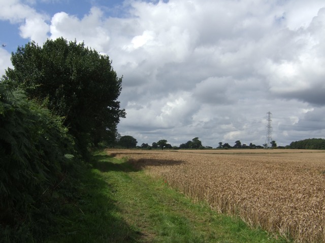
The woodland comprises mainly of native broadleaf species such as oak, birch, and beech, providing a rich habitat for a variety of wildlife. Visitors may be lucky enough to spot deer, foxes, rabbits, and numerous species of birds including woodpeckers and owls.

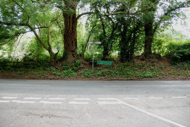
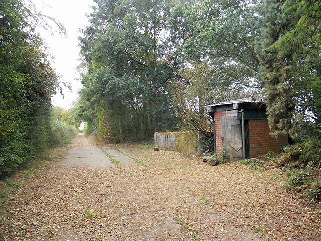
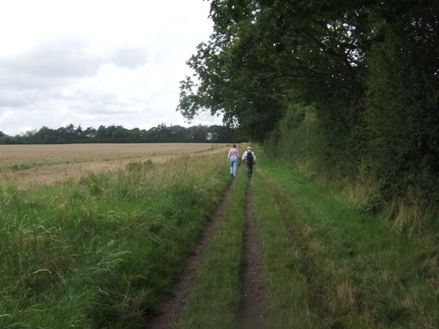
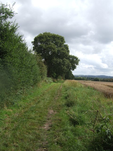
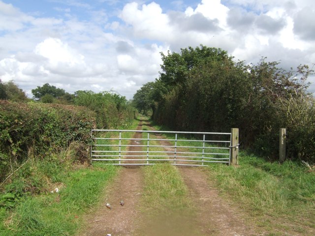
Brewood Park Gorse offers several well-marked trails that wind through the woodland, catering to different levels of fitness and interests. The paths are well-maintained, making it accessible for all visitors, including families with young children or individuals with mobility challenges.

In addition to its natural beauty, the park also features picnic areas and benches, inviting visitors to relax and enjoy the peaceful surroundings. Interpretive signs provide information about the flora and fauna, enhancing the educational and recreational aspects of the park.

Brewood Park Gorse is a hidden gem in Staffordshire, offering a tranquil retreat from the hustle and bustle of everyday life. Whether you are seeking a leisurely stroll, a wildlife spotting adventure, or simply a place to unwind, this woodland is a must-visit destination for nature lovers.

If you have any feedback on the listing, please let us know in the comments section below.

Brewood Park Gorse Images

Images are sourced within 2km of 52.65278/-2.1546515 or Grid Reference SJ8906. Thanks to Geograph Open Source API. All images are credited.

River Penk - upstream at Pendeford Hall Lane
River Penk - downstream at Pendeford Hall Lane
Somerford Lane meets Brewood Road-Coven Road
Bridleway near Long Birch Farm
Monarch's Way
Monarch's Way
Shropshire Union towpath near Lower Hattons Bridge The Monarch's Way follows the towpath south to Pendeford Bridge on its way from Boscobel to Moseley Old Hall.
Shropshire Union towpath near Lower Hattons Bridge
The Monarch's Way follows the towpath south to Pendeford Bridge on its way from Boscobel to Moseley Old Hall.
Walkers on the Monarchs Way Between Hunting Bridge and Port Lane.
Walkers on the Monarchs Way
Between Hunting Bridge and Port Lane.
Monarch's Way The path drops down from Port Lane to Hunting Bridge heading for Pendeford Mill.
Monarch's Way
The path drops down from Port Lane to Hunting Bridge heading for Pendeford Mill.
Shropshire Union Canal - View towards Park Bridge
Sunflowers in the field margin
Monarch's Way The footpath drops down from Port Lane to Hunting Bridge.
Monarch's Way
The footpath drops down from Port Lane to Hunting Bridge.
Winding hole north of Lower Hattons Bridge On the Shropshire Union Canal.
Winding hole north of Lower Hattons Bridge
On the Shropshire Union Canal.
Farm lane by the Hattons Permissive footpath and bridleway.
Farm lane by the Hattons
Permissive footpath and bridleway.
Bridleway to Pendeford The overgrown path looked to be too much of a challenge without a machete.
Bridleway to Pendeford
The overgrown path looked to be too much of a challenge without a machete.
M54, eastbound The M54 is a 23 mile east-west motorway in Shropshire and Staffordshire. It is a two-lane dual carriageway for the majority of its length, with sections of three-lane.
The M54 spur connects the M6 motorway near Essington, Staffordshire with the A5 trunk road at Wellington, Shropshire. The motorway forms part of the route to North Wales, roughly following the path of the Roman Watling Street and the A5 north-westwards, towards the port of Holyhead.
M54, eastbound
The M54 is a 23 mile east-west motorway in Shropshire and Staffordshire. It is a two-lane dual carriageway for the majority of its length, with sections of three-lane. The M54 spur connects the M6 motorway near Essington, Staffordshire with the A5 trunk road at Wellington, Shropshire. The motorway forms part of the route to North Wales, roughly following the path of the Roman Watling Street and the A5 north-westwards, towards the port of Holyhead.
M54, farm access bridge The M54 is a 23 mile east-west motorway in Shropshire and Staffordshire. It is a two-lane dual carriageway for the majority of its length, with sections of three-lane.
The M54 spur connects the M6 motorway near Essington, Staffordshire with the A5 trunk road at Wellington, Shropshire. The motorway forms part of the route to North Wales, roughly following the path of the Roman Watling Street and the A5 north-westwards, towards the port of Holyhead.
M54, farm access bridge
The M54 is a 23 mile east-west motorway in Shropshire and Staffordshire. It is a two-lane dual carriageway for the majority of its length, with sections of three-lane. The M54 spur connects the M6 motorway near Essington, Staffordshire with the A5 trunk road at Wellington, Shropshire. The motorway forms part of the route to North Wales, roughly following the path of the Roman Watling Street and the A5 north-westwards, towards the port of Holyhead.
M54 near Ash Coppice The M54 is a 23 mile east-west motorway in Shropshire and Staffordshire. It is a two-lane dual carriageway for the majority of its length, with sections of three-lane.
The M54 spur connects the M6 motorway near Essington, Staffordshire with the A5 trunk road at Wellington, Shropshire. The motorway forms part of the route to North Wales, roughly following the path of the Roman Watling Street and the A5 north-westwards, towards the port of Holyhead.
M54 near Ash Coppice
The M54 is a 23 mile east-west motorway in Shropshire and Staffordshire. It is a two-lane dual carriageway for the majority of its length, with sections of three-lane. The M54 spur connects the M6 motorway near Essington, Staffordshire with the A5 trunk road at Wellington, Shropshire. The motorway forms part of the route to North Wales, roughly following the path of the Roman Watling Street and the A5 north-westwards, towards the port of Holyhead.
The Upper Hattons 'wide' A particularly wide section of the Shroppy canal, just north of the Upper Hattons bridge.
The Upper Hattons 'wide'
A particularly wide section of the Shroppy canal, just north of the Upper Hattons bridge.
Show me another place!

Brewood Park Gorse is located at Grid Ref: SJ8906 (Lat: 52.65278, Lng: -2.1546515)

Administrative County: Staffordshire

District: South Staffordshire

Police Authority: Staffordshire

What 3 Words

///system.bill.verse. Near Coven, Staffordshire

Nearby Locations

Brewood Park Gorse

Related Wikis

Coven, Staffordshire

Coven is a village in the district of South Staffordshire, England, near to the border with Wolverhampton. Together with Brewood it forms part of the...

St Paul's Church, Coven

St Paul's Church, Coven is a Grade II listed parish church in the Church of England in Coven, Staffordshire == History == The church was built in 1857...

Somerford Hall

Somerford Hall is an 18th-century Palladian style mansion house at Brewood, Staffordshire. It is a Grade II* listed building. Somerford is a name of Old...

Wolverhampton Casuals F.C.

Wolverhampton Casuals Football Club are a football club based in Featherstone, near Wolverhampton, England. Established in 1899, they are currently members...

Brinsford Parkway railway station

Brinsford Parkway is a proposed mainline railway station to the north of Wolverhampton, England. It has yet to be passed and is still in planning stages...
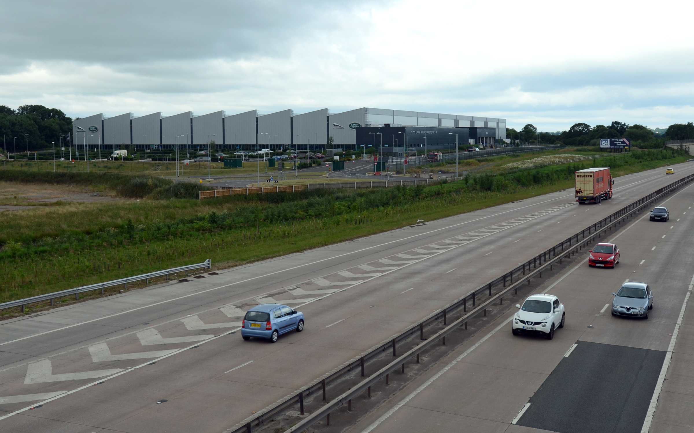
I54

i54 South Staffordshire is a 98-hectare (240-acre) UK technology-based business park located at Junction 2 on the M54 Motorway in the West Midlands, on...

HM Prison Oakwood

HM Prison Oakwood is a Category C prison in Featherstone, Staffordshire, England. First opened in April 2012, the prison is operated by G4S and was primed...

Goodrich F.C.

Goodrich F.C. was a football club based in Wolverhampton, West Midlands, England. The team joined the West Midlands (Regional) League Division One North...

Have you been to Brewood Park Gorse?

Leave your review of Brewood Park Gorse below (or comments, questions and feedback).