Coneybury Wood

Wood, Forest in Worcestershire Wychavon

England

Coneybury Wood

Under the Rails The footpath passes under the Birmingham to Cheltenham railway line near Bredicot.
Under the Rails Credit: Gordon Griffiths

Coneybury Wood is a picturesque woodland located in the county of Worcestershire, England. Covering an area of approximately 50 hectares, it is a cherished natural gem that attracts visitors from near and far. Nestled in the heart of the county, the wood is easily accessible from nearby towns and villages.

The wood boasts a diverse range of flora and fauna, making it a haven for nature enthusiasts. Towering oak and beech trees dominate the landscape, providing a rich canopy that offers shelter and habitat for various woodland creatures. Bluebells carpet the forest floor in spring, creating a breathtaking display of vibrant colors. The wood is also home to a variety of bird species, including woodpeckers, owls, and thrushes, making it a popular spot for birdwatchers.

A network of well-maintained footpaths weaves through the wood, allowing visitors to explore its beauty at their own pace. Whether you prefer a leisurely stroll or a more adventurous hike, Coneybury Wood caters to all abilities. The trails lead visitors through enchanting glades, past babbling brooks, and to secluded clearings perfect for picnics or quiet contemplation.

Coneybury Wood has a rich history, with evidence of human activity dating back centuries. Archaeological finds, such as ancient burial mounds and remnants of Iron Age settlements, provide glimpses into the wood's past. Visitors can immerse themselves in the area's history and imagine the lives of those who once called it home.

Overall, Coneybury Wood is a captivating destination that offers a peaceful retreat for those seeking solace in nature. Its beauty, biodiversity, and historical significance make it a true treasure in Worcestershire's natural landscape.

If you have any feedback on the listing, please let us know in the comments section below.

Coneybury Wood Images

Images are sourced within 2km of 52.211808/-2.1557181 or Grid Reference SO8957. Thanks to Geograph Open Source API. All images are credited.

Under the Rails The footpath passes under the Birmingham to Cheltenham railway line near Bredicot.
Under the Rails
The footpath passes under the Birmingham to Cheltenham railway line near Bredicot.
Clover Path The footpath view near Thrift Wood, Crowle.
Clover Path
The footpath view near Thrift Wood, Crowle.
Path to the Rails The footpath view towards the railway line near Bredicot.
Path to the Rails
The footpath view towards the railway line near Bredicot.
Smite Lane From The Pear Tree
Footpath on farm track over the railway, Tibberton
Eco-friendly transport, Tibberton The "Tesco" train on its daily trip from Daventry to Cardiff. Containers are
emblazoned "Less CO2 rail". Missed getting a good photo, hence the hedge, had to be taken from further along the footpath.
Eco-friendly transport, Tibberton
The "Tesco" train on its daily trip from Daventry to Cardiff. Containers are emblazoned "Less CO2 rail". Missed getting a good photo, hence the hedge, had to be taken from further along the footpath.
The Pear Tree Large country hotel, conference centre and pub on the north side of Smite Lane.
<span class="nowrap"><a title="http://www.thepeartree.co.uk/" rel="nofollow ugc noopener" href="http://www.thepeartree.co.uk/">Link</a><img style="margin-left:2px;" alt="External link" title="External link - shift click to open in new window" src="https://s1.geograph.org.uk/img/external.png" width="10" height="10"/></span>
The Pear Tree
Large country hotel, conference centre and pub on the north side of Smite Lane. LinkExternal link
Arable land on Smite Hill Sweeping south-east down to the M5 with Crowle on the hill opposite.
Arable land on Smite Hill
Sweeping south-east down to the M5 with Crowle on the hill opposite.
M5 bridge near Smite Hill The little-used farm track is purely for connecting fields and to take the public footpath. Very much a tunnel under the motorway.
M5 bridge near Smite Hill
The little-used farm track is purely for connecting fields and to take the public footpath. Very much a tunnel under the motorway.
Footpath to Tibberton Not much evidence of use for this public footpath, which heads south-east towards the houses at Tibberton Bridge.
Footpath to Tibberton
Not much evidence of use for this public footpath, which heads south-east towards the houses at Tibberton Bridge.
Reeds on the Worcester & Birmingham Canal Last year's reed crop is still standing in April as the houses on the south side of the canal at Tibberton catch the evening sun.
Reeds on the Worcester & Birmingham Canal
Last year's reed crop is still standing in April as the houses on the south side of the canal at Tibberton catch the evening sun.
Worcester & Birmingham Canal at Tibberton Bridge Looking east along the row of moored narrowboats and a particularly well-tended vegetable garden.
Worcester & Birmingham Canal at Tibberton Bridge
Looking east along the row of moored narrowboats and a particularly well-tended vegetable garden.
Towards Tibberton View from the railway line between Bromsgrove and Tewkesbury. The large tree on the left is shown on the maps. A footpath crosses the field behind the tree, heading from the railway towards the village on its hill.
Towards Tibberton
View from the railway line between Bromsgrove and Tewkesbury. The large tree on the left is shown on the maps. A footpath crosses the field behind the tree, heading from the railway towards the village on its hill.
Field boundary near Bredicot A distinctive double right-angled bend betraying the removal of other field boundaries, seen from the railway line between Bromsgrove and Tewkesbury just a few metres north of the bridge shown in <a href="https://www.geograph.org.uk/photo/2584226">SO9055 : Under the Rails</a>.
Field boundary near Bredicot
A distinctive double right-angled bend betraying the removal of other field boundaries, seen from the railway line between Bromsgrove and Tewkesbury just a few metres north of the bridge shown in SO9055 : Under the Rails.
Bridge 25, Tibberton Bridge, from the west Carrying Plough Lane over the Worcester and Birmingham Canal.
Bridge 25, Tibberton Bridge, from the west
Carrying Plough Lane over the Worcester and Birmingham Canal.
House in Foredraught Lane, Tibberton Seen from a narrowboat on the Worcester and Birmingham Canal.
House in Foredraught Lane, Tibberton
Seen from a narrowboat on the Worcester and Birmingham Canal.
Bend on the Worcester and Birmingham Canal About 100 metres to the west, the M5 is heard but not seen.
Bend on the Worcester and Birmingham Canal
About 100 metres to the west, the M5 is heard but not seen.
Tibberton on the Worcester and Birmingham Canal  Mooring south west of the Bridge Inn at Tibberton on the Worcester and Birmingham Canal.
It seems to be a busy place even early in summer when we were there.
The pub had a strange collection of pottery ladies underwear for sale on the windowsills!
Tibberton on the Worcester and Birmingham Canal
Mooring south west of the Bridge Inn at Tibberton on the Worcester and Birmingham Canal. It seems to be a busy place even early in summer when we were there. The pub had a strange collection of pottery ladies underwear for sale on the windowsills!
Show me another place!

Coneybury Wood is located at Grid Ref: SO8957 (Lat: 52.211808, Lng: -2.1557181)

Administrative County: Worcestershire

District: Wychavon

Police Authority: West Mercia

What 3 Words

///guests.factored.kennels. Near Fernhill Heath, Worcestershire

Nearby Locations

Coneybury Wood

Related Wikis

Sixways Stadium

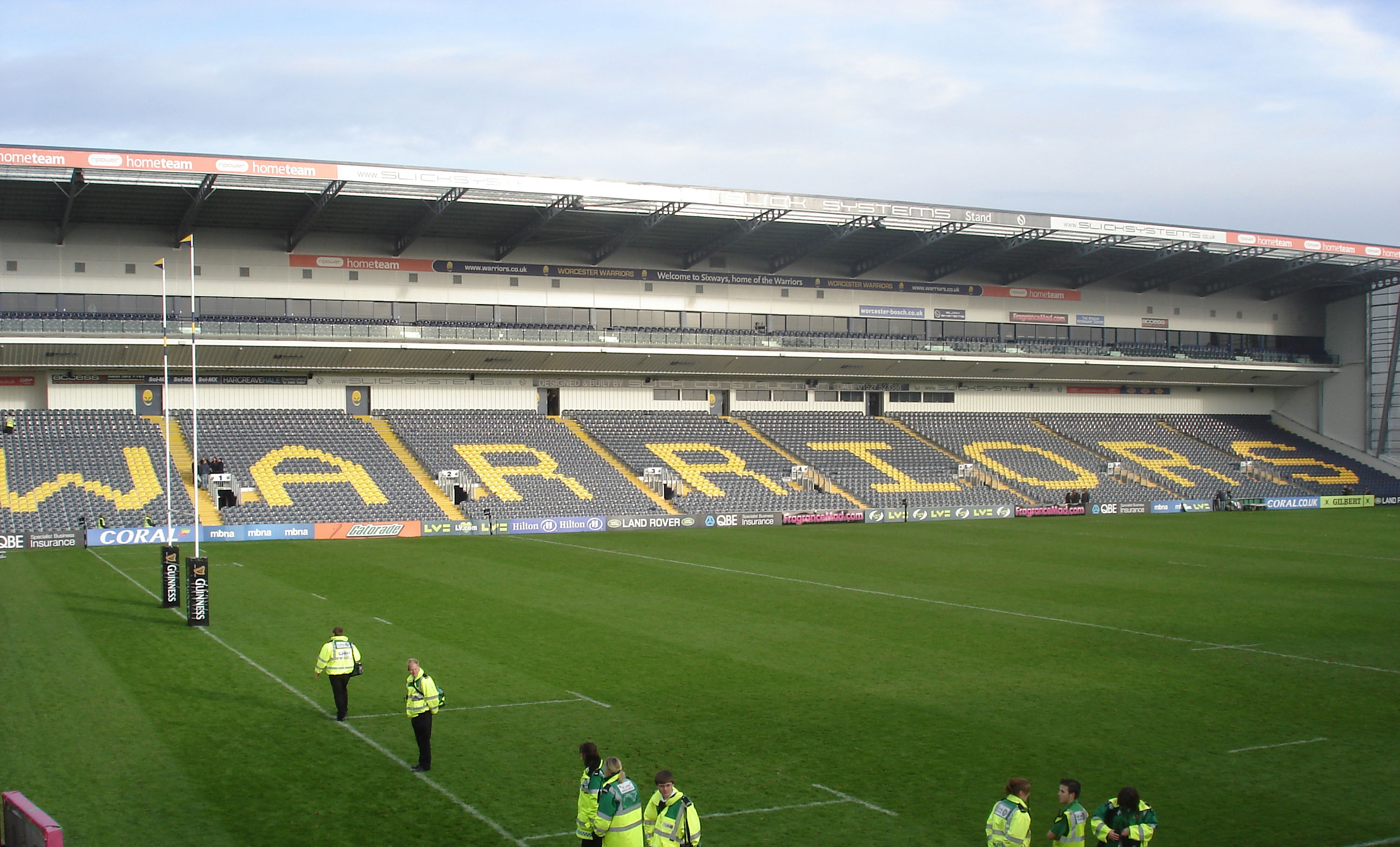
Sixways Stadium is a stadium in Worcester, England. It is currently used for rugby union and association football matches and is the home stadium of Premier...

Worcester Raiders F.C.

Worcester Raiders Football Club is a football club based in Worcester, Worcestershire, England. They are currently members of the Hellenic League Premier...

Tibberton, Worcestershire

Tibberton is a village in Worcestershire, England. It is located around 4 miles north-east of Worcester and less than a mile from junction 6 of the M5...
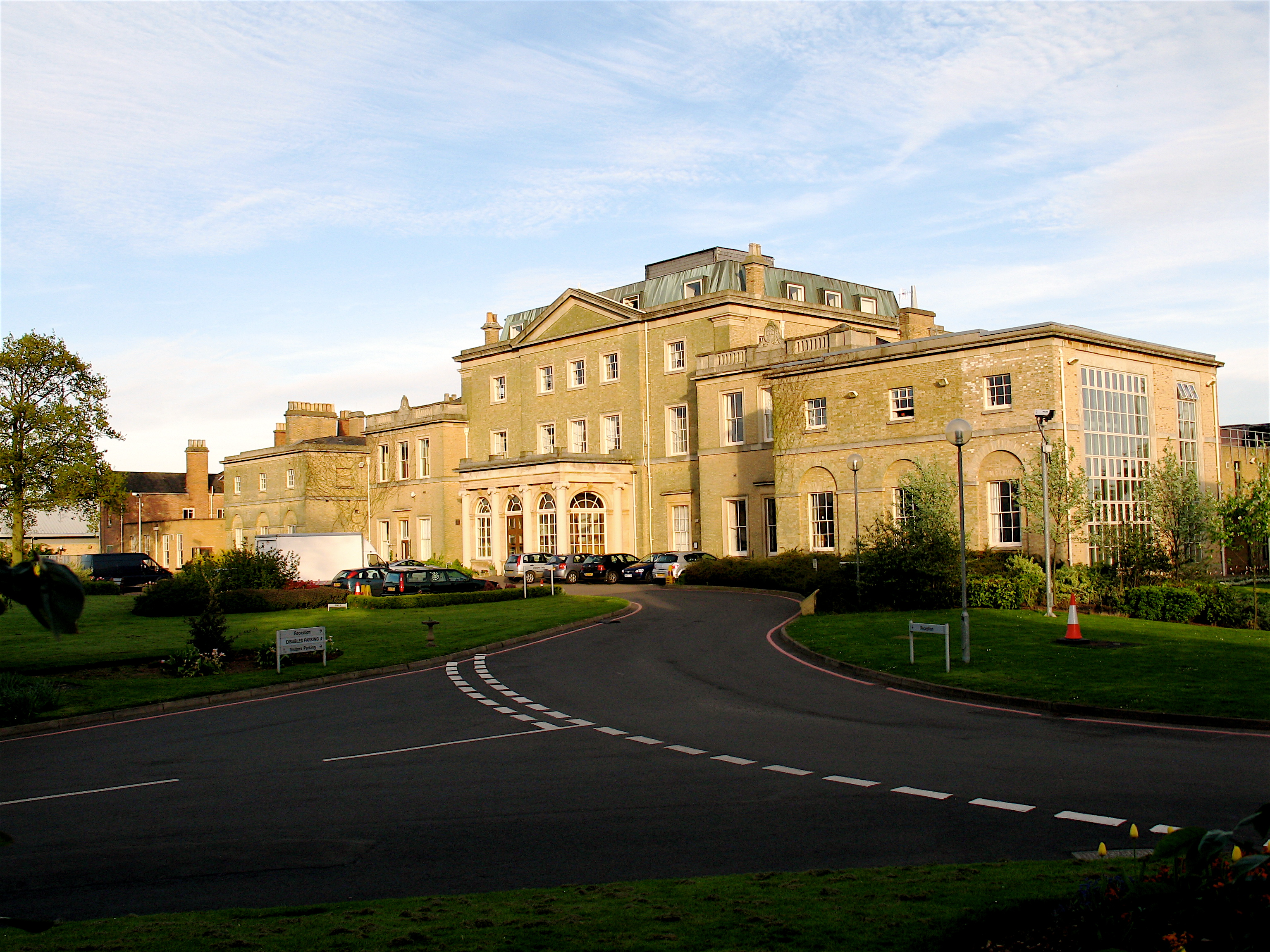
Hindlip Hall

Hindlip Hall is a stately home in Hindlip, Worcestershire, England. The first major hall was built before 1575, and it played a significant role in both...

Worcestershire

Worcestershire ( WUUST-ər-shər, -⁠sheer; written abbreviation: Worcs) is a ceremonial county in the West Midlands of England. It is bordered by Shropshire...

Warndon

Warndon is a suburb and civil parish of the City of Worcester in Worcestershire, England, located on the north eastern edge of the city. The parish, which...

Hindlip

Hindlip or Hinlip is a village and civil parish 3 miles (4.8 km) north east of Worcester, in the Wychavon district, in the county of Worcestershire, England...

Bredicot railway station

Bredicot railway station served the village of Bredicot, Worcestershire, England, from 1845 to 1855 on the Birmingham and Gloucester Railway. == History... ==

Nearby Amenities

Located within 500m of 52.211808,-2.1557181
Traffic Signals
Traffic Signals: signal
Lat/Long: 52.2120822/-2.1590835
Traffic Signals
Traffic Signals: signal
Lat/Long: 52.2121721/-2.1569431
Power: tower
Lat/Long: 52.209221/-2.1606456
Power: tower
Lat/Long: 52.2118922/-2.1601097
Power: tower
Lat/Long: 52.2144279/-2.1587917
Phone
Check Date: 2022-03-16
Emergency: phone
Source: survey
Lat/Long: 52.2129689/-2.1581012
Phone
Check Date: 2022-03-16
Emergency: phone
Source: survey
Lat/Long: 52.2128521/-2.1575893
Traffic Signals
Traffic Signals: signal
Lat/Long: 52.2121761/-2.1588822
Traffic Signals
Traffic Signals: signal
Lat/Long: 52.2123457/-2.1570946
Traffic Signals
Traffic Signals: signal
Lat/Long: 52.2132523/-2.1598659
Traffic Signals
Traffic Signals: signal
Lat/Long: 52.2133514/-2.1571412
Traffic Signals
Traffic Signals: signal
Lat/Long: 52.2133838/-2.1569118
Barrier: kissing_gate
Lat/Long: 52.2077332/-2.1541914
Traffic Signals
Traffic Signals: signal
Lat/Long: 52.213159/-2.1597282
Barrier: kissing_gate
Lat/Long: 52.2076666/-2.1544446
Material: wood
Power: pole
Lat/Long: 52.2097007/-2.1579565
Coneybury
Power: pole
Transformer: distribution
Voltage Primary: 11000
Lat/Long: 52.2098634/-2.1562815
Motorway Sign 44.3 Warndon South
Material: wood
Power: pole
Transformer: distribution
Voltage Primary: 11000
Lat/Long: 52.2096513/-2.1585198
N Power
Power: transformer
Transformer: distribution
Voltage Primary: 11000
Lat/Long: 52.2126557/-2.1620294
Warndon Maintenance Depot
Power: transformer
Transformer: distribution
Voltage Primary: 11000
Lat/Long: 52.2146854/-2.1599507
The data included in this document is from www.openstreetmap.org. The data is made available under ODbL.

Have you been to Coneybury Wood?

Leave your review of Coneybury Wood below (or comments, questions and feedback).