Marsh Covert

Wood, Forest in Worcestershire Malvern Hills

England

Marsh Covert

The old main road The old A4104 has now become a parking lot and storage space at this end. Still a right of way, but barely accessible over a large mound of earth.
The old main road Credit: Trevor Rickard

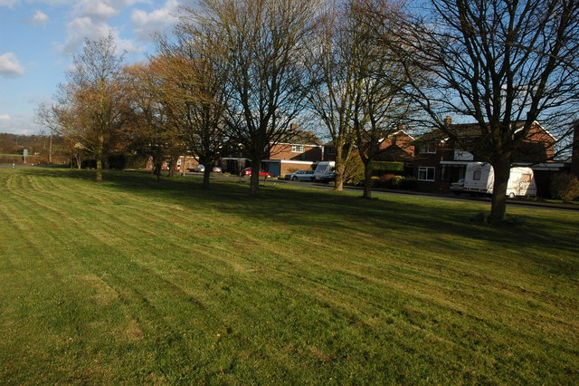
Marsh Covert is a small woodland area located in Worcestershire, England. It is situated within the wider region known as the Wyre Forest, which encompasses a total area of approximately 26 square miles. The woodland is characterized by its dense vegetation, consisting mainly of a mix of deciduous and coniferous trees, creating a rich and diverse ecosystem.

Marsh Covert is home to a wide variety of plant and animal species, making it an important site for biodiversity conservation. The woodland provides habitat for several protected species, including the great crested newt, which is considered a European protected species. Additionally, the area is known for its diverse bird population, with species such as the tawny owl, woodpecker, and red kite frequently spotted in the area.

Visitors to Marsh Covert can enjoy peaceful walks through the woodland, taking in the tranquil atmosphere and enjoying the sights and sounds of nature. The forest is also a popular spot for nature enthusiasts, photographers, and birdwatchers, who come to observe and capture the diverse wildlife that resides within the woodland.

Marsh Covert is easily accessible, with several footpaths and trails leading through the woodland, allowing visitors to explore its beauty at their own pace. The area is well-maintained, with efforts made to preserve its natural state and protect the delicate ecosystem.

Overall, Marsh Covert in Worcestershire is a picturesque woodland area that offers a haven for wildlife and a peaceful retreat for visitors seeking to connect with nature.

If you have any feedback on the listing, please let us know in the comments section below.

Marsh Covert Images

Images are sourced within 2km of 52.082073/-2.1575711 or Grid Reference SO8942. Thanks to Geograph Open Source API. All images are credited.

The old main road The old A4104 has now become a parking lot and storage space at this end. Still a right of way, but barely accessible over a large mound of earth.
The old main road
The old A4104 has now become a parking lot and storage space at this end. Still a right of way, but barely accessible over a large mound of earth.
Landing strip near Woodmancote This marker denotes the eastern end of the private grass landing strip to the north of the village. Large barns serving as hangars on the left. The Malvern Hills in the distance (the Worcestershire Beacon is just above the wind sock).
See <a href="https://www.geograph.org.uk/photo/2448255">SO9043 : Landing strip near Woodmancote</a> for the reverse view.
Landing strip near Woodmancote
This marker denotes the eastern end of the private grass landing strip to the north of the village. Large barns serving as hangars on the left. The Malvern Hills in the distance (the Worcestershire Beacon is just above the wind sock). See SO9043 : Landing strip near Woodmancote for the reverse view.
Path to woodland near Porter's Ashbed Looking north-west to an isolated wood near the Defford airfield. The landowner kindly allows access to this wood and several other private paths nearby. The public footpath ends at the corner of the wood, but a sign there reads "Visitors are permitted to enjoy this space, so long as dogs are kept under control and no wildlife, timber or flora are disturbed. No horse riding or motor vehicles please". I found the area most relaxing and at this time of year there are bluebells flowering in the wood.
Path to woodland near Porter's Ashbed
Looking north-west to an isolated wood near the Defford airfield. The landowner kindly allows access to this wood and several other private paths nearby. The public footpath ends at the corner of the wood, but a sign there reads "Visitors are permitted to enjoy this space, so long as dogs are kept under control and no wildlife, timber or flora are disturbed. No horse riding or motor vehicles please". I found the area most relaxing and at this time of year there are bluebells flowering in the wood.
Seat at the end of the landing strip At the west end of the light aircraft landing strip is a seat with a view across flat farmland to the Malvern Hills.
Seat at the end of the landing strip
At the west end of the light aircraft landing strip is a seat with a view across flat farmland to the Malvern Hills.
Landing strip near Woodmancote View east from the end of the grass runway. The large barns serving as hangars are beyond the oilseed rape crop on the right. 
See <a href="https://www.geograph.org.uk/photo/2446965">SO9143 : Landing strip near Woodmancote</a> for the other end of the strip.
Landing strip near Woodmancote
View east from the end of the grass runway. The large barns serving as hangars are beyond the oilseed rape crop on the right. See SO9143 : Landing strip near Woodmancote for the other end of the strip.
Track north of Woodmancote Heading north to the landing strip hangars just behind the farmhouse.
Track north of Woodmancote
Heading north to the landing strip hangars just behind the farmhouse.
A4104 at the turning for Defford
Slip road at Elm Lodge Farm Somewhat unusually, a dedicated east to south slip road exists at the junction of the A4104 and Bourne Road.
Slip road at Elm Lodge Farm
Somewhat unusually, a dedicated east to south slip road exists at the junction of the A4104 and Bourne Road.
Bourne Road
Bourne Road
Bourne Road and adjoining farmland
Bourne Road approaching Bourne Farm
Bourne Road at Bourne Farm
View to Bredon Hill View to Bredon Hill from meadowland beside the River Avon.  The village of Eckington can be seen in the middle distance.
View to Bredon Hill
View to Bredon Hill from meadowland beside the River Avon. The village of Eckington can be seen in the middle distance.
Into the sunset A car heads west towards Upton on the A4104 at Woodmancote.
Into the sunset
A car heads west towards Upton on the A4104 at Woodmancote.
Footpath to Woodmancote Brake Looking south from the A4104.
Footpath to Woodmancote Brake
Looking south from the A4104.
A4104 passes the Oak Inn
Bourne Farm View from Bourne Road; the green vehicle looks to be a 1960's ambulance.
Bourne Farm
View from Bourne Road; the green vehicle looks to be a 1960's ambulance.
Flat land of the Avon floodplain View towards Bredon Hill from Bourne Road.
Flat land of the Avon floodplain
View towards Bredon Hill from Bourne Road.
Show me another place!

Marsh Covert is located at Grid Ref: SO8942 (Lat: 52.082073, Lng: -2.1575711)

Administrative County: Worcestershire

District: Malvern Hills

Police Authority: West Mercia

What 3 Words

///barstool.spices.garage. Near Eckington, Worcestershire

Related Wikis

Dunstall Common

Dunstall Common is a village in Worcestershire, England.

Baughton

Baughton is a hamlet in Worcestershire, England. The Population of Baughton is 193. The population as a whole is older than the national average and the...

RAF Defford

Royal Air Force Defford, or more simply RAF Defford, is a former Royal Air Force station located 1.1 miles (1.8 km) northwest of Defford, Worcestershire...
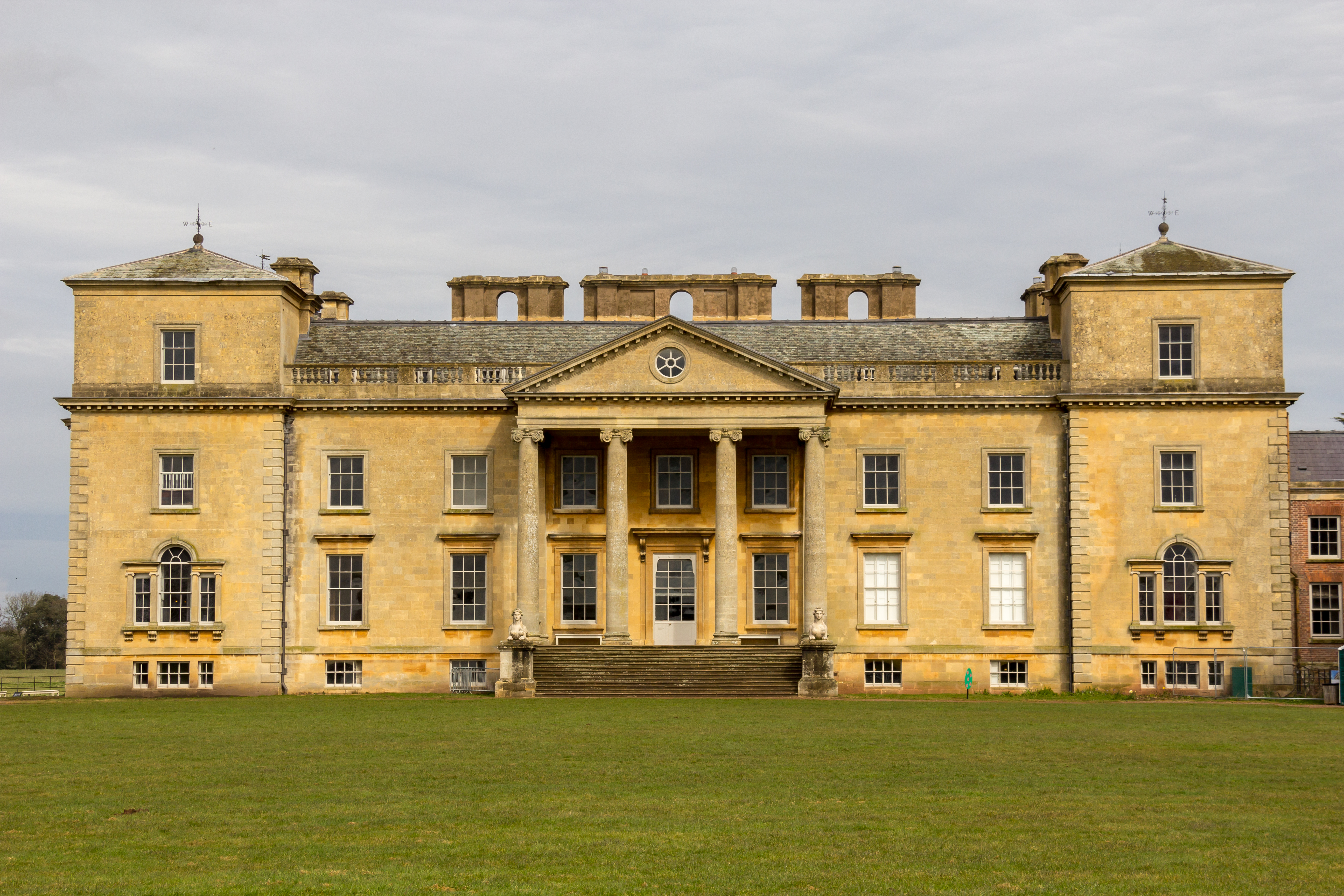
Croome Court

Croome Court is a mid-18th-century Neo-Palladian mansion surrounded by extensive landscaped parkland at Croome D'Abitot, near Upton-upon-Severn in south...

Horewell Forest

Horewell Forest was a royal forest, i. e. a royal game preserve. In the west, it bordered the river Severn, and Strensham in the south and extended to...

Hill Croome

Hill Croome is a village, and a civil parish which covers 1000 acres, in the Malvern Hills District in the county of Worcestershire, England. Historically...

Defford railway station

Defford railway station was a station in Defford, Worcestershire, England. The station was opened in 1840 and closed in 1965. == References == == Further... ==

Earls Croome

Earl's Croome is a village and civil parish in the Malvern Hills District in the county of Worcestershire, England. It had a population of 243 in 2021...

Nearby Amenities

Located within 500m of 52.082073,-2.1575711
Marsh Common
Naptan AtcoCode: 2000G673008
Naptan Bearing: NE
Naptan BusStopType: CUS
Naptan CommonName: Marsh Common
Naptan Indicator: Adj
Naptan Landmark: Mill Pond Avon Farm
Naptan NaptanCode: wocdawag
Naptan Street: A4104
Naptan Verified: no
Source: naptan_import
Lat/Long: 52.0790171/-2.1569685
Barrier: stile
Foot: yes
Lat/Long: 52.085257/-2.1621524
Location Transition: yes
Power: pole
Lat/Long: 52.0847113/-2.1605609
Red Deer Park Farm
Power: pole
Transformer: distribution
Voltage Primary: 11000
Lat/Long: 52.0843191/-2.1607742
Power: pole
Lat/Long: 52.0817849/-2.1520342
Power: pole
Lat/Long: 52.0808775/-2.1522863
Power: pole
Lat/Long: 52.0802511/-2.1534947
Power: pole
Lat/Long: 52.079642/-2.1546896
Mill Pond Avon Farm
Power: pole
Transformer: distribution
Voltage Primary: 11000
Lat/Long: 52.0794022/-2.1547218
Power: pole
Lat/Long: 52.0788161/-2.154813
Power: pole
Lat/Long: 52.0782161/-2.1549015
Location Transition: yes
Operator: National Grid Electricity Distribution
Operator Wikidata: Q7988183
Power: pole
Lat/Long: 52.0826457/-2.1518136
Defford SW Site
Power: transformer
Lat/Long: 52.0834031/-2.1536147
The data included in this document is from www.openstreetmap.org. The data is made available under ODbL.

Have you been to Marsh Covert?

Leave your review of Marsh Covert below (or comments, questions and feedback).