Ardmore

Settlement in Ross-shire

Scotland

Ardmore

Track to Rheguile The farm at Rheguile is the ideal starting point for a walk up Struie Hill, either direct to the mast or a traverse of the whole ridge.
Track to Rheguile Credit: Peter Moore

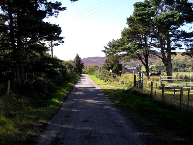
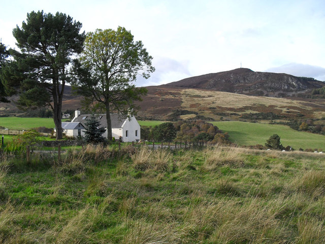
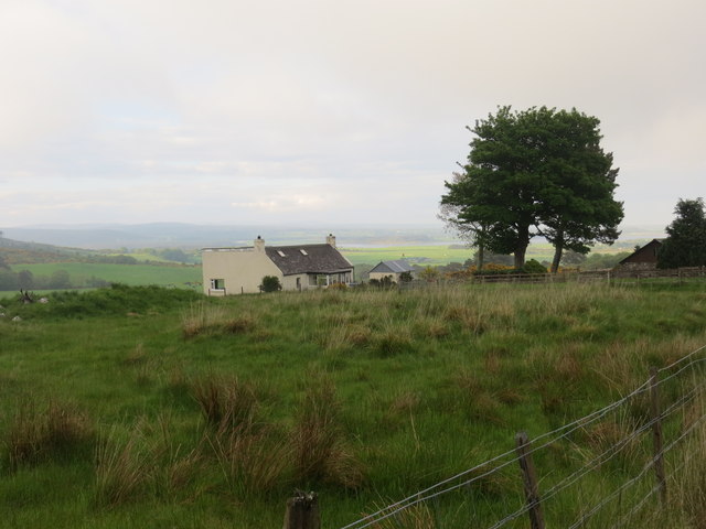
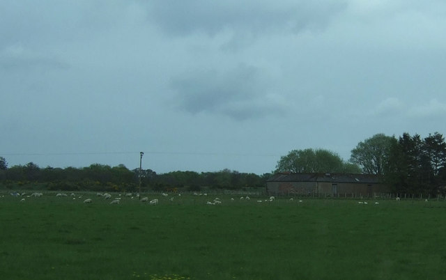
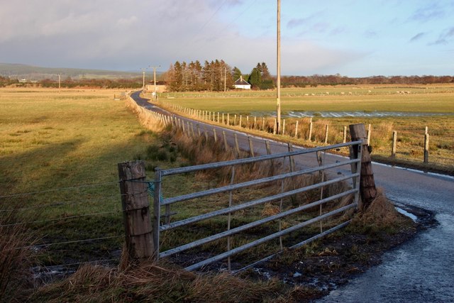
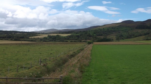
Ardmore is a small village located in the county of Ross-shire, in the Highland region of Scotland. Situated on the east coast of the country, it is nestled between the towns of Invergordon and Alness. The village sits on the shores of the Cromarty Firth, offering beautiful views of the water and the surrounding countryside.

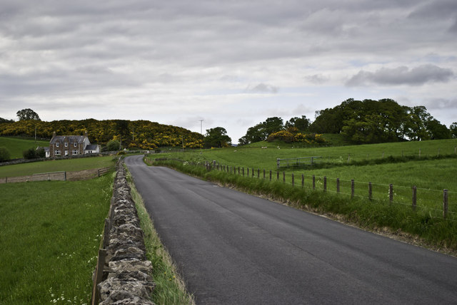
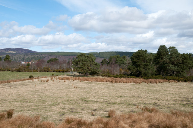
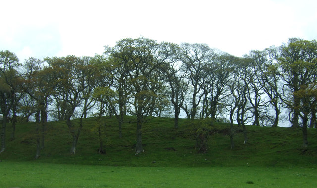
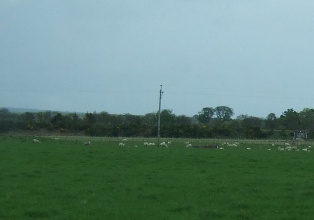
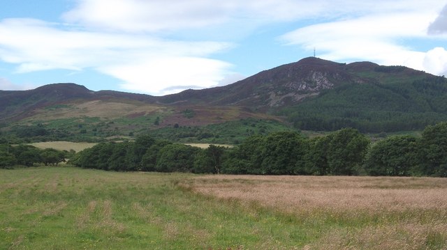
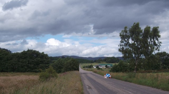
Ardmore is known for its picturesque landscapes and tranquil atmosphere, making it a popular destination for nature lovers and those seeking a peaceful retreat. The area is characterized by rolling hills and lush green fields, providing ample opportunities for hiking, cycling, and other outdoor activities.

The village itself is home to a close-knit community, with a population of around 500 residents. It boasts a number of amenities, including a primary school, a community center, and a local pub. The residents take pride in their village and actively participate in various community events and initiatives.

For those interested in history, Ardmore offers a glimpse into the past. The ruins of Ardmore Castle, a 16th-century tower house, can be found on the outskirts of the village. This historic site attracts visitors who are intrigued by the area's rich cultural heritage.

Overall, Ardmore is a charming village that combines natural beauty with a strong sense of community. Its idyllic setting and friendly atmosphere make it a delightful place to visit or call home.

If you have any feedback on the listing, please let us know in the comments section below.

Ardmore Images

Images are sourced within 2km of 57.845699/-4.187571 or Grid Reference NH7086. Thanks to Geograph Open Source API. All images are credited.

Track to Rheguile The farm at Rheguile is the ideal starting point for a walk up Struie Hill, either direct to the mast or a traverse of the whole ridge.
Track to Rheguile
The farm at Rheguile is the ideal starting point for a walk up Struie Hill, either direct to the mast or a traverse of the whole ridge.
Garbad under Struie
Garbad under Struie
Dounie and copse A quiet stretch of the old A9 between Tain and Ardgay - much less frequented after the opening of the Dornoch Firth Bridge in 1991.
Dounie and copse
A quiet stretch of the old A9 between Tain and Ardgay - much less frequented after the opening of the Dornoch Firth Bridge in 1991.
Afternoon service to Wick DMU 158723 heading north
Afternoon service to Wick
DMU 158723 heading north
Field at Ardvannie The field lies north of the A836 at Ardvannie, a location below Dounie Wood. The distant ground with plantations lies on the north side of the Dornoch Firth.
Field at Ardvannie
The field lies north of the A836 at Ardvannie, a location below Dounie Wood. The distant ground with plantations lies on the north side of the Dornoch Firth.
Cottage at Garbad
Cottage at Garbad
Woodland east of the A836
Grazing off the A836 Looking east.
Grazing off the A836
Looking east.
Grazing north of Little Dallas
Road to Ardmore from the A836
View of Struie Hill Rheguile near Edderton.
View of Struie Hill
Rheguile near Edderton.
A836, Rheguile Before the Dornoch Bridge was opened this was a long loop in the A9.  Nearly everybody went over the Struie then.
A836, Rheguile
Before the Dornoch Bridge was opened this was a long loop in the A9. Nearly everybody went over the Struie then.
Ditch, Dounie Draining low lying ground at the foot of Struie Hill.
Ditch, Dounie
Draining low lying ground at the foot of Struie Hill.
Field near Ardvannie As the coastal plain gets squeezed by Struie Hill, the ground turns to woodland in contrast to the big fields around Edderton.  A small field remains beside the A836.
Field near Ardvannie
As the coastal plain gets squeezed by Struie Hill, the ground turns to woodland in contrast to the big fields around Edderton. A small field remains beside the A836.
Leaving Dounie Wood A rough path exits the woodland for the A836.
Leaving Dounie Wood
A rough path exits the woodland for the A836.
Doune Wood Mature larches at the foot of Struie Hill.
Doune Wood
Mature larches at the foot of Struie Hill.
Farm Building, Dounie
Grazing towards woodland near Ardvannie
Show me another place!

Ardmore is located at Grid Ref: NH7086 (Lat: 57.845699, Lng: -4.187571)

Unitary Authority: Highland

Police Authority: Highlands and Islands

What 3 Words

///impulse.dictation.crib. Near Tain, Highland

Nearby Locations

Ardmore

Related Wikis

Ardmore, Easter Ross

Ardmore (Scottish Gaelic: An Àird Mhòr) is a village on the south shore of Dornoch Firth in Tain, Ross-shire, Highland and is in the Scottish council area...

Balblair distillery

Balblair distillery is a Scotch malt whisky distillery located in Edderton, Ross-shire, Scotland. Founded in 1790, the distillery was rebuilt in 1895 by...

Edderton railway station

Edderton railway station served the village of Edderton, Highland, Scotland from 1864 to 1960 on the Inverness and Ross-shire Railway. == History == The...
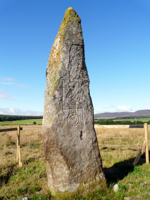
Clach Biorach

Clach Chairidh, alternatively named Clach Biorach (from Scots Gaelic, meaning 'the Pointed Stone'), is a Class I Pictish stone located in a field near...

Edderton Cross Slab

Edderton Cross Slab is a Class III Pictish stone standing in the old graveyard of the village of Edderton, Easter Ross. The stone is of red sandstone...

Edderton

Edderton (Scottish Gaelic: Eadardan) is a village near Tain, lying on the shores of the Dornoch Firth, Easter Ross and is in the Highland council area...

Balleigh

Balleigh is a small village, 0.5 miles southeast of Edderton and 7 miles west of Tain, in eastern Ross-shire, Scottish Highlands and is in the Scottish...

Meikle Ferry disaster

The Meikle Ferry took passengers across the tidal Dornoch Firth in North Scotland. On 16 August 1809, in clear weather conditions, the overloaded ferry...

Nearby Amenities

Located within 500m of 57.845699,-4.187571
Bus Stop
Ardmore House
Naptan AtcoCode: 6700713853
Naptan Bearing: SW
Naptan CommonName: Ardmore House
Naptan Indicator: o/s
Naptan Landmark: Ardmore House
Naptan NaptanCode: 45328969
Naptan Street: Unclassified
Naptan Verified: no
Source: naptan_import
Lat/Long: 57.8468882/-4.1843261
Bus Stop
Ardmore House
Naptan AtcoCode: 6700713853A
Naptan Bearing: NE
Naptan CommonName: Ardmore House
Naptan Indicator: opp
Naptan Landmark: Ardmore House
Naptan NaptanCode: 45329679
Naptan Street: Unclassified
Naptan Verified: no
Source: naptan_import
Lat/Long: 57.8469594/-4.1843641
Ardmore
Place: locality
Lat/Long: 57.8481672/-4.1814572
Power: pole
Lat/Long: 57.8467409/-4.1957822
Power: pole
Lat/Long: 57.8461771/-4.195227
Power: pole
Lat/Long: 57.8455847/-4.1946638
Power: pole
Lat/Long: 57.8449765/-4.1940925
Power: pole
Lat/Long: 57.8444041/-4.1935426
Power: pole
Lat/Long: 57.8438231/-4.1930008
Power: pole
Lat/Long: 57.8432207/-4.1923946
Power: pole
Lat/Long: 57.8426553/-4.1918689
Power: pole
Lat/Long: 57.8420572/-4.1913271
Power: pole
Lat/Long: 57.8443439/-4.1796728
Power: pole
Lat/Long: 57.8455978/-4.1808132
Power: pole
Lat/Long: 57.8468284/-4.1819333
Power: pole
Lat/Long: 57.8477511/-4.183024
Power: pole
Lat/Long: 57.8477263/-4.1844019
Power: pole
Lat/Long: 57.8477663/-4.1856458
Power: pole
Lat/Long: 57.8482446/-4.1864696
Power: pole
Lat/Long: 57.8482338/-4.1876892
Power: pole
Lat/Long: 57.8474013/-4.1850471
Power: pole
Lat/Long: 57.847033/-4.1843958
Power: pole
Lat/Long: 57.8476356/-4.182186
Power: pole
Lat/Long: 57.8478764/-4.1814879
Power: pole
Lat/Long: 57.8468818/-4.1945834
Power: pole
Lat/Long: 57.8470373/-4.1933638
Power: pole
Lat/Long: 57.8471766/-4.1927125
Power: pole
Lat/Long: 57.8474153/-4.1916755
Power: pole
Lat/Long: 57.847844/-4.1909998
Power: pole
Lat/Long: 57.8480341/-4.1907279
Power: pole
Lat/Long: 57.8482392/-4.1899182
Power: pole
Lat/Long: 57.8468721/-4.1955919
Power: pole
Lat/Long: 57.842212/-4.1917212
The data included in this document is from www.openstreetmap.org. The data is made available under ODbL.

Have you been to Ardmore?

Leave your review of Ardmore below (or comments, questions and feedback).