Branxton Plantation

Wood, Forest in Northumberland

England

Branxton Plantation

Flodden Battlefield Monument (1513), Northumberland The Battle of Flodden, Flodden Field, or occasionally Branxton, was a battle fought on 9 September 1513 during the War of the League of Cambrai between the Kingdom of England and the Kingdom of Scotland, resulting in an English victory. The battle was fought near Branxton in the county of Northumberland in northern England, between an invading Scots army under King James IV and an English army commanded by the Earl of Surrey. In terms of troop numbers, it was the largest battle fought between the two kingdoms.

<span class="nowrap"><a title="https://en.wikipedia.org/wiki/Battle_of_Flodden" rel="nofollow ugc noopener" href="https://en.wikipedia.org/wiki/Battle_of_Flodden">Link</a><img style="margin-left:2px;" alt="External link" title="External link - shift click to open in new window" src="https://s1.geograph.org.uk/img/external.png" width="10" height="10"/></span>
Flodden Battlefield Monument (1513), Northumberland Credit: Brian Deegan

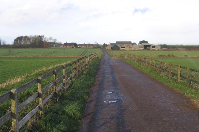
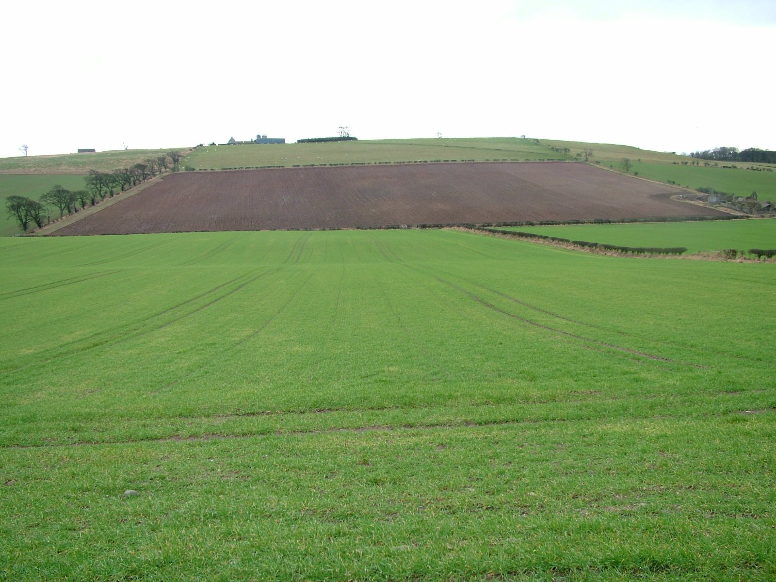
Branxton Plantation is a picturesque woodland area located in Northumberland, England. Spanning over a vast expanse of land, it offers visitors a tranquil and serene escape from the hustle and bustle of city life. The plantation is situated near the village of Branxton, just a short drive away from the Scottish border.

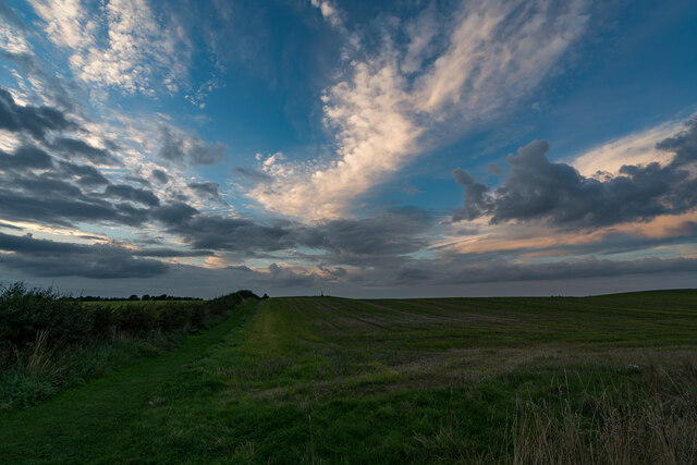
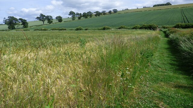
The woodland of Branxton Plantation is renowned for its rich biodiversity and natural beauty. It is home to a diverse range of flora and fauna, including ancient oak trees, birches, and a variety of wildflowers. The dense foliage provides a habitat for numerous species of birds, mammals, and insects, making it a haven for wildlife enthusiasts and nature lovers.

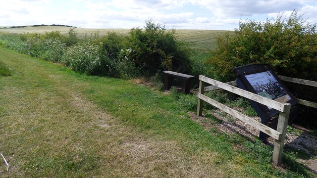
Visitors can explore the plantation through a network of well-maintained walking trails, which wind their way through the enchanting woodland. These trails offer breathtaking views of the surrounding countryside, with glimpses of rolling hills and distant valleys. The peaceful atmosphere and the soothing sounds of nature make it an ideal location for hiking, birdwatching, or simply enjoying a leisurely stroll.

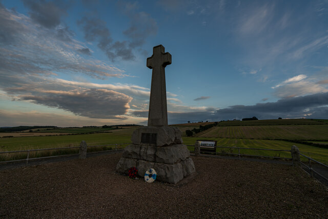
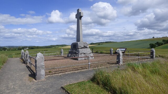
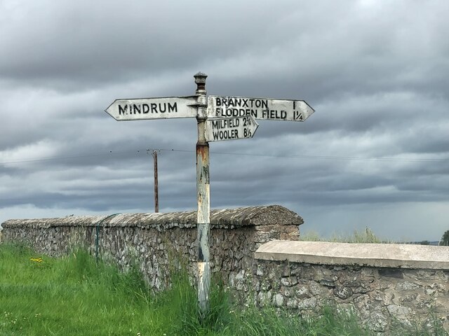
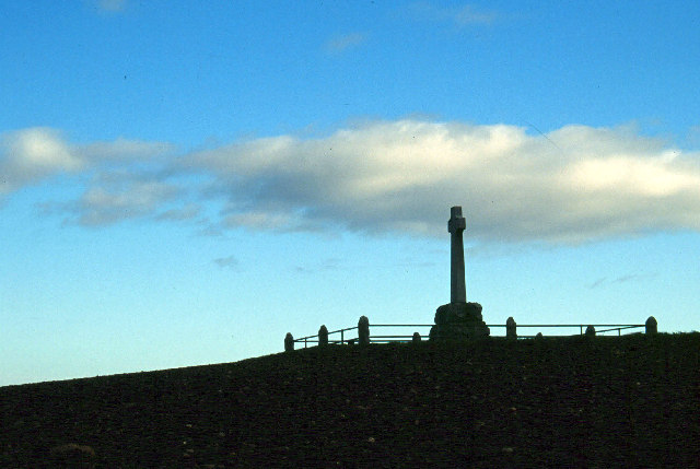
In addition to its natural beauty, Branxton Plantation also holds historical significance. It is believed to have been a site of conflict during the Battle of Flodden in 1513, where English and Scottish forces clashed. Today, visitors can learn about this historic event through informative plaques and markers scattered throughout the plantation.

Overall, Branxton Plantation is a hidden gem in Northumberland, offering visitors a harmonious blend of natural splendor and historical intrigue. Whether one is seeking solace in nature or yearning to delve into the region's past, this woodland sanctuary is sure to leave a lasting impression.

If you have any feedback on the listing, please let us know in the comments section below.

Branxton Plantation Images

Images are sourced within 2km of 55.620243/-2.180428 or Grid Reference NT8836. Thanks to Geograph Open Source API. All images are credited.

Flodden Battlefield Monument (1513), Northumberland The Battle of Flodden, Flodden Field, or occasionally Branxton, was a battle fought on 9 September 1513 during the War of the League of Cambrai between the Kingdom of England and the Kingdom of Scotland, resulting in an English victory. The battle was fought near Branxton in the county of Northumberland in northern England, between an invading Scots army under King James IV and an English army commanded by the Earl of Surrey. In terms of troop numbers, it was the largest battle fought between the two kingdoms.

<span class="nowrap"><a title="https://en.wikipedia.org/wiki/Battle_of_Flodden" rel="nofollow ugc noopener" href="https://en.wikipedia.org/wiki/Battle_of_Flodden">Link</a><img style="margin-left:2px;" alt="External link" title="External link - shift click to open in new window" src="https://s1.geograph.org.uk/img/external.png" width="10" height="10"/></span>
Flodden Battlefield Monument (1513), Northumberland
The Battle of Flodden, Flodden Field, or occasionally Branxton, was a battle fought on 9 September 1513 during the War of the League of Cambrai between the Kingdom of England and the Kingdom of Scotland, resulting in an English victory. The battle was fought near Branxton in the county of Northumberland in northern England, between an invading Scots army under King James IV and an English army commanded by the Earl of Surrey. In terms of troop numbers, it was the largest battle fought between the two kingdoms. LinkExternal link
Battle Ground Flodden (1513) Looking back up the hill to the monument. This would have been marsh ground and very difficult to cross.
Battle Ground Flodden (1513)
Looking back up the hill to the monument. This would have been marsh ground and very difficult to cross.
St Paul's Church, Branxton
Battle of Flodden Field Monument <span class="nowrap"><a title="https://www.flodden1513ecomuseum.org/places/local/flodden-field" rel="nofollow ugc noopener" href="https://www.flodden1513ecomuseum.org/places/local/flodden-field">Link</a><img style="margin-left:2px;" alt="External link" title="External link - shift click to open in new window" src="https://s1.geograph.org.uk/img/external.png" width="10" height="10"/></span>
Battle of Flodden Field Monument
Flodden Field Where barley now grows there once was a bog that swallowed up an army.
Flodden Field
Where barley now grows there once was a bog that swallowed up an army.
Flodden Field At this spot James IV of Scotland was killed.
Flodden Field
At this spot James IV of Scotland was killed.
Branxton. Northumberland St Paul's Church, Branxton.
Branxton. Northumberland
St Paul's Church, Branxton.
Stock Law, Northumberland Looking southeast across Stock Law. In the distance can be seen the Flodden Field Memorial.
Stock Law, Northumberland
Looking southeast across Stock Law. In the distance can be seen the Flodden Field Memorial.
Direction Sign – Signpost at Branxtonmoor Located on the north side of the T junction at Branxtonmoor in Branxton parish. 3 arms and cap finial. See also <a title="https://www.geograph.org.uk/photo/6559125" href="https://www.geograph.org.uk/photo/6559125">Link</a> and <a title="https://www.geograph.org.uk/photo/3647184" href="https://www.geograph.org.uk/photo/3647184">Link</a>.

Milestone Society National ID: NB_NT8935
Direction Sign – Signpost at Branxtonmoor
Located on the north side of the T junction at Branxtonmoor in Branxton parish. 3 arms and cap finial. See also Link and Link. Milestone Society National ID: NB_NT8935
Flodden Memorial This monument commemorates the Battle of Flodden Field in 1513.
Flodden Memorial
This monument commemorates the Battle of Flodden Field in 1513.
Flodden Monument, Branxton
Branxton Church
Branxton Church
Site of the Battle of Flodden Field Taken near the monument showing the field of battle (1513) with Branxton Hill in the background.
Site of the Battle of Flodden Field
Taken near the monument showing the field of battle (1513) with Branxton Hill in the background.
The access road to Callerburn Farm
A signpost for Moneylaws Directions for East and West Moneylaws from the minor road between East Learmouth and Branxton Moor.
A signpost for Moneylaws
Directions for East and West Moneylaws from the minor road between East Learmouth and Branxton Moor.
Tithe Hill Farm The small hill in the background is Blake Law.
Tithe Hill Farm
The small hill in the background is Blake Law.
Farm track Between East Moneylaws and West Moneylaws.
Farm track
Between East Moneylaws and West Moneylaws.
Cottages at East Moneylaws
Show me another place!

Branxton Plantation is located at Grid Ref: NT8836 (Lat: 55.620243, Lng: -2.180428)

Unitary Authority: Northumberland

Police Authority: Northumbria

What 3 Words

///lessening.practical.coasted. Near Coldstream, Scottish Borders

Nearby Locations

Branxton Plantation

Related Wikis

Battle of Flodden

The Battle of Flodden, Flodden Field, or occasionally Branxton or Brainston Moor was a battle that was fought on 9 September 1513 during the War of the...

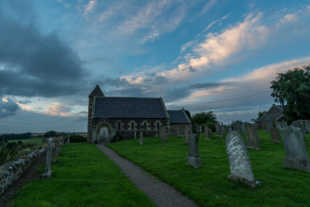
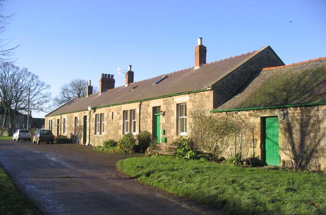
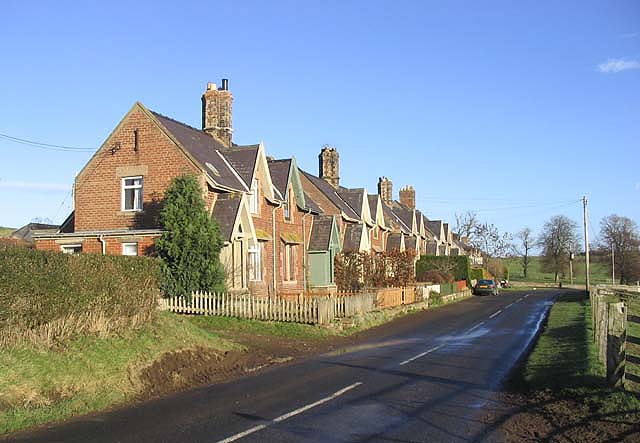
Branxton, Northumberland

Branxton is a village and civil parish in northern Northumberland, England. It lies about 3 miles (5 km) from the England-Scotland border and about 4 miles...

Howtel

Howtel is a village and former civil parish, now in the parish of Kilham, in Northumberland, England about 8 miles (13 km) northwest of Wooler. The name...

Bareless

Bareless is a village in Northumberland, England. == Governance == Bareless is in the parliamentary constituency of Berwick-upon-Tweed. == References ==

Nearby Amenities

Located within 500m of 55.620243,-2.180428
Power: tower
Source: Bing
Lat/Long: 55.6195763/-2.1803198
Power: tower
Source: Bing
Lat/Long: 55.6175214/-2.1782887
Power: tower
Source: Bing
Lat/Long: 55.6225738/-2.1846147
Branxton Hill
Natural: peak
Lat/Long: 55.621007/-2.1745504
The data included in this document is from www.openstreetmap.org. The data is made available under ODbL.

Have you been to Branxton Plantation?

Leave your review of Branxton Plantation below (or comments, questions and feedback).