Crockerhill

Settlement in Sussex Chichester

England

Crockerhill

Road near Oakham Farm
Road near Oakham Farm Credit: P Gaskell

Crockerhill is a small village located in Sussex, England. Nestled amidst the rolling hills and picturesque countryside, it is renowned for its natural beauty and tranquil atmosphere. With a population of around 500 residents, Crockerhill offers a peaceful and close-knit community.

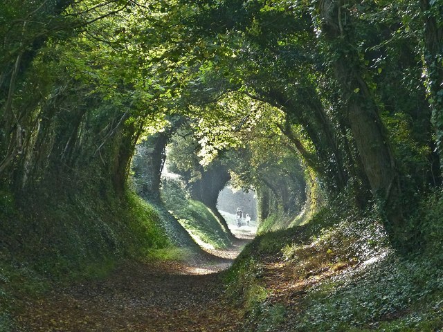
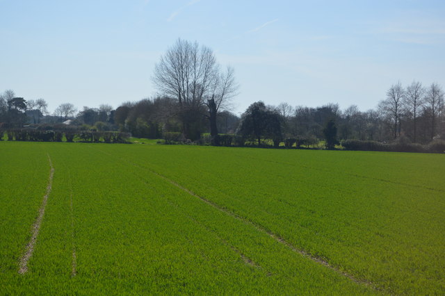
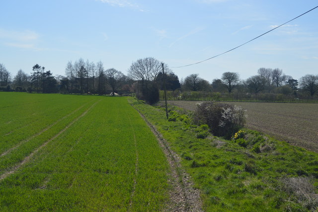
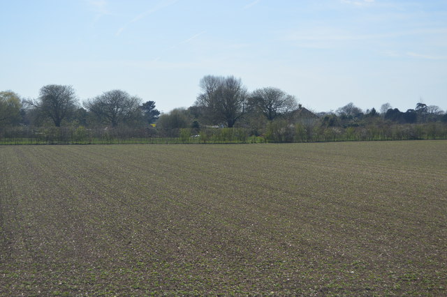
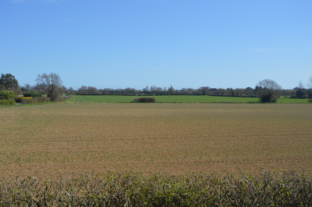
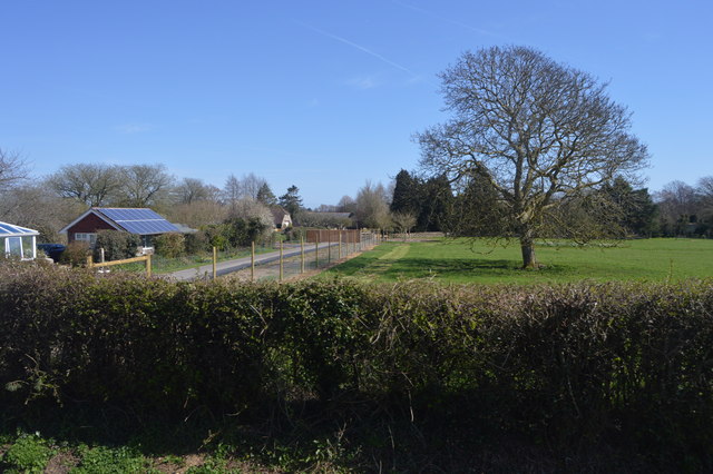
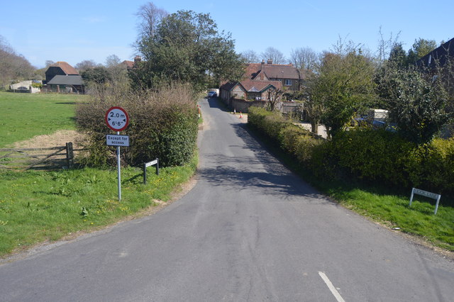
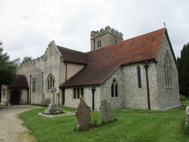
The village is characterized by its charming traditional cottages, some of which date back several centuries. These architectural gems add to the village's rustic charm and give a glimpse into its rich history. Surrounded by lush green fields and meadows, Crockerhill is a haven for nature enthusiasts and those seeking a rural retreat.

The village boasts a number of amenities to cater to the needs of its residents. There is a local pub, The Crocker's Arms, which serves as a meeting place for villagers to socialize and enjoy traditional English fare. Additionally, Crockerhill has a primary school, providing education for the younger generation.

For outdoor enthusiasts, there are plenty of opportunities for recreational activities in the surrounding area. The South Downs National Park, a short distance from Crockerhill, offers breathtaking views and numerous walking trails, allowing residents to explore the stunning countryside. The nearby coastline also provides opportunities for seaside walks and water sports.

Crockerhill's central location allows for easy access to neighboring towns and cities. The historic town of Lewes is just a short drive away, offering a range of cultural and historical attractions. Brighton, a vibrant seaside city, is also within reach, providing a plethora of shopping, dining, and entertainment options.

In conclusion, Crockerhill is a charming village that offers a peaceful and idyllic lifestyle amidst the beauty of the Sussex countryside. Its rich history, natural surroundings, and close-knit community make it a desirable place to live for those seeking a tranquil rural retreat.

If you have any feedback on the listing, please let us know in the comments section below.
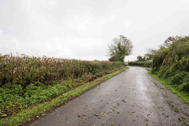
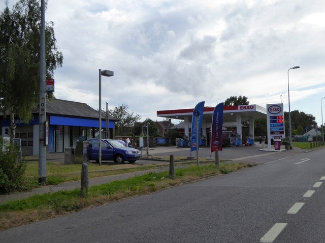
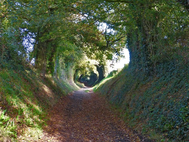
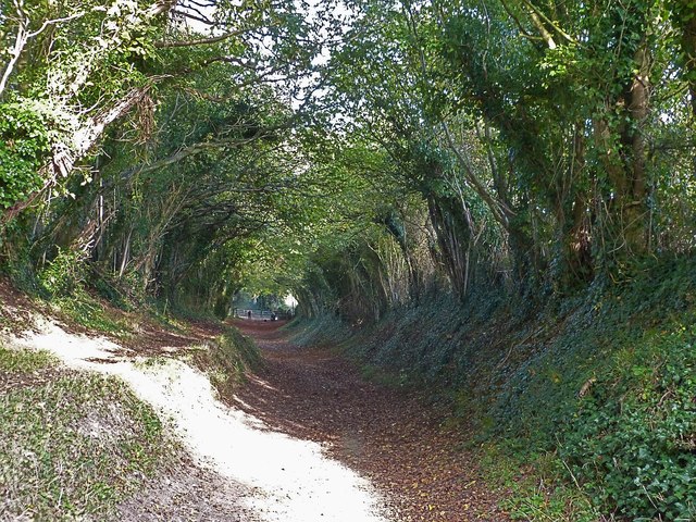
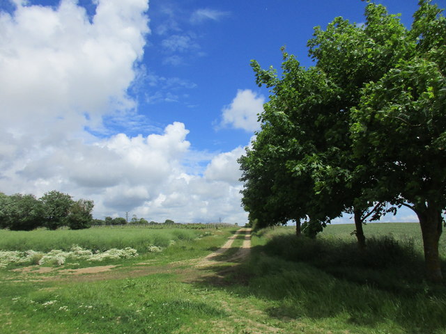
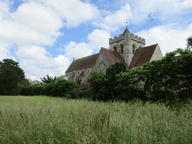
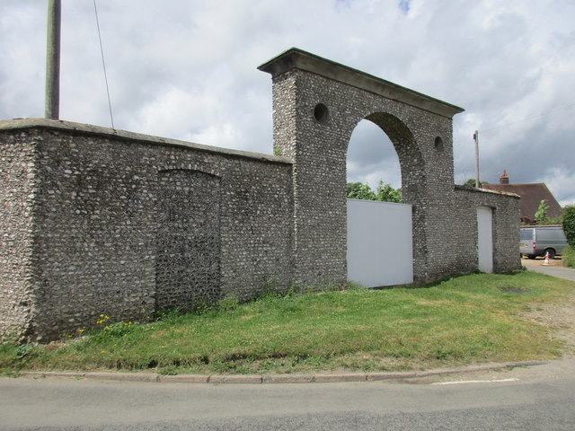
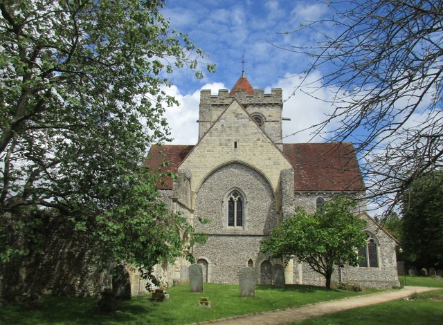
Crockerhill Images

Images are sourced within 2km of 50.857149/-0.688879 or Grid Reference SU9207. Thanks to Geograph Open Source API. All images are credited.

Road near Oakham Farm
Esso filling station on A27 in Tangmere
Mill Lane, Halnaker view northeastwards Mill Lane to the northeast of the village of Halnaker follows the route of the old Roman Road, Stane Street at this point. With its tunnel-like overarching canopy of  trees it is a particularly attractive walk, especially with the Autumn colours beginning to show. Its beauty is well known, as there were numerous photographers about trying to take a particularly good photo of the scene.
Mill Lane is so called because after a while it diverges from Stane Street, heading north to Halnaker Windmill atop nearby Halnaker Hill.
See also <a href="https://www.geograph.org.uk/photo/4727988">SU9108 : Mill Lane section of Stane Street in Autumn</a> and <a href="https://www.geograph.org.uk/photo/4727996">SU9108 : Mill Lane, Halnaker view southwestwards</a>
Mill Lane, Halnaker view northeastwards
Mill Lane to the northeast of the village of Halnaker follows the route of the old Roman Road, Stane Street at this point. With its tunnel-like overarching canopy of trees it is a particularly attractive walk, especially with the Autumn colours beginning to show. Its beauty is well known, as there were numerous photographers about trying to take a particularly good photo of the scene. Mill Lane is so called because after a while it diverges from Stane Street, heading north to Halnaker Windmill atop nearby Halnaker Hill. See also SU9108 : Mill Lane section of Stane Street in Autumn and SU9108 : Mill Lane, Halnaker view southwestwards
Mill Lane section of Stane Street in Autumn A view a little further along Mill Lane than <a href="https://www.geograph.org.uk/photo/4727983">SU9108 : Mill Lane, Halnaker view northeastwards</a> (q.v. for more information). Ahead can be seen a gate which crosses the track with the public footpath being diverted to the south of the track but immediately parallel with it. The group of people seen in front of the gate are all photographers, hoping to get a really good photo of this very attractive lane in its Autumn foliage.
See also <a href="https://www.geograph.org.uk/photo/4727996">SU9108 : Mill Lane, Halnaker view southwestwards</a> looking in the opposite direction, from that gate.
Mill Lane section of Stane Street in Autumn
A view a little further along Mill Lane than SU9108 : Mill Lane, Halnaker view northeastwards (q.v. for more information). Ahead can be seen a gate which crosses the track with the public footpath being diverted to the south of the track but immediately parallel with it. The group of people seen in front of the gate are all photographers, hoping to get a really good photo of this very attractive lane in its Autumn foliage. See also SU9108 : Mill Lane, Halnaker view southwestwards looking in the opposite direction, from that gate.
Mill Lane, Halnaker view southwestwards This view southwestwards along Mill Lane to the northeast of Halnaker, particularly shows the tunnel-like effect created by the trees overarching the track. I was far from alone in taking photos of this scene, as it seems to be a well-known spot with photographers trying to catch a fine example of Autumnal colours. The photo was taken from the gate seen in the distance in <a href="https://www.geograph.org.uk/photo/4727988">SU9108 : Mill Lane section of Stane Street in Autumn</a>. At this point the public footpath leaves the main track and runs parallel with it on a bank immediately to the south. A little further to the northeast the footpath forks, with one footpath continuing roughly straight northeastwards along the old Stane Street route, while a second path heads northwards to <a href="https://www.geograph.org.uk/photo/4728332">SU9209 : Halnaker Windmill</a> atop Halnaker Hill.
See also <a href="https://www.geograph.org.uk/photo/4727983">SU9108 : Mill Lane, Halnaker view northeastwards</a>
Mill Lane, Halnaker view southwestwards
This view southwestwards along Mill Lane to the northeast of Halnaker, particularly shows the tunnel-like effect created by the trees overarching the track. I was far from alone in taking photos of this scene, as it seems to be a well-known spot with photographers trying to catch a fine example of Autumnal colours. The photo was taken from the gate seen in the distance in SU9108 : Mill Lane section of Stane Street in Autumn. At this point the public footpath leaves the main track and runs parallel with it on a bank immediately to the south. A little further to the northeast the footpath forks, with one footpath continuing roughly straight northeastwards along the old Stane Street route, while a second path heads northwards to SU9209 : Halnaker Windmill atop Halnaker Hill. See also SU9108 : Mill Lane, Halnaker view northeastwards
Iris berries in the verge From research on the web, I believe that these berries belong to the "Stinking Iris" Iris foetidissima. They were growing in the verge beside the path  just after it had departed from Mill Lane and was still following the route of Stane Street.
The Stinking Iris is alternatively known as "Gladdon". See a photograph of its unusually coloured flower here <a href="https://www.geograph.org.uk/photo/5506740">TQ7818 : Gladdon or stinking iris flower with ants, Churchland Lane</a>
Iris berries in the verge
From research on the web, I believe that these berries belong to the "Stinking Iris" Iris foetidissima. They were growing in the verge beside the path just after it had departed from Mill Lane and was still following the route of Stane Street. The Stinking Iris is alternatively known as "Gladdon". See a photograph of its unusually coloured flower here TQ7818 : Gladdon or stinking iris flower with ants, Churchland Lane
Arable landscape
Arable landscape
Field boundary and ditch
Farmland by Nyton Rd
Church Farm
Church Farm
Hook Lane
Hook Lane
The church of St. Mary the Virgin. Aldingbourne
Footpath to Boxgrove Common
Boxgrove Priory church from the north west Most of the nave has disappeared.
Boxgrove Priory church from the north west
Most of the nave has disappeared.
Gateway into the Goodwood estate
Boxgrove Priory, west end Most of the nave was demolished in the sixteenth century.
Boxgrove Priory, west end
Most of the nave was demolished in the sixteenth century.
Boxgrove Priory, remains of the Guest House Dates from about 1300.
Boxgrove Priory, remains of the Guest House
Dates from about 1300.
Show me another place!

Crockerhill is located at Grid Ref: SU9207 (Lat: 50.857149, Lng: -0.688879)

Administrative County: West Sussex

District: Chichester

Police Authority: Sussex

What 3 Words

///tinsel.dote.upset. Near Boxgrove, West Sussex

Nearby Locations

Crockerhill

Related Wikis

Crockerhill, West Sussex

Crockerhill is a hamlet on the A27 road between Tangmere and Fontwell in West Sussex, England. It has one public house, The Winterton Arms.. At the 2011...

Eartham Pit, Boxgrove

Eartham Pit is an internationally important archaeological site north-east of Boxgrove in West Sussex with findings that date to the Lower Palaeolithic...
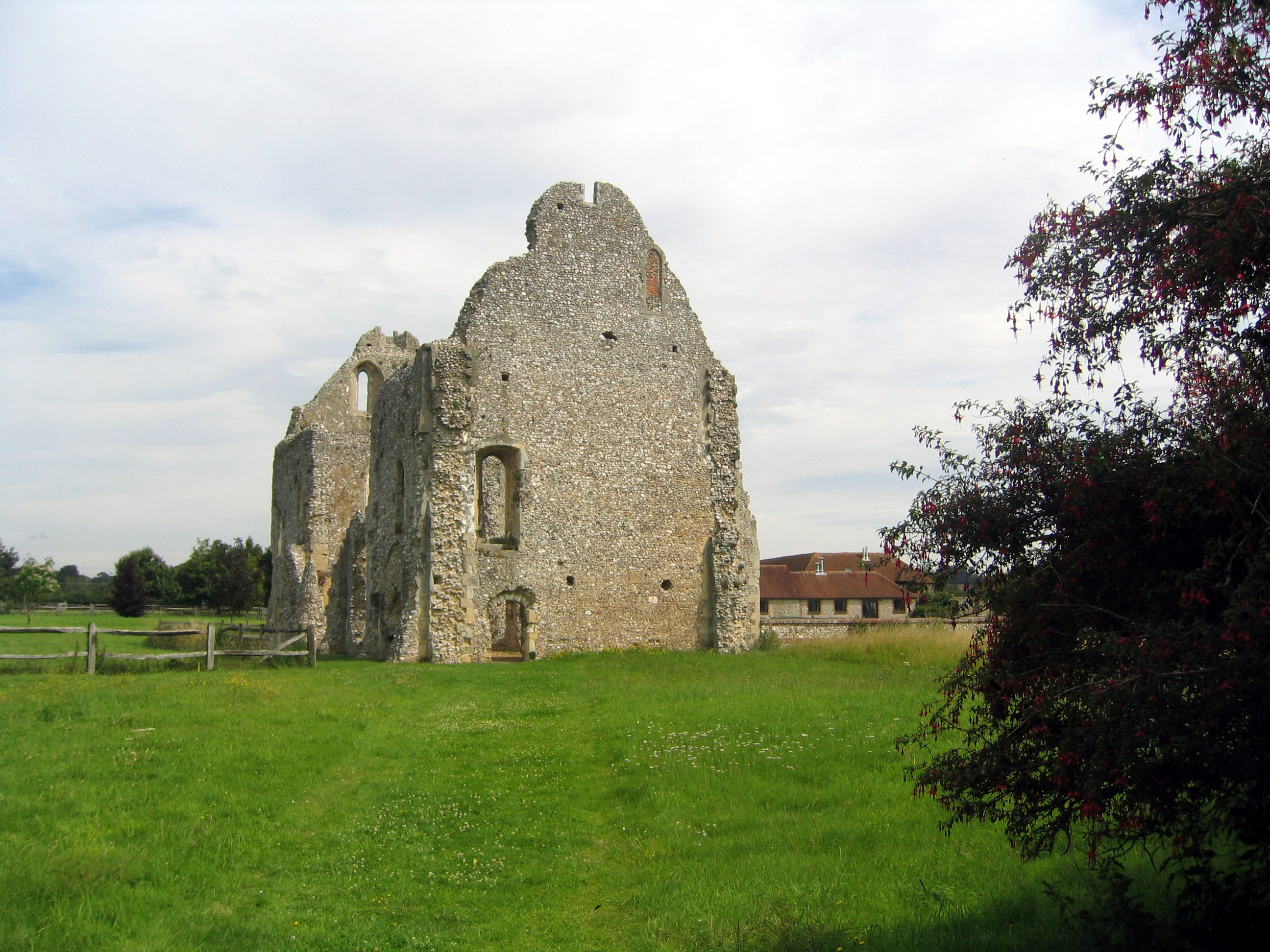
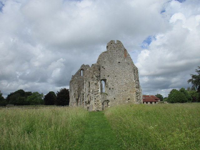
Boxgrove Priory

Boxgrove Priory is a ruined priory in the village of Boxgrove in Sussex, England. It was founded in the 12th century. == History == === Origins === The Priory...
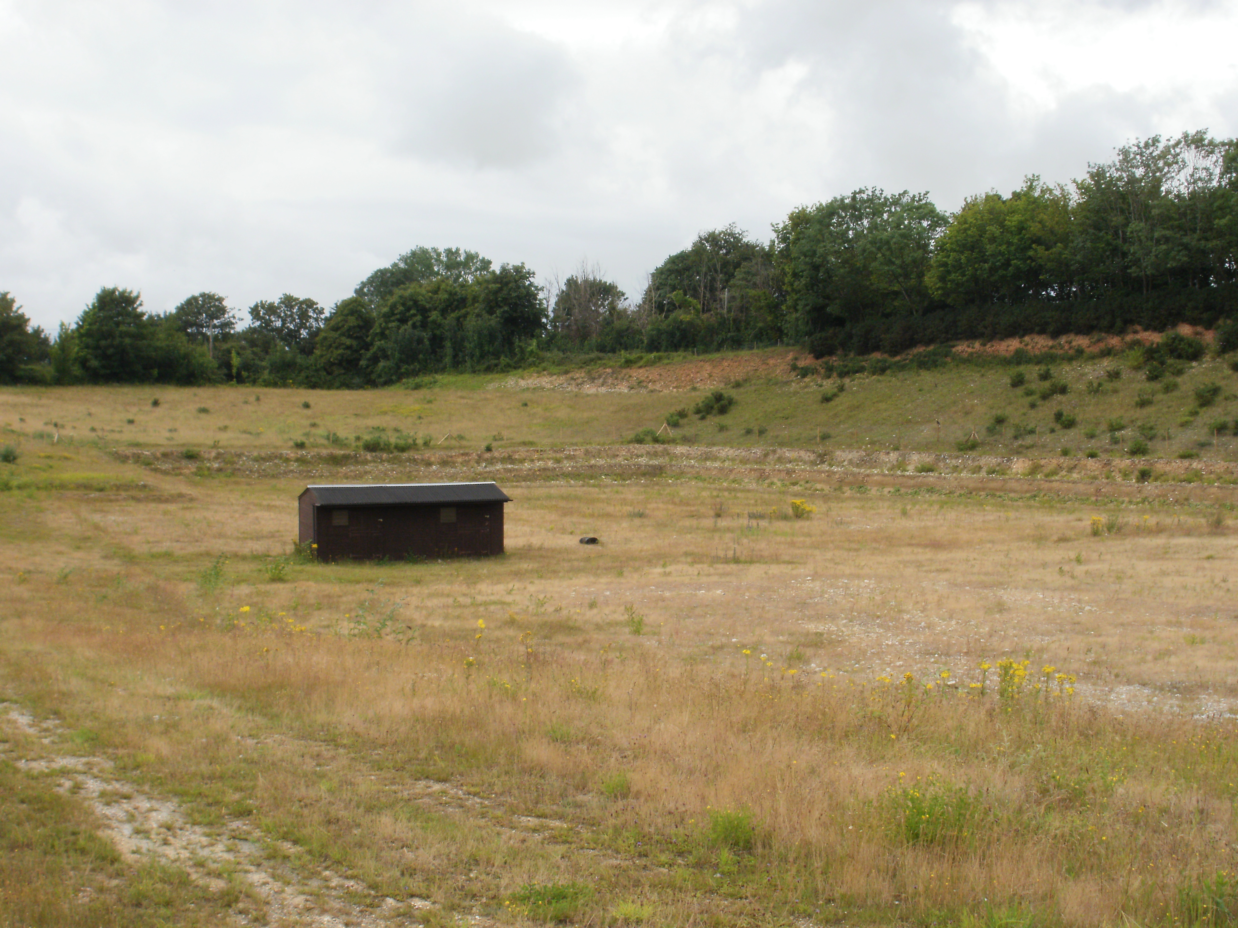
Halnaker Chalk Pit

Halnaker Chalk Pit is a 6.4-hectare (16-acre) biological Site of Special Scientific Interest north-east of Boxgrove in West Sussex.This chalk pit is important...
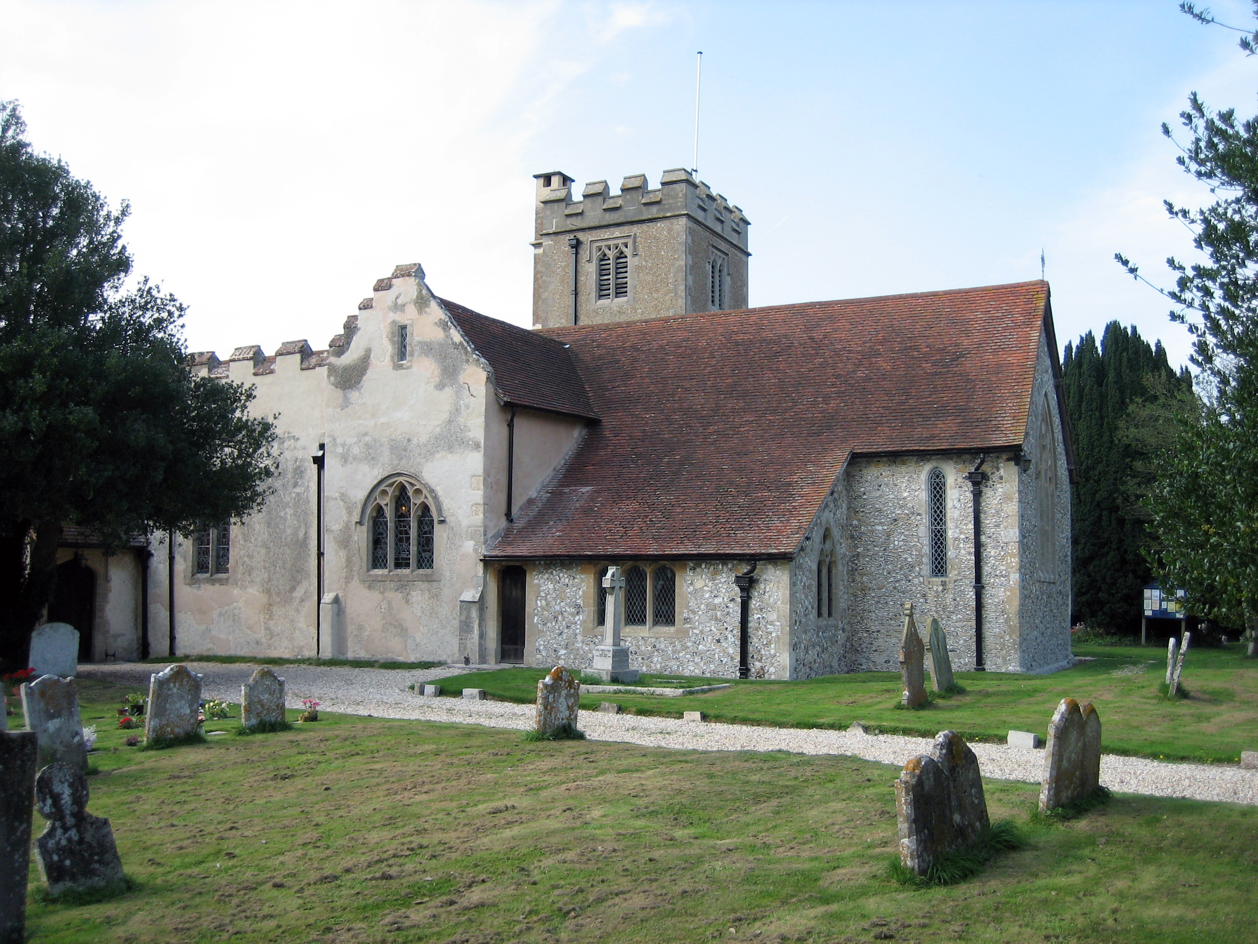
Boxgrove

Boxgrove is a village, ecclesiastical parish and civil parish in the Chichester District of the English county of West Sussex, about 3.5 miles (5.6 km...
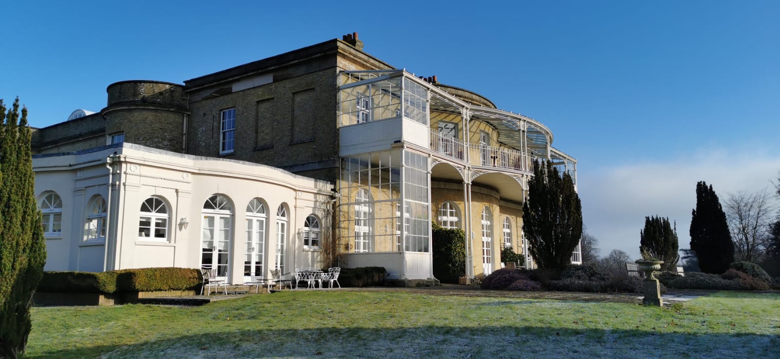
Aldingbourne House

Aldingbourne House is a Regency Era Grade II listed country house in the Arun district of West Sussex. It was built in 1799, with later alterations and...

RAF Tangmere

Royal Air Force Tangmere or more simply RAF Tangmere is a former Royal Air Force station located in Tangmere, England, famous for its role in the Battle...

Aldingbourne

Aldingbourne is a village and civil parish in the Arun District of West Sussex, England. It is centred 4 miles (6.4 km) north of Bognor Regis and 4 miles...

Nearby Amenities

Located within 500m of 50.857149,-0.688879
Winterton Arms
Naptan AtcoCode: 4400LH0361
Naptan Bearing: E
Naptan BusStopType: CUS
Naptan CommonName: Winterton Arms
Naptan Indicator: adj Crockerhill turnoff
Naptan Landmark: opp. Nyton Road
Naptan NaptanCode: wsxdatgt
Naptan Street: A27
Naptan Verified: no
Source: naptan_import
Lat/Long: 50.8556424/-0.6921428
Bus Stop
A27
Bus: yes
Naptan AtcoCode: 4400LH0736
Naptan Bearing: E
Naptan BusStopType: CUS
Naptan CommonName: A27
Naptan Indicator: HAR
Naptan Landmark: Hail & Ride
Naptan NaptanCode: wsxdtwdt
Naptan Street: A27
Naptan Verified: no
Public Transport: platform
Source: naptan_import
Lat/Long: 50.8547308/-0.6841097
Bus Stop
A27
Bus: yes
Naptan AtcoCode: 4400LH0737
Naptan Bearing: W
Naptan BusStopType: CUS
Naptan CommonName: A27
Naptan Indicator: HAR
Naptan Landmark: Hail & Ride
Naptan NaptanCode: wsxdtwdw
Naptan Street: A27
Naptan Verified: no
Public Transport: platform
Source: naptan_import
Lat/Long: 50.8544446/-0.6842456
Bus Stop
Nyton Road
Bench: no
Bin: no
Bus: yes
Lit: no
Naptan AtcoCode: 4400LH0840
Naptan Bearing: NW
Naptan CommonName: Nyton Road
Naptan Indicator: adj Marsh Lane
Naptan Landmark: Marsh Lane
Naptan NaptanCode: wsxdpwja
Naptan Street: Nyton rd
Naptan Verified: no
Public Transport: platform
Shelter: no
Source: naptan_import
Tactile Paving: no
Lat/Long: 50.8540641/-0.6919994
Bus Stop
Nyton Road
Bench: no
Bin: no
Bus: yes
Lit: no
Naptan AtcoCode: 4400LH0841
Naptan Bearing: SE
Naptan CommonName: Nyton Road
Naptan Indicator: opp Marsh Lane
Naptan Landmark: Marsh Lane
Naptan NaptanCode: wsxdpwjd
Naptan Street: Nyton Rd
Naptan Verified: no
Public Transport: platform
Shelter: no
Source: naptan_import
Tactile Paving: no
Lat/Long: 50.8540892/-0.6918282
Bus Stop
St Andrews Close
Bus: yes
Naptan AtcoCode: 4400MO0015
Naptan Bearing: N
Naptan CommonName: St Andrews Close
Naptan Indicator: o/s Winterton Arms
Naptan Landmark: Aldingbourne Drive
Naptan NaptanCode: wsxdgpjm
Naptan Street: unmarked road
Naptan Verified: no
Public Transport: platform
Source: naptan_import
Lat/Long: 50.8556746/-0.6912581
Power: pole
Lat/Long: 50.8591042/-0.6905886
Power: pole
Lat/Long: 50.8598017/-0.6945099
Power: tower
Lat/Long: 50.8590923/-0.6897544
Power: pole
Lat/Long: 50.8595342/-0.6906637
Power: pole
Lat/Long: 50.8591482/-0.6911947
Power: pole
Lat/Long: 50.8553386/-0.6935658
Power: pole
Lat/Long: 50.8571909/-0.6924822
Power: pole
Lat/Long: 50.8582949/-0.6915702
Power: pole
Lat/Long: 50.8598999/-0.6944456
Power: pole
Lat/Long: 50.856026/-0.6934478
Power: pole
Lat/Long: 50.8611579/-0.6895156
Crossing
Crossing: unmarked
Crossing Markings: no
Danger: yes
Lat/Long: 50.8550582/-0.6906151
Power: pole
Lat/Long: 50.8592227/-0.6909694
Power: tower
Lat/Long: 50.8611731/-0.689344
Power: pole
Lat/Long: 50.8588536/-0.6910874
Crossing
Crossing: unmarked
Crossing Markings: no
Lat/Long: 50.8546416/-0.6858626
Crossing
Crossing: unmarked
Crossing Markings: no
Lat/Long: 50.8547566/-0.6855908
Crossing
Bicycle: yes
Crossing: unmarked
Crossing Markings: no
Kerb: flush
Lat/Long: 50.8547422/-0.6922891
Crossing
Bicycle: yes
Crossing: unmarked
Crossing Markings: no
Kerb: flush
Lat/Long: 50.8547488/-0.6922196
Crockerhill
Place: hamlet
Wikidata: Q5187336
Lat/Long: 50.8563525/-0.6916675
Crossing
Crossing: unmarked
Crossing Markings: no
Hazard: cyclists
Lat/Long: 50.8549081/-0.6908894
Post Box
Collection Plate: CP7D
Collection Times: Mo-Fr 09:00; Sa 07:00
Operator: Royal Mail
Operator Wikidata: Q638098
Post Box Type: lamp
Ref: PO18 13D
Royal Cypher: EIIR
Royal Cypher Wikidata: Q33102113
Lat/Long: 50.8558052/-0.6921731
Location Transition: yes
Power: pole
Lat/Long: 50.8544899/-0.693663
Power: pole
Lat/Long: 50.859145/-0.6906541
Power: pole
Lat/Long: 50.8592897/-0.6909558
Power: pole
Lat/Long: 50.8597578/-0.6843174
Power: pole
Lat/Long: 50.859768/-0.6856155
Location Transition: yes
Power: pole
Lat/Long: 50.8597951/-0.6878538
Location Transition: yes
Power: pole
Lat/Long: 50.8598527/-0.6877908
Power: pole
Lat/Long: 50.859834/-0.685932
Power: pole
Lat/Long: 50.8598273/-0.6842905
The data included in this document is from www.openstreetmap.org. The data is made available under ODbL.

Have you been to Crockerhill?

Leave your review of Crockerhill below (or comments, questions and feedback).