Little Iverley Covert

Wood, Forest in Staffordshire South Staffordshire

England

Little Iverley Covert

Man on ladder mural Man on a ladder mural on the side of Katie Fitzgeralds
Man on ladder mural Credit: Alan Cartwright

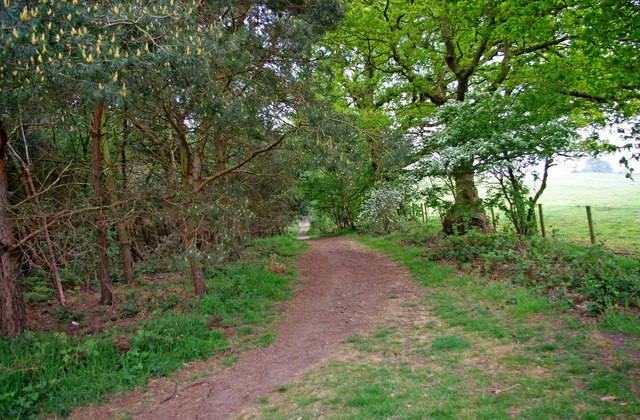
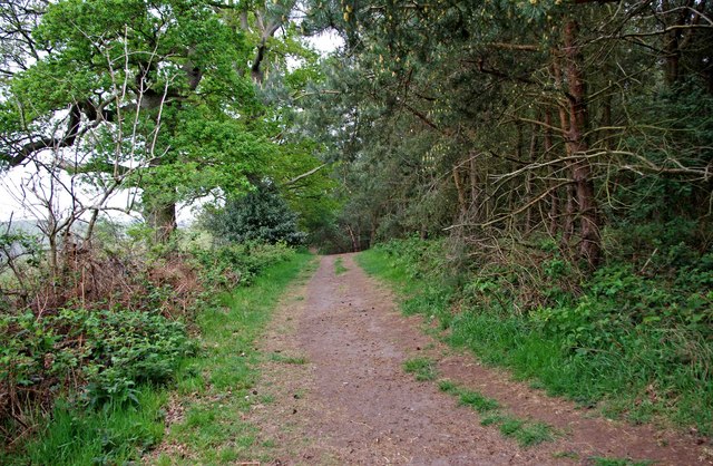
Little Iverley Covert is a small woodland area located in Staffordshire, England. It is situated within the larger Iverley Covert, which spans across the counties of Staffordshire and Worcestershire. The woodland is primarily composed of a mix of deciduous and coniferous trees, creating a diverse and picturesque environment.

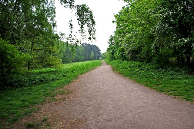
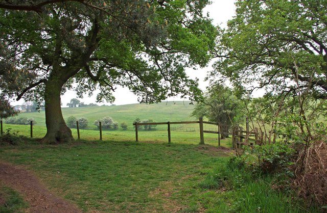
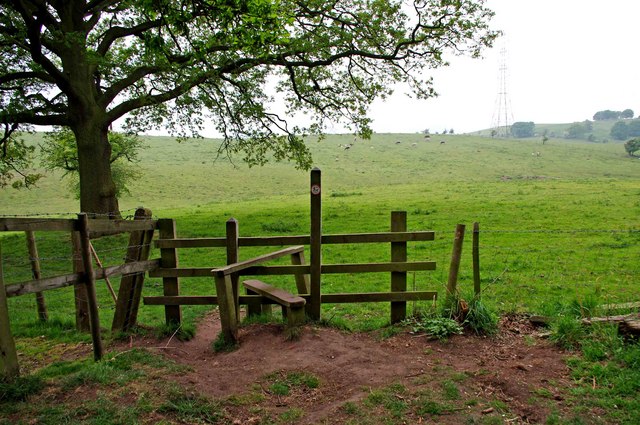
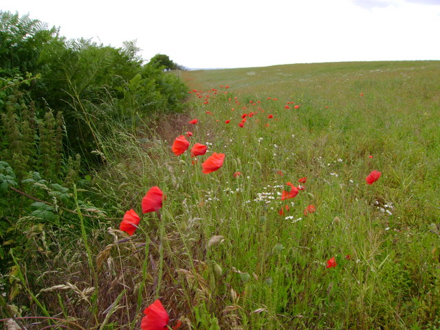
Covering an area of approximately 10 acres, Little Iverley Covert offers a tranquil retreat for nature enthusiasts and walkers alike. The woodland is known for its rich biodiversity, with a variety of plant and animal species calling it home. Visitors can expect to encounter native British wildlife such as deer, squirrels, and a wide range of bird species.

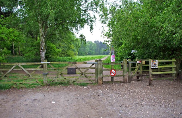
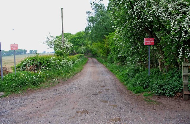
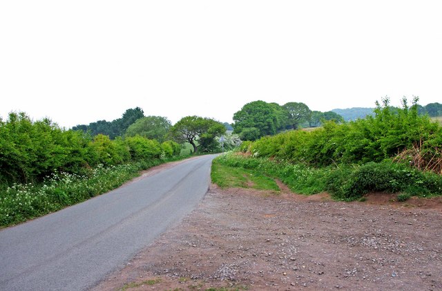
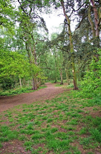
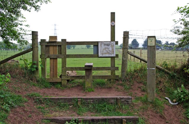
The woodland is accessible via a network of footpaths and trails, allowing visitors to explore its beauty at their own pace. These paths lead through a mixture of open glades, dense thickets, and shaded groves, providing a sense of adventure and discovery as one navigates through the wood.

Little Iverley Covert also serves as an important habitat for rare and protected species. It is particularly known for its population of great crested newts, a species of European newt that is legally protected in the UK. The woodland provides a crucial breeding ground for these amphibians, which are considered indicators of a healthy ecosystem.

Overall, Little Iverley Covert offers a peaceful and enchanting experience for nature lovers, providing an opportunity to immerse oneself in the beauty of Staffordshire's woodlands and forests.

If you have any feedback on the listing, please let us know in the comments section below.

Little Iverley Covert Images

Images are sourced within 2km of 52.447667/-2.1744266 or Grid Reference SO8883. Thanks to Geograph Open Source API. All images are credited.

Man on ladder mural Man on a ladder mural on the side of Katie Fitzgeralds
Man on ladder mural
Man on a ladder mural on the side of Katie Fitzgeralds
Entrance to Bunkers Hill Wood from Whittington Hall Lane near Whittington Bunkers Hill Wood is owned and managed by the Woodland Trust, a registered charity. Like all their sites, it is open to the public, and although there are only two public footpaths within the wood, there are a large number of other paths which are permissive footpaths. This view shows one of the entrances, adjacent to which is a small area for car parking.
Entrance to Bunkers Hill Wood from Whittington Hall Lane near Whittington
Bunkers Hill Wood is owned and managed by the Woodland Trust, a registered charity. Like all their sites, it is open to the public, and although there are only two public footpaths within the wood, there are a large number of other paths which are permissive footpaths. This view shows one of the entrances, adjacent to which is a small area for car parking.
Sandy Lane near Whittington This lane runs between Whittington Hall Lane and the edge of the town of Stourbridge. There is a public footpath running along its whole length. For part of the way, it runs adjacent to Bunkers Hill Wood.
Sandy Lane near Whittington
This lane runs between Whittington Hall Lane and the edge of the town of Stourbridge. There is a public footpath running along its whole length. For part of the way, it runs adjacent to Bunkers Hill Wood.
Whittington Hall Lane near Whittington On the left of the lane is a gravelled area, which can be used by visitors to the nearby Bunkers Hill Woods, when the small car park by the wood's entrance is full.
Whittington Hall Lane near Whittington
On the left of the lane is a gravelled area, which can be used by visitors to the nearby Bunkers Hill Woods, when the small car park by the wood's entrance is full.
Public footpath in Bunkers Hill Wood near Whittington This public footpath, which starts here at the entrance to the wood from Whittington Hall Lane, is one of the two public footpaths to be found in the woods. There are many other paths there however, which the public can use, but they are permissive footpaths. These date from when the wood was used for shooting purposes. This was before its acquisition by the Woodland Trust.
Public footpath in Bunkers Hill Wood near Whittington
This public footpath, which starts here at the entrance to the wood from Whittington Hall Lane, is one of the two public footpaths to be found in the woods. There are many other paths there however, which the public can use, but they are permissive footpaths. These date from when the wood was used for shooting purposes. This was before its acquisition by the Woodland Trust.
Bunkers Hill Wood near Whittington Hall Lane Bunkers Hill Wood is about half a mile west of Stourbridge. According to its owners, the Woodland Trust, it contains a mixture of predominantly secondary plantation trees with mature and veteran broadleaves and conifers, including Sweet Chestnut, Oak, Scots Pine and Corsican Pine. These are contrasted by younger stands of broadleaves and conifers and areas of naturally regenerated Birch.

The site, which was formerly part of Iverley Heath, was originally planted around 1860, with subsequent replanting as recently as 20 to 25 years ago.
Bunkers Hill Wood near Whittington Hall Lane
Bunkers Hill Wood is about half a mile west of Stourbridge. According to its owners, the Woodland Trust, it contains a mixture of predominantly secondary plantation trees with mature and veteran broadleaves and conifers, including Sweet Chestnut, Oak, Scots Pine and Corsican Pine. These are contrasted by younger stands of broadleaves and conifers and areas of naturally regenerated Birch. The site, which was formerly part of Iverley Heath, was originally planted around 1860, with subsequent replanting as recently as 20 to 25 years ago.
A litter bin and two dog waste bins at Bunkers Hill Wood, near Whittington Bunkers Hill Wood is only about half a mile from the edge of the town of Stourbridge, It is therefore a very popular spot with people from there for walking with, or without, dogs. These bins are conveniently situated near the entrance from Whittington Hall Lane. Normally the wood would have a lot of visitors, but on the day of the wedding of Prince William and Kate Middleton, it was very quiet.
A litter bin and two dog waste bins at Bunkers Hill Wood, near Whittington
Bunkers Hill Wood is only about half a mile from the edge of the town of Stourbridge, It is therefore a very popular spot with people from there for walking with, or without, dogs. These bins are conveniently situated near the entrance from Whittington Hall Lane. Normally the wood would have a lot of visitors, but on the day of the wedding of Prince William and Kate Middleton, it was very quiet.
Southwestern edge of Bunkers Hill Wood near Whittington Here is the very edge of the wood, beyond which are fields. A permissive footpath goes off to the left, and another, behind the photographer, goes along the west boundary of the wood to the entrance on Whittington Hall Lane. The last stretch of this is a public footpath. On the right of this view is a stile, which gives access to what appears to be a new public footpath, across fields, which is not shown on the 2006 edition of OS Explorer Map sheet 219.
Southwestern edge of Bunkers Hill Wood near Whittington
Here is the very edge of the wood, beyond which are fields. A permissive footpath goes off to the left, and another, behind the photographer, goes along the west boundary of the wood to the entrance on Whittington Hall Lane. The last stretch of this is a public footpath. On the right of this view is a stile, which gives access to what appears to be a new public footpath, across fields, which is not shown on the 2006 edition of OS Explorer Map sheet 219.
Permissive footpath on edge of Bunkers Hill Wood, near Whittington This is one of the many permissive footpaths within the wood. Here it is running along the edge of the wood.
Permissive footpath on edge of Bunkers Hill Wood, near Whittington
This is one of the many permissive footpaths within the wood. Here it is running along the edge of the wood.
Stile at southwest corner of Bunkers Hill Wood near Whittington In the southwest corner of the wood is this stile. On the other side is what appears to be a new public footpath, as it is not shown on the 2006 edition of OS Explorer Map sheet 219. The little disc on the post is marked Staffordshire County Council, and requests that dogs be kept on leads. It is not obvious, on the ground, quite where the path goes but there are fields adjacent to this part of the wood, with some livestock in them.
Stile at southwest corner of Bunkers Hill Wood near Whittington
In the southwest corner of the wood is this stile. On the other side is what appears to be a new public footpath, as it is not shown on the 2006 edition of OS Explorer Map sheet 219. The little disc on the post is marked Staffordshire County Council, and requests that dogs be kept on leads. It is not obvious, on the ground, quite where the path goes but there are fields adjacent to this part of the wood, with some livestock in them.
Permissive footpath on edge of Bunkers Hill Wood, near Whittington This permissive footpath is heading for the entrance off Whittington Hall Lane. Further on it is a public footpath.
Permissive footpath on edge of Bunkers Hill Wood, near Whittington
This permissive footpath is heading for the entrance off Whittington Hall Lane. Further on it is a public footpath.
Stile at start of footpath from Bunkers Hill Wood to Whittington Hall Lane The footpath starts at the stile, and go west across fields to Whittington Hall Lane.
Stile at start of footpath from Bunkers Hill Wood to Whittington Hall Lane
The footpath starts at the stile, and go west across fields to Whittington Hall Lane.
The Red Lion, Stourbridge
The Cottage Inn, Stourbridge
Royal Exchange, Stourbridge
The Queens Head, Stourbridge
Somerset House, Stourbridge
Poppies at field margin Poppies, bracken, nettles and bramble all flourishing at the edge of a rape seed field.
Poppies at field margin
Poppies, bracken, nettles and bramble all flourishing at the edge of a rape seed field.
Show me another place!

Little Iverley Covert is located at Grid Ref: SO8883 (Lat: 52.447667, Lng: -2.1744266)

Administrative County: Staffordshire

District: South Staffordshire

Police Authority: Staffordshire

What 3 Words

///breakaway.squirted.continues. Near Stourbridge, West Midlands

Nearby Locations

Little Iverley Covert

Related Wikis

Norton, Stourbridge

Norton is a suburb and council ward in the town of Stourbridge, West Midlands. It has a population of 11,943 in an area of 569 hectares. The population...

Ridgewood High School, Wollaston

Ridgewood High School is a coeducational secondary school, a part of the Stour Vale Academy Trust situated in Wollaston (near Stourbridge), in the West...
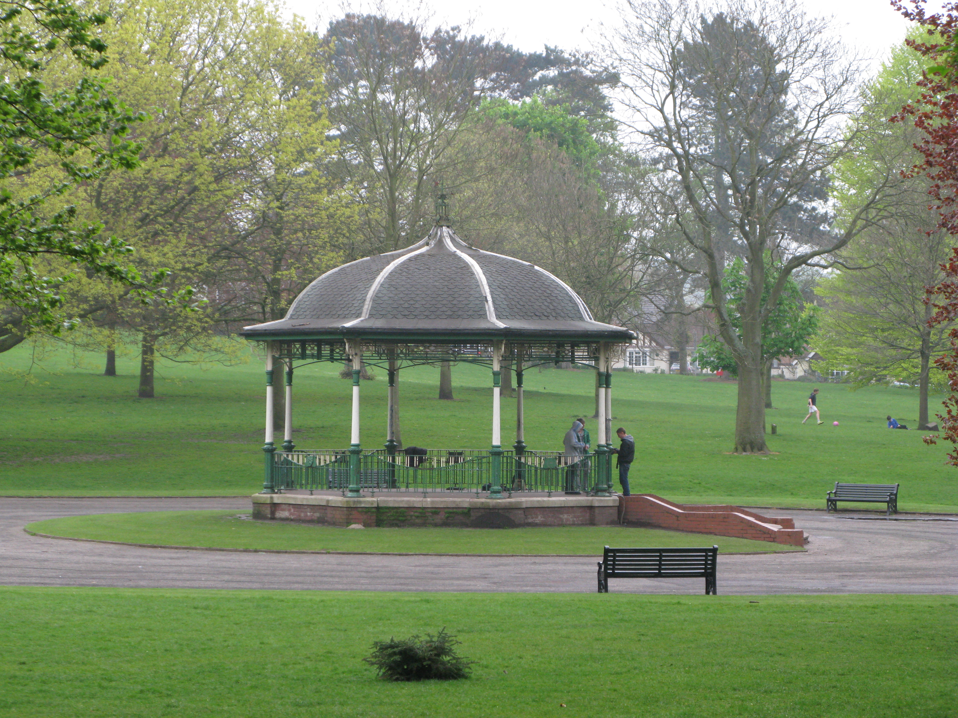
Mary Stevens Park

Mary Stevens Park is a public park located in Norton, Stourbridge, West Midlands, UK. Opened to the public in 1931, it attracts 1.3 million visitors per...

Battle of Stourbridge Heath

The Battle of Stourbridge Heath (26 March 1644) was a skirmish that took place during the First English Civil War, in which a Parliamentarian contingent...

Nearby Amenities

Located within 500m of 52.447667,-2.1744266
Bus Stop
Shenstone Ave / Westwood Avenue
NaPTANAreaCode: 43000824601
Bus: yes
Naptan AtcoCode: 43000824601
Naptan Bearing: S
Naptan BusStopType: MKD
Naptan CommonName: Westwood Avenue
Naptan Indicator: after
Naptan NaptanCode: nwmjtjaw
Naptan PlusbusZoneRef: BHAMNWS
Naptan Status: ACT
Naptan StopType: BCT
Naptan Street: SHENSTONE AVE
Naptan Towards: Stourbridge
Naptan Verified: no
Public Transport: platform
Route Ref: 276
Shelter: yes
Shelter Ref: 408204
Source: WMCA
Lat/Long: 52.446808/-2.1697513
Bus Stop
Shenstone Ave / Westwood Avenue
Bus: yes
Naptan AtcoCode: 43000824602
Naptan Bearing: N
Naptan BusStopType: MKD
Naptan CommonName: Westwood Avenue
Naptan Indicator: before
Naptan NaptanCode: nwmjtjda
Naptan PlusbusZoneRef: BHAMNWS
Naptan Status: ACT
Naptan StopType: BCT
Naptan Street: SHENSTONE AVE
Naptan Towards: Wollaston
Naptan Verified: no
Public Transport: platform
Route Ref: 276;288
Source: WMCA
Lat/Long: 52.4472702/-2.1699715
Bus Stop
Shenstone Ave / Lavender Lane
Bus: yes
Naptan AtcoCode: 43000824701
Naptan Bearing: SW
Naptan BusStopType: MKD
Naptan CommonName: Lavender Lane
Naptan Indicator: adj
Naptan NaptanCode: nwmjtjdg
Naptan PlusbusZoneRef: BHAMNWS
Naptan Status: ACT
Naptan StopType: BCT
Naptan Street: SHENSTONE AVE
Naptan Towards: Stourbridge
Naptan Verified: no
Public Transport: platform
Route Ref: 276
Source: WMCA
Lat/Long: 52.4484934/-2.1696378
Bus Stop
Shenstone Ave / Lavender Lane
Bus: yes
Naptan AtcoCode: 43000824702
Naptan Bearing: NE
Naptan BusStopType: MKD
Naptan CommonName: Lavender Lane
Naptan Indicator: opp
Naptan NaptanCode: nwmjtjdj
Naptan PlusbusZoneRef: BHAMNWS
Naptan Status: ACT
Naptan StopType: BCT
Naptan Street: SHENSTONE AVE
Naptan Towards: Wollaston
Naptan Verified: no
Public Transport: platform
Route Ref: 276;288
Source: WMCA
Lat/Long: 52.4487726/-2.1692711
Bus Stop
Shenstone Ave / Rosemary Lane
Bus: yes
Naptan AtcoCode: 43000824801
Naptan Bearing: SW
Naptan BusStopType: MKD
Naptan CommonName: Rosemary Lane
Naptan Indicator: adj
Naptan NaptanCode: nwmjtjdm
Naptan PlusbusZoneRef: BHAMNWS
Naptan Status: ACT
Naptan StopType: BCT
Naptan Street: SHENSTONE AVE
Naptan Towards: Stourbridge
Naptan Verified: no
Public Transport: platform
Route Ref: 276
Source: WMCA
Lat/Long: 52.4490623/-2.1678596
Give Way
Source: bing
Lat/Long: 52.4470477/-2.1699264
Give Way
Source: bing
Lat/Long: 52.4470517/-2.1697942
Generator Method: photovoltaic
Generator Output Electricity: yes
Generator Source: solar
Generator Type: solar_photovoltaic_panel
Location: roof
Power: generator
Lat/Long: 52.4480366/-2.1683487
Generator Method: photovoltaic
Generator Output Electricity: yes
Generator Source: solar
Generator Type: solar_photovoltaic_panel
Location: roof
Power: generator
Lat/Long: 52.4467517/-2.1701217
Generator Method: photovoltaic
Generator Output Electricity: yes
Generator Source: solar
Generator Type: solar_photovoltaic_panel
Location: roof
Power: generator
Lat/Long: 52.4468211/-2.1694364
Generator Method: photovoltaic
Generator Output Electricity: yes
Generator Source: solar
Generator Type: solar_photovoltaic_panel
Location: roof
Power: generator
Lat/Long: 52.44611/-2.1714091
Generator Method: photovoltaic
Generator Output Electricity: yes
Generator Source: solar
Generator Type: solar_photovoltaic_panel
Location: roof
Power: generator
Lat/Long: 52.4461116/-2.1713287
Generator Method: photovoltaic
Generator Output Electricity: yes
Generator Source: solar
Generator Type: solar_photovoltaic_panel
Location: roof
Power: generator
Lat/Long: 52.4467819/-2.1700868
Generator Method: photovoltaic
Generator Output Electricity: yes
Generator Source: solar
Generator Type: solar_photovoltaic_panel
Location: roof
Power: generator
Lat/Long: 52.4443689/-2.1703926
Post Box
Lat/Long: 52.4469757/-2.1697383
Marker: pedestal
Operator: Esso
Utility: oil
Lat/Long: 52.4466267/-2.1779821
Marker: pedestal
Operator: Esso
Utility: oil
Lat/Long: 52.4467287/-2.178023
The data included in this document is from www.openstreetmap.org. The data is made available under ODbL.

Have you been to Little Iverley Covert?

Leave your review of Little Iverley Covert below (or comments, questions and feedback).