Cringleford

Settlement in Norfolk South Norfolk

England

Cringleford

The A47 west approaching junction with A11
The A47 west approaching junction with A11 Credit: Roy Hughes

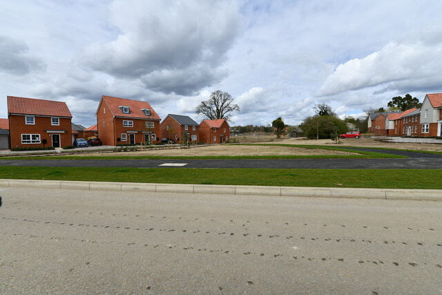
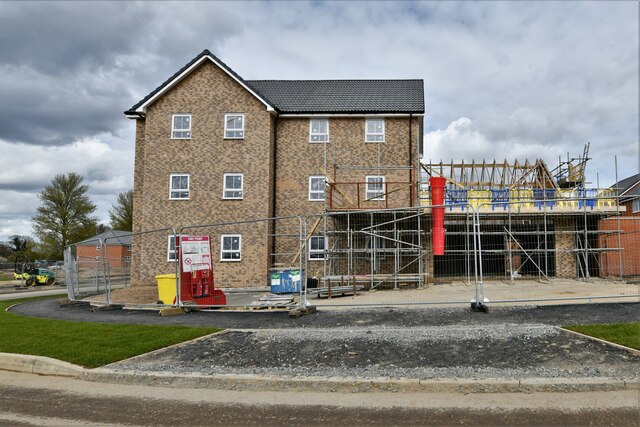
Cringleford is a charming village located in the county of Norfolk, England. Situated approximately four miles southwest of the historic city of Norwich, Cringleford is nestled amidst picturesque countryside, offering a peaceful and idyllic setting for its residents. The village has a population of around 2,500 people and is well-known for its strong sense of community.

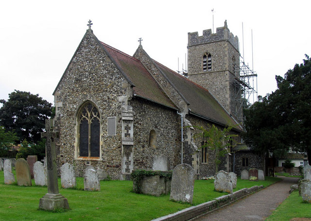
Cringleford boasts a rich history dating back to the Saxon era, with evidence of settlements from as early as the 10th century. Today, visitors can still catch glimpses of the village's past through its well-preserved medieval church, St. Peter's, which stands at the heart of the community.

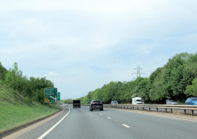
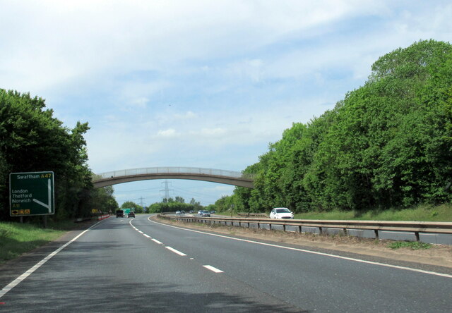
The village is a popular choice for families and professionals seeking a tranquil yet well-connected place to reside. It benefits from excellent transport links, with easy access to major roads and regular bus services to nearby towns and cities. Additionally, Cringleford is home to a train station, providing convenient connections to Norwich and beyond.

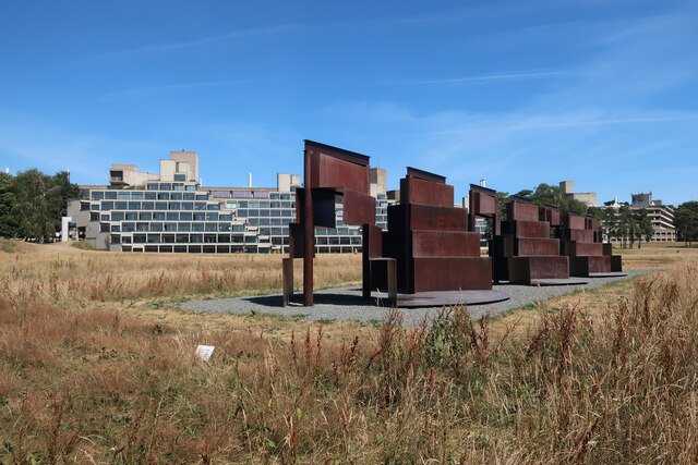
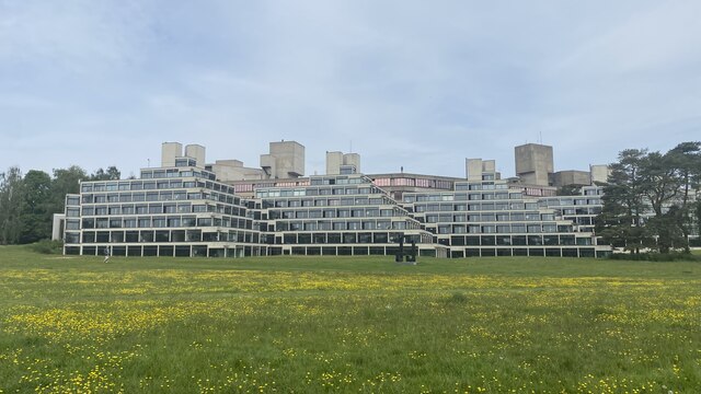
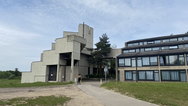
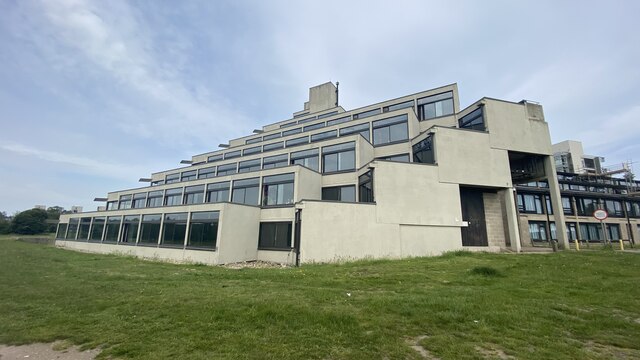
Residents of Cringleford enjoy a range of amenities, including a local primary school, a community center, and several green spaces. The village is also within close proximity to the University of East Anglia, offering educational and cultural opportunities to both locals and students.

In terms of leisure activities, Cringleford boasts a golf course, sports clubs, and scenic walking paths, allowing residents to enjoy the surrounding natural beauty. The village also has a range of shops, cafes, and restaurants, ensuring that daily needs are readily met.

Overall, Cringleford offers a harmonious blend of history, tranquility, and convenience, making it an attractive place to live and visit in the Norfolk region.

If you have any feedback on the listing, please let us know in the comments section below.

Cringleford Images

Images are sourced within 2km of 52.605796/1.243724 or Grid Reference TG1905. Thanks to Geograph Open Source API. All images are credited.

The A47 west approaching junction with A11
Footbridge over the A47 west approaching junction with A11
Slip road leaving the A47 to join the A11
Goodwood Steps, UEA campus Anthony Caro sculpture which sits well with the stepped nature of the campus buildings behind.
Goodwood Steps, UEA campus
Anthony Caro sculpture which sits well with the stepped nature of the campus buildings behind.
Suffolk Terrace (ziggurats), University of East Anglia
Sainsbury Centre, University of East Anglia
Footbridge leading into the Sainsbury Centre, University of East Anglia The Sainsbury Centre at the University of East Anglia is a renowned art gallery, housed in a pioneering example by Norman Foster of high-tech architecture.
Footbridge leading into the Sainsbury Centre, University of East Anglia
The Sainsbury Centre at the University of East Anglia is a renowned art gallery, housed in a pioneering example by Norman Foster of high-tech architecture.
Bridge, Cringleford Built in 1520, replacing a bridge washed away in 1519, and widened in 1780. The facings are in limestone, "a rarity in Norfolk other than for churches and bridges". Grade II* listed.
It carries Eaton Street over the River Yare.
Bridge, Cringleford
Built in 1520, replacing a bridge washed away in 1519, and widened in 1780. The facings are in limestone, "a rarity in Norfolk other than for churches and bridges". Grade II* listed. It carries Eaton Street over the River Yare.
Cringleford: 79, Woolhouse Way
Cringleford: Work in progress on a huge housing estate
Cringleford: Davies Drive
Cringleford: Housing street to be named though numbered
Cringleford: House under construction
Cringleford: Haldane Drive
Cringleford: Barratt Homes 'Cringleford Heights' site and sales office
UEA: Lasdun's Teaching Wall The Teaching Wall in 2014 prior to redevelopment.  This is a 450m-long, six-storey block at the University of East Anglia - arranged as a single long spine.  Designed by architect Denys Lasdun (1964-8).  

Lasdun "...hugged the lines of the contours with long, narrow buildings which also achieved a vertical segregation, with pedestrians on an upper walkway system and vehicles on the ground below. The walkways resemble a street, with the teaching facilities to one side and the residential blocks on the other, slung between the entrance square of communal buildings at one end..."
Elain Harwood, 4 Jan 2010, bdonline <span class="nowrap"><a title="https://www.bdonline.co.uk/revisiting-denys-lasduns-uea/5010945.article" rel="nofollow ugc noopener" href="https://www.bdonline.co.uk/revisiting-denys-lasduns-uea/5010945.article">Link</a><img style="margin-left:2px;" alt="External link" title="External link - shift click to open in new window" src="https://s1.geograph.org.uk/img/external.png" width="10" height="10"/></span>

The building was designed to be repurposed internally as needs changed.  In 2022 UEA announced its intention to refurbish and reimagine the Teaching Wall for the 21st century.  The renewed building will have two floors of modern teaching space and four floors of laboratory space and learning facilities.
News: <span class="nowrap"><a title="https://www.uea.ac.uk/news/-/article/the-lasdun-wall-refurbishment-project" rel="nofollow ugc noopener" href="https://www.uea.ac.uk/news/-/article/the-lasdun-wall-refurbishment-project">Link</a><img style="margin-left:2px;" alt="External link" title="External link - shift click to open in new window" src="https://s1.geograph.org.uk/img/external.png" width="10" height="10"/></span>
Project: <span class="nowrap"><a title="https://www.uea.ac.uk/about/university-information/campus-and-community/campus-investment/lasdun-wall-development" rel="nofollow ugc noopener" href="https://www.uea.ac.uk/about/university-information/campus-and-community/campus-investment/lasdun-wall-development">Link</a><img style="margin-left:2px;" alt="External link" title="External link - shift click to open in new window" src="https://s1.geograph.org.uk/img/external.png" width="10" height="10"/></span>

Grade II listed (English Heritage): <span class="nowrap"><a title="https://historicengland.org.uk/listing/the-list/list-entry/1390648" rel="nofollow ugc noopener" href="https://historicengland.org.uk/listing/the-list/list-entry/1390648">Link</a><img style="margin-left:2px;" alt="External link" title="External link - shift click to open in new window" src="https://s1.geograph.org.uk/img/external.png" width="10" height="10"/></span>

The University of East Anglia was founded in 1960, and Lasdun was commissioned as consultant architect in April 1962. The site is on 165 acres of parkland on the edge of Norwich.
UEA: Lasdun's Teaching Wall
The Teaching Wall in 2014 prior to redevelopment. This is a 450m-long, six-storey block at the University of East Anglia - arranged as a single long spine. Designed by architect Denys Lasdun (1964-8). Lasdun "...hugged the lines of the contours with long, narrow buildings which also achieved a vertical segregation, with pedestrians on an upper walkway system and vehicles on the ground below. The walkways resemble a street, with the teaching facilities to one side and the residential blocks on the other, slung between the entrance square of communal buildings at one end..." Elain Harwood, 4 Jan 2010, bdonline LinkExternal link The building was designed to be repurposed internally as needs changed. In 2022 UEA announced its intention to refurbish and reimagine the Teaching Wall for the 21st century. The renewed building will have two floors of modern teaching space and four floors of laboratory space and learning facilities. News: LinkExternal link Project: LinkExternal link Grade II listed (English Heritage): LinkExternal link The University of East Anglia was founded in 1960, and Lasdun was commissioned as consultant architect in April 1962. The site is on 165 acres of parkland on the edge of Norwich.
Show me another place!

Cringleford is located at Grid Ref: TG1905 (Lat: 52.605796, Lng: 1.243724)

Administrative County: Norfolk

District: South Norfolk

Police Authority: Norfolk

What 3 Words

///hiking.boring.circle. Near Cringleford, Norfolk

Nearby Locations

Cringleford Cringleford

Related Wikis

Cringleford

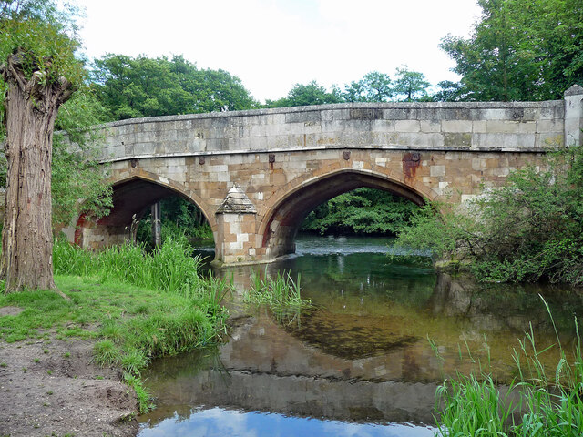
Cringleford is a civil parish and village in the English county of Norfolk. The village sits on the River Yare and forms part of the outskirts of Norwich...

Eaton Chalk Pit

Eaton Chalk Pit is a 0.16-hectare (0.40-acre) biological Site of Special Scientific Interest on the southern outskirts of Norwich in Norfolk.These former...
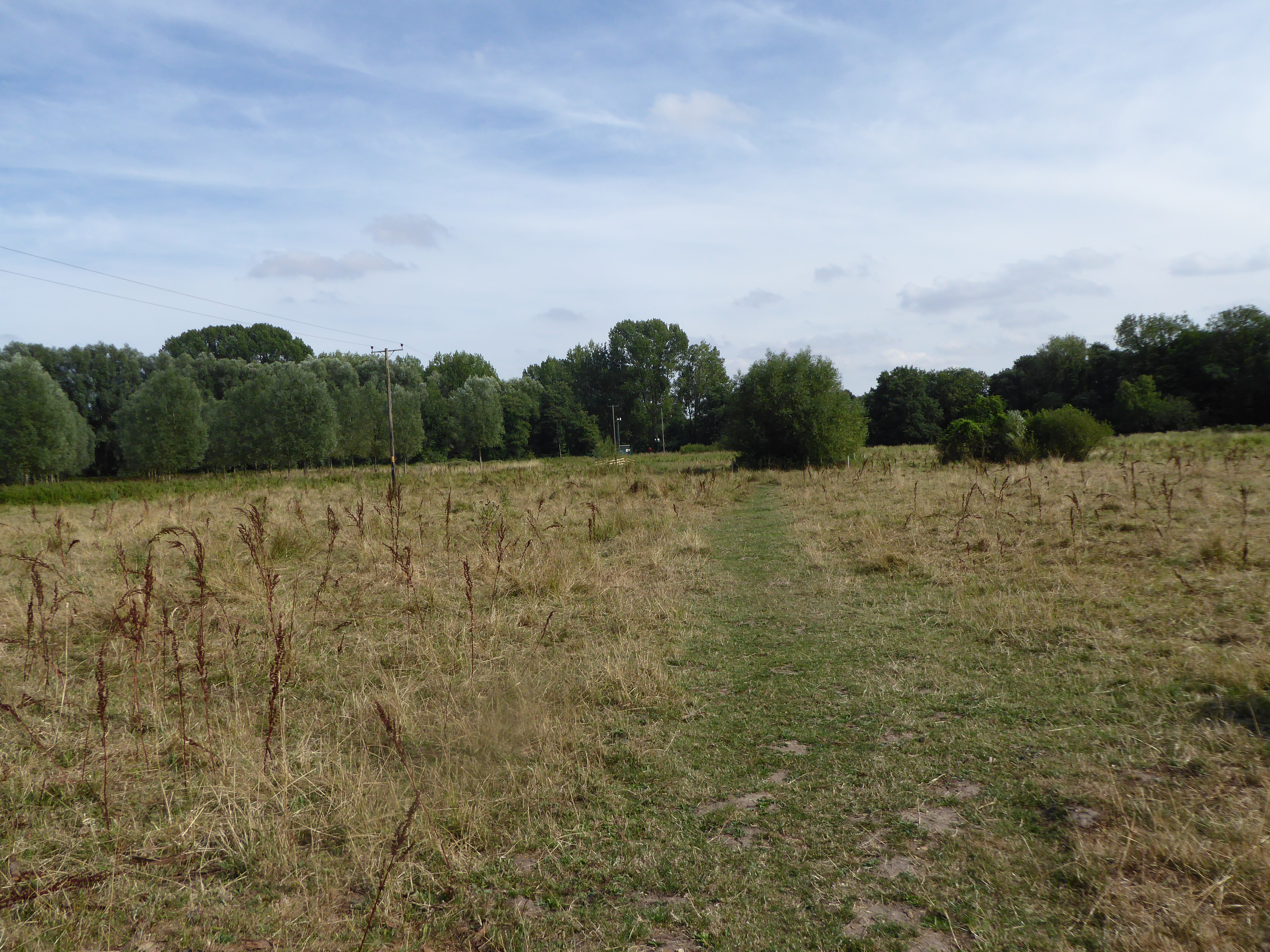
Eaton Common

Eaton Common is a 5.3-hectare (13-acre) Local Nature Reserve on the southern outskirts of Norwich in the county of Norfolk in England, United Kingdom...
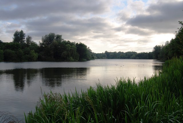
UEA Broad

UEA Broad is an area of open water that neighbours the University of East Anglia, from which it gets its name. It is a part of The Broads in Norfolk....

Intwood

Intwood is a village and former civil parish, now in the parish of Keswick and Intwood, in the South Norfolk district, in the county of Norfolk, England...
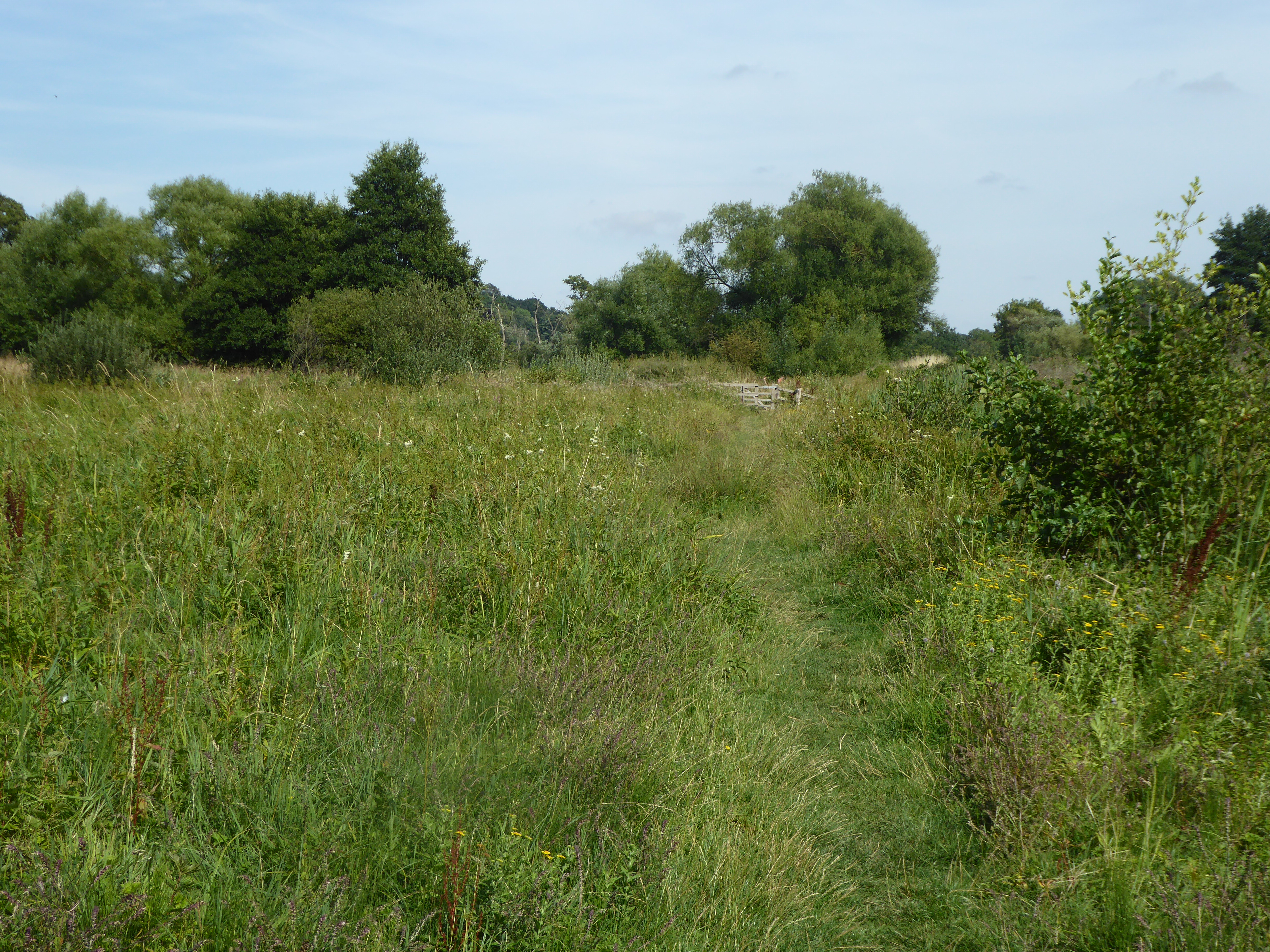
Marston Marshes

Marston Marshes is a 25.9-hectare (64-acre) Local Nature Reserve on the southern outskirts of Norwich in Norfolk. It is owned and managed by Norwich City...

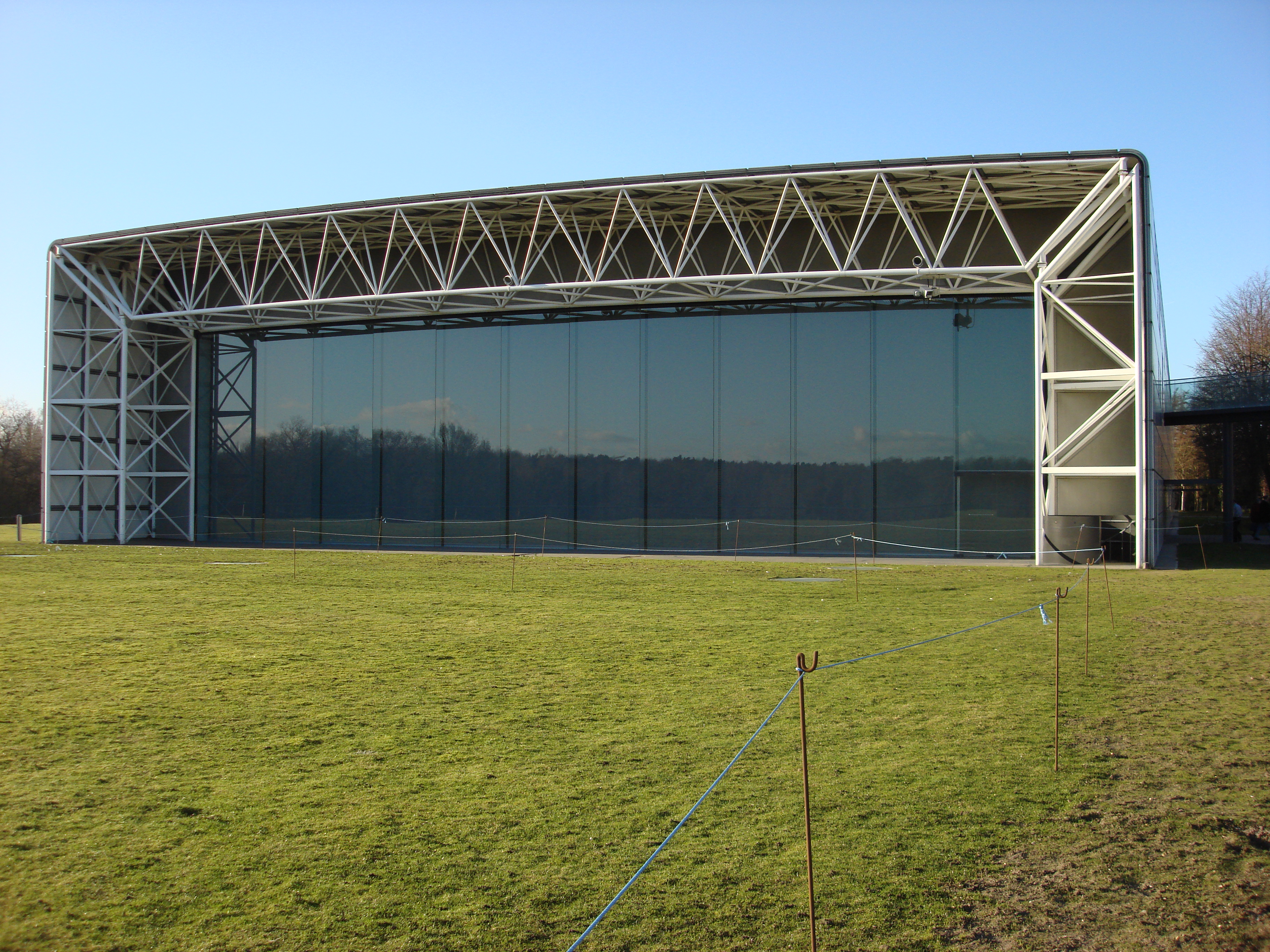
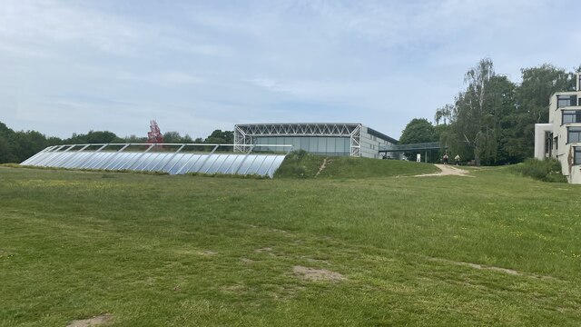
Sainsbury Centre for Visual Arts

The Sainsbury Centre is an art gallery and museum located on the campus of the University of East Anglia, Norwich, England. The building, which contains...

Marston Marsh

Marston Marsh is a Local Nature Reserve in southwest Norwich, Norfolk, England. == References == == External links == "Map of Marston Marshes". Local Nature...

Nearby Amenities

Located within 500m of 52.605796,1.243724
Motorway Junction
Lat/Long: 52.6048794/1.2395423
Crossing
Crossing: unmarked
Crossing Island: no
Tactile Paving: no
Lat/Long: 52.6075543/1.2415953
Collection Times: Mo-Fr 09:00; Sa 07:00
Fixme: Check on relocation of this box
Note: Being relocated at request of private landowner
Operator: Royal Mail
Post Box Type: pillar
Ref: NR4 436D
Royal Cypher: VR
Royal Cypher Wikidata: Q33102356
Was Amenity: post_box
Lat/Long: 52.6082903/1.2401273
Bus Stop
Cringleford / Keswick Road
Naptan AtcoCode: 2900C3527
Naptan Bearing: W
Naptan CommonName: school
Naptan Indicator: adj
Naptan Landmark: school
Naptan Locality: Cringleford
Naptan NaptanCode: nfoamagt
Naptan PlusbusZoneRef: NRCH
Naptan ShortCommonName: school
Naptan Street: Newmarket Road
Ref: NFOAMAGT
Shelter: no
Source: naptan_import;survey
Lat/Long: 52.6042895/1.2391673
Crossing
Crossing: unmarked
Lat/Long: 52.6045258/1.2411063
Crossing
Crossing: unmarked
Supervised: no
Lat/Long: 52.6041153/1.2393429
Traffic Calming: bump
Lat/Long: 52.6052029/1.247974
Give Way
Lat/Long: 52.6075375/1.2500331
Crossing
Crossing: unmarked
Crossing Island: yes
Kerb: flush
Tactile Paving: no
Lat/Long: 52.6061536/1.2467333
Old Phone: +44 1603 454218
Removed Amenity: telephone
Lat/Long: 52.6079169/1.2498184
Crossing
Crossing: uncontrolled
Crossing Island: no
Crossing Ref: zebra
Lit: yes
Tactile Paving: yes
Lat/Long: 52.6055807/1.2428109
Turning Circle
Lat/Long: 52.6047968/1.2405179
Turning Circle
Lat/Long: 52.6041588/1.2436324
Turning Circle
Lat/Long: 52.6039772/1.2406685
Turning Circle
Lat/Long: 52.6030244/1.2425011
Turning Circle
Lat/Long: 52.6025833/1.2422134
Turning Circle
Lat/Long: 52.6020776/1.247386
Turning Circle
Lat/Long: 52.6025578/1.2464232
Post Box
Collection Times: Mo-Fr 16:15; Sa 11:30
Operator: Royal Mail
Post Box Type: pillar
Ref: NR4 419
Royal Cypher: GR
Royal Cypher Wikidata: Q33102273
Lat/Long: 52.6040876/1.2394628
Cringleford
Inscription: 1920 / 1970
Man Made: village_sign
Material: fibreglass;wood
Place: village
Postal Code: NR4
Wikidata: Q2187751
Wikipedia: en:Cringleford
Lat/Long: 52.6043749/1.2400163
Crossing
Crossing: marked
Crossing Island: yes
Tactile Paving: no
Lat/Long: 52.6077722/1.2495496
Crossing
Crossing: uncontrolled
Crossing Island: no
Crossing Ref: zebra
Tactile Paving: yes
Lat/Long: 52.6076325/1.2497326
Crossing
Crossing: unmarked
Lat/Long: 52.6045187/1.2404898
Crossing
Crossing: unmarked
Crossing Island: yes
Tactile Paving: yes
Lat/Long: 52.6075121/1.248717
Post Box
Collection Times: Mo-Fr 16:00; Sa 11:30
Operator: Royal Mail
Post Box Type: pillar
Ref: NR4 400
Royal Cypher: EIIR
Royal Cypher Wikidata: Q33102113
Lat/Long: 52.6026521/1.2447075
Waste Basket
Lat/Long: 52.6090554/1.239324
Grit Bin
Lat/Long: 52.6072347/1.2420525
Waste Basket
Lat/Long: 52.6059666/1.2437884
Waste Basket
Colour: red
Material: plastic
Waste: dog_excrement
Lat/Long: 52.6040938/1.239569
Waste Basket
Colour: yellow
Material: plastic
Waste: trash
Lat/Long: 52.6040097/1.239469
Waste Basket
Lat/Long: 52.6041066/1.2392482
Grit Bin
Lat/Long: 52.6041085/1.2392314
Bus Stop
Intwood Road / Oakfields Road
Naptan AtcoCode: 2900C3513
Naptan Bearing: SW
Naptan CommonName: Oakfields Road
Naptan Indicator: adj
Naptan Landmark: Oakfields Road
Naptan Locality: Cringleford
Naptan NaptanCode: nfoajwtm
Naptan PlusbusZoneRef: NRCH
Naptan ShortCommonName: Oakfields Road
Naptan Street: Intwood Road
Shelter: no
Source: naptan_import;survey
Lat/Long: 52.6037097/1.2454071
Bus Stop
Intwood Road / The Loke
Naptan AtcoCode: 2900C3511
Naptan Bearing: SW
Naptan CommonName: The Loke
Naptan Indicator: adj
Naptan Landmark: The Loke
Naptan Locality: Cringleford
Naptan NaptanCode: nfoajwtg
Naptan PlusbusZoneRef: NRCH
Naptan ShortCommonName: The Loke
Naptan Street: Intwood Road
Operator: Anglian Coaches Ltd.
Ref: NFOAJWTG
Shelter: no
Source: naptan_import;survey
Lat/Long: 52.6059997/1.2468646
Give Way
Lat/Long: 52.6043343/1.239297
Operator: EDF Energy Networks Ltd.
Power: substation
Ref: TG 1937 0568
Lat/Long: 52.604575/1.2383143
Barrier: kissing_gate
Foot: yes
Lat/Long: 52.6074687/1.2488251
Crossing
Crossing: unmarked
Tactile Paving: yes
Lat/Long: 52.6056235/1.2431406
Grit Bin
Lat/Long: 52.6075473/1.2499361
Waste Basket
Check Date: 2021-07-15
Colour: black
Material: plastic
Waste: trash
Lat/Long: 52.6026216/1.2484946
Waste Basket
Check Date: 2021-07-15
Colour: red
Material: metal
Waste: dog_excrement
Lat/Long: 52.6026223/1.2485099
Man Made: service_area_interface
Operator: BT
Ref: 33
Lat/Long: 52.606668/1.242319
Man Made: serving_area_interface
Operator: BT
Ref: 5
Lat/Long: 52.606985/1.247913
Bus Stop
Cringleford / Flyover
Naptan AtcoCode: 2900C359
Naptan Bearing: E
Naptan CommonName: Church
Naptan Indicator: opp
Naptan Locality: Cringleford
Naptan NaptanCode: nfoamajt
Naptan PlusbusZoneRef: NRCH
Naptan Street: Colney Lane
Operator: First Eastern Counties; Anglian Coaches Ltd.;H. Semmence & Co Ltd.
Shelter: no
Source: naptan_import;survey
Lat/Long: 52.6059638/1.2437277
Bus Stop
Post Office
Naptan AtcoCode: 2900C3515
Naptan Bearing: SW
Naptan CommonName: post office
Naptan Indicator: adj
Naptan Landmark: post office
Naptan Locality: Cringleford
Naptan NaptanCode: nfoajwtw
Naptan PlusbusZoneRef: NRCH
Naptan ShortCommonName: post office
Naptan Street: Intwood Road
Operator: Anglian Coaches Ltd.
Physically Present: no
Shelter: no
Source: naptan_import;survey
Lat/Long: 52.6025876/1.2446392
Bus Stop
Intwood Road / Keswick Road
Naptan AtcoCode: 2900C3517
Naptan Bearing: SW
Naptan CommonName: Keswick Road
Naptan Indicator: adj
Naptan Landmark: Keswick Road
Naptan Locality: Cringleford
Naptan NaptanCode: nfoamadg
Naptan PlusbusZoneRef: NRCH
Naptan ShortCommonName: Keswick Rd
Naptan Street: Intwood Road
Operator: Anglian Coaches Ltd.
Shelter: no
Source: naptan_import;survey
Lat/Long: 52.6014448/1.2431826
Bus Stop
Cringleford / Colney Lane
Bench: no
Bin: no
Check Date Shelter: 2022-02-03
Naptan AtcoCode: 2900C352
Naptan Bearing: W
Naptan CommonName: Church
Naptan Indicator: adj
Naptan Landmark: church
Naptan Locality: Cringleford
Naptan NaptanCode: nfoamadp
Naptan PlusbusZoneRef: NRCH
Naptan Street: Newmarket Road
Operator: First Eastern Counties;Anglian Coaches Ltd.;H. Semmence & Co Ltd.
Shelter: no
Source: naptan_import;survey
Tactile Paving: no
Lat/Long: 52.6058664/1.2441654
Bus Stop
The Green
Naptan AtcoCode: 2900C3528
Naptan Bearing: W
Naptan CommonName: green
Naptan Indicator: adj
Naptan Landmark: green
Naptan Locality: Cringleford
Naptan NaptanCode: nfoamagw
Naptan PlusbusZoneRef: NRCH
Naptan ShortCommonName: green
Naptan Street: Newmarket Road
Operator: First Eastern Counties;Anglian Coaches Ltd.;H.Semmence & Co. Ltd.
Physically Present: no
Source: naptan_import;survey
Lat/Long: 52.6045047/1.2405034
Bus Stop
Newmarket Road / Opp The Green
Naptan AtcoCode: 2900C3529
Naptan Bearing: E
Naptan CommonName: green
Naptan Indicator: opp
Naptan Landmark: green
Naptan Locality: Cringleford
Naptan NaptanCode: nfoamaja
Naptan PlusbusZoneRef: NRCH
Naptan ShortCommonName: green
Naptan Street: Newmarket Road
Operator: Anglian Coaches Ltd.
Ref: NFOAMAJA
Shelter: no
Source: naptan_import;survey
Lat/Long: 52.6044839/1.2395937
Bus Stop
Aspen Way
Naptan AtcoCode: 2900C3537
Naptan Bearing: NW
Naptan BusStopType: CUS
Naptan CommonName: Aspen Way
Naptan Indicator: opp
Naptan Locality: Cringleford
Naptan NaptanCode: nfogpagj
Naptan PlusbusZoneRef: NRCH
Naptan Street: Keswick Road
Operator: Anglian Coaches Ltd.
Physically Present: no
Source: naptan_import;survey
Lat/Long: 52.6025676/1.2406262
Bus Stop
Aspen Way
Naptan AtcoCode: 2900C3538
Naptan Bearing: SE
Naptan BusStopType: CUS
Naptan CommonName: Aspen Way
Naptan Indicator: adj
Naptan Locality: Cringleford
Naptan NaptanCode: nfogpagm
Naptan PlusbusZoneRef: NRCH
Naptan Street: Keswick Road
Operator: Anglian Coaches Ltd.
Physically Present: no
Source: naptan_import;survey
Lat/Long: 52.6023544/1.2411865
Crossing
Crossing: unmarked
Crossing Island: yes
Tactile Paving: yes
Lat/Long: 52.6079912/1.2498302
Street Lamp
Operator: Cringleford Parish Council
Ref: 1
Lat/Long: 52.6076575/1.2415431
Street Lamp
Operator: Cringleford Parish Council
Ref: 2
Lat/Long: 52.607911/1.2410564
Street Lamp
Operator: Cringleford Parish Council
Ref: 5
Lat/Long: 52.6090757/1.2393035
Street Lamp
Operator: Cringleford Parish Council
Ref: 4
Lat/Long: 52.6083102/1.2401029
Street Lamp
Operator: Cringleford Parish Council
Ref: 3
Lat/Long: 52.608142/1.240606
Street Lamp
Lit: no
Operator: Cringleford Parish Council
Lat/Long: 52.605767/1.243652
Street Lamp
Operator: Norfolk County Council
Lat/Long: 52.607041/1.242153
Crossing
Crossing: uncontrolled
Crossing Island: no
Crossing Ref: zebra
Kerb: flush
Tactile Paving: yes
Lat/Long: 52.6059527/1.2459261
Barrier: cycle_barrier
Bicycle: yes
Lat/Long: 52.6090164/1.2392394
Parking
Church & Churchyard
Capacity: 4
Fee: no
Parking: surface
Lat/Long: 52.6058876/1.2456574
Milestone
Distance Norwich: 3 mi
Distance Thetford: 26 mi
Listed Status: Grade II
Marker: stone
Lat/Long: 52.6049909/1.2417939
Bench
Backrest: no
Material: wood
Seats: 2
Lat/Long: 52.6080084/1.2479457
Parish Notices
Description: Cringleford Parish Council Notices
Information: board
Tourism: information
Lat/Long: 52.6052835/1.2422848
Waste Basket
Colour: green
Material: plastic
Operator: Norwich City Council
Waste: trash
Lat/Long: 52.6077039/1.2487592
Man Made: service_area_interface
Operator: BT
Ref: 38
Lat/Long: 52.6041053/1.2392304
Bench
Backrest: yes
Colour: grey
Inscription: TO REMEMBER GEORGE REX WAIN-HEAPY / What is this life is, full of care, / We have no time to stand and stare ?
Material: wood
Seats: 3
Lat/Long: 52.6041554/1.2394675
Bench
Lat/Long: 52.6041896/1.2391924
Street Lamp
Operator: Norfolk County Council
Ref: 28
Lat/Long: 52.606812/1.2436411
Street Lamp
Operator: Norfolk County Council
Ref: 31
Lat/Long: 52.6075295/1.2453507
Street Lamp
Operator: Norfolk County Council
Ref: 102
Lat/Long: 52.6085327/1.24836
Street Lamp
Operator: Norfolk County Council
Ref: 103
Lat/Long: 52.6087051/1.2490009
Street Lamp
Operator: Norfolk County Council
Ref: 17
Lat/Long: 52.6044106/1.2382539
Street Lamp
Operator: Norfolk County Council
Ref: 23
Lat/Long: 52.6055426/1.2411246
Street Lamp
Operator: Norfolk County Council
Ref: 24
Lat/Long: 52.6058128/1.2416476
Street Lamp
Operator: Norfolk County Council
Ref: 27
Lat/Long: 52.6065545/1.2430971
Street Lamp
Operator: Norfolk County Council
Ref: 22
Lat/Long: 52.6052835/1.2406212
Street Lamp
Operator: Norfolk County Council
Ref: 99
Lat/Long: 52.6079449/1.2464767
Street Lamp
Operator: Norfolk County Council
Ref: 16
Lat/Long: 52.6042845/1.2377224
Street Lamp
Operator: Norfolk County Council
Ref: 98
Lat/Long: 52.6077393/1.2459136
Street Lamp
Operator: Norfolk County Council
Ref: 19
Lat/Long: 52.6047036/1.2392501
Street Lamp
Operator: Norfolk County Council
Ref: 100
Lat/Long: 52.6081514/1.2470896
Street Lamp
Operator: Norfolk County Council
Ref: 30
Lat/Long: 52.6073194/1.2448095
Street Lamp
Operator: Norfolk County Council
Ref: 21
Lat/Long: 52.6050813/1.240159
Street Lamp
Operator: Norfolk County Council
Ref: 18
Lat/Long: 52.604553/1.2388022
Street Lamp
Operator: Norfolk County Council
Ref: 25
Lat/Long: 52.606055/1.2421128
Street Lamp
Operator: Norfolk County Council
Ref: 15
Lat/Long: 52.6042305/1.237242
Street Lamp
Operator: Norfolk County Council
Ref: 29
Lat/Long: 52.6070633/1.2442044
Street Lamp
Operator: Norfolk County Council
Ref: 20
Lat/Long: 52.6048725/1.2396856
Street Lamp
Operator: Norfolk County Council
Ref: 26
Lat/Long: 52.6062841/1.242557
Street Lamp
Operator: Norfolk County Council
Ref: 101
Lat/Long: 52.608348/1.2477205
Street Lamp
Operator: Norfolk County Council
Ref: 56
Lat/Long: 52.6077115/1.2434098
Street Lamp
Operator: Norfolk County Council
Ref: 57
Lat/Long: 52.6079387/1.2437141
Street Lamp
Operator: Norfolk County Council
Ref: 42
Lat/Long: 52.605563/1.240652
Street Lamp
Operator: Norfolk County Council
Ref: 50
Lat/Long: 52.6064988/1.2425856
Street Lamp
Operator: Norfolk County Council
Ref: 44
Lat/Long: 52.605957/1.241308
Street Lamp
Operator: Norfolk County Council
Ref: 47
Lat/Long: 52.606537/1.242201
Street Lamp
Operator: Norfolk County Council
Ref: 54
Lat/Long: 52.6073409/1.2426195
Street Lamp
Operator: Norfolk County Council
Ref: 49
Lat/Long: 52.606699/1.242585
Street Lamp
Operator: Norfolk County Council
Ref: 41
Lat/Long: 52.605384/1.240305
Street Lamp
Operator: Norfolk County Council
Ref: 53
Lat/Long: 52.607253/1.2421451
Street Lamp
Operator: Norfolk County Council
Ref: 43
Lat/Long: 52.605737/1.240965
Street Lamp
Operator: Norfolk County Council
Ref: 46
Lat/Long: 52.606362/1.241937
Street Lamp
Operator: Norfolk County Council
Ref: 55
Lat/Long: 52.6075778/1.2429525
Street Lamp
Lit: no
Operator: Norfolk County Council
Ref: 48
Lat/Long: 52.606718/1.242327
Street Lamp
Operator: Norfolk County Council
Ref: 45
Lat/Long: 52.606165/1.241634
Street Lamp
Operator: Norfolk County Council
Ref: 52
Lat/Long: 52.606063/1.243501
Bench
Inscription: In memory of Stanley Downs / 1923 - 2008
Lat/Long: 52.6057689/1.2452162
Barrier: cycle_barrier
Lat/Long: 52.6033263/1.2492155
Crossing
Crossing: uncontrolled
Crossing Island: no
Crossing Ref: zebra
Tactile Paving: yes
Traffic Calming: hump
Lat/Long: 52.6074351/1.2504179
Entrance: main
Lat/Long: 52.6057967/1.2450693
Street Lamp
Operator: Norwich City Council
Ref: 2177
Lat/Long: 52.6080919/1.2497934
Street Lamp
Operator: Cringleford Parish Council
Ref: 1
Lat/Long: 52.6041125/1.239437
Crossing
Bicycle: designated
Crossing: unmarked
Crossing Island: no
Tactile Paving: no
Lat/Long: 52.6065943/1.2424193
Crossing
Crossing: unmarked
Crossing Island: no
Tactile Paving: no
Lat/Long: 52.6083445/1.2402377
Street Lamp
Lat/Long: 52.6035467/1.2382074
Street Lamp
Operator: Cringleford Parish Council
Lat/Long: 52.6058961/1.244677
Barrier: cycle_barrier
Lat/Long: 52.6031705/1.2418751
Street Lamp
Ref: 77
Lat/Long: 52.6031899/1.2418522
Barrier: cycle_barrier
Lat/Long: 52.603554/1.2426233
Street Lamp
Operator: Norfolk County Council
Ref: 40
Lat/Long: 52.604236/1.2394145
Street Lamp
Operator: Norfolk County Council
Ref: 37
Lat/Long: 52.6042733/1.2391423
Street Lamp
Lit: no
Operator: Norfolk County Council
Ref: 39
Lat/Long: 52.6043542/1.2395629
Street Lamp
Operator: Norfolk County Council
Ref: 38
Lat/Long: 52.6044013/1.2392775
Street Lamp
Operator: Cringleford Parish Council
Ref: 4
Lat/Long: 52.6078164/1.2384928
Street Lamp
Operator: Cringleford Parish Council
Ref: 3
Lat/Long: 52.6080671/1.2383677
Street Lamp
Operator: Cringleford Parish Council
Ref: 2
Lat/Long: 52.6084214/1.238873
Street Lamp
Operator: Cringleford Parish Council
Ref: 1
Lat/Long: 52.6084917/1.2396794
Barrier: bollard
Bollard: fixed
Material: wood
Lat/Long: 52.6076306/1.2484304
Barrier: bollard
Bollard: fixed
Material: wood
Lat/Long: 52.6077058/1.2484878
Kett's Country Trail
Board Type: history
Description: Journey across a landscape echoing with rebellion
Information: board
Tourism: information
Website: https://www.norfolk.gov.uk/KettsCountry
Lat/Long: 52.607462/1.2487439
Colour: black
Handle: lever
Height: 2.3
Listed Status: Grade II
Location: outdoor
Man Made: pump
Material: cast_iron
Mechanical Driver: manual
Note: Originally situated around 600 m west over a 72 ft bore, but moved due to road widening around 1974
Start Date: 1835
Substance: water
Lat/Long: 52.6043476/1.2397239
Bench
Backrest: yes
Colour: brown
Inscription: In loving memory of / FRANCES CAMPBELL 1910-2004 / and / KENNETH CAMPBELL 1909-2002
Material: wood
Seats: 3
Lat/Long: 52.606991/1.2471903
Parish Notices
Description: Cringleford Parish Council Notices
Tourism: information
Lat/Long: 52.60917/1.2392173
Street Lamp
Operator: Norfolk County Council
Ref: 2
Lat/Long: 52.6061928/1.2429869
Entrance: yes
Lat/Long: 52.6064009/1.2367124
Bench
Backrest: yes
Colour: brown
Inscription: Presented to the parish / by the Cringleford Neighbourhood Scheme / to commemorate the silver jubilee of / H.M. Queen Elizabeth II / - 7th June 1977 - / Made by Mr. P. J. Cranness
Material: wood
Lat/Long: 52.6059725/1.2437537
Crossing
Crossing: unmarked
Lat/Long: 52.6059972/1.2437067
Bus Stop
Operator: Konectbus
Website: https://www.konectbus.co.uk/
Lat/Long: 52.6059783/1.2445371
Welcome to Norwich / A Fine City
Colour: white
Inscription: UNESCO World City of Literature / Twinned with Rouen, Koblenz, Novi Sad and El Viejo
Material: metal
Traffic Sign: city_limit
Lat/Long: 52.6085318/1.2479851
Street Lamp
Operator: Cringleford Parish Council
Lat/Long: 52.6060007/1.2458904
Inscription: This Road was Widen'd / 13 Feet / Anno Domini 1825. / Garrett Taylor Knott / Surveyor.
Lat/Long: 52.6060011/1.2457818
Inscription: This Road was Widened / 18 Feet / Anno Domini 1929. / Herbert E. Taylor. C.C. / S.H.Warren. A.M.Inst.C.E. / County Surveyor.
Lat/Long: 52.6060018/1.2458268
Barrier: bollard
Bicycle: yes
Lat/Long: 52.6045791/1.2382326
Barrier: bollard
Bicycle: yes
Lat/Long: 52.6048757/1.238211
Bicycle Parking
Bicycle Parking: stands
Capacity: 8
Covered: yes
Lat/Long: 52.605044/1.2378049
Grit Bin
Lat/Long: 52.6043732/1.2454797
Grit Bin
Lat/Long: 52.6060066/1.2468681
Crossing
Crossing: unmarked
Lat/Long: 52.6026624/1.2408759
Traffic Calming: cushion
Lat/Long: 52.6059696/1.2446454
Proposed: traffic_calming
Proposed Traffic Calming: speed_cushion
Lat/Long: 52.6073454/1.2484065
Proposed: traffic_calming
Proposed Traffic Calming: speed_cushion
Lat/Long: 52.6077171/1.2491838
Bench
Backrest: yes
Material: wood
Seats: 3
Lat/Long: 52.6044875/1.2396444
Give Way
Lat/Long: 52.6058768/1.2436202
Crossing
Crossing: uncontrolled
Crossing Ref: zebra
Tactile Paving: yes
Lat/Long: 52.6061029/1.2433325
Traffic Signals
Traffic Signals Direction: backward
Lat/Long: 52.6070074/1.2478208
Traffic Signals
Traffic Signals Direction: forward
Lat/Long: 52.6063452/1.2468874
Give Way
Lat/Long: 52.6054526/1.2405329
Give Way
Lat/Long: 52.606618/1.2424582
Give Way
Lat/Long: 52.6066218/1.242378
Give Way
Direction: backward
Lat/Long: 52.6071789/1.2420392
Defibrillator
Emergency: defibrillator
Indoor: no
Ref GB The Circuit: 2F616213-7D23-4458-845E-AD3D00844E4E
Lat/Long: 52.6030719/1.2495372
Welcome to Eaton
Alt Name: Welcome to Cringleford
Colour: white
Inscription: Please drive carefully
Material: wood
Traffic Sign: city_limit
Lat/Long: 52.6070131/1.2477395
Give Way
Lat/Long: 52.6040572/1.2392992
Traffic Calming: hump
Lat/Long: 52.6018185/1.2417541
Give Way
Lat/Long: 52.6065683/1.2424588
Give Way
Lat/Long: 52.6067087/1.2423409
Give Way
Lat/Long: 52.6074193/1.2505187
Give Way
Lat/Long: 52.6072557/1.2506718
Give Way
Lat/Long: 52.6073553/1.2504888
Give Way
Lat/Long: 52.6074648/1.2502841
Power: pole
Lat/Long: 52.6044729/1.2502085
Power: pole
Lat/Long: 52.6053387/1.2492965
Power: pole
Lat/Long: 52.6056481/1.2478334
Waste Basket
Lat/Long: 52.6069745/1.2474656
Barrier: bollard
Bollard: fixed
Colour: black
Material: metal
Lat/Long: 52.6074908/1.2498969
Barrier: bollard
Bollard: fixed
Colour: black
Material: metal
Lat/Long: 52.6074765/1.249877
Charging Station
Shell Recharge
Authentication App: yes
Authentication Membership Card: yes
Authentication Nfc: yes
Brand: newmotion
Capacity: 2
Fee: £0.55/kWh
Opening Hours: Mo-Sa 07:00-20:00; Su 10:00-16:00
Operator: Shell Recharge Solutions (UK)
Payment Contactless: yes
Phases: 3
Phone: +44 20 3868 1036
Ref: 08106326;08106344
Socket Type2: 2
Socket Type2 Current: 32
Socket Type2 Output: 22 kW
Socket Type2 Voltage: 230
Website: https://find.shell.com/gb/fuel/12883058-shell-recharge-waitrose-norwich/en_GB
Lat/Long: 52.6073916/1.2496955
Charging Station
Shell Recharge
Authentication App: yes
Authentication Membership Card: yes
Authentication Nfc: yes
Brand: newmotion
Capacity: 2
Fee: £0.55/kWh
Opening Hours: Mo-Sa 07:00-20:00; Su 10:00-16:00
Operator: Shell Recharge Solutions (UK)
Payment Contactless: yes
Phases: 3
Phone: +44 20 3868 1036
Ref: 08106346;08105721
Socket Type2: 2
Socket Type2 Current: 32
Socket Type2 Output: 22 kW
Socket Type2 Voltage: 230
Website: https://find.shell.com/gb/fuel/12883058-shell-recharge-waitrose-norwich/en_GB
Lat/Long: 52.6074254/1.2497444
Charging Station
Shell Recharge
Authentication App: yes
Authentication Membership Card: yes
Authentication Nfc: yes
Brand: newmotion
Capacity: 2
Fee: £0.55/kWh
Opening Hours: Mo-Sa 07:00-20:00; Su 10:00-16:00
Operator: Shell Recharge Solutions (UK)
Payment Contactless: yes
Phases: 3
Phone: +44 20 3868 1036
Ref: 08105716;09103035
Socket Type2: 2
Socket Type2 Current: 32
Socket Type2 Output: 22 kW
Socket Type2 Voltage: 230
Website: https://find.shell.com/gb/fuel/12883058-shell-recharge-waitrose-norwich/en_GB
Lat/Long: 52.6074592/1.2497931
Charging Station
Shell Recharge
Amperage: 125
Authentication App: yes
Authentication Membership Card: yes
Authentication Nfc: yes
Brand: ABB
Capacity: 1
Email: dcoperations.uk@newmotion.com
Fee: £0.79/kWh
Opening Hours: Mo-Sa 07:00-20:00; Su 10:00-16:00
Operator: Shell Recharge Solutions (UK)
Payment Contactless: yes
Phases: 1
Phone: +44 8000 266440
Power: 50 kW
Ref: T54-IT1-3721-138
Ref Serial: TERRA_54_007
Socket Chademo: 1
Socket Type2 Combo: 1
Voltage: 400
Website: https://find.shell.com/gb/fuel/12883058-shell-recharge-waitrose-norwich/en_GB
Lat/Long: 52.6074768/1.2498974
Charging Station
Shell Recharge
Amperage: 125
Authentication App: yes
Authentication Membership Card: yes
Authentication Nfc: yes
Brand: ABB
Capacity: 1
Email: dcoperations.uk@newmotion.com
Fee: £0.79/kWh
Opening Hours: Mo-Sa 07:00-20:00; Su 10:00-16:00
Operator: Shell Recharge Solutions (UK)
Payment Contactless: yes
Phases: 1
Phone: +44 8000 266440
Power: 50 kW
Ref: T54-IT1-3721-048
Ref Serial: TERRA_54_006
Socket Chademo: 1
Socket Type2 Combo: 1
Voltage: 500
Website: https://find.shell.com/gb/fuel/12883058-shell-recharge-waitrose-norwich/en_GB
Lat/Long: 52.6074898/1.2498753
Barrier: bollard
Bollard: fixed
Colour: black
Material: metal
Lat/Long: 52.6075124/1.2499268
Give Way
Lat/Long: 52.6061859/1.2466884
Give Way
Lat/Long: 52.6030483/1.24185
Give Way
Lat/Long: 52.6026358/1.2408024
Generator Method: photovoltaic
Generator Output Electricity: yes
Generator Solar Modules: 10
Generator Source: solar
Generator Type: solar_photovoltaic_panel
Location: roof
Power: generator
Lat/Long: 52.6082421/1.2411453
Generator Method: photovoltaic
Generator Output Electricity: yes
Generator Solar Modules: 16
Generator Source: solar
Generator Type: solar_photovoltaic_panel
Location: roof
Power: generator
Lat/Long: 52.6072938/1.2441521
Generator Method: photovoltaic
Generator Output Electricity: yes
Generator Solar Modules: 16
Generator Source: solar
Generator Type: solar_photovoltaic_panel
Location: roof
Power: generator
Lat/Long: 52.6072111/1.2414095
Generator Method: photovoltaic
Generator Output Electricity: yes
Generator Solar Modules: 6
Generator Source: solar
Generator Type: solar_photovoltaic_panel
Location: roof
Power: generator
Lat/Long: 52.6065383/1.2378676
Generator Method: photovoltaic
Generator Output Electricity: yes
Generator Solar Modules: 16
Generator Source: solar
Generator Type: solar_photovoltaic_panel
Location: roof
Power: generator
Lat/Long: 52.6061051/1.2385502
Generator Method: photovoltaic
Generator Output Electricity: yes
Generator Source: solar
Generator Type: solar_photovoltaic_panel
Location: roof
Power: generator
Lat/Long: 52.6058607/1.2470287
Generator Method: photovoltaic
Generator Output Electricity: yes
Generator Source: solar
Generator Type: solar_photovoltaic_panel
Location: roof
Power: generator
Lat/Long: 52.6056995/1.2473237
Generator Method: photovoltaic
Generator Output Electricity: yes
Generator Source: solar
Generator Type: solar_photovoltaic_panel
Location: roof
Power: generator
Lat/Long: 52.6054433/1.2457412
Generator Method: photovoltaic
Generator Output Electricity: yes
Generator Solar Modules: 16
Generator Source: solar
Generator Type: solar_photovoltaic_panel
Location: roof
Power: generator
Lat/Long: 52.603836/1.2399128
Generator Method: photovoltaic
Generator Output Electricity: yes
Generator Source: solar
Generator Type: solar_photovoltaic_panel
Location: roof
Power: generator
Lat/Long: 52.6037187/1.2449339
Generator Method: photovoltaic
Generator Output Electricity: yes
Generator Source: solar
Generator Type: solar_photovoltaic_panel
Location: roof
Power: generator
Lat/Long: 52.6019545/1.2443733
Generator Method: photovoltaic
Generator Output Electricity: yes
Generator Solar Modules: 16
Generator Source: solar
Generator Type: solar_photovoltaic_panel
Location: roof
Power: generator
Lat/Long: 52.6031029/1.239768
ANPR
Camera Mount: pole
Camera Type: fixed
Direction: 346
Man Made: surveillance
Surveillance: outdoor
Surveillance Type: camera
Surveillance Zone: parking
Lat/Long: 52.6076101/1.2501729
Cringleford, Keswick and Eaton Parish Walks
Hiking: yes
Information: map
Map Size: region
Map Type: street
Operator: Norfolk County Council
Tourism: information
Lat/Long: 52.6040445/1.2395319
Give Way
Lat/Long: 52.6046192/1.2410196
Bench
Backrest: yes
Colour: brown
Inscription: King Charles III CIIIR 6th May 2023
Material: wood
Seats: 3
Lat/Long: 52.6042786/1.2399839
Give Way
Lat/Long: 52.6045028/1.2400756
Give Way
Lat/Long: 52.6086403/1.2398307
Generator Method: photovoltaic
Generator Output Electricity: yes
Generator Solar Modules: 16
Generator Source: solar
Generator Type: solar_photovoltaic_panel
Location: roof
Power: generator
Lat/Long: 52.6075051/1.2425615
Generator Method: photovoltaic
Generator Output Electricity: yes
Generator Solar Modules: 12
Generator Source: solar
Generator Type: solar_photovoltaic_panel
Location: roof
Power: generator
Lat/Long: 52.6074204/1.2385797
Generator Method: photovoltaic
Generator Output Electricity: yes
Generator Solar Modules: 8
Generator Source: solar
Generator Type: solar_photovoltaic_panel
Location: roof
Power: generator
Lat/Long: 52.6074529/1.2384443
Generator Method: photovoltaic
Generator Output Electricity: yes
Generator Solar Modules: 11
Generator Source: solar
Generator Type: solar_photovoltaic_panel
Location: roof
Power: generator
Lat/Long: 52.6097207/1.241074
Generator Method: photovoltaic
Generator Output Electricity: yes
Generator Solar Modules: 16
Generator Source: solar
Generator Type: solar_photovoltaic_panel
Location: roof
Power: generator
Lat/Long: 52.609824/1.2412185
Crossing
Crossing: unmarked
Kerb: flush
Lat/Long: 52.6078675/1.2411646
Generator Method: photovoltaic
Generator Output Electricity: yes
Generator Solar Modules: 16
Generator Source: solar
Generator Type: solar_photovoltaic_panel
Location: roof
Power: generator
Lat/Long: 52.603537/1.2384993
Give Way
Lat/Long: 52.6040779/1.2455428
Give Way
Lat/Long: 52.6030988/1.2476604
Welcome to Cringleford Meadow
Board Type: nature
Information: board
Tourism: information
Lat/Long: 52.6076297/1.2483618
Kett's Country
Artwork Subject: Perched predatory bird, voles, butterflies and hedgehog
Artwork Type: sculpture
Material: wood
Tourism: artwork
Lat/Long: 52.607469/1.2487587
Cringleford, Keswick and Eaton Parish Walks
Hiking: yes
Information: map
Map Size: region
Map Type: street
Operator: Norfolk County Council
Tourism: information
Lat/Long: 52.6074529/1.2488714
Hiking: yes
Information: guidepost
Material: wood
Tourism: information
Lat/Long: 52.6075991/1.2487601
Hiking: yes
Information: guidepost
Material: wood
Tourism: information
Lat/Long: 52.6077169/1.248507
Board Type: notice
Information: board
Tourism: information
Lat/Long: 52.6039832/1.2394927
Life Saving Defibrillator
Defibrillator
Colour: yellow
Defibrillator Location: On outside wall of St Peters Church Hall, Cringleford, facing Newmarket Road.
Emergency: defibrillator
Operator: Heart 2 Heart
Ref GB The Circuit: 1BDCE159-72F8-442C-84CF-B06600A7E97D
Lat/Long: 52.6057541/1.2440585
Traffic Mirror
Lat/Long: 52.6051648/1.2420613
Entrance: yes
Lat/Long: 52.6051005/1.2422825
Colour: beige
Communication Mobile Phone: yes
Man Made: mast
Material: metal
Operator: O2-UK;Vodafone UK
Tower Construction: freestanding
Tower Type: communication
Lat/Long: 52.6040876/1.2499161
Communication Mobile Phone: yes
Man Made: mast
Material: metal
Operator: EE
Tower Construction: freestanding
Tower Type: communication
Lat/Long: 52.604527/1.2496331
Location Transition: yes
Man Made: utility_pole
Material: wood
Operator: Openreach
Ref: 40
Utility: telecom
Lat/Long: 52.608374/1.2402481
Location Transition: yes
Man Made: utility_pole
Material: wood
Operator: Openreach
Ref: 41
Utility: telecom
Lat/Long: 52.6077999/1.2413324
Generator Method: photovoltaic
Generator Output Electricity: yes
Generator Solar Modules: 16
Generator Source: solar
Generator Type: solar_photovoltaic_panel
Location: roof
Power: generator
Lat/Long: 52.6047588/1.2372158
Waste Basket
Colour: red
Material: plastic
Waste: dog_excrement
Lat/Long: 52.606961/1.237995
Board Type: notice
Information: board
Operator: Cringleford Parish Council
Tourism: information
Lat/Long: 52.6026423/1.248583
Bench
Backrest: yes
Inscription: For Ruth Hinchliffe / If you seek a memorial, look around you
Material: wood
Lat/Long: 52.6026767/1.2487101
Barrier: cycle_barrier
Bicycle: no
Colour: grey
Material: aluminium
Lat/Long: 52.6045431/1.2485107
Traffic Calming: bump
Lat/Long: 52.6050086/1.2480936
Traffic Calming: bump
Lat/Long: 52.6055342/1.2477676
Material: wood
Power: pole
Ref: 555835
Lat/Long: 52.6055317/1.2477455
The data included in this document is from www.openstreetmap.org. The data is made available under ODbL.

Have you been to Cringleford?

Leave your review of Cringleford below (or comments, questions and feedback).