Lulworth Heath

Wood, Forest in Dorset

England

Lulworth Heath

Highwood, signpost Coming from East Stoke; left, Purbeck Way, right, to Coombe Heath.
Highwood, signpost Credit: Mike Faherty

Lulworth Heath is a natural heathland located in the county of Dorset, England. Situated near the village of East Lulworth, it spans an area of approximately 150 hectares. The heath is part of the larger Lulworth Estate, which is owned and managed by the Weld family.

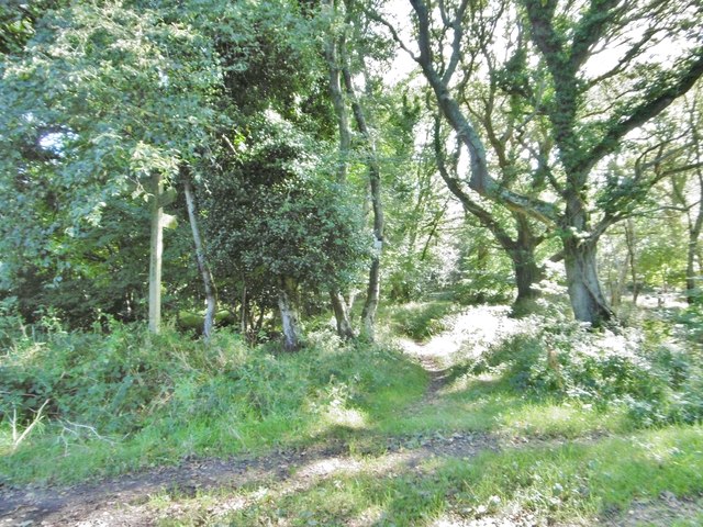
The landscape of Lulworth Heath is characterized by its open and undulating terrain, covered with a variety of low-growing vegetation. The dominant plant species on the heath include heather, gorse, and bracken, which contribute to its distinct appearance throughout the year. In the summer months, the heather blooms with vibrant purple flowers, adding a splash of color to the landscape.

The heathland is home to a diverse range of wildlife, including several species of birds, reptiles, and insects. Bird watchers frequent the area to spot species such as the Dartford warbler, stonechat, and nightjar. Reptiles, including sand lizards and adders, can also be found basking in the sun on warmer days.

Lulworth Heath is a popular destination for nature enthusiasts and walkers, who can explore its numerous paths and trails. The heath is crisscrossed by footpaths, providing visitors with the opportunity to discover its hidden corners and enjoy panoramic views of the surrounding countryside.

Managed by the National Trust, Lulworth Heath is protected as a Site of Special Scientific Interest (SSSI) due to its ecological importance. The heathland habitat provides a valuable home for rare and endangered species, making it a vital conservation area for nature lovers and researchers alike.

If you have any feedback on the listing, please let us know in the comments section below.

Lulworth Heath Images

Images are sourced within 2km of 50.653662/-2.1837571 or Grid Reference SY8783. Thanks to Geograph Open Source API. All images are credited.

Highwood, signpost Coming from East Stoke; left, Purbeck Way, right, to Coombe Heath.
Highwood, signpost
Coming from East Stoke; left, Purbeck Way, right, to Coombe Heath.
Highwood, bridleway From Highwood to Coombe Heath, skirting MoD property (left).
Highwood, bridleway
From Highwood to Coombe Heath, skirting MoD property (left).
Highwood, plantation Conifers at MoD Tyneham Ranges.
Highwood, plantation
Conifers at MoD Tyneham Ranges.
Highwood, warning sign At the boundary of MoD Tyneham Ranges.
Highwood, warning sign
At the boundary of MoD Tyneham Ranges.
Coombe Heath, bridleway marker On the bridleway to East Lulworth.
Coombe Heath, bridleway marker
On the bridleway to East Lulworth.
Coombe Heath, woodland Wet woodland, with bracken, oak and birch carr.
Coombe Heath, woodland
Wet woodland, with bracken, oak and birch carr.
Coombe Heath, gate On the bridleway to East Lulworth, at the entrance to Coombe Heath Nature Reserve; left, MoD property with warning sign. <span class="nowrap"><a title="http://www.natureofdorset.co.uk/sites/coombe-heath-nature-reserve" rel="nofollow ugc noopener" href="http://www.natureofdorset.co.uk/sites/coombe-heath-nature-reserve">Link</a><img style="margin-left:2px;" alt="External link" title="External link - shift click to open in new window" src="https://s1.geograph.org.uk/img/external.png" width="10" height="10"/></span>
Coombe Heath, gate
On the bridleway to East Lulworth, at the entrance to Coombe Heath Nature Reserve; left, MoD property with warning sign. LinkExternal link
Coombe Heath, red flag Marking the boundary of MoD Tyneham Ranges; right, access land at Coombe Heath.
Coombe Heath, red flag
Marking the boundary of MoD Tyneham Ranges; right, access land at Coombe Heath.
Coombe Heath At this point, dry heathland; heather has gone over, but stems of Ling, Bell Heather, Dorset Heath and Cross-leaved Heath hang on. <span class="nowrap"><a title="http://www.natureofdorset.co.uk/sites/coombe-heath-nature-reserve" rel="nofollow ugc noopener" href="http://www.natureofdorset.co.uk/sites/coombe-heath-nature-reserve">Link</a><img style="margin-left:2px;" alt="External link" title="External link - shift click to open in new window" src="https://s1.geograph.org.uk/img/external.png" width="10" height="10"/></span>
Coombe Heath
At this point, dry heathland; heather has gone over, but stems of Ling, Bell Heather, Dorset Heath and Cross-leaved Heath hang on. LinkExternal link
Coombe Heath, bridleway From Highwood to East Lulworth, skirting MoD Tyneham Ranges - note the red flag, left.
Coombe Heath, bridleway
From Highwood to East Lulworth, skirting MoD Tyneham Ranges - note the red flag, left.
Coombe Heath, timber Awaiting collection at the boundary of MoD Tyneham Ranges.
Coombe Heath, timber
Awaiting collection at the boundary of MoD Tyneham Ranges.
Coombe Heath, bridleway junction Coming from Highwood: left, to Shaggs, right, to Wood Street.
Coombe Heath, bridleway junction
Coming from Highwood: left, to Shaggs, right, to Wood Street.
Wood Street, farm road Road and bridleway, from Oak Tree Farm to Wood Street.
Wood Street, farm road
Road and bridleway, from Oak Tree Farm to Wood Street.
Wood Street, farm road Road and bridleway, from Oak Tree Farm to Wood Street.
Wood Street, farm road
Road and bridleway, from Oak Tree Farm to Wood Street.
Wood Street, heathland Sedge, with patches of gorse; the area appears dry at the moment.
Wood Street, heathland
Sedge, with patches of gorse; the area appears dry at the moment.
Wood Street, signpost Left, to Highwood; ahead, to Coombe Heath; right, to Coombe Keynes.
Wood Street, signpost
Left, to Highwood; ahead, to Coombe Heath; right, to Coombe Keynes.
Highwood, timber Awaiting collection next to Purbeck Way.
Highwood, timber
Awaiting collection next to Purbeck Way.
Wood Street, bridleway Through a strip of woodland towards Wood Street; on Hardy Way.
Wood Street, bridleway
Through a strip of woodland towards Wood Street; on Hardy Way.
Show me another place!

Lulworth Heath is located at Grid Ref: SY8783 (Lat: 50.653662, Lng: -2.1837571)

Unitary Authority: Dorset

Police Authority: Dorset

What 3 Words

///amazed.marching.grumble. Near Wool, Dorset

Related Wikis

Lulworth Ranges

The Lulworth Ranges are military firing ranges located between Wareham and Lulworth in Dorset, England. They cover an area of more than 2,830 hectares...

East Lulworth

East Lulworth is a village and civil parish nine miles east of Dorchester, near Lulworth Cove, in the county of Dorset, South West England. It consists...

Bestival

Bestival was a four-day music festival held in the south of England. The name Bestival is a portmanteau of the words best and festival. It had been held...
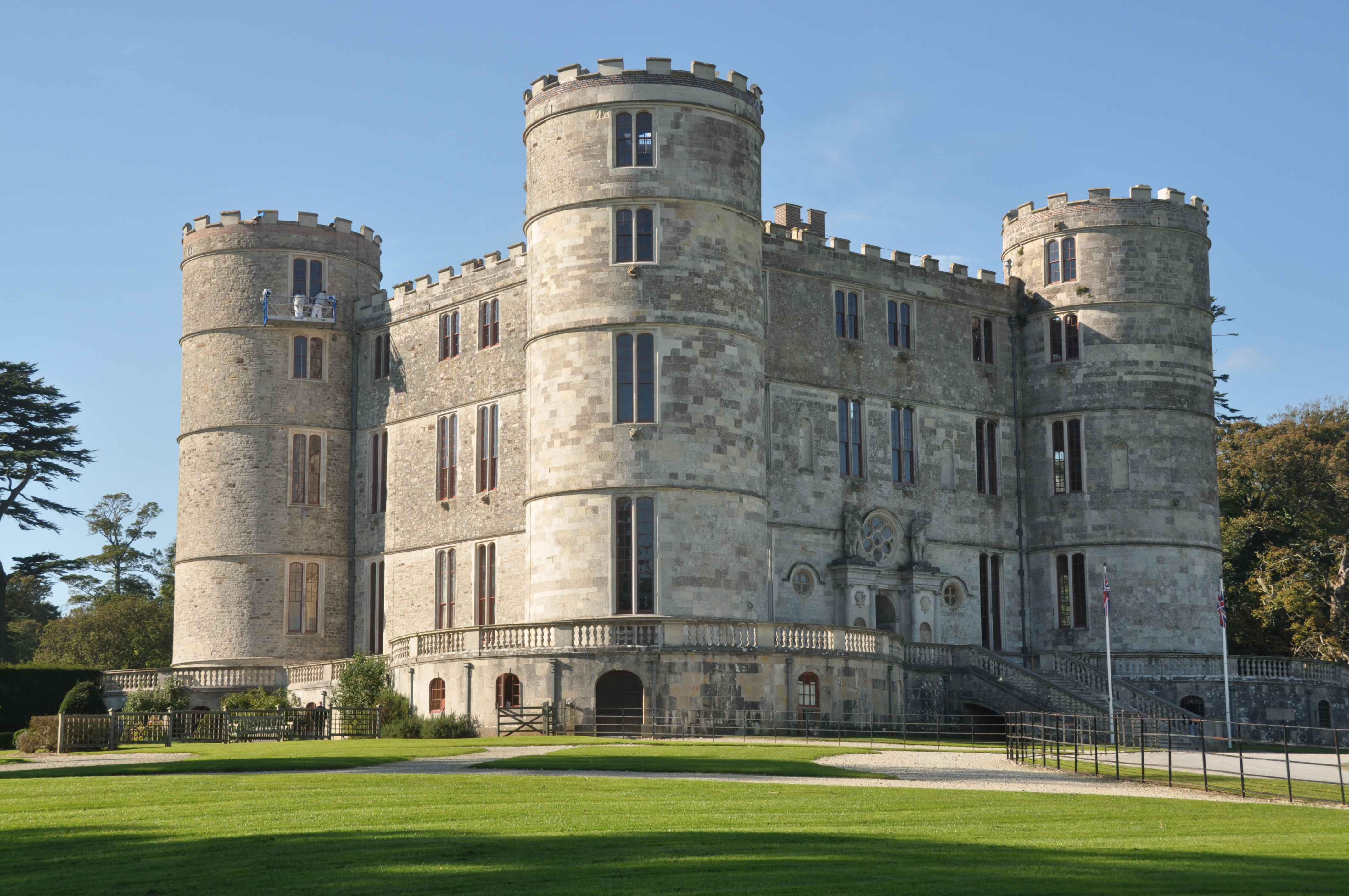
Lulworth Castle

Lulworth Castle, in East Lulworth, Dorset, England, situated south of the village of Wool, is an early 17th-century hunting lodge erected in the style...

Nearby Amenities

Located within 500m of 50.653662,-2.1837571
The data included in this document is from www.openstreetmap.org. The data is made available under ODbL.

Have you been to Lulworth Heath?

Leave your review of Lulworth Heath below (or comments, questions and feedback).