Skidmarsh Wood

Wood, Forest in Wiltshire

England

Skidmarsh Wood

East Knoyle, St, Mary's Church: North western aspect
East Knoyle, St, Mary's Church: North western aspect Credit: Michael Garlick

Skidmarsh Wood is a picturesque woodland located in the county of Wiltshire, England. Situated near the village of Skidmarsh, this forested area covers a total area of approximately 200 hectares. It is known for its diverse range of flora and fauna, making it a popular destination for nature enthusiasts and wildlife lovers.

The woodland is predominantly composed of ancient broadleaf trees, including oak, beech, and ash, providing a rich habitat for various bird species, mammals, and insects. The dense canopy formed by these towering trees creates a peaceful and serene atmosphere, perfect for those seeking tranquility and a connection with nature.

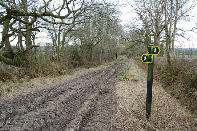
Skidmarsh Wood is crisscrossed by a network of footpaths, offering visitors the opportunity to explore its enchanting surroundings. The trails wind through the forest, allowing hikers to discover hidden gems such as babbling brooks, wildflower meadows, and even the occasional small waterfall.

The woodland is also home to a diverse range of wildlife, including deer, foxes, badgers, and numerous bird species such as woodpeckers, owls, and warblers. These creatures can often be spotted by patient observers, making the woodland a haven for wildlife photography and birdwatching.

Visitors to Skidmarsh Wood are reminded to respect the natural environment and follow local guidelines to ensure the preservation of this beautiful woodland for future generations to enjoy.

If you have any feedback on the listing, please let us know in the comments section below.

Skidmarsh Wood Images

Images are sourced within 2km of 51.082712/-2.1884806 or Grid Reference ST8631. Thanks to Geograph Open Source API. All images are credited.

East Knoyle, St, Mary's Church: North western aspect
East Knoyle, St, Mary's Church: Eastern aspect
East Knoyle: Community building
East Knoyle: Plantation access track
East Knoyle, St, Mary's Church: North eastern aspect
East Knoyle Windmill
Footpath/ Bridleway intersection
The Orange Way in Wiltshire (41) There's another field ahead.
The Orange Way in Wiltshire (41)
There's another field ahead.
The Orange Way in Wiltshire (42) This is looking north on The Street in West Knoyle.
The Orange Way in Wiltshire (42)
This is looking north on The Street in West Knoyle.
The Orange Way in Wiltshire (43) This view is looking up The Street to the church at West Knoyle.
The Orange Way in Wiltshire (43)
This view is looking up The Street to the church at West Knoyle.
The Orange Way in Wiltshire (44) The flag of England flies from the tower at West Knoyle.
The Orange Way in Wiltshire (44)
The flag of England flies from the tower at West Knoyle.
The Orange Way in Wiltshire (45) Here's the start of quite a climb.
The Orange Way in Wiltshire (45)
Here's the start of quite a climb.
The Orange Way in Wiltshire (46) This feeding station is popular.
The Orange Way in Wiltshire (46)
This feeding station is popular.
The Orange Way in Wiltshire (47) And still the Orange Way follows the Monarch's Way.
The Orange Way in Wiltshire (47)
And still the Orange Way follows the Monarch's Way.
The Orange Way in Wiltshire (48) Here I took a quick look back.
The Orange Way in Wiltshire (48)
Here I took a quick look back.
The Orange Way in Wiltshire (49) Here's the view back to the church and Manor Farm at West Knoyle.
The Orange Way in Wiltshire (49)
Here's the view back to the church and Manor Farm at West Knoyle.
The Orange Way in Wiltshire (50) Oh dear, it's a silly picture of a triangulation pillar across the valley which is called The Warren.
The Orange Way in Wiltshire (50)
Oh dear, it's a silly picture of a triangulation pillar across the valley which is called The Warren.
Show me another place!

Skidmarsh Wood is located at Grid Ref: ST8631 (Lat: 51.082712, Lng: -2.1884806)

Unitary Authority: Wiltshire

Police Authority: Wiltshire

What 3 Words

///skater.bluffing.runners. Near Hindon, Wiltshire

Related Wikis

Hang Wood

Hang Wood (grid reference ST861319) is a 20.3 hectare biological Site of Special Scientific Interest in Wiltshire, notified in 1986. == Sources == Natural...

Clouds House

Clouds House, also known simply as Clouds, is a Grade II* listed building at East Knoyle in Wiltshire, England. Designed by Arts and Crafts architect Philip...

St. Mary's Church, East Knoyle

St. Mary's Church is a Church of England parish church in East Knoyle, Wiltshire, England. == History == The Church of England Parish Church of St Mary...

West Knoyle

West Knoyle is a small village and civil parish in southwest Wiltshire, England, close to the southern edge of Salisbury Plain. The village is about 2...

Nearby Amenities

Located within 500m of 51.082712,-2.1884806
The Green
Place: hamlet
Lat/Long: 51.0806514/-2.1848062
Pub
The Fox and Hounds
Lat/Long: 51.0812956/-2.1853524
Public Bookcase
The Library on the Green
Booth: K6
Disused Amenity: telephone
Man Made: telephone_box
Public Bookcase Type: phone_box
Lat/Long: 51.0807947/-2.1851929
Post Box
Post Box Mounting: brick_pillar
Post Box Type: wall
Royal Cypher: GR
Lat/Long: 51.0809112/-2.1853981
The data included in this document is from www.openstreetmap.org. The data is made available under ODbL.

Have you been to Skidmarsh Wood?

Leave your review of Skidmarsh Wood below (or comments, questions and feedback).