Gibbet Wood

Wood, Forest in Staffordshire South Staffordshire

England

Gibbet Wood

The Old Grammar School The school from 1511 stands alongside the Holloway in Kinver and is now a private house.
The Old Grammar School Credit: Gordon Griffiths

Gibbet Wood is a picturesque woodland located in Staffordshire, England. Covering an area of approximately 100 acres, it is a popular destination for nature enthusiasts and those seeking a peaceful retreat amidst nature's beauty. The wood is situated in close proximity to the village of Abbots Bromley, adding to its accessibility and charm.

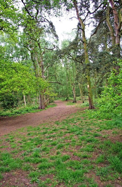
The woodland boasts a diverse range of trees, including oak, beech, and birch, creating a rich and vibrant ecosystem. The dense canopy provides a haven for various bird species, making it a haven for birdwatchers. Exploring the wood, visitors may also spot other wildlife such as deer, foxes, and rabbits.

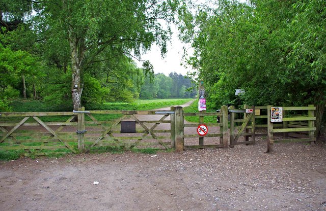
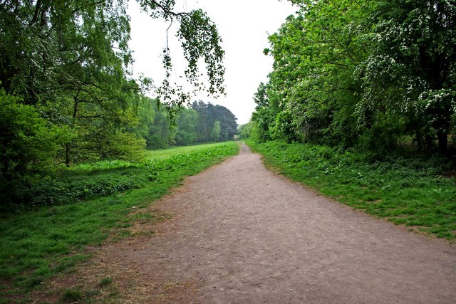
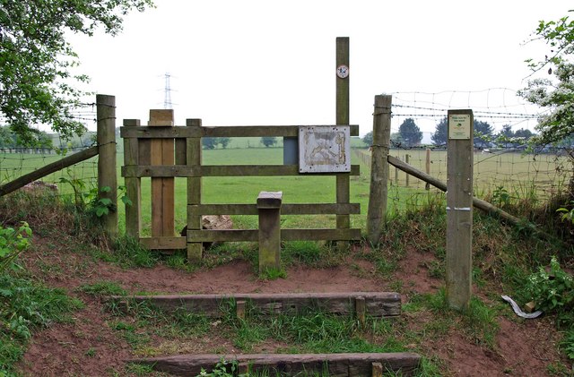
Gibbet Wood is renowned for its well-maintained walking trails, allowing visitors to immerse themselves in the tranquil surroundings. These paths wind through the wood, offering glimpses of the vibrant flora and fauna that thrive in the area. Along the way, visitors can also find several benches, providing opportunities for rest and contemplation in this serene environment.

In addition to its natural beauty, Gibbet Wood holds historical significance. The wood is home to the remains of a medieval gallows, known as a gibbet, from which the wood derives its name. This historical relic serves as a reminder of the area's past and adds an intriguing element to the woodland's allure.

Overall, Gibbet Wood in Staffordshire offers a delightful blend of natural beauty, recreational opportunities, and a touch of history. Whether it be for a leisurely walk, birdwatching, or simply enjoying the tranquility of nature, this woodland provides a welcome escape from the hustle and bustle of everyday life.

If you have any feedback on the listing, please let us know in the comments section below.
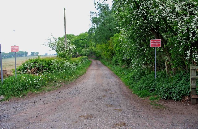
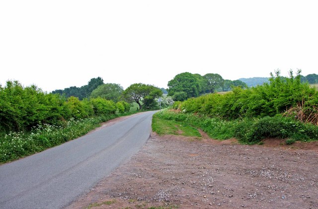
Gibbet Wood Images

Images are sourced within 2km of 52.453077/-2.198625 or Grid Reference SO8683. Thanks to Geograph Open Source API. All images are credited.

The Old Grammar School The school from 1511 stands alongside the Holloway in Kinver and is now a private house.
The Old Grammar School
The school from 1511 stands alongside the Holloway in Kinver and is now a private house.
The Cross Inn The Kinver Pub stands on the corner of Church Hill and Dark Lane.
The Cross Inn
The Kinver Pub stands on the corner of Church Hill and Dark Lane.
Inside the Cross Inn The Kinver Pub on Church Hill.
Inside the Cross Inn
The Kinver Pub on Church Hill.
Grammar School Plaque The plaque on the front of the former school house in Dark Lane Kinver. See <a href="https://www.geograph.org.uk/photo/2338355">SO8483 : The Old Grammar School</a>
Grammar School Plaque
The plaque on the front of the former school house in Dark Lane Kinver. See SO8483 : The Old Grammar School
Entrance to Bunkers Hill Wood from Whittington Hall Lane near Whittington Bunkers Hill Wood is owned and managed by the Woodland Trust, a registered charity. Like all their sites, it is open to the public, and although there are only two public footpaths within the wood, there are a large number of other paths which are permissive footpaths. This view shows one of the entrances, adjacent to which is a small area for car parking.
Entrance to Bunkers Hill Wood from Whittington Hall Lane near Whittington
Bunkers Hill Wood is owned and managed by the Woodland Trust, a registered charity. Like all their sites, it is open to the public, and although there are only two public footpaths within the wood, there are a large number of other paths which are permissive footpaths. This view shows one of the entrances, adjacent to which is a small area for car parking.
Sandy Lane near Whittington This lane runs between Whittington Hall Lane and the edge of the town of Stourbridge. There is a public footpath running along its whole length. For part of the way, it runs adjacent to Bunkers Hill Wood.
Sandy Lane near Whittington
This lane runs between Whittington Hall Lane and the edge of the town of Stourbridge. There is a public footpath running along its whole length. For part of the way, it runs adjacent to Bunkers Hill Wood.
Whittington Hall Lane near Whittington On the left of the lane is a gravelled area, which can be used by visitors to the nearby Bunkers Hill Woods, when the small car park by the wood's entrance is full.
Whittington Hall Lane near Whittington
On the left of the lane is a gravelled area, which can be used by visitors to the nearby Bunkers Hill Woods, when the small car park by the wood's entrance is full.
Public footpath in Bunkers Hill Wood near Whittington This public footpath, which starts here at the entrance to the wood from Whittington Hall Lane, is one of the two public footpaths to be found in the woods. There are many other paths there however, which the public can use, but they are permissive footpaths. These date from when the wood was used for shooting purposes. This was before its acquisition by the Woodland Trust.
Public footpath in Bunkers Hill Wood near Whittington
This public footpath, which starts here at the entrance to the wood from Whittington Hall Lane, is one of the two public footpaths to be found in the woods. There are many other paths there however, which the public can use, but they are permissive footpaths. These date from when the wood was used for shooting purposes. This was before its acquisition by the Woodland Trust.
Bunkers Hill Wood near Whittington Hall Lane Bunkers Hill Wood is about half a mile west of Stourbridge. According to its owners, the Woodland Trust, it contains a mixture of predominantly secondary plantation trees with mature and veteran broadleaves and conifers, including Sweet Chestnut, Oak, Scots Pine and Corsican Pine. These are contrasted by younger stands of broadleaves and conifers and areas of naturally regenerated Birch.

The site, which was formerly part of Iverley Heath, was originally planted around 1860, with subsequent replanting as recently as 20 to 25 years ago.
Bunkers Hill Wood near Whittington Hall Lane
Bunkers Hill Wood is about half a mile west of Stourbridge. According to its owners, the Woodland Trust, it contains a mixture of predominantly secondary plantation trees with mature and veteran broadleaves and conifers, including Sweet Chestnut, Oak, Scots Pine and Corsican Pine. These are contrasted by younger stands of broadleaves and conifers and areas of naturally regenerated Birch. The site, which was formerly part of Iverley Heath, was originally planted around 1860, with subsequent replanting as recently as 20 to 25 years ago.
A litter bin and two dog waste bins at Bunkers Hill Wood, near Whittington Bunkers Hill Wood is only about half a mile from the edge of the town of Stourbridge, It is therefore a very popular spot with people from there for walking with, or without, dogs. These bins are conveniently situated near the entrance from Whittington Hall Lane. Normally the wood would have a lot of visitors, but on the day of the wedding of Prince William and Kate Middleton, it was very quiet.
A litter bin and two dog waste bins at Bunkers Hill Wood, near Whittington
Bunkers Hill Wood is only about half a mile from the edge of the town of Stourbridge, It is therefore a very popular spot with people from there for walking with, or without, dogs. These bins are conveniently situated near the entrance from Whittington Hall Lane. Normally the wood would have a lot of visitors, but on the day of the wedding of Prince William and Kate Middleton, it was very quiet.
Stile at start of footpath from Bunkers Hill Wood to Whittington Hall Lane The footpath starts at the stile, and go west across fields to Whittington Hall Lane.
Stile at start of footpath from Bunkers Hill Wood to Whittington Hall Lane
The footpath starts at the stile, and go west across fields to Whittington Hall Lane.
Devil's Den stretch of the Staffs Worcs Canal at Prestwood Curious name and curious, spooky boat house cut into the cliff face.
Devil's Den stretch of the Staffs Worcs Canal at Prestwood
Curious name and curious, spooky boat house cut into the cliff face.
Stourton Farm, Greensforge Lane
Small Hamlet on Greensforge Lane
Greensforge Lane Meeting the Bridgnorth Road A458
South Road at High Park Avenue roundabout
Roman Road houses The remnants of an early morning frost are still visible on this side road.
Roman Road houses
The remnants of an early morning frost are still visible on this side road.
A458 approaching the B4537 junction
Show me another place!

Gibbet Wood is located at Grid Ref: SO8683 (Lat: 52.453077, Lng: -2.198625)

Administrative County: Staffordshire

District: South Staffordshire

Police Authority: Staffordshire

What 3 Words

///dreams.teardrop.pines. Near Kinvere, Staffordshire

Related Wikis

Stourton, Staffordshire

Stourton is a hamlet in Staffordshire, England a few miles to the northwest of Stourbridge. There is a fair amount of dispute over the pronunciation, being...

Dunsley, Staffordshire

Dunsley is a hamlet in Kinver, Staffordshire, England. The settled part of the hamlet is the part of the village of Kinver, lying east of the River Stour...

Smestow Brook

The Smestow Brook, sometimes called the River Smestow, is a small river that plays an important part in the drainage of Wolverhampton, South Staffordshire...

Ridgewood High School, Wollaston

Ridgewood High School is a coeducational secondary school, a part of the Stour Vale Academy Trust situated in Wollaston (near Stourbridge), in the West...

Kinver

Kinver is a large village in the District of South Staffordshire in Staffordshire, England. It is in the far south-west of the county, at the end of the...

Prestwood (Kinver)

Prestwood is a hamlet now in the parish of Kinver, but in the Kingswinford until the creation of Brierley Hill Urban District in the 1930s. == History... ==

Kinver High School

Kinver High School (formerly Edgecliff High School) is a mixed secondary school and sixth form located in Kinver in the English county of Staffordshire...

Wollaston, West Midlands

Wollaston is a village on the outskirts of Stourbridge in the English West Midlands. It is located in the south of the Dudley Metropolitan Borough, one...

Nearby Amenities

Located within 500m of 52.453077,-2.198625
Barrier: stile
Foot: yes
Stile: stepover
Lat/Long: 52.4520508/-2.1936824
Barrier: stile
Stile: stepover
Lat/Long: 52.4518853/-2.1936585
The data included in this document is from www.openstreetmap.org. The data is made available under ODbL.

Have you been to Gibbet Wood?

Leave your review of Gibbet Wood below (or comments, questions and feedback).