Hurcott Wood

Wood, Forest in Worcestershire Wyre Forest

England

Hurcott Wood

Open farmland, east of Kidderminster. Picture taken from the minor road at SO8513 76982, looking south-east towards Offmore Farm, visible on the right of the photograph. Lack of public access limits the scope of recording geographical features within this square.
Open farmland, east of Kidderminster. Credit: Martyn B

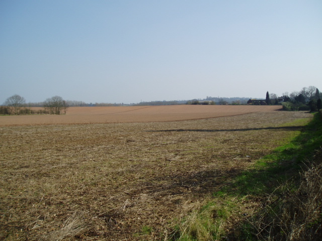
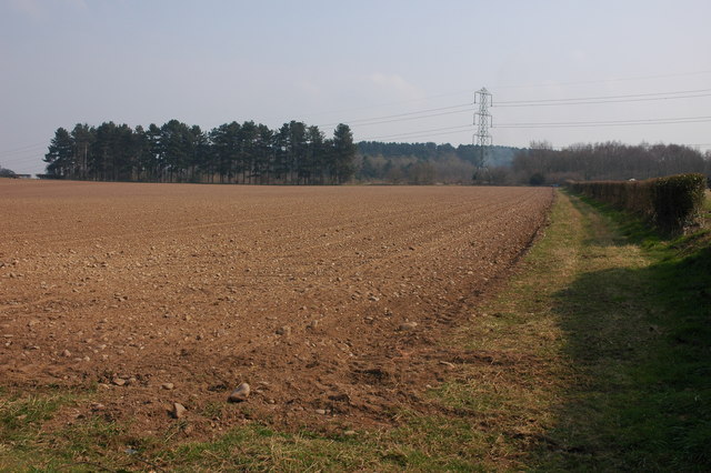
Hurcott Wood is a picturesque woodland located in Worcestershire, England. Covering an area of approximately 200 acres, the wood is situated near the village of Hurcott, just a short distance from the town of Kidderminster. It is owned and managed by the Forestry Commission.

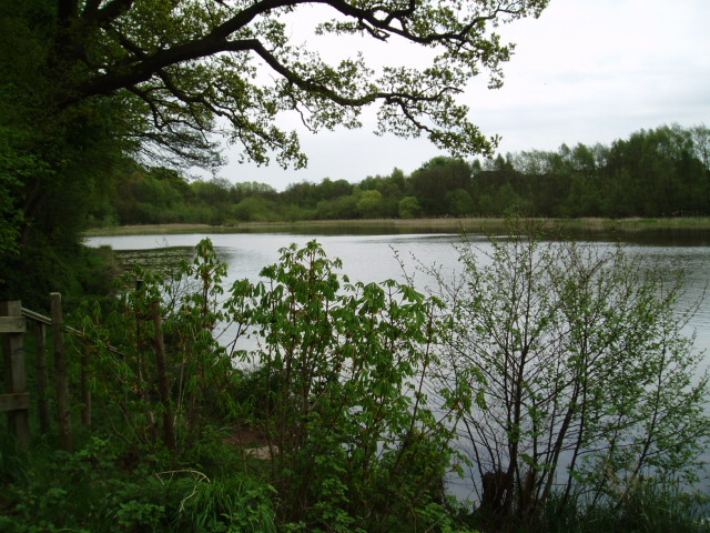
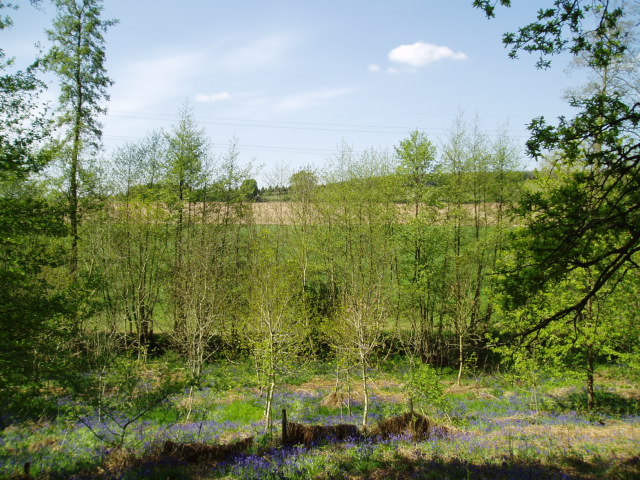
The wood is predominantly composed of broadleaf trees, such as oak, beech, and ash, creating a diverse and vibrant ecosystem. The dense canopy provides a habitat for a variety of wildlife, including birds, squirrels, and deer. Walking through the wood, visitors can enjoy the tranquility and serenity of nature, surrounded by the sounds of birdsong and the rustling of leaves underfoot.

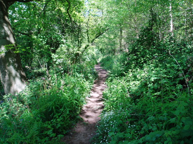
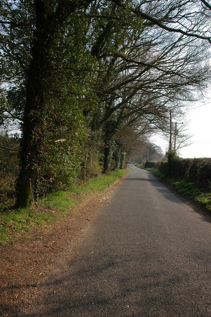
There are several well-maintained footpaths and trails that wind their way through the wood, allowing visitors to explore and discover the beauty of the area. These paths are suitable for walkers of all abilities, with some routes also accessible to wheelchair users.

In addition to its natural beauty, Hurcott Wood holds historical significance. It was once part of the ancient Wyre Forest, which covered a much larger area in medieval times. The wood has been managed for centuries, providing timber for local industries. Today, it serves as a popular recreational area for locals and visitors alike.

Overall, Hurcott Wood offers a peaceful escape from the bustle of everyday life. Whether it's a leisurely walk, birdwatching, or simply enjoying the beauty of nature, this woodland provides a welcome retreat for nature enthusiasts and those seeking a moment of tranquility.

If you have any feedback on the listing, please let us know in the comments section below.
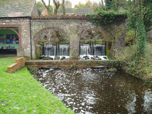
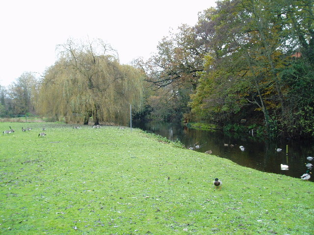
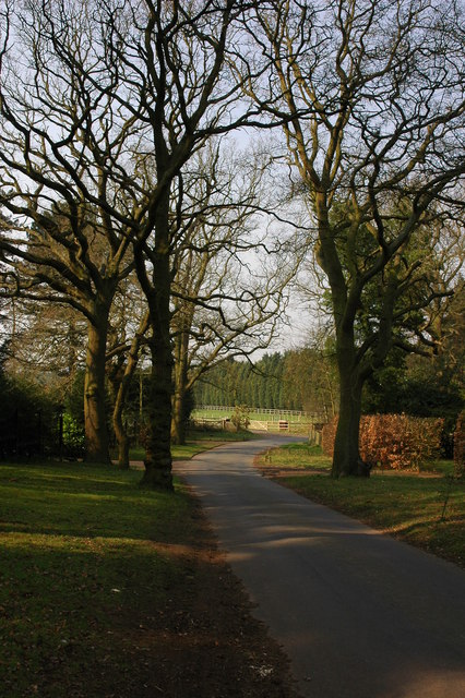
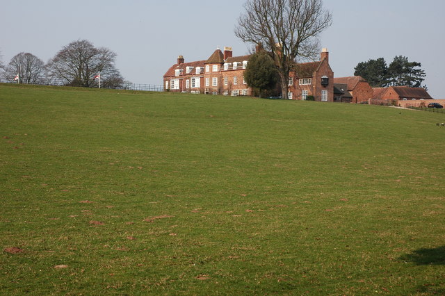
Hurcott Wood Images

Images are sourced within 2km of 52.401279/-2.2075635 or Grid Reference SO8578. Thanks to Geograph Open Source API. All images are credited.

Open farmland, east of Kidderminster. Picture taken from the minor road at SO8513 76982, looking south-east towards Offmore Farm, visible on the right of the photograph. Lack of public access limits the scope of recording geographical features within this square.
Open farmland, east of Kidderminster.
Picture taken from the minor road at SO8513 76982, looking south-east towards Offmore Farm, visible on the right of the photograph. Lack of public access limits the scope of recording geographical features within this square.
Hurcott Pool Picture taken from SO 85164 77937, the car park at the west end of the pool, looking east.
Hurcott Pool
Picture taken from SO 85164 77937, the car park at the west end of the pool, looking east.
Around Dunclent, Mount Segg Public access is limited to a footpath across the south-east corner of this square, thus limiting photographic opportunities. The picture is taken from the public footpath at SO 86912 76245, looking north across the farmland towards the southern tip of Bissell Wood.
Around Dunclent, Mount Segg
Public access is limited to a footpath across the south-east corner of this square, thus limiting photographic opportunities. The picture is taken from the public footpath at SO 86912 76245, looking north across the farmland towards the southern tip of Bissell Wood.
Mount Segg Taken from the same location as the main picture at SO 86912 76245, looking north-east along the footpath through woodland at Mount Segg
Mount Segg
Taken from the same location as the main picture at SO 86912 76245, looking north-east along the footpath through woodland at Mount Segg
Broadwaters Mill Broadwaters Mill is situated immediately adjacent to the A449 trunk road, at the foot of the grid square. Picture taken from SO 84138 78036.
Broadwaters Mill
Broadwaters Mill is situated immediately adjacent to the A449 trunk road, at the foot of the grid square. Picture taken from SO 84138 78036.
Broadwaters Mill pool The picture shows the feeder pool situated to the east of Broadwaters Mill. Taken from SO 84166 78026.
Broadwaters Mill pool
The picture shows the feeder pool situated to the east of Broadwaters Mill. Taken from SO 84166 78026.
Lea Hall Castle or maybe just a gatehouse? This gatehouse was the entrance to Lea Castle. The mansion was built by local ironmaster Edward Knight in 1818 but was sadly pulled down in 1945. It is a prominent landmark for users of the A449 between Wolverhampton and Kidderminster.
Lea Hall Castle or maybe just a gatehouse?
This gatehouse was the entrance to Lea Castle. The mansion was built by local ironmaster Edward Knight in 1818 but was sadly pulled down in 1945. It is a prominent landmark for users of the A449 between Wolverhampton and Kidderminster.
Sandy Lane, Blakedown Along Sandy Lane are a number of very attractive properties.
Sandy Lane, Blakedown
Along Sandy Lane are a number of very attractive properties.
Park Hall, Blakedown
Ploughed field near Blakedown This ploughed field is opposite Woodhouse Farm.
Ploughed field near Blakedown
This ploughed field is opposite Woodhouse Farm.
Waggon Lane Waggon Lane goes to Churchill.
Waggon Lane
Waggon Lane goes to Churchill.
Field of Oil Seed Rape near Cookley The last day of March and the Oil Seed Rape crop is starting to blossom.
Field of Oil Seed Rape near Cookley
The last day of March and the Oil Seed Rape crop is starting to blossom.
A train crossing a viaduct at Blakedown
Hurcott and pool, Worcestershire
Hurcott Wood, Worcestershire
The Broadwaters Inn Looking north-east
The Broadwaters Inn
Looking north-east
Hurcott Wood This footpath leads into the wood along the side of Hurcott Pool.
Hurcott Wood
This footpath leads into the wood along the side of Hurcott Pool.
Table & chairs Large wooden carvings in Hurcott Wood.
Table & chairs
Large wooden carvings in Hurcott Wood.
Show me another place!

Hurcott Wood is located at Grid Ref: SO8578 (Lat: 52.401279, Lng: -2.2075635)

Administrative County: Worcestershire

District: Wyre Forest

Police Authority: West Mercia

What 3 Words

///spark.flexed.whizzing. Near Kidderminster, Worcestershire

Nearby Locations

Hurcott Wood

Related Wikis

Axborough

Axborough is a low wooded hill east of Cookley in north Worcestershire, England. == History == Its Saxon name meant hassock grass barrow. This does not...

Blakedown

Blakedown is a village in the Wyre Forest District lying along the A456 in the north of the county of Worcestershire, England. Following enclosures and...

Chester Road North Ground, Kidderminster

The Chester Road North Ground, often referred to simply as Chester Road or Kidderminster, is a cricket ground in Kidderminster, Worcestershire, England...
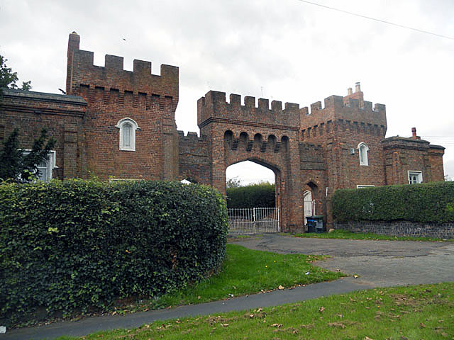
Lea Castle, England

Lea Castle is a ruined Grade II listed Neo Gothic mock castle mansion near Wolverley, England. == History == Lea Castle was built by Edward Knight in 1762...

Nearby Amenities

Located within 500m of 52.401279,-2.2075635
Barrier: kissing_gate
Foot: yes
Source: gps_survey
Lat/Long: 52.4009895/-2.2008642
Power: tower
Source: bing
Lat/Long: 52.4017424/-2.2002448
The data included in this document is from www.openstreetmap.org. The data is made available under ODbL.

Have you been to Hurcott Wood?

Leave your review of Hurcott Wood below (or comments, questions and feedback).