Great Plantation
Wood, Forest in Dorset
England
Great Plantation
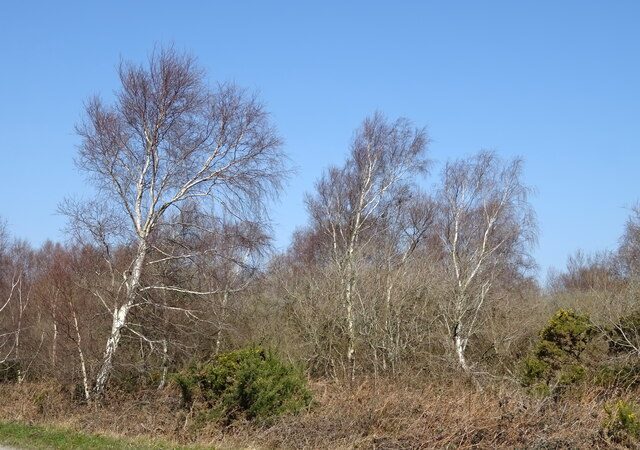
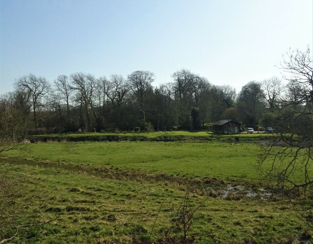
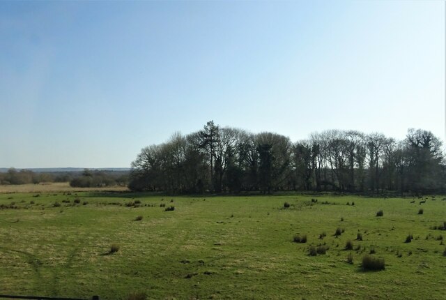
Great Plantation, located in Dorset, is a magnificent woodland that covers a vast area of the region. This breathtaking forest is known for its diverse range of flora and fauna, making it a popular destination for nature enthusiasts and outdoor adventurers alike. With its rich history and stunning natural beauty, Great Plantation provides a tranquil escape from the hustle and bustle of everyday life.
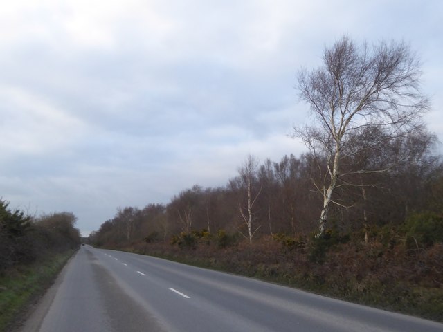
The forest is home to a wide variety of tree species, including oak, beech, and ash, which create a dense canopy that provides shade and shelter for the abundant wildlife. Visitors to Great Plantation can expect to see an array of creatures, such as deer, foxes, badgers, and a plethora of bird species, making it a haven for wildlife lovers and birdwatchers.
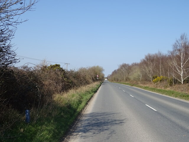
The woodland boasts numerous walking trails and paths that meander through its enchanting landscape, allowing visitors to immerse themselves in the beauty of nature. These trails cater to all levels of fitness and provide an opportunity to explore the forest's hidden gems, such as tranquil ponds, ancient ruins, and vibrant wildflower meadows.
Great Plantation also offers recreational activities such as camping, picnicking, and nature photography, providing visitors with a chance to fully engage with the natural surroundings. The forest is well-maintained, with designated picnic areas and camping spots equipped with essential facilities.
Overall, Great Plantation in Dorset is a remarkable woodland that showcases the stunning natural beauty of the region. Whether it's a leisurely stroll, birdwatching, or camping, this forest provides an immersive experience for nature lovers of all ages.
If you have any feedback on the listing, please let us know in the comments section below.
Great Plantation Images
Images are sourced within 2km of 50.695064/-2.2008522 or Grid Reference SY8588. Thanks to Geograph Open Source API. All images are credited.
![Woolbridge Manor [1] On the north bank of the River Frome, adjacent to Wool Bridge, stands Woolbridge Manor House and a cluster of farming outbuildings. The house was built in the 12th century and restored in the 17th century. One of the barns was a Saxon chapel, and later the manor was part of the monastery of Bindon Abbey. The house, some cottages and most of the outbuildings are listed.
The detached early 17th century manor house was a restoration of a 12th century building with a wing added circa 1660. The main front is of brick with stone quoins and details, the other walls are of rubble stone, all under a tile roof with lower courses of stone slates. The interior has been greatly altered, but two wall paintings survive. The house features in Thomas Hardy&#039;s book, &#039;Tess of the Durbervilles&#039;. Listed, grade II*, with details at: <span class="nowrap"><a title="https://historicengland.org.uk/listing/the-list/list-entry/1323300" rel="nofollow ugc noopener" href="https://historicengland.org.uk/listing/the-list/list-entry/1323300">Link</a><img style="margin-left:2px;" alt="External link" title="External link - shift click to open in new window" src="https://s1.geograph.org.uk/img/external.png" width="10" height="10"/></span>](https://s0.geograph.org.uk/geophotos/07/25/69/7256908_8db82229.jpg)
![Woolbridge Manor [2] On the north bank of the River Frome, adjacent to Wool Bridge, stands Woolbridge Manor House and a cluster of farming outbuildings. The house was built in the 12th century and restored in the 17th century. One of the barns was a Saxon chapel, and later the manor was part of the monastery of Bindon Abbey. The house, some cottages and most of the outbuildings are listed.
Chapel Barn contains some herringbone stone work, fragments of a Saxon chapel, and in common with many other chapels was built near a bridge to further the interests of an ancient monastery. Walls mainly of rubble stone, partly rebuilt in brick under a tiled roof with stone eaves courses. Listed, grade II, with details at: <span class="nowrap"><a title="https://historicengland.org.uk/listing/the-list/list-entry/1323301" rel="nofollow ugc noopener" href="https://historicengland.org.uk/listing/the-list/list-entry/1323301">Link</a><img style="margin-left:2px;" alt="External link" title="External link - shift click to open in new window" src="https://s1.geograph.org.uk/img/external.png" width="10" height="10"/></span>](https://s1.geograph.org.uk/geophotos/07/25/69/7256909_d8081e34.jpg)
![Woolbridge Manor [3] On the north bank of the River Frome, adjacent to Wool Bridge, stands Woolbridge Manor House and a cluster of farming outbuildings. The house was built in the 12th century and restored in the 17th century. One of the barns was a Saxon chapel, and later the manor was part of the monastery of Bindon Abbey. The house, some cottages and most of the outbuildings are listed.
This barn, with a projecting porch, was probably built in the 18th century. Constructed of brick on a stone plinth under a tile roof with stone eaves courses. Listed, grade II, with details at: <span class="nowrap"><a title="https://historicengland.org.uk/listing/the-list/list-entry/1120579" rel="nofollow ugc noopener" href="https://historicengland.org.uk/listing/the-list/list-entry/1120579">Link</a><img style="margin-left:2px;" alt="External link" title="External link - shift click to open in new window" src="https://s1.geograph.org.uk/img/external.png" width="10" height="10"/></span>](https://s2.geograph.org.uk/geophotos/07/25/69/7256910_869552b4.jpg)
![Woolbridge Manor [4] On the north bank of the River Frome, adjacent to Wool Bridge, stands Woolbridge Manor House and a cluster of farming outbuildings. The house was built in the 12th century and restored in the 17th century. One of the barns was a Saxon chapel, and later the manor was part of the monastery of Bindon Abbey. The house, some cottages and most of the outbuildings are listed.
This dovecote and the attached garden walls were probably built in the 18th century. Constructed of brick with a tile roof to the dovecote. Listed, for group value, grade II, with details at: <span class="nowrap"><a title="https://historicengland.org.uk/listing/the-list/list-entry/1171252" rel="nofollow ugc noopener" href="https://historicengland.org.uk/listing/the-list/list-entry/1171252">Link</a><img style="margin-left:2px;" alt="External link" title="External link - shift click to open in new window" src="https://s1.geograph.org.uk/img/external.png" width="10" height="10"/></span>](https://s3.geograph.org.uk/geophotos/07/25/69/7256911_78b9c159.jpg)
![Woolbridge Manor [5] On the north bank of the River Frome, adjacent to Wool Bridge, stands Woolbridge Manor House and a cluster of farming outbuildings. The house was built in the 12th century and restored in the 17th century. One of the barns was a Saxon chapel, and later the manor was part of the monastery of Bindon Abbey. The house, some cottages and most of the outbuildings are listed.
This detached stable range was probably built in the 18th century. Constructed of brick on a stone base under a tile roof with stone eaves courses. Listed, for group value, grade II, with details at: <span class="nowrap"><a title="https://historicengland.org.uk/listing/the-list/list-entry/1171262" rel="nofollow ugc noopener" href="https://historicengland.org.uk/listing/the-list/list-entry/1171262">Link</a><img style="margin-left:2px;" alt="External link" title="External link - shift click to open in new window" src="https://s1.geograph.org.uk/img/external.png" width="10" height="10"/></span>](https://s0.geograph.org.uk/geophotos/07/25/69/7256912_16897531.jpg)
![Woolbridge Manor [6] On the north bank of the River Frome, adjacent to Wool Bridge, stands Woolbridge Manor House and a cluster of farming outbuildings. The house was built in the 12th century and restored in the 17th century. One of the barns was a Saxon chapel, and later the manor was part of the monastery of Bindon Abbey. The house, some cottages and most of the outbuildings are listed.
Known as Harry&#039;s Cottages, this pair of cottages, adjacent to the manor house, were probably built in the 18th century. Constructed of a mixture of rubble stone, brick and plastered cob under thatch roofs. Listed, grade II, with details at: <span class="nowrap"><a title="https://historicengland.org.uk/listing/the-list/list-entry/1120580" rel="nofollow ugc noopener" href="https://historicengland.org.uk/listing/the-list/list-entry/1120580">Link</a><img style="margin-left:2px;" alt="External link" title="External link - shift click to open in new window" src="https://s1.geograph.org.uk/img/external.png" width="10" height="10"/></span>](https://s1.geograph.org.uk/geophotos/07/25/69/7256913_05fb3c29.jpg)
![Wool Bridge [1] A bridge over the River Frome is recorded at this point in 1343, but the current Wool Bridge is probably 16th century. Repairs are documented in 1607, 1688, 1742 and 1806. An additional flood arch, was built in, probably, the late 19th century. During the Second World War, the bridge was widened and the parapets removed to allow tanks from nearby Bovingdon Camp to cross. The parapets were later rebuilt using the same stone. The bridge is now only passable to horse riders, cyclists and pedestrians. Listed, grade II*, with details at: <span class="nowrap"><a title="https://historicengland.org.uk/listing/the-list/list-entry/1171233" rel="nofollow ugc noopener" href="https://historicengland.org.uk/listing/the-list/list-entry/1171233">Link</a><img style="margin-left:2px;" alt="External link" title="External link - shift click to open in new window" src="https://s1.geograph.org.uk/img/external.png" width="10" height="10"/></span>](https://s2.geograph.org.uk/geophotos/07/25/69/7256914_3248aeb1.jpg)
![Wool Bridge [2] A bridge over the River Frome is recorded at this point in 1343, but the current Wool Bridge is probably 16th century. Repairs are documented in 1607, 1688, 1742 and 1806. An additional flood arch, was built in, probably, the late 19th century. During the Second World War, the bridge was widened and the parapets removed to allow tanks from nearby Bovingdon Camp to cross. The parapets were later rebuilt using the same stone. The bridge is now only passable to horse riders, cyclists and pedestrians. Listed, grade II*, with details at: <span class="nowrap"><a title="https://historicengland.org.uk/listing/the-list/list-entry/1171233" rel="nofollow ugc noopener" href="https://historicengland.org.uk/listing/the-list/list-entry/1171233">Link</a><img style="margin-left:2px;" alt="External link" title="External link - shift click to open in new window" src="https://s1.geograph.org.uk/img/external.png" width="10" height="10"/></span>](https://s3.geograph.org.uk/geophotos/07/25/69/7256915_21104063.jpg)
![Wool Bridge [3] A plaque on the bridge.
A bridge over the River Frome is recorded at this point in 1343, but the current Wool Bridge is probably 16th century. Repairs are documented in 1607, 1688, 1742 and 1806. An additional flood arch, was built in, probably, the late 19th century. During the Second World War, the bridge was widened and the parapets removed to allow tanks from nearby Bovingdon Camp to cross. The parapets were later rebuilt using the same stone. The bridge is now only passable to horse riders, cyclists and pedestrians. Listed, grade II*, with details at: <span class="nowrap"><a title="https://historicengland.org.uk/listing/the-list/list-entry/1171233" rel="nofollow ugc noopener" href="https://historicengland.org.uk/listing/the-list/list-entry/1171233">Link</a><img style="margin-left:2px;" alt="External link" title="External link - shift click to open in new window" src="https://s1.geograph.org.uk/img/external.png" width="10" height="10"/></span>](https://s0.geograph.org.uk/geophotos/07/25/69/7256916_97178f70.jpg)
![Wool Bridge [4] The River Frome, looking downstream from the bridge.
A bridge over the River Frome is recorded at this point in 1343, but the current Wool Bridge is probably 16th century. Repairs are documented in 1607, 1688, 1742 and 1806. An additional flood arch, was built in, probably, the late 19th century. During the Second World War, the bridge was widened and the parapets removed to allow tanks from nearby Bovingdon Camp to cross. The parapets were later rebuilt using the same stone. The bridge is now only passable to horse riders, cyclists and pedestrians. Listed, grade II*, with details at: <span class="nowrap"><a title="https://historicengland.org.uk/listing/the-list/list-entry/1171233" rel="nofollow ugc noopener" href="https://historicengland.org.uk/listing/the-list/list-entry/1171233">Link</a><img style="margin-left:2px;" alt="External link" title="External link - shift click to open in new window" src="https://s1.geograph.org.uk/img/external.png" width="10" height="10"/></span>](https://s1.geograph.org.uk/geophotos/07/25/69/7256917_60452eb9.jpg)
![Wool Bridge [5] The River Frome, looking upstream from the bridge.
A bridge over the River Frome is recorded at this point in 1343, but the current Wool Bridge is probably 16th century. Repairs are documented in 1607, 1688, 1742 and 1806. An additional flood arch, was built in, probably, the late 19th century. During the Second World War, the bridge was widened and the parapets removed to allow tanks from nearby Bovingdon Camp to cross. The parapets were later rebuilt using the same stone. The bridge is now only passable to horse riders, cyclists and pedestrians. Listed, grade II*, with details at: <span class="nowrap"><a title="https://historicengland.org.uk/listing/the-list/list-entry/1171233" rel="nofollow ugc noopener" href="https://historicengland.org.uk/listing/the-list/list-entry/1171233">Link</a><img style="margin-left:2px;" alt="External link" title="External link - shift click to open in new window" src="https://s1.geograph.org.uk/img/external.png" width="10" height="10"/></span>](https://s2.geograph.org.uk/geophotos/07/25/80/7258062_79117311.jpg)
![Wool features [4] The village pound in Bindon Lane. The square enclosure of brick was probably built in the 19th century. Listed, grade II, with details at: <span class="nowrap"><a title="https://historicengland.org.uk/listing/the-list/list-entry/1120398" rel="nofollow ugc noopener" href="https://historicengland.org.uk/listing/the-list/list-entry/1120398">Link</a><img style="margin-left:2px;" alt="External link" title="External link - shift click to open in new window" src="https://s1.geograph.org.uk/img/external.png" width="10" height="10"/></span>
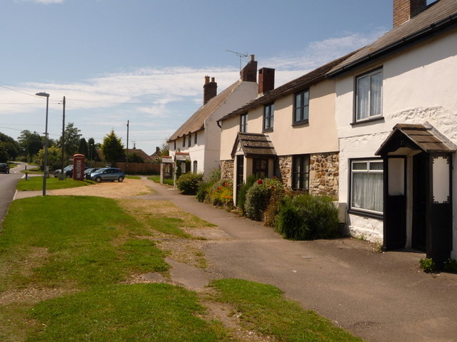
Wool is a large village in Dorset, midway between Dorchester and Poole, both about 10 miles distant. Set on the south bank of the River Frome, the village includes Bovington Camp army base to the north. The place-name &#039;Wool&#039; is first recorded in Anglo-Saxon Writs in the first years of the 11th century. The ruins of Bindon Abbey are nearby, demolished in 1539, the stone was used to build castles in Portland, Lulworth and Sandsfoot.](https://s1.geograph.org.uk/geophotos/07/25/80/7258069_4400a5f0.jpg)
Great Plantation is located at Grid Ref: SY8588 (Lat: 50.695064, Lng: -2.2008522)
Unitary Authority: Dorset
Police Authority: Dorset
What 3 Words
///grumbling.ridiculed.cardinal. Near Wool, Dorset
Nearby Locations
Related Wikis

Monkey World
The Monkey World Ape Rescue Centre is a 65-acre (26.3 ha) ape and monkey sanctuary and rescue centre near Wool, Dorset, England. == History == Set up in...

Woolbridge Manor House
Woolbridge Manor is a 17th-century manor house just outside the village of Wool, in Dorset, England. English Heritage have designated it a Grade II* listed...

Bindon Abbey
Bindon Abbey (Bindonium) was a Cistercian monastery, of which only ruins remain, on the River Frome about half a mile east of Wool in the Purbeck District...

Wool railway station
Wool railway station serves the village of Wool in Dorset, England. It is on the South West Main Line, 125 miles 69 chains (202.6 km) down the line from...
Wool, Dorset
Wool is a large village, civil parish and electoral ward in south Dorset, England. In the 2011 census the parish – which includes Bovington Camp army base...

East Stoke, Dorset
East Stoke is a village in the English county of Dorset. It lies three miles west of the small town of Wareham and two miles east of Wool. In 2013 the...
Winfrith Hundred
Winfrith Hundred was a hundred in the county of Dorset, England, containing the following parishes: Coombe Keynes East Lulworth East Stoke Moreton (part...

Bovington Camp
Bovington Camp () is a British Army military base in Dorset, England. Together with Lulworth Camp it forms part of Bovington Garrison. The garrison is...
Have you been to Great Plantation?
Leave your review of Great Plantation below (or comments, questions and feedback).