Bent's Wood

Wood, Forest in Cheshire

England

Bent's Wood

Over Alderley and Birtles Village Hall Known locally as The Reading Room
Over Alderley and Birtles Village Hall Credit: Philip Cornwall

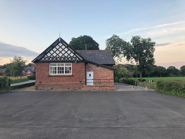
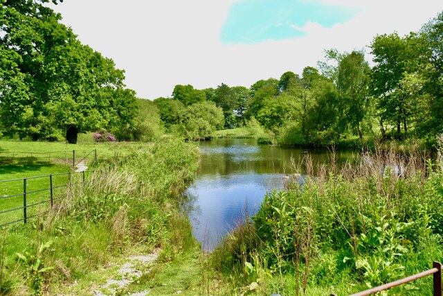
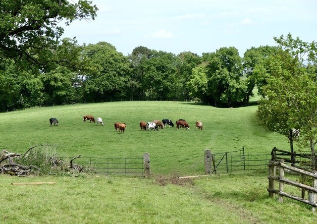
Bent's Wood is a picturesque and enchanting forest located in Cheshire, England. This woodland covers an extensive area of approximately 100 hectares, providing a serene and tranquil escape from the hustle and bustle of urban life. Known for its diverse range of tree species, Bent's Wood is a haven for nature enthusiasts and a habitat for a variety of wildlife.

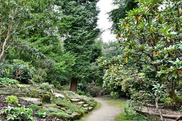
The forest boasts a mixture of ancient oak, beech, and birch trees, creating a striking and mesmerizing landscape. The woodland floor is adorned with an array of wildflowers, ferns, and mosses, adding to the natural beauty of the area. The dense canopy of the trees provides a cool and shaded environment, perfect for leisurely walks or picnics on warm summer days.

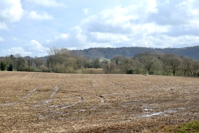
Bent's Wood is home to an assortment of wildlife, including deer, foxes, and a plethora of bird species. Birdwatchers will delight in the chance to spot woodpeckers, thrushes, and numerous other feathered creatures in their natural habitat. The forest also contains several ponds and streams, attracting an array of amphibians and insects.

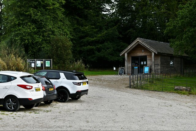
Visitors to Bent's Wood can explore the numerous well-maintained footpaths and trails, allowing for leisurely strolls or more adventurous hikes. Information boards and signposts are strategically placed throughout the forest, providing educational insights into the local flora and fauna.

Overall, Bent's Wood offers a peaceful retreat for nature lovers and outdoor enthusiasts alike. Its stunning woodland scenery, diverse wildlife, and well-preserved trails make it an idyllic destination for individuals seeking a connection with nature in the heart of Cheshire.

If you have any feedback on the listing, please let us know in the comments section below.

Bent's Wood Images

Images are sourced within 2km of 53.283157/-2.2136769 or Grid Reference SJ8576. Thanks to Geograph Open Source API. All images are credited.

Over Alderley and Birtles Village Hall Known locally as The Reading Room
Over Alderley and Birtles Village Hall
Known locally as The Reading Room
Hare Hill (National Trust): Car park and entrance
Hare Hill (National Trust): End of the Woodland Walk
Hare Hill (National Trust): Slanting holly tree
Hare Hill (National Trust): Cyclamen beginning to flower
Around Wilmslow (13) View south to Alderley Edge
Around Wilmslow (13)
View south to Alderley Edge
On Hare Hill Estate (1) Lake
On Hare Hill Estate (1)
Lake
On Hare Hill Estate (2) Cattle
On Hare Hill Estate (2)
Cattle
On Hare Hill Estate (3) Flowers
On Hare Hill Estate (3)
Flowers
View over Oak Farm Taken from the path up to Alderley Edge.
View over Oak Farm
Taken from the path up to Alderley Edge.
Noah's Ark, Over Alderley
Track at Noah's Ark, Over Alderley
Path running northwest from Birtles Lane, Over Alderley
Frosted rocks, Stormy Point, Alderley Edge
The Edge, Alderley Edge A favourite viewpoint, here the sandstone escarpment of Alderley Edge drops sharply to the plain below.
The Edge, Alderley Edge
A favourite viewpoint, here the sandstone escarpment of Alderley Edge drops sharply to the plain below.
The Edge Alderley Edge - The Edge has a long history for mining - lots of mine shafts, and tunnels in the area.
The Edge
Alderley Edge - The Edge has a long history for mining - lots of mine shafts, and tunnels in the area.
Alderley Edge Woodland on Alderley Edge. The hill here was worked for copper, there are many pits and mounds from the mining days.
Alderley Edge
Woodland on Alderley Edge. The hill here was worked for copper, there are many pits and mounds from the mining days.
Show me another place!

Bent's Wood is located at Grid Ref: SJ8576 (Lat: 53.283157, Lng: -2.2136769)

Unitary Authority: Cheshire East

Police Authority: Cheshire

What 3 Words

///fattening.sued.remodels. Near Alderley Edge, Cheshire

Nearby Locations

Bent's Wood

Related Wikis

Over Alderley

Over Alderley is a civil parish in Cheshire, England. It had a population of 318 at the 2011 Census.It includes the hamlets of Adders Moss, Adshead Green...

Alderley, Cheshire

Alderley was one of the eight ancient parishes of the Macclesfield Hundred of Cheshire, England. It included the following townships: Over Alderley Nether...

Alderley Edge Mines

The Alderley Edge Mines are located on the escarpment in Alderley Edge, Cheshire. Archaeological evidence indicates that copper mining took place here...

Alderley Old Hall

Alderley Old Hall is the remaining part of a former 17th-century manor house near the village of Nether Alderley, Cheshire, England. It stands adjacent...

Nether Alderley Mill

Nether Alderley Mill is a 16th-century watermill located in Congleton Road (the A34), to the south of the village of Nether Alderley, Cheshire, England...

St Catherine's Church, Over Alderley

St Catherine's Church, Over Alderley, also known as St Catherine's Church, Birtles, stands in an isolated position in Birtles Lane, near to Birtles Hall...

Nether Alderley

Nether Alderley is a village and civil parish in Cheshire, England, on the A34 a mile and a half south of Alderley Edge. The civil parish includes the...

Hare Hill

Hare Hill Hall is a country house and a garden in the parish of Over Alderley, Cheshire, England. The house and grounds are privately owned, and the separate...

Nearby Amenities

Located within 500m of 53.283157,-2.2136769
Barrier: kissing_gate
Material: wood
Lat/Long: 53.2862279/-2.2112718
Barrier: kissing_gate
Material: metal
Lat/Long: 53.284982/-2.2145649
Barrier: kissing_gate
Material: metal
Lat/Long: 53.2829502/-2.2193567
Barrier: kissing_gate
Material: metal
Lat/Long: 53.2827913/-2.219579
Power: pole
Lat/Long: 53.2789272/-2.2127102
Power: pole
Lat/Long: 53.2794843/-2.2135975
Power: pole
Lat/Long: 53.2799897/-2.2144054
Power: pole
Lat/Long: 53.2811064/-2.2161337
Power: pole
Lat/Long: 53.2806268/-2.2152816
Power: pole
Lat/Long: 53.2817227/-2.2172804
Power: pole
Lat/Long: 53.2819349/-2.2178688
Power: pole
Lat/Long: 53.282619/-2.217703
Power: pole
Lat/Long: 53.2820815/-2.2184409
Power: pole
Lat/Long: 53.2832123/-2.2178245
Power: pole
Lat/Long: 53.2839061/-2.2173318
Power: pole
Lat/Long: 53.2846878/-2.2168204
Power: pole
Lat/Long: 53.2845063/-2.2157557
Power: pole
Lat/Long: 53.2843039/-2.2146208
Power: pole
Lat/Long: 53.2843528/-2.2135654
Power: pole
Lat/Long: 53.2844338/-2.2125287
Power: pole
Lat/Long: 53.2850661/-2.2114546
Power: pole
Lat/Long: 53.2844435/-2.2113682
Power: pole
Lat/Long: 53.2844868/-2.2103104
Power: pole
Lat/Long: 53.2845315/-2.2091523
Power: pole
Lat/Long: 53.2845817/-2.2080572
Power: pole
Lat/Long: 53.2846404/-2.2067426
Hayman's Farm
Place: farm
Lat/Long: 53.2821624/-2.2194664
Higher House Farm
Place: farm
Lat/Long: 53.2791983/-2.2162261
Turning Circle
Lat/Long: 53.2859953/-2.2111029
Bench
Lat/Long: 53.2864171/-2.2099967
The data included in this document is from www.openstreetmap.org. The data is made available under ODbL.

Have you been to Bent's Wood?

Leave your review of Bent's Wood below (or comments, questions and feedback).