Mill Coppice

Wood, Forest in Staffordshire South Staffordshire

England

Mill Coppice

The Old Grammar School The school from 1511 stands alongside the Holloway in Kinver and is now a private house.
The Old Grammar School Credit: Gordon Griffiths

Mill Coppice is a picturesque woodland located in Staffordshire, England. Stretching over an area of approximately 50 acres, it is a haven for nature enthusiasts and those seeking tranquility amidst the hustle and bustle of daily life.

The coppice, which refers to an area of woodland managed for the purpose of producing timber, is characterized by its dense canopy of trees, predominantly consisting of oak, birch, and beech. These majestic trees provide a stunning backdrop throughout the changing seasons, with vibrant shades of green in the spring and summer, and a rich tapestry of red, orange, and gold in the autumn months.

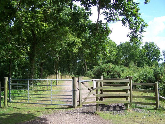
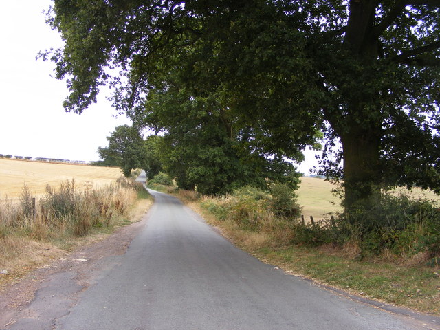
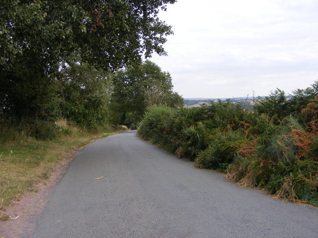
The woodland is crisscrossed by a network of well-maintained footpaths, allowing visitors to explore its natural beauty at their own pace. As they wander through the woods, visitors may encounter an array of wildlife, including squirrels, foxes, and a variety of bird species. The peaceful atmosphere and abundance of flora and fauna make Mill Coppice an ideal spot for birdwatching and wildlife photography.

In addition to its natural splendor, Mill Coppice boasts a rich history. The woodland was once part of a larger estate, and remnants of its past can still be seen today, including the ruins of an old mill. These historical features add a touch of intrigue and provide a glimpse into the area's past.

Overall, Mill Coppice in Staffordshire offers a serene escape from the daily grind, with its enchanting woodland, diverse wildlife, and historical charm. It is a place where visitors can immerse themselves in nature and connect with the beauty of the natural world.

If you have any feedback on the listing, please let us know in the comments section below.

Mill Coppice Images

Images are sourced within 2km of 52.43916/-2.2192747 or Grid Reference SO8582. Thanks to Geograph Open Source API. All images are credited.

The Old Grammar School The school from 1511 stands alongside the Holloway in Kinver and is now a private house.
The Old Grammar School
The school from 1511 stands alongside the Holloway in Kinver and is now a private house.
The Cross Inn The Kinver Pub stands on the corner of Church Hill and Dark Lane.
The Cross Inn
The Kinver Pub stands on the corner of Church Hill and Dark Lane.
Inside the Cross Inn The Kinver Pub on Church Hill.
Inside the Cross Inn
The Kinver Pub on Church Hill.
Grammar School Plaque The plaque on the front of the former school house in Dark Lane Kinver. See <a href="https://www.geograph.org.uk/photo/2338355">SO8483 : The Old Grammar School</a>
Grammar School Plaque
The plaque on the front of the former school house in Dark Lane Kinver. See SO8483 : The Old Grammar School
Staffordshire Way Nearing Kinver
Gipsy Lane The lane runs from Kinver Edge to Cookley Lane.
Gipsy Lane
The lane runs from Kinver Edge to Cookley Lane.
Gipsy Lane View The Kinver Edge lane at its junction with Cookley Lane.
Gipsy Lane View
The Kinver Edge lane at its junction with Cookley Lane.
Gipsy Lane The lane runs from Kinver Edge towards Cookley Lane.
Gipsy Lane
The lane runs from Kinver Edge towards Cookley Lane.
Kinver Edge Car Park The car and picnic site at the junction of Sandy Lane and Gipsy Lane.
Kinver Edge Car Park
The car and picnic site at the junction of Sandy Lane and Gipsy Lane.
Kinver Training Camp The view from The Compa of the drive to the local scout hall and the district camp site on Kinver Edge.
Kinver Training Camp
The view from The Compa of the drive to the local scout hall and the district camp site on Kinver Edge.
Kinver Edge Scene The view of the woodland and heath on the National Trust's Kinver Edge near Comber Road.
Kinver Edge Scene
The view of the woodland and heath on the National Trust's Kinver Edge near Comber Road.
Kinver Edge Gate The view of the path into the woodland on the National Trust's Kinver Edge near Comber Road.
Kinver Edge Gate
The view of the path into the woodland on the National Trust's Kinver Edge near Comber Road.
Kinver Edge Trees The view of the trees and heathland on the National Trust's Kinver Edge near Comber Road.
Kinver Edge Trees
The view of the trees and heathland on the National Trust's Kinver Edge near Comber Road.
Kinver Edge View The view from the heathland on the border of the National Trust's Kinver Edge.
Kinver Edge View
The view from the heathland on the border of the National Trust's Kinver Edge.
Kinver Edge Sheep Two sheep take a drink from the trough on the border of the National Trust's Kinver Edge.
Kinver Edge Sheep
Two sheep take a drink from the trough on the border of the National Trust's Kinver Edge.
The Royal Exchange (1), High Street, Kinver It has been a public house for at least a hundred years, probably considerably longer. In the 1911 census it is described as the Royal Exchange Inn. Apparently at one time it was known by local people as the Cherry Tree. Possibly this was once its name, or perhaps more likely there used to be a cherry tree there.

<a href="https://www.geograph.org.uk/photo/2570247">SO8483 : The Royal Exchange (2) - sign, High Street, Kinver</a>.
The Royal Exchange (1), High Street, Kinver
It has been a public house for at least a hundred years, probably considerably longer. In the 1911 census it is described as the Royal Exchange Inn. Apparently at one time it was known by local people as the Cherry Tree. Possibly this was once its name, or perhaps more likely there used to be a cherry tree there. SO8483 : The Royal Exchange (2) - sign, High Street, Kinver.
The Royal Exchange (2) - sign, High Street, Kinver There are various explanations for the meaning of this pub name. This one seems to have something to do with a king, as one is clearly shown on the sign. It is unfortunately rather faded.

<a href="https://www.geograph.org.uk/photo/2570228">SO8483 : The Royal Exchange (1), High Street, Kinver</a>.
The Royal Exchange (2) - sign, High Street, Kinver
There are various explanations for the meaning of this pub name. This one seems to have something to do with a king, as one is clearly shown on the sign. It is unfortunately rather faded. SO8483 : The Royal Exchange (1), High Street, Kinver.
High Street, Kinver A small section of Kinver's very long High Street, which is the main road in the village. The road coming in from the right is Sterrymere Gardens.
High Street, Kinver
A small section of Kinver's very long High Street, which is the main road in the village. The road coming in from the right is Sterrymere Gardens.
Show me another place!

Mill Coppice is located at Grid Ref: SO8582 (Lat: 52.43916, Lng: -2.2192747)

Administrative County: Staffordshire

District: South Staffordshire

Police Authority: Staffordshire

What 3 Words

///closes.senior.squashes. Near Kinvere, Staffordshire

Related Wikis

Kinver

Kinver is a large village in the District of South Staffordshire in Staffordshire, England. It is in the far south-west of the county, at the end of the...

Dunsley, Staffordshire

Dunsley is a hamlet in Kinver, Staffordshire, England. The settled part of the hamlet is the part of the village of Kinver, lying east of the River Stour...

Caunsall

Caunsall is a hamlet in Worcestershire, England a few miles to the north of Kidderminster and close to the villages of Kinver, Cookley and Wolverley. It...

Kinver High School

Kinver High School (formerly Edgecliff High School) is a mixed secondary school and sixth form located in Kinver in the English county of Staffordshire...

Kinver Edge Hillfort

Kinver Edge Hillfort, is a univallate Iron Age hillfort with a massive rampart and outer ditch along the south-west and south-east sides, with natural...

Kinver Edge

Kinver Edge is a high heath and woodland escarpment just west of Kinver, about four miles west of Stourbridge, and four miles north of Kidderminster, and...

Kingsford Country Park

Kingsford Country Park, officially Kingsford Forest Park, was in Worcestershire, England, U.K. and managed by Worcestershire County Council. It adjoined...

Blakeshall

Blakeshall is a hamlet in Worcestershire, England. It is one of the ancient townships of the manor of Wolverley, whose extent was similar to that of the...

Nearby Amenities

Located within 500m of 52.43916,-2.2192747
Seamark Type: gate
Waterway: lock_gate
Lat/Long: 52.4400559/-2.2174446
Seamark Type: gate
Waterway: lock_gate
Lat/Long: 52.4402722/-2.2173965
Power: pole
Lat/Long: 52.4408635/-2.2146651
Power: pole
Lat/Long: 52.4418546/-2.2146851
Power: pole
Lat/Long: 52.440893/-2.214389
Power: pole
Lat/Long: 52.441302/-2.21472
Power: pole
Lat/Long: 52.4411108/-2.2138645
Power: pole
Lat/Long: 52.4407229/-2.214869
Power: pole
Lat/Long: 52.4418333/-2.2144063
Power: pole
Lat/Long: 52.4408439/-2.2148341
Barrier: yes
Lat/Long: 52.4417607/-2.225178
Power: pole
Lat/Long: 52.4350605/-2.2216335
Power: pole
Lat/Long: 52.4358781/-2.2202629
Power: pole
Lat/Long: 52.4366237/-2.2182781
Power: pole
Lat/Long: 52.4368265/-2.2177202
Power: pole
Lat/Long: 52.4376457/-2.2166848
Power: pole
Lat/Long: 52.4383831/-2.2156951
Location Transition: yes
Power: pole
Lat/Long: 52.4393413/-2.2144184
Power: pole
Lat/Long: 52.4398531/-2.2169879
Power: pole
Lat/Long: 52.4396683/-2.2157192
Power: pole
Lat/Long: 52.4395326/-2.2145605
Power: pole
Lat/Long: 52.4394983/-2.2133777
Power: pole
Lat/Long: 52.4383374/-2.2120446
Power: pole
Lat/Long: 52.4389276/-2.2120097
Power: pole
Lat/Long: 52.4394607/-2.2119829
Location Transition: yes
Power: pole
Lat/Long: 52.4404891/-2.2131497
The data included in this document is from www.openstreetmap.org. The data is made available under ODbL.

Have you been to Mill Coppice?

Leave your review of Mill Coppice below (or comments, questions and feedback).