Cressbrook

Settlement in Derbyshire Derbyshire Dales

England

Cressbrook

Crossroads on the B6465. South of Wardlow.
Crossroads on the B6465. Credit: steven ruffles

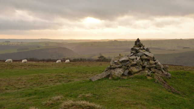
Cressbrook is a small village located in the county of Derbyshire, England. Situated within the Peak District National Park, it is surrounded by picturesque landscapes and is renowned for its natural beauty. The village is a popular destination for outdoor enthusiasts and nature lovers alike.

Cressbrook is characterized by its charming stone-built cottages and traditional architecture, reflecting its historical roots. The village was originally established during the Industrial Revolution and was primarily known for its cotton mills, which played a significant role in the local economy. Today, remnants of these mills can still be seen, adding a touch of historical significance to the area.

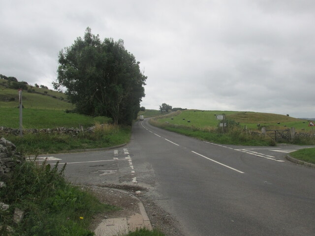
One of the main attractions in Cressbrook is the Cressbrook Mill, a Grade II listed building that has been converted into residential apartments. This iconic structure stands as a testament to the village's industrial past. Additionally, the village is home to a number of footpaths and trails, providing ample opportunities for walking, hiking, and exploring the surrounding countryside.

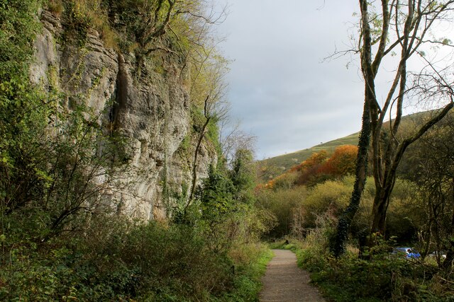
Cressbrook is also known for its proximity to the popular Monsal Trail, a former railway line that has been transformed into a scenic walking and cycling route. This trail offers stunning views of the surrounding countryside, including the impressive Monsal Viaduct.

In terms of amenities, Cressbrook has a small community hall and a pub, providing a cozy gathering place for locals and visitors alike. The village exudes a tranquil and peaceful atmosphere, making it an ideal retreat for those seeking an escape from the hustle and bustle of city life.

Overall, Cressbrook is a charming village that offers a unique blend of natural beauty, historical significance, and outdoor recreational opportunities.

If you have any feedback on the listing, please let us know in the comments section below.

Cressbrook Images

Images are sourced within 2km of 53.251024/-1.743676 or Grid Reference SK1772. Thanks to Geograph Open Source API. All images are credited.

Crossroads on the B6465. South of Wardlow.
Crossroads on the B6465.
South of Wardlow.
Litton, Bottomhill Road Gatepost BM BM on gatepost, E side of road
Litton, Bottomhill Road Gatepost BM
BM on gatepost, E side of road
Cressbrook, Bottomhill Road BM on roadside wall
Cressbrook, Bottomhill Road
BM on roadside wall
Path in Monsal Dale Looking up the dale. The River Wye is off to the right.
Path in Monsal Dale
Looking up the dale. The River Wye is off to the right.
Path by the River Wye Heading down Monsal Dale.
Path by the River Wye
Heading down Monsal Dale.
The Road to Litton Mill Follows the course of the River Wye through Millers Dale
The Road to Litton Mill
Follows the course of the River Wye through Millers Dale
Footpath at Tongue End looking North West Beginning of the footpath that runs up Tideswell Dale
Footpath at Tongue End looking North West
Beginning of the footpath that runs up Tideswell Dale
The End of the Footpath that runs down Tideswell Dale The footpath reaches the road to Litton Mill, beside the River Wye.
The End of the Footpath that runs down Tideswell Dale
The footpath reaches the road to Litton Mill, beside the River Wye.
Path heading up Tideswell Dale (1)
Path heading up  Tideswell Dale (2) Gradual climb up this limestone dale towards the ancient village of Tideswell.
Path heading up Tideswell Dale (2)
Gradual climb up this limestone dale towards the ancient village of Tideswell.
Entering Tideswell Dale
Ash Requiem 2021, Tideswell Dale Diseased, 'ash dieback' trees were being felled in this area.
Ash Requiem 2021, Tideswell Dale
Diseased, 'ash dieback' trees were being felled in this area.
Tumulus on Longstone Moor, Derbyshire A stone cairn marking the site of a tumulus at the highest point (395 m, 1296 ft) on Longstone Moor in the Peak District.  In the background is Monsal Dale.
Tumulus on Longstone Moor, Derbyshire
A stone cairn marking the site of a tumulus at the highest point (395 m, 1296 ft) on Longstone Moor in the Peak District. In the background is Monsal Dale.
Cressbrook  Mill  and  River  Wye  from  Monsal  Trail The mill ceased spinning in 1965. It has been converted into private apartments
Cressbrook Mill and River Wye from Monsal Trail
The mill ceased spinning in 1965. It has been converted into private apartments
Entrance  to  Cressbrook  Tunnel  on  Monsal  Trail
Entrance to Cressbrook Tunnel on Monsal Trail
Into  Miller's  Dale  from  Monsal  Trail
Into Miller's Dale from Monsal Trail
Entrance  to  Cressbrook  tunnel  Miller's  Dale A well light tunnel on the Monsal Trail, just watch out for bikes coming up behind
Entrance to Cressbrook tunnel Miller's Dale
A well light tunnel on the Monsal Trail, just watch out for bikes coming up behind
River Wye near Miller's Dale
Show me another place!

Cressbrook is located at Grid Ref: SK1772 (Lat: 53.251024, Lng: -1.743676)

Administrative County: Derbyshire

District: Derbyshire Dales

Police Authority: Derbyshire

What 3 Words

///coupler.sunblock.clef. Near Tideswell, Derbyshire

Related Wikis

Cressbrook

Cressbrook is a village in the Peak District National Park in Derbyshire. It lies in Water-cum-Jolly Dale at the foot of Cressbrook Dale. Population details...

Cressbrook Dale

Cressbrook Dale (also called Ravensdale) is a dry carboniferous limestone gorge near Bakewell, Derbyshire, in the Peak District of England. The dale is...

Monsal Dale railway station

Monsal Dale railway station was opened in 1866 by the Midland Railway on its line from Rowsley, extending the Manchester, Buxton, Matlock and Midlands...

Monsal Dale

Monsal Dale is a valley in Derbyshire, England, in the White Peak limestone area of the Peak District National Park. It is a Site of Special Scientific...

Monsal Trail

The Monsal Trail is a cycling, horse riding and walking trail in the Derbyshire Peak District. It was constructed from a section of the former Manchester...

Litton Mill

Litton Mill is a textile mill at Millers Dale, near Tideswell in Derbyshire. The original 19th-century mill became notorious during the Industrial Revolution...

Fin Cop

Fin Cop is a hill and an associated Iron Age hill fort in Monsal Dale, close to Ashford in the Water in Derbyshire, England.The fort shows evidence of...

Brushfield

Brushfield is a hamlet and civil parish in the Derbyshire Dales district of Derbyshire, England, in the Peak District National Park. It is about 8 miles...

Nearby Amenities

Located within 500m of 53.251024,-1.743676
Cressbrook (Phone Box)
Bus: yes
Public Transport: stop_position
Lat/Long: 53.2547334/-1.7469412
Cressbrook
Is In: Derbyshire, England, UK
Place: village
Wikidata: Q5184488
Wikipedia: en:Cressbrook
Lat/Long: 53.2548332/-1.7458863
Information: board
Inscription: Cressbrook - Monsal Trail
Operator: Peak District National Park Authority
Tourism: information
Lat/Long: 53.2484172/-1.7434921
Bench
Lat/Long: 53.2484138/-1.7434841
Water-cum-Jolly Dale
Place: locality
Lat/Long: 53.2520399/-1.745249
Post Box
Collection Times: Mo-Fr 09:00; Sa 07:00
Operator: Royal Mail
Post Box Type: lamp
Ref: SK17 84
Royal Cypher: EIIR
Royal Cypher Wikidata: Q33102113
Lat/Long: 53.2546817/-1.7479195
Defibrillator
HE Ref: 1140150
Access: yes
Booth: K6
Check Date: 2023-03-09
Covered: booth
Defibrillator Location: in red phone box in Cressbrook
Disused Amenity: telephone
Emergency: defibrillator
Indoor: no
Listed Status: Grade II
Source: survey
Wikidata: Q26432945
Lat/Long: 53.2547026/-1.746909
HE Ref: 1158755
Historic: memorial
Listed Status: Grade II
Memorial: war_memorial
Source: survey
Wikidata: Q26452500
Lat/Long: 53.2548001/-1.7469444
Bus Stop
Cressbrook (Phone Box)
Bench: no
Bus: yes
Public Transport: platform
Shelter: no
Source: survey
Lat/Long: 53.2547042/-1.7469441
Bench
Backrest: yes
Material: stone
Lat/Long: 53.2528392/-1.7428068
Waste Basket
Waste: dog_excrement
Lat/Long: 53.2511285/-1.741414
Hiking: yes
Information: guidepost
Material: wood
Tourism: information
Lat/Long: 53.2511522/-1.7414017
Fixme: Needs continuing
Lat/Long: 53.2504303/-1.7492698
Tourism: information
Lat/Long: 53.2547035/-1.7472384
Waste Basket
Waste: dog_excrement
Lat/Long: 53.2549102/-1.7452642
Bench
Openbenches Id: 31039
Lat/Long: 53.2548168/-1.7455774
Bench
Lat/Long: 53.2548225/-1.7455504
Bench
Lat/Long: 53.2521029/-1.7432615
Wild Peak Rounds: Cramside Wood
Tourism: information
Lat/Long: 53.2516167/-1.7485847
The data included in this document is from www.openstreetmap.org. The data is made available under ODbL.

Have you been to Cressbrook?

Leave your review of Cressbrook below (or comments, questions and feedback).