Vary Coppice
Wood, Forest in Dorset
England
Vary Coppice
![A short walk to Belhuish Farm [1] From the B3071 road, this track, a public footpath and permissive bridleway, runs alongside Burngate Wood towards Coombe Keynes.
From the B3071 road, the walk follows the long distance Hardy Way to the cluster of buildings at Belhuish Farm and returns the same way. Almost exactly 1 mile.](https://s2.geograph.org.uk/geophotos/07/26/01/7260186_994ce584.jpg)
Vary Coppice, located in the county of Dorset, is a picturesque wood or forest that covers a significant area of land. Situated in the southern part of England, this natural haven offers visitors a tranquil and serene escape from the hustle and bustle of everyday life.
The wood is characterized by its dense vegetation and an abundance of trees, predominantly consisting of oak, ash, and beech. The diverse array of flora and fauna found within Vary Coppice makes it a popular spot for nature enthusiasts and avid birdwatchers. The wood is home to various species of birds, including woodpeckers, owls, and finches, as well as mammals such as deer, foxes, and badgers.
Vary Coppice boasts a network of well-maintained footpaths, allowing visitors to explore the wood at their own pace. These trails wind through the trees, offering breathtaking views of the surrounding landscape. Along the way, visitors may stumble upon hidden clearings or small streams, adding to the charm and beauty of the wood.
The wood also serves as a valuable resource for local communities, providing timber for various purposes, including construction and firewood. Sustainable forestry practices are employed to ensure the long-term health and vitality of the wood.
Whether one seeks a peaceful stroll, an opportunity to connect with nature, or a chance to observe wildlife in its natural habitat, Vary Coppice is an idyllic destination that offers a truly immersive experience in the heart of Dorset's natural beauty.
If you have any feedback on the listing, please let us know in the comments section below.
Vary Coppice Images
Images are sourced within 2km of 50.655529/-2.2173052 or Grid Reference SY8484. Thanks to Geograph Open Source API. All images are credited.
![A short walk to Belhuish Farm [2] A notice giving details of the access along the track seen at <a href="https://www.geograph.org.uk/photo/7260186">SY8383 : A short walk to Belhuish Farm [1]</a>.
From the B3071 road, the walk follows the long distance Hardy Way to the cluster of buildings at Belhuish Farm and returns the same way. Almost exactly 1 mile.](https://s0.geograph.org.uk/geophotos/07/26/01/7260188_79530c33.jpg)
![A short walk to Belhuish Farm [3] Looking across the B3071 road to the track leading to Belhuish Farm.
From the B3071 road, the walk follows the long distance Hardy Way to the cluster of buildings at Belhuish Farm and returns the same way. Almost exactly 1 mile.](https://s1.geograph.org.uk/geophotos/07/26/01/7260189_3a57f18f.jpg)
![A short walk to Belhuish Farm [4] Looking across the B3071 road to the track leading to Coombe Keynes.
From the B3071 road, the walk follows the long distance Hardy Way to the cluster of buildings at Belhuish Farm and returns the same way. Almost exactly 1 mile.](https://s0.geograph.org.uk/geophotos/07/26/01/7260192_c2ff5405.jpg)
![A short walk to Belhuish Farm [5] The view from the track, looking northwest.
From the B3071 road, the walk follows the long distance Hardy Way to the cluster of buildings at Belhuish Farm and returns the same way. Almost exactly 1 mile.](https://s1.geograph.org.uk/geophotos/07/26/01/7260193_15511430.jpg)
![A short walk to Belhuish Farm [6] These gates give access to the fields from the track. Seen from the same viewpoint as <a href="https://www.geograph.org.uk/photo/7260193">SY8383 : A short walk to Belhuish Farm [5]</a>, looking southwest.
From the B3071 road, the walk follows the long distance Hardy Way to the cluster of buildings at Belhuish Farm and returns the same way. Almost exactly 1 mile.](https://s3.geograph.org.uk/geophotos/07/26/07/7260759_16920a2a.jpg)
![A short walk to Belhuish Farm [7] The view from the track, looking southwest over the farmland.
From the B3071 road, the walk follows the long distance Hardy Way to the cluster of buildings at Belhuish Farm and returns the same way. Almost exactly 1 mile.](https://s2.geograph.org.uk/geophotos/07/26/07/7260762_37865b39.jpg)
![A short walk to Belhuish Farm [8] The extensive view from the track, looking north northwest.
From the B3071 road, the walk follows the long distance Hardy Way to the cluster of buildings at Belhuish Farm and returns the same way. Almost exactly 1 mile.](https://s1.geograph.org.uk/geophotos/07/26/07/7260765_83211973.jpg)
![A short walk to Belhuish Farm [9] The track starts to descend towards the farm in the valley bottom. Belhuish Barn and Belhuish Coppice are seen in the distance.
From the B3071 road, the walk follows the long distance Hardy Way to the cluster of buildings at Belhuish Farm and returns the same way. Almost exactly 1 mile.](https://s0.geograph.org.uk/geophotos/07/26/07/7260768_6a3d7a51.jpg)
![A short walk to Belhuish Farm [10] At this junction of tracks, the buildings of Belhuish Farm come into view.
From the B3071 road, the walk follows the long distance Hardy Way to the cluster of buildings at Belhuish Farm and returns the same way. Almost exactly 1 mile.](https://s2.geograph.org.uk/geophotos/07/26/07/7260770_bdd5c579.jpg)
![Coombe Keynes hamlet [1] East Coombe Farmhouse was probably built in the early 19th century in two builds. Constructed of brick with a stone gable wall, under a tile roof.
There are various lean-to later extensions. Listed, grade II, with details at: <span class="nowrap"><a title="https://historicengland.org.uk/listing/the-list/list-entry/1172277" rel="nofollow ugc noopener" href="https://historicengland.org.uk/listing/the-list/list-entry/1172277">Link</a><img style="margin-left:2px;" alt="External link" title="External link - shift click to open in new window" src="https://s1.geograph.org.uk/img/external.png" width="10" height="10"/></span>
Coombe Keynes is a hamlet, and depopulated village in Dorset, some 1½ miles south of Wool and about 5 miles southwest of Wareham. Extensive settlement remains have been found by excavation to the east of the church, indicating that once there were many more buildings. The area of earthworks, extending to some 20 acres, is a Scheduled Ancient Monument with details at: <span class="nowrap"><a title="https://historicengland.org.uk/listing/the-list/list-entry/1017260" rel="nofollow ugc noopener" href="https://historicengland.org.uk/listing/the-list/list-entry/1017260">Link</a><img style="margin-left:2px;" alt="External link" title="External link - shift click to open in new window" src="https://s1.geograph.org.uk/img/external.png" width="10" height="10"/></span>](https://s3.geograph.org.uk/geophotos/07/26/08/7260803_c2052567.jpg)
![Coombe Keynes hamlet [2] This early 19th century boundary wall, east of East Coombe Farmhouse, is constructed of brick and stone, with tiled capping. There is a similar, but lower wall in front of the house. Listed, for group value, grade II, with details at: <span class="nowrap"><a title="https://historicengland.org.uk/listing/the-list/list-entry/1120494" rel="nofollow ugc noopener" href="https://historicengland.org.uk/listing/the-list/list-entry/1120494">Link</a><img style="margin-left:2px;" alt="External link" title="External link - shift click to open in new window" src="https://s1.geograph.org.uk/img/external.png" width="10" height="10"/></span>
Coombe Keynes is a hamlet, and depopulated village in Dorset, some 1½ miles south of Wool and about 5 miles southwest of Wareham. Extensive settlement remains have been found by excavation to the east of the church, indicating that once there were many more buildings. The area of earthworks, extending to some 20 acres, is a Scheduled Ancient Monument with details at: <span class="nowrap"><a title="https://historicengland.org.uk/listing/the-list/list-entry/1017260" rel="nofollow ugc noopener" href="https://historicengland.org.uk/listing/the-list/list-entry/1017260">Link</a><img style="margin-left:2px;" alt="External link" title="External link - shift click to open in new window" src="https://s1.geograph.org.uk/img/external.png" width="10" height="10"/></span>](https://s2.geograph.org.uk/geophotos/07/26/08/7260806_92c91272.jpg)
![Coombe Keynes hamlet [3] Dairy Barn is a barn and other farm buildings converted into a house. The main building is probably late 18th century. Constructed of rubble stone with brick dressings, quoins and buttresses, all under a slate roof with stone eaves courses. A lean-to with a catslide roof has pigeonholes. Listed, grade II, with details at: <span class="nowrap"><a title="https://historicengland.org.uk/listing/the-list/list-entry/1120493" rel="nofollow ugc noopener" href="https://historicengland.org.uk/listing/the-list/list-entry/1120493">Link</a><img style="margin-left:2px;" alt="External link" title="External link - shift click to open in new window" src="https://s1.geograph.org.uk/img/external.png" width="10" height="10"/></span>
Coombe Keynes is a hamlet, and depopulated village in Dorset, some 1½ miles south of Wool and about 5 miles southwest of Wareham. Extensive settlement remains have been found by excavation to the east of the church, indicating that once there were many more buildings. The area of earthworks, extending to some 20 acres, is a Scheduled Ancient Monument with details at: <span class="nowrap"><a title="https://historicengland.org.uk/listing/the-list/list-entry/1017260" rel="nofollow ugc noopener" href="https://historicengland.org.uk/listing/the-list/list-entry/1017260">Link</a><img style="margin-left:2px;" alt="External link" title="External link - shift click to open in new window" src="https://s1.geograph.org.uk/img/external.png" width="10" height="10"/></span>](https://s3.geograph.org.uk/geophotos/07/26/08/7260811_e8145a33.jpg)
![Coombe Keynes hamlet [4] The curiously named Odd Nod is a cottage in a terrace, probably built in the early 19th century. Constructed of rubble stone with brick dressings under a thatch roof. Some original internal features remain. Listed, grade II, with details at: <span class="nowrap"><a title="https://historicengland.org.uk/listing/the-list/list-entry/1172303" rel="nofollow ugc noopener" href="https://historicengland.org.uk/listing/the-list/list-entry/1172303">Link</a><img style="margin-left:2px;" alt="External link" title="External link - shift click to open in new window" src="https://s1.geograph.org.uk/img/external.png" width="10" height="10"/></span>
Coombe Keynes is a hamlet, and depopulated village in Dorset, some 1½ miles south of Wool and about 5 miles southwest of Wareham. Extensive settlement remains have been found by excavation to the east of the church, indicating that once there were many more buildings. The area of earthworks, extending to some 20 acres, is a Scheduled Ancient Monument with details at: <span class="nowrap"><a title="https://historicengland.org.uk/listing/the-list/list-entry/1017260" rel="nofollow ugc noopener" href="https://historicengland.org.uk/listing/the-list/list-entry/1017260">Link</a><img style="margin-left:2px;" alt="External link" title="External link - shift click to open in new window" src="https://s1.geograph.org.uk/img/external.png" width="10" height="10"/></span>](https://s1.geograph.org.uk/geophotos/07/26/08/7260813_fc3c6530.jpg)
![Coombe Keynes hamlet [5] The curiously named Mini Nod is a cottage in a terrace, probably built in the early 19th century. Constructed of rubble stone with brick dressings under a thatch roof. Some original internal features remain. Listed, grade II, with details at: <span class="nowrap"><a title="https://historicengland.org.uk/listing/the-list/list-entry/1305228" rel="nofollow ugc noopener" href="https://historicengland.org.uk/listing/the-list/list-entry/1305228">Link</a><img style="margin-left:2px;" alt="External link" title="External link - shift click to open in new window" src="https://s1.geograph.org.uk/img/external.png" width="10" height="10"/></span>
Coombe Keynes is a hamlet, and depopulated village in Dorset, some 1½ miles south of Wool and about 5 miles southwest of Wareham. Extensive settlement remains have been found by excavation to the east of the church, indicating that once there were many more buildings. The area of earthworks, extending to some 20 acres, is a Scheduled Ancient Monument with details at: <span class="nowrap"><a title="https://historicengland.org.uk/listing/the-list/list-entry/1017260" rel="nofollow ugc noopener" href="https://historicengland.org.uk/listing/the-list/list-entry/1017260">Link</a><img style="margin-left:2px;" alt="External link" title="External link - shift click to open in new window" src="https://s1.geograph.org.uk/img/external.png" width="10" height="10"/></span>](https://s3.geograph.org.uk/geophotos/07/26/08/7260815_de05cc56.jpg)
![Coombe Keynes hamlet [6] The curiously named Cuckoo Nod is a cottage in a terrace, probably built in the early 19th century. Constructed of rubble stone with brick dressings under a thatch roof. A single-storey extension is of brick under a tile roof. Some original internal features remain. Listed, grade II, with details at: <span class="nowrap"><a title="https://historicengland.org.uk/listing/the-list/list-entry/1120492" rel="nofollow ugc noopener" href="https://historicengland.org.uk/listing/the-list/list-entry/1120492">Link</a><img style="margin-left:2px;" alt="External link" title="External link - shift click to open in new window" src="https://s1.geograph.org.uk/img/external.png" width="10" height="10"/></span>
Coombe Keynes is a hamlet, and depopulated village in Dorset, some 1½ miles south of Wool and about 5 miles southwest of Wareham. Extensive settlement remains have been found by excavation to the east of the church, indicating that once there were many more buildings. The area of earthworks, extending to some 20 acres, is a Scheduled Ancient Monument with details at: <span class="nowrap"><a title="https://historicengland.org.uk/listing/the-list/list-entry/1017260" rel="nofollow ugc noopener" href="https://historicengland.org.uk/listing/the-list/list-entry/1017260">Link</a><img style="margin-left:2px;" alt="External link" title="External link - shift click to open in new window" src="https://s1.geograph.org.uk/img/external.png" width="10" height="10"/></span>](https://s2.geograph.org.uk/geophotos/07/26/08/7260818_0aefff55.jpg)
![Coombe Keynes hamlet [7] The centre of the hamlet has this delightful small green, complete with a shady seat. Listed, grade II, with details at: <span class="nowrap"><a title="https://historicengland.org.uk/listing/the-list/list-entry/1120492" rel="nofollow ugc noopener" href="https://historicengland.org.uk/listing/the-list/list-entry/1120492">Link</a><img style="margin-left:2px;" alt="External link" title="External link - shift click to open in new window" src="https://s1.geograph.org.uk/img/external.png" width="10" height="10"/></span>
Coombe Keynes is a hamlet, and depopulated village in Dorset, some 1½ miles south of Wool and about 5 miles southwest of Wareham. Extensive settlement remains have been found by excavation to the east of the church, indicating that once there were many more buildings. The area of earthworks, extending to some 20 acres, is a Scheduled Ancient Monument with details at: <span class="nowrap"><a title="https://historicengland.org.uk/listing/the-list/list-entry/1017260" rel="nofollow ugc noopener" href="https://historicengland.org.uk/listing/the-list/list-entry/1017260">Link</a><img style="margin-left:2px;" alt="External link" title="External link - shift click to open in new window" src="https://s1.geograph.org.uk/img/external.png" width="10" height="10"/></span>](https://s0.geograph.org.uk/geophotos/07/26/08/7260820_06eefbbf.jpg)
![Coombe Keynes hamlet [8] Numbers 7 and 8 Main Street, were originally built in the 17th century and converted to two cottages in the 19th century. Constructed of rubble stone, partly roughcast, under a thatch roof. The extension on the right is of brick under a tile roof. Some windows are horizontally sliding sashes. Listed, grade II, with details at: <span class="nowrap"><a title="https://historicengland.org.uk/listing/the-list/list-entry/1323337" rel="nofollow ugc noopener" href="https://historicengland.org.uk/listing/the-list/list-entry/1323337">Link</a><img style="margin-left:2px;" alt="External link" title="External link - shift click to open in new window" src="https://s1.geograph.org.uk/img/external.png" width="10" height="10"/></span>
Coombe Keynes is a hamlet, and depopulated village in Dorset, some 1½ miles south of Wool and about 5 miles southwest of Wareham. Extensive settlement remains have been found by excavation to the east of the church, indicating that once there were many more buildings. The area of earthworks, extending to some 20 acres, is a Scheduled Ancient Monument with details at: <span class="nowrap"><a title="https://historicengland.org.uk/listing/the-list/list-entry/1017260" rel="nofollow ugc noopener" href="https://historicengland.org.uk/listing/the-list/list-entry/1017260">Link</a><img style="margin-left:2px;" alt="External link" title="External link - shift click to open in new window" src="https://s1.geograph.org.uk/img/external.png" width="10" height="10"/></span>](https://s0.geograph.org.uk/geophotos/07/26/08/7260824_dadf443a.jpg)
Vary Coppice is located at Grid Ref: SY8484 (Lat: 50.655529, Lng: -2.2173052)
Unitary Authority: Dorset
Police Authority: Dorset
What 3 Words
///sensibly.croaking.unclaimed. Near Wool, Dorset
Nearby Locations
Related Wikis

Holy Rood Church, Coombe Keynes
Holy Rood Church is a former Church of England church in Coombe Keynes, Dorset, England. Most of the church dates to a rebuild of 1860–61, but the tower...
Coombe Keynes
Coombe Keynes is a hamlet, civil parish and depopulated village in the Purbeck district of Dorset, England. The village is about 2 miles (3 km) south of...

Bestival
Bestival was a four-day music festival held in the south of England. The name Bestival is a portmanteau of the words best and festival. It had been held...
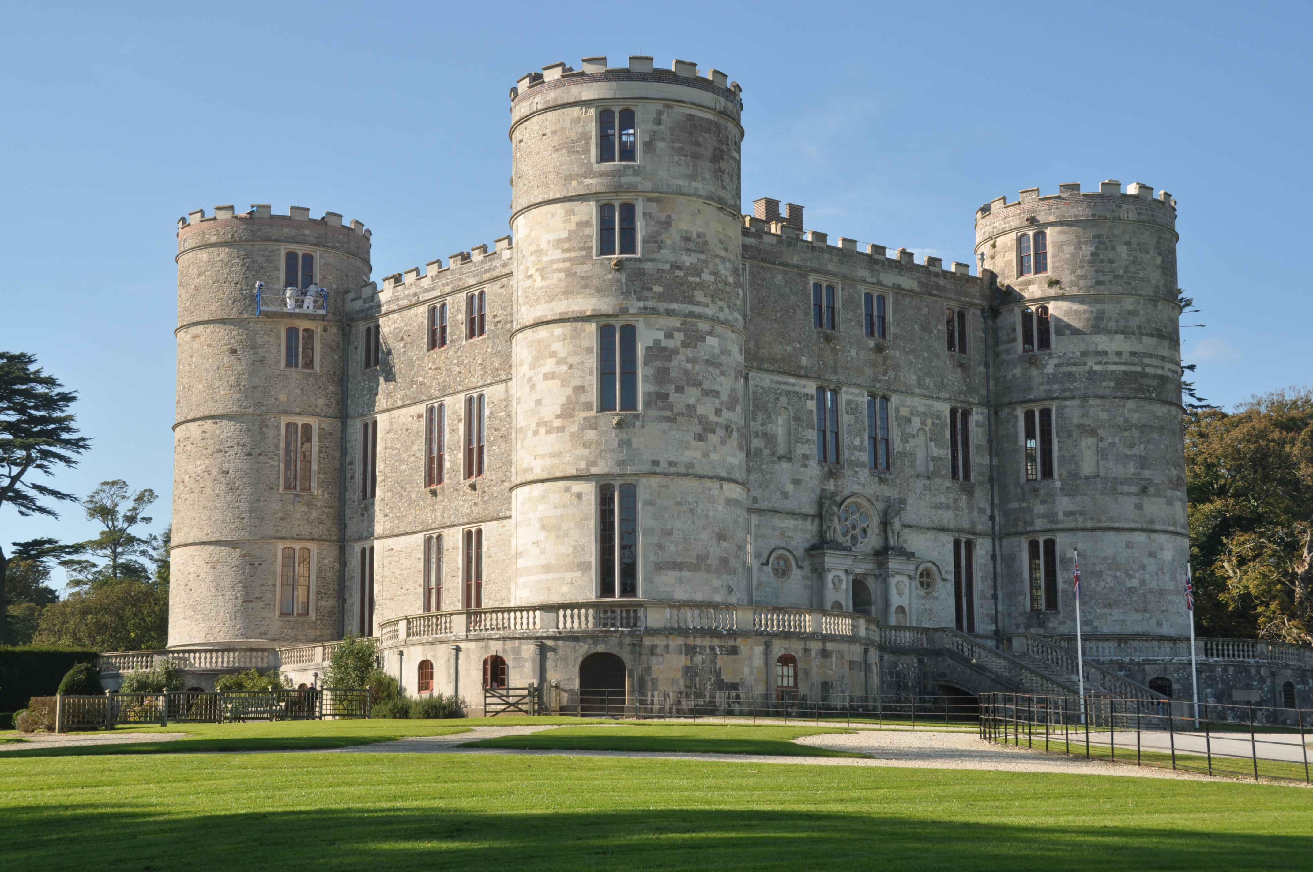
Lulworth Castle
Lulworth Castle, in East Lulworth, Dorset, England, situated south of the village of Wool, is an early 17th-century hunting lodge erected in the style...
Nearby Amenities
Located within 500m of 50.655529,-2.2173052Have you been to Vary Coppice?
Leave your review of Vary Coppice below (or comments, questions and feedback).