Cregrina

Settlement in Radnorshire

Wales

Cregrina

Farm at Rhos The road widens out here at the farm entrance, but most of the way towards Glascwm it is sufficiently narrow and twisting to make 20mph a rather risky maximum speed for a car.
Farm at Rhos Credit: Gordon Hatton

Cregrina is a small village located in the county of Radnorshire, Wales. Situated in the heart of the picturesque Elan Valley, it is surrounded by rolling hills and beautiful landscapes. The village is part of the community of Llanbadarn Fynydd and is approximately 7 miles northwest of the town of Llandrindod Wells.

With a population of around 200 residents, Cregrina is known for its close-knit community and peaceful atmosphere. The village mainly consists of traditional stone cottages, giving it a charming and rustic character. The surrounding countryside offers opportunities for outdoor activities such as hiking, cycling, and birdwatching, making it a popular destination for nature enthusiasts.

Although Cregrina is a small village, it does have some amenities to offer its residents and visitors. The village has a community hall, which serves as a venue for various events and gatherings. Additionally, there is a small pub where locals and visitors can socialize and enjoy a drink or a meal.

The village is well-connected to nearby towns and villages through a network of roads, making it easily accessible by car. Despite its rural location, Cregrina benefits from good transport links to the wider area.

Overall, Cregrina is a tranquil and picturesque village, offering a peaceful retreat for those seeking a rural escape amidst the stunning Welsh countryside.

If you have any feedback on the listing, please let us know in the comments section below.
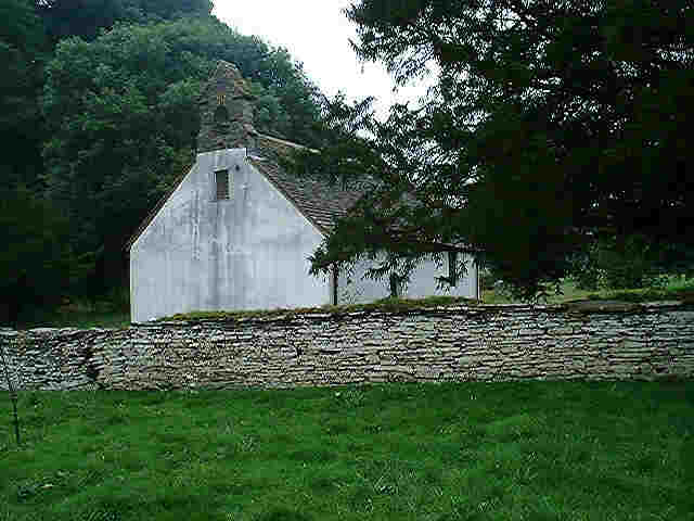
Cregrina Images

Images are sourced within 2km of 52.161676/-3.283553 or Grid Reference SO1252. Thanks to Geograph Open Source API. All images are credited.

Farm at Rhos The road widens out here at the farm entrance, but most of the way towards Glascwm it is sufficiently narrow and twisting to make 20mph a rather risky maximum speed for a car.
Farm at Rhos
The road widens out here at the farm entrance, but most of the way towards Glascwm it is sufficiently narrow and twisting to make 20mph a rather risky maximum speed for a car.
Lots to view Some where in the mist is the village of Hundred House which is lost to view from here above Fforest Wood
Lots to view
Some where in the mist is the village of Hundred House which is lost to view from here above Fforest Wood
Shadow on the mist Somewhere down there is Fforest Fields Camp site but all you can see is a shadow on the mist.
Shadow on the mist
Somewhere down there is Fforest Fields Camp site but all you can see is a shadow on the mist.
Rising sun The sun has just risen over the horizon and now breaking through the clouds near Fforest Wood
Rising sun
The sun has just risen over the horizon and now breaking through the clouds near Fforest Wood
Mosaic mural at Cregrina This mosaic mural is situated at the church car park, with St. David church seen in the background. Here is a full-length view of the <a href="https://www.geograph.org.uk/photo/4279087">SO1252 : Mural near the Church</a> from 2014.
Mosaic mural at Cregrina
This mosaic mural is situated at the church car park, with St. David church seen in the background. Here is a full-length view of the SO1252 : Mural near the Church from 2014.
The River Edw (Cregrina) Here is the River Edw from Cregrina Bridge, viewed from the south parapet of the bridge.
The River Edw (Cregrina)
Here is the River Edw from Cregrina Bridge, viewed from the south parapet of the bridge.
Wylfre (Viewed from Cregrina) The hill in the distance is 410 m (1,345 ft) high.
Wylfre (Viewed from Cregrina)
The hill in the distance is 410 m (1,345 ft) high.
Lane at Cregrina The stone bridge in the foreground carries the country lane over the Clas Brook.
Lane at Cregrina
The stone bridge in the foreground carries the country lane over the Clas Brook.
Lane at Cregrina Hidden by the embankment to the east is a road junction with the country lane to Glascwm, Colva and Gladestry.
Lane at Cregrina
Hidden by the embankment to the east is a road junction with the country lane to Glascwm, Colva and Gladestry.
Clas Brook (Cregrina) Taken from a stone bridge near Pentwyn farm, this view facing west shows the stream reaching a confluence with the River Edw (albeit covered by trees from this viewpoint).
Clas Brook (Cregrina)
Taken from a stone bridge near Pentwyn farm, this view facing west shows the stream reaching a confluence with the River Edw (albeit covered by trees from this viewpoint).
Wylfre (Viewed from Cregrina) The hill in the distance is 410 m (1,345 ft) high.
Wylfre (Viewed from Cregrina)
The hill in the distance is 410 m (1,345 ft) high.
Countryside at Cregrina
Lane at Cregrina
Lane at Cregrina
Llandeilo Hill (Viewed from Rhulen)
Llan-fraith Hill (Viewed from Rhulen) The hill in the distance is 386 m (1,266 ft) high.
Llan-fraith Hill (Viewed from Rhulen)
The hill in the distance is 386 m (1,266 ft) high.
Lane to Rhulen This was the country lane we walked on to find St. David's church.
Lane to Rhulen
This was the country lane we walked on to find St. David's church.
Rhulen Hill (Viewed from Rhulen) The hill in the distance is 464 m (1,522 ft) high.
Rhulen Hill (Viewed from Rhulen)
The hill in the distance is 464 m (1,522 ft) high.
Road junction at Rhulen
Show me another place!

Cregrina is located at Grid Ref: SO1252 (Lat: 52.161676, Lng: -3.283553)

Unitary Authority: Powys

Police Authority: Dyfed Powys

What 3 Words

///butlers.chicken.september. Near Builth Wells, Powys

Related Wikis

Colwyn Castle

Colwyn Castle was a medieval castle near Llansantffraed in Wales. In the Manor of Glascwm, in the county of Radnorshire.It was built on the site of a Roman...

Llanbadarn y Garreg

Llanbadarn-y-Garreg is a village in the community of Aberedw, Powys, Wales. It is 45.1 miles (72.6 km) from Cardiff and 141.9 miles (228.4 km) from London...

Mechain

Mechain was a medieval cantref in the Kingdom of Powys. This cantref has also been referred to as Y Fyrnwy (Vyrnwy). Mechain may owe its name to the River...

Gwaunceste Hill

Gwaunceste Hill (Welsh: Bryn Gwaun-cest) is a 542-metre-high hill in the county of Powys in east Wales. It falls within the communities of Gladestry and...

Nearby Amenities

Located within 500m of 52.161676,-3.283553
Telephone
Booth: K6
Covered: booth
Operator: BT
Phone: +44 1982 570247
Lat/Long: 52.1606001/-3.2820078
Place Of Worship
Cregrina Free Mission
Religion: christian
Wikidata: Q99452257
Lat/Long: 52.1615448/-3.2814167
Cregrina
Place: hamlet
Lat/Long: 52.161076/-3.2832917
Post Box
Letters Only: yes
Post Box Design: hovis
Post Box Mounting: wall
Post Box Type: lamp
Ref: LD1 77D
Royal Cypher: GR
Royal Cypher Wikidata: Q33102273
Lat/Long: 52.1612043/-3.2815912
The data included in this document is from www.openstreetmap.org. The data is made available under ODbL.

Have you been to Cregrina?

Leave your review of Cregrina below (or comments, questions and feedback).