Comber Copse

Wood, Forest in Staffordshire South Staffordshire

England

Comber Copse

Canal north-east of Kinver in Staffordshire The Staffordshire and Worcestershire Canal is meandering towards Kinver and Kidderminster. The Kinver Light Railway (from Amblecote) ran alongside the towpath from 1901 until it closed in February 1930. This is a very popular rural mooring place for crews not obsessed with stopping by a pub.
Canal north-east of Kinver in Staffordshire Credit: Roger Kidd

Comber Copse is a picturesque woodland located in Staffordshire, England. Spanning over a vast area, this dense forest is a haven for nature enthusiasts and a popular destination for outdoor activities. The copse is situated in close proximity to the village of Comberford, adding to its accessibility and appeal.

Comber Copse is home to a diverse range of flora and fauna, creating a vibrant ecosystem. The woodland is predominantly composed of deciduous trees such as oak, ash, and beech, which provide a stunning display of colors during the autumn season. Bluebells carpet the forest floor in spring, creating a breathtaking sight.

The copse offers a tranquil environment, making it an ideal spot for walking, hiking, and birdwatching. Numerous well-marked trails crisscross the wood, allowing visitors to explore its beauty at their own pace. As one ventures deeper into the forest, they may encounter various species of birds, including woodpeckers, owls, and songbirds. Additionally, the copse is also home to small mammals like squirrels and rabbits.

Comber Copse is managed by local authorities, ensuring its preservation and maintenance. The woodland is equipped with picnic areas, benches, and well-maintained footpaths, providing visitors with a comfortable and enjoyable experience. The copse is also popular among photographers, who visit to capture its natural beauty throughout the seasons.

Overall, Comber Copse in Staffordshire is a remarkable woodland that offers a diverse range of experiences for nature enthusiasts. Whether one seeks a peaceful walk in nature or an opportunity to spot wildlife, this forest provides an idyllic setting to connect with the natural world.

If you have any feedback on the listing, please let us know in the comments section below.
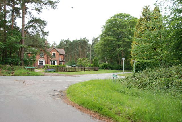
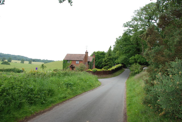
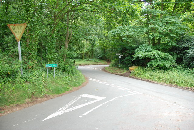
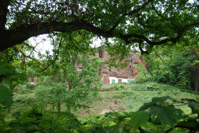
Comber Copse Images

Images are sourced within 2km of 52.445717/-2.2362858 or Grid Reference SO8483. Thanks to Geograph Open Source API. All images are credited.

Canal north-east of Kinver in Staffordshire The Staffordshire and Worcestershire Canal is meandering towards Kinver and Kidderminster. The Kinver Light Railway (from Amblecote) ran alongside the towpath from 1901 until it closed in February 1930. This is a very popular rural mooring place for crews not obsessed with stopping by a pub.
Canal north-east of Kinver in Staffordshire
The Staffordshire and Worcestershire Canal is meandering towards Kinver and Kidderminster. The Kinver Light Railway (from Amblecote) ran alongside the towpath from 1901 until it closed in February 1930. This is a very popular rural mooring place for crews not obsessed with stopping by a pub.
Canal north-east of Kinver in Staffordshire The Staffordshire and Worcestershire Canal is meandering towards Kinver and Kidderminster. The Kinver Light Railway (from Amblecote) ran alongside the towpath here from 1901 until it closed in February 1930. This is a very popular rural mooring place for crews not requiring the services of a pub.
Canal north-east of Kinver in Staffordshire
The Staffordshire and Worcestershire Canal is meandering towards Kinver and Kidderminster. The Kinver Light Railway (from Amblecote) ran alongside the towpath here from 1901 until it closed in February 1930. This is a very popular rural mooring place for crews not requiring the services of a pub.
Staffordshire and Worcestershire Canal near Kinver in Staffordshire The Staffordshire and Worcestershire Canal is meandering towards Kinver and Kidderminster. The Kinver Light Railway (from Amblecote) ran alongside the towpath here from 1901 until it closed in February 1930. This is a very popular rural mooring place for crews not requiring the services of a pub.
Staffordshire and Worcestershire Canal near Kinver in Staffordshire
The Staffordshire and Worcestershire Canal is meandering towards Kinver and Kidderminster. The Kinver Light Railway (from Amblecote) ran alongside the towpath here from 1901 until it closed in February 1930. This is a very popular rural mooring place for crews not requiring the services of a pub.
River Stour near Kinver in Staffordshire This is looking north (upstream) from close to the canal towpath.
River Stour near Kinver in Staffordshire
This is looking north (upstream) from close to the canal towpath.
Visitor moorings near Kinver in Staffordshire The Staffordshire and Worcestershire Canal meanders on towards Kidderminster and Stourport. Moorings here at Dunsley near Kinver are very good, but can be busy during the summer. If you are travelling north towards Stourton you may need to moor here, east of Kinver Lock. because private moorings dominate the towpath as far as Hyde Lock, nearly three quarters of a mile and two locks distant!
Visitor moorings near Kinver in Staffordshire
The Staffordshire and Worcestershire Canal meanders on towards Kidderminster and Stourport. Moorings here at Dunsley near Kinver are very good, but can be busy during the summer. If you are travelling north towards Stourton you may need to moor here, east of Kinver Lock. because private moorings dominate the towpath as far as Hyde Lock, nearly three quarters of a mile and two locks distant!
Canal at Dunsley near Kinver in Staffordshire Looking east here, the Staffordshire and Worcestershire Canal meanders on sothwards towards Kidderminster and Stourport. Moorings here at Dunsley near Kinver are very good, but can be busy during the summer. If you are travelling north towards Stourton you may need to moor here, east of Kinver Lock. because private moorings dominate the towpath as far as Hyde Lock, nearly three quarters of a mile and two locks distant!
Canal at Dunsley near Kinver in Staffordshire
Looking east here, the Staffordshire and Worcestershire Canal meanders on sothwards towards Kidderminster and Stourport. Moorings here at Dunsley near Kinver are very good, but can be busy during the summer. If you are travelling north towards Stourton you may need to moor here, east of Kinver Lock. because private moorings dominate the towpath as far as Hyde Lock, nearly three quarters of a mile and two locks distant!
Whittington Horse Bridge near Kinver in Staffordshire Whittington Horse Bridge is No 28 across the Staffordshire and Worcestershire Canal. Horse Bridge Lane is reduced to a narrow bridleway as it crosses the water.
<a href="https://www.geograph.org.uk/photo/2899537">SO8582 : Whittington Horse Bridge (No. 28) on the Staffs & Worcs Canal</a>
Whittington Horse Bridge near Kinver in Staffordshire
Whittington Horse Bridge is No 28 across the Staffordshire and Worcestershire Canal. Horse Bridge Lane is reduced to a narrow bridleway as it crosses the water. SO8582 : Whittington Horse Bridge (No. 28) on the Staffs & Worcs Canal
Staffordshire and Worcestershire Canal near Whittington in Staffordshire The Staffordshire and Worcestershire Canal is meandering south towards Kidderminster and Stourport.
Staffordshire and Worcestershire Canal near Whittington in Staffordshire
The Staffordshire and Worcestershire Canal is meandering south towards Kidderminster and Stourport.
Canalside heron south of Whittington in Staffordshire This bird was so "cool" about people that it declined to fly off while we passed close by and a cyclist walked by it, heading north. Staffordshire and Worcestershire Canal.
Canalside heron south of Whittington in Staffordshire
This bird was so "cool" about people that it declined to fly off while we passed close by and a cyclist walked by it, heading north. Staffordshire and Worcestershire Canal.
Canalside heron south of Whittington in Staffordshire This bird was so "cool" about people that it declined to fly off while we passed close by and a cyclist walked by it, heading north. Staffordshire and Worcestershire Canal.

<a href="https://www.geograph.org.uk/photo/7685237">SO8581 : Canalside heron south of Whittington in Staffordshire</a>
Canalside heron south of Whittington in Staffordshire
This bird was so "cool" about people that it declined to fly off while we passed close by and a cyclist walked by it, heading north. Staffordshire and Worcestershire Canal. SO8581 : Canalside heron south of Whittington in Staffordshire
The Old Grammar School The school from 1511 stands alongside the Holloway in Kinver and is now a private house.
The Old Grammar School
The school from 1511 stands alongside the Holloway in Kinver and is now a private house.
The Cross Inn The Kinver Pub stands on the corner of Church Hill and Dark Lane.
The Cross Inn
The Kinver Pub stands on the corner of Church Hill and Dark Lane.
Inside the Cross Inn The Kinver Pub on Church Hill.
Inside the Cross Inn
The Kinver Pub on Church Hill.
Grammar School Plaque The plaque on the front of the former school house in Dark Lane Kinver. See <a href="https://www.geograph.org.uk/photo/2338355">SO8483 : The Old Grammar School</a>
Grammar School Plaque
The plaque on the front of the former school house in Dark Lane Kinver. See SO8483 : The Old Grammar School
Gamekeepers Cottages. These Cottages are on the Enville Road, Compton Road crossroads. Just outside Kinver.
Gamekeepers Cottages.
These Cottages are on the Enville Road, Compton Road crossroads. Just outside Kinver.
House On The Outskirts Of Kinver. This house replaced an old Cottage, around 1990
House On The Outskirts Of Kinver.
This house replaced an old Cottage, around 1990
Crossroads Near Holy Austin Rock, Kinver. These Crossroads are at the Kinver end of Kingsford Lane.
Crossroads Near Holy Austin Rock, Kinver.
These Crossroads are at the Kinver end of Kingsford Lane.
Holy Austin Rock, Kinver. One of the Rock houses has been restored, and is open to the public at certain times.The others have been closed off, as is evident from the Photo, for Health & Safety reasons.
Holy Austin Rock, Kinver.
One of the Rock houses has been restored, and is open to the public at certain times.The others have been closed off, as is evident from the Photo, for Health & Safety reasons.
Show me another place!

Comber Copse is located at Grid Ref: SO8483 (Lat: 52.445717, Lng: -2.2362858)

Administrative County: Staffordshire

District: South Staffordshire

Police Authority: Staffordshire

What 3 Words

///teaching.unity.directive. Near Kinvere, Staffordshire

Nearby Locations

Comber Copse

Related Wikis

Kinver Edge Hillfort

Kinver Edge Hillfort, is a univallate Iron Age hillfort with a massive rampart and outer ditch along the south-west and south-east sides, with natural...

Kinver Edge

Kinver Edge is a high heath and woodland escarpment just west of Kinver, about four miles west of Stourbridge, and four miles north of Kidderminster, and...

Kinver

Kinver is a large village in the District of South Staffordshire in Staffordshire, England. It is in the far south-west of the county, at the end of the...

Kinver High School

Kinver High School (formerly Edgecliff High School) is a mixed secondary school and sixth form located in Kinver in the English county of Staffordshire...

Kingsford Country Park

Kingsford Country Park, officially Kingsford Forest Park, was in Worcestershire, England, U.K. and managed by Worcestershire County Council. It adjoined...

Dunsley, Staffordshire

Dunsley is a hamlet in Kinver, Staffordshire, England. The settled part of the hamlet is the part of the village of Kinver, lying east of the River Stour...

Blakeshall

Blakeshall is a hamlet in Worcestershire, England. It is one of the ancient townships of the manor of Wolverley, whose extent was similar to that of the...

Kingsford, Worcestershire

Kingsford is a large hamlet in Worcestershire, England. == Location == Kingsford is located one mile (1.6 km) north of the village of Wolverley, Worcestershire...

Nearby Amenities

Located within 500m of 52.445717,-2.2362858
Bus Stop
Fairfield Drive
Bus: yes
Naptan AtcoCode: 3800C606200
Naptan Bearing: NW
Naptan CommonName: Fairfield Drive
Naptan Indicator: Adj
Naptan Landmark: Fairfield Drive
Naptan Street: Comber Grove
Naptan Verified: no
Public Transport: platform
Source: naptan_import
Lat/Long: 52.4485488/-2.2322463
Turning Circle
Turning Circle: y-head
Lat/Long: 52.4496287/-2.2390739
Cafe
Kinver Edge Maize Maze and Farm Shop
Lat/Long: 52.4419125/-2.239706
Kinver Scout Campsite
Tourism: camp_site
Lat/Long: 52.4474156/-2.2337365
Bicycle Parking
Bicycle Parking: stands
Capacity: 10
Covered: no
Fee: no
Lat/Long: 52.4490139/-2.2325064
Junction: roundabout
Lat/Long: 52.4427658/-2.2368832
Bench
Backrest: no
Material: wood
Seats: 2
Lat/Long: 52.4484221/-2.2406964
The data included in this document is from www.openstreetmap.org. The data is made available under ODbL.

Have you been to Comber Copse?

Leave your review of Comber Copse below (or comments, questions and feedback).