Middop Wood

Wood, Forest in Yorkshire Ribble Valley

England

Middop Wood

Old Guide Stone by A682, Rimington Lane junction with Hardacre Lane (East face) The Guide Stone is located in angle of minor roads, next to grey metal junction box on the West side of the road.  Parish of Rimington (Ribble Valley District). Carved stone post, erected in the 18th Century, old edge chips. An earlier photograph can be found here: <a title="https://www.geograph.org.uk/photo/6076649" href="https://www.geograph.org.uk/photo/6076649">Link</a> 

Inscription reads:- 
TO / {hand to left}  / BurnLey /(1) 2 m : : TO / {hand to right} / (?) /5 ms / TO E {hand to left} / Gisbern / 1m 

Grade II listed. 
List Entry Number: 1165264 <span class="nowrap"><a title="https://historicengland.org.uk/listing/the-list/list-entry/1165264" rel="nofollow ugc noopener" href="https://historicengland.org.uk/listing/the-list/list-entry/1165264">Link</a><img style="margin-left:2px;" alt="External link" title="External link - shift click to open in new window" src="https://s1.geograph.org.uk/img/external.png" width="10" height="10"/></span> 

Milestone Society National ID: YW_XGIS
Old Guide Stone by A682, Rimington Lane junction with Hardacre Lane (East face) Credit: Hilary Jones

Middop Wood is a picturesque forest located in the county of Yorkshire, England. Situated in the heart of the Ribble Valley, this woodland covers an area of approximately 500 acres and is known for its natural beauty and diverse wildlife.

The wood consists primarily of deciduous trees, including oak, birch, and beech, which provide a stunning display of vibrant colors during the autumn months. The forest floor is covered with a rich carpet of ferns, mosses, and wildflowers, offering a delightful experience for nature enthusiasts and hikers.

Middop Wood is home to a variety of wildlife, including red deer, roe deer, and numerous species of birds such as woodpeckers, owls, and songbirds. The tranquil atmosphere of the forest provides a haven for these animals, making it an ideal location for birdwatching and wildlife photography.

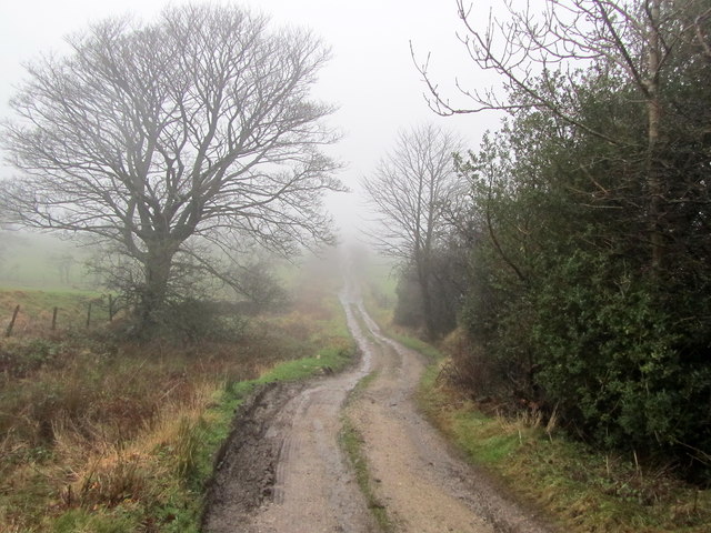
The wood offers several well-maintained walking trails, allowing visitors to explore its beauty at their own pace. These paths wind through the forest, offering breathtaking views of the surrounding countryside and the nearby River Ribble. Along the way, there are several designated picnic areas, providing a perfect spot to rest and enjoy the serenity of the surroundings.

Middop Wood is a popular destination for both locals and tourists alike, attracting nature lovers, outdoor enthusiasts, and families seeking a peaceful retreat. With its stunning scenery, diverse flora and fauna, and well-marked trails, this woodland offers a truly immersive experience in the heart of Yorkshire's natural beauty.

If you have any feedback on the listing, please let us know in the comments section below.
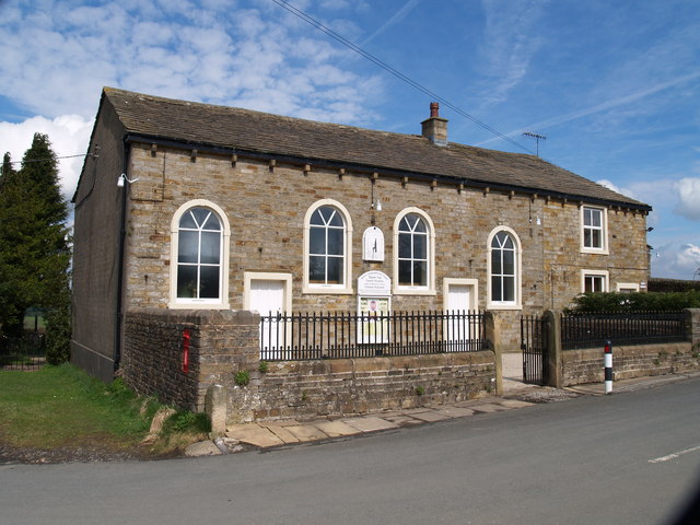
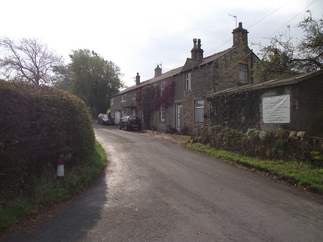
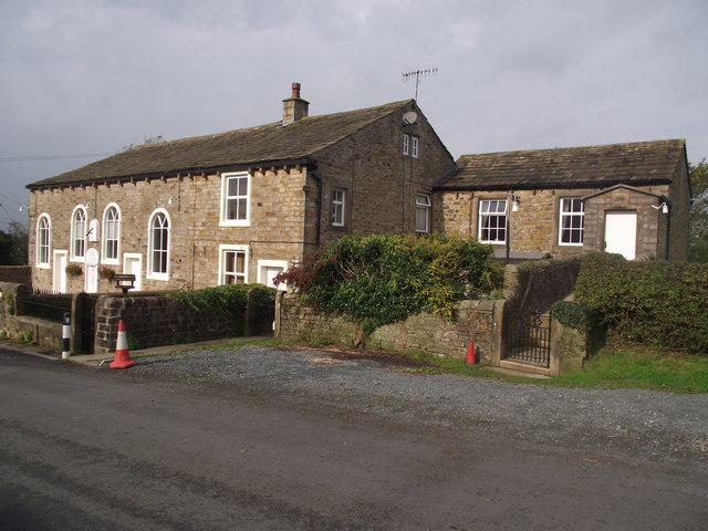
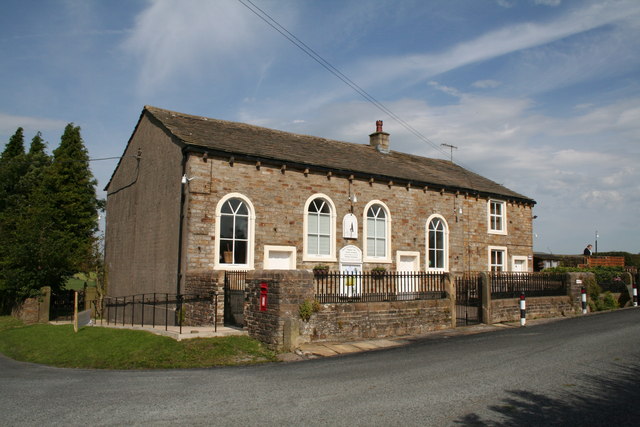
Middop Wood Images

Images are sourced within 2km of 53.907811/-2.2528855 or Grid Reference SD8345. Thanks to Geograph Open Source API. All images are credited.

Old Guide Stone by A682, Rimington Lane junction with Hardacre Lane (East face) The Guide Stone is located in angle of minor roads, next to grey metal junction box on the West side of the road.  Parish of Rimington (Ribble Valley District). Carved stone post, erected in the 18th Century, old edge chips. An earlier photograph can be found here: <a title="https://www.geograph.org.uk/photo/6076649" href="https://www.geograph.org.uk/photo/6076649">Link</a> 

Inscription reads:- 
TO / {hand to left}  / BurnLey /(1) 2 m : : TO / {hand to right} / (?) /5 ms / TO E {hand to left} / Gisbern / 1m 

Grade II listed. 
List Entry Number: 1165264 <span class="nowrap"><a title="https://historicengland.org.uk/listing/the-list/list-entry/1165264" rel="nofollow ugc noopener" href="https://historicengland.org.uk/listing/the-list/list-entry/1165264">Link</a><img style="margin-left:2px;" alt="External link" title="External link - shift click to open in new window" src="https://s1.geograph.org.uk/img/external.png" width="10" height="10"/></span> 

Milestone Society National ID: YW_XGIS
Old Guide Stone by A682, Rimington Lane junction with Hardacre Lane (East face)
The Guide Stone is located in angle of minor roads, next to grey metal junction box on the West side of the road.  Parish of Rimington (Ribble Valley District). Carved stone post, erected in the 18th Century, old edge chips. An earlier photograph can be found here: Link  Inscription reads:- TO / {hand to left} / BurnLey /(1) 2 m : : TO / {hand to right} / (?) /5 ms / TO E {hand to left} / Gisbern / 1m Grade II listed. List Entry Number: 1165264 LinkExternal link Milestone Society National ID: YW_XGIS
Old Guide Stone by A682, Rimington Lane junction with Hardacre Lane (West Face) The Guide Stone is located in angle of minor roads, next to grey metal junction box on the West side of the road.  Parish of Rimington (Ribble Valley District). Carved stone post, erected in the 18th Century, old edge chips. East face photograph can be found here: <a title="https://www.geograph.org.uk/photo/7383066" href="https://www.geograph.org.uk/photo/7383066">Link</a> 

Inscription reads:- 
TO / {hand to left}  / BurnLey /(1) 2 m : : TO / {hand to right} / (?) / 5 ms / TO E {hand to left} / Gisbern / 1m 

Grade II listed. 
List Entry Number: 1165264 <span class="nowrap"><a title="https://historicengland.org.uk/listing/the-list/list-entry/1165264" rel="nofollow ugc noopener" href="https://historicengland.org.uk/listing/the-list/list-entry/1165264">Link</a><img style="margin-left:2px;" alt="External link" title="External link - shift click to open in new window" src="https://s1.geograph.org.uk/img/external.png" width="10" height="10"/></span> 

Milestone Society National ID: YW_XGIS
Old Guide Stone by A682, Rimington Lane junction with Hardacre Lane (West Face)
The Guide Stone is located in angle of minor roads, next to grey metal junction box on the West side of the road.  Parish of Rimington (Ribble Valley District). Carved stone post, erected in the 18th Century, old edge chips. East face photograph can be found here: Link Inscription reads:- TO / {hand to left} / BurnLey /(1) 2 m : : TO / {hand to right} / (?) / 5 ms / TO E {hand to left} / Gisbern / 1m Grade II listed. List Entry Number: 1165264 LinkExternal link Milestone Society National ID: YW_XGIS
Salem Congregational Chapel The Chapel at the junction of Long Lover Lane,Martin Top lane and Newby Lane, the post box can just be seen, it is built into the wall on the left.
Salem Congregational Chapel
The Chapel at the junction of Long Lover Lane,Martin Top lane and Newby Lane, the post box can just be seen, it is built into the wall on the left.
Cottages on Martin Top Lane At the junction of Stopper Lane and Martin Top Lane.
Cottages on Martin Top Lane
At the junction of Stopper Lane and Martin Top Lane.
Salem Congregational Church and Manse At Martin Top near Newby.
Salem Congregational Church and Manse
At Martin Top near Newby.
Flass House Farm in the Mist Brogden Lane passing Flass House Farm on a miserable misty winters day
Flass House Farm in the Mist
Brogden Lane passing Flass House Farm on a miserable misty winters day
Coal Pit Lane Unmetalled Lane descending gradually towards the Ribble Valley, recently adopted by the Pennine Bridleway.
Coal Pit Lane
Unmetalled Lane descending gradually towards the Ribble Valley, recently adopted by the Pennine Bridleway.
Access Drive to Coverdale The driveway seen on a rather grim misty day, from Coal Pit Lane
Access Drive to Coverdale
The driveway seen on a rather grim misty day, from Coal Pit Lane
Coal Pit Lane in Winter A bleak midwinter scene along Coal Pit Lane - recently adopted by the Pennine Bridleway National Trail
Coal Pit Lane in Winter
A bleak midwinter scene along Coal Pit Lane - recently adopted by the Pennine Bridleway National Trail
Gisburn:  Coal Pit Lane Looking southeast.  Coal Pit Lane was once part of the ancient route from Gisburn to Colne.  It joined up with Gisburn Old Road near the top of Weets Hill.  However, the connection is no longer possible, as Coal Pit Lane ceases to be metalled in another 500 yards at Bonny Blacks Farm, and although bridleway rights exist further on, eventually the way becomes quite impassable, even for a pedestrian.  As it is not a through road, there is very little traffic along Coal Pit Lane, (even Bonny Blacks can be reached much more easily by a different route).
Gisburn: Coal Pit Lane
Looking southeast. Coal Pit Lane was once part of the ancient route from Gisburn to Colne. It joined up with Gisburn Old Road near the top of Weets Hill. However, the connection is no longer possible, as Coal Pit Lane ceases to be metalled in another 500 yards at Bonny Blacks Farm, and although bridleway rights exist further on, eventually the way becomes quite impassable, even for a pedestrian. As it is not a through road, there is very little traffic along Coal Pit Lane, (even Bonny Blacks can be reached much more easily by a different route).
Gisburn:  Hardhouse Farm A caravan site adjoins, but tents are not allowed.
Gisburn: Hardhouse Farm
A caravan site adjoins, but tents are not allowed.
Rimington:  Salem Congregational  Chapel Built in 1861.  The far end of the building is actually the manse, while a small Sunday School (out of view) adjoins the far end.  The chapel is still in use.  The road in front of the chapel has the name 'Long Lover's Lane', which must rank high in my order of favourite road names, after Hull's 'Land of Green Ginger'.
Rimington: Salem Congregational Chapel
Built in 1861. The far end of the building is actually the manse, while a small Sunday School (out of view) adjoins the far end. The chapel is still in use. The road in front of the chapel has the name 'Long Lover's Lane', which must rank high in my order of favourite road names, after Hull's 'Land of Green Ginger'.
Rimington:  Salem Sunday School Built in 1906 at the eastern end of the chapel/manse building.
Rimington: Salem Sunday School
Built in 1906 at the eastern end of the chapel/manse building.
Rimington:  Cottages at Newby The small settlement of Newby lies about half a mile east of Rimington Village centre.  It is a very pleasant and relaxing place.  I think the cottage nearest the lane is called 'Elmdale', the next one is 'Oakdene'
Rimington: Cottages at Newby
The small settlement of Newby lies about half a mile east of Rimington Village centre. It is a very pleasant and relaxing place. I think the cottage nearest the lane is called 'Elmdale', the next one is 'Oakdene'
Rimington:  Looking uphill in Newby Looking east we see the house 'Pen-y-ghent' at the top of the rise, while the one on the right is 'Ingledale'.  The lane is called Newby Lane.
Rimington: Looking uphill in Newby
Looking east we see the house 'Pen-y-ghent' at the top of the rise, while the one on the right is 'Ingledale'. The lane is called Newby Lane.
Rimington:  Cottages on Newby Lane The nearest cottage is 'Elmdale' and the next is 'Oakdene'
Rimington: Cottages on Newby Lane
The nearest cottage is 'Elmdale' and the next is 'Oakdene'
Rimington:  'Ingledale' on Newby Lane
Rimington: 'Ingledale' on Newby Lane
Field below Cringlands Hill An area of fields, all ploughed up, making progress difficult for walkers on the missing paths.
Field below Cringlands Hill
An area of fields, all ploughed up, making progress difficult for walkers on the missing paths.
Show me another place!

Middop Wood is located at Grid Ref: SD8345 (Lat: 53.907811, Lng: -2.2528855)

Division: West Riding

Administrative County: Lancashire

District: Ribble Valley

Police Authority: Lancashire

What 3 Words

///identity.robot.shielding. Near Barnoldswick, Lancashire

Nearby Locations

Middop Wood

Related Wikis

Middop

Middop is a rural hamlet and civil parish in Lancashire, England. It is in Ribble Valley district. Middop is near the villages of Rimington and Gisburn...

Weets Hill

Weets Hill is a hill in the West Craven area of Pendle, Lancashire, England. It is 2+1⁄2 miles (4.0 km) south-west of the town of Barnoldswick and is 4...

Rimington

Rimington is a rural village and civil parish in the Ribble Valley, Lancashire, England. The population of the civil parish was 382 at the 2001 Census...

Gisburn

Gisburn (formerly Gisburne) is a village and civil parish within the Ribble Valley borough of Lancashire, England. Historically within the West Riding...

Twiston

Twiston is a village and a civil parish in the Ribble Valley District, in the English county of Lancashire. It is near the town of Clitheroe and the village...

Gisburn Tunnel

Gisburn Tunnel is a short railway tunnel on the Ribble Valley line in Lancashire, England. The tunnel is 157 yards (144 m) long, just to the east of Gisburn...

Gisburn railway station

Gisburn railway station served the small village of Gisburn, which is now in Lancashire, England, but was in the West Riding of Yorkshire at the time....

Rimington railway station

Rimington railway station was a railway station that served the small village of Rimington in Lancashire. It was built by the Lancashire and Yorkshire...

Have you been to Middop Wood?

Leave your review of Middop Wood below (or comments, questions and feedback).