Solcum Coppice

Wood, Forest in Worcestershire Wyre Forest

England

Solcum Coppice

Cookley Village Hall & Sports Club (1), Lea Lane, Cookley This £945,000 project was officially opened on the 5th February 2011. Over 300 people attended the opening. The facility replaced the old Parish Hall. The building comprises a sports club lounge, two meeting rooms with computers and internet, a kitchen, a snooker room and a 200 metre square hall, with a stage for performances.

<a href="https://www.geograph.org.uk/photo/2337173">SO8480 : Cookley Village Hall & Sports Club (2), Lea Lane, Cookley</a>.
Cookley Village Hall & Sports Club (1), Lea Lane, Cookley Credit: P L Chadwick

Salcum Coppice is a picturesque woodland located in Worcestershire, England. Covering approximately 50 acres, it is nestled in the heart of the county and is a popular destination for nature enthusiasts and hikers alike.

The woodland is characterized by its diverse array of tree species, including oak, beech, ash, and birch, creating a rich and vibrant ecosystem. The dense canopy formed by these trees provides a habitat for various wildlife species, such as birds, squirrels, and deer, making it a haven for nature lovers.

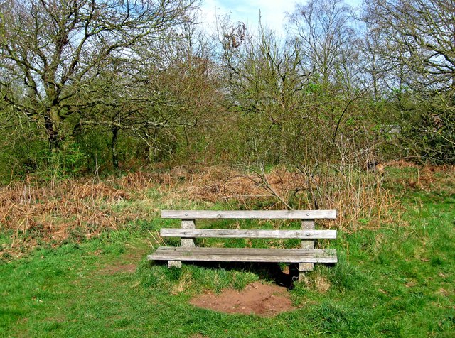
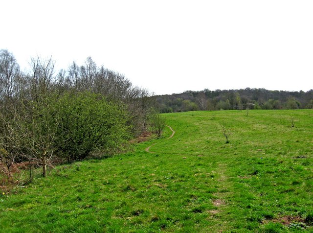
Salcum Coppice is crisscrossed by a network of well-maintained footpaths, allowing visitors to explore the woodland and appreciate its natural beauty. These paths wind through the ancient trees, offering stunning views of the surrounding countryside and providing opportunities for peaceful walks and picnics.

In addition to its natural beauty, Salcum Coppice also holds historical significance. It is believed to have been used for charcoal production in the past, and remnants of this industry can still be found within the woodland. These historical elements add an extra layer of intrigue to the site, making it an ideal destination for those interested in local history.

Whether it is the tranquility of a woodland stroll, the thrill of spotting wildlife, or the intrigue of local history, Salcum Coppice has something to offer for everyone. It is a hidden gem in Worcestershire, providing a peaceful retreat from the hustle and bustle of everyday life.

If you have any feedback on the listing, please let us know in the comments section below.

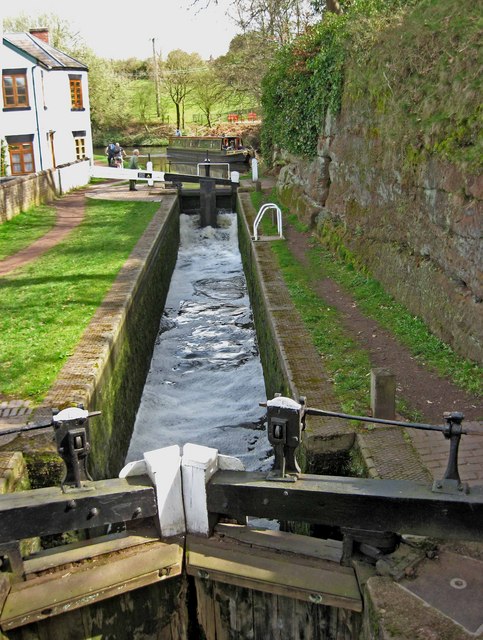
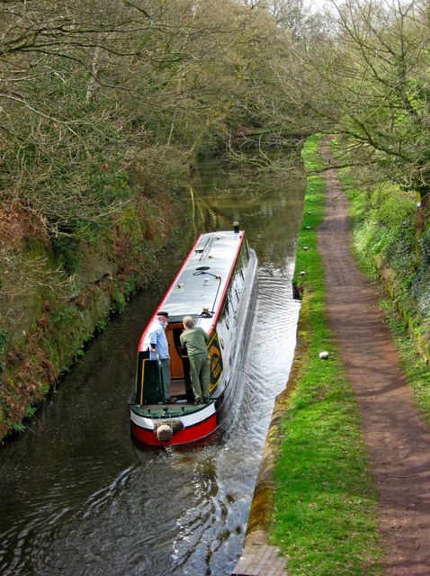
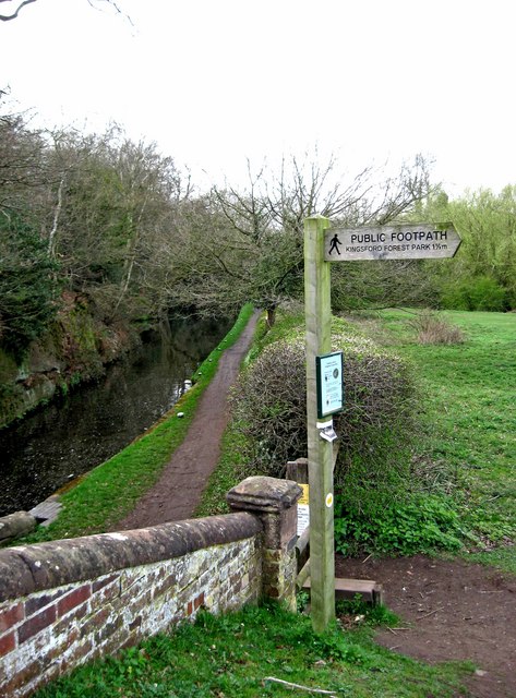
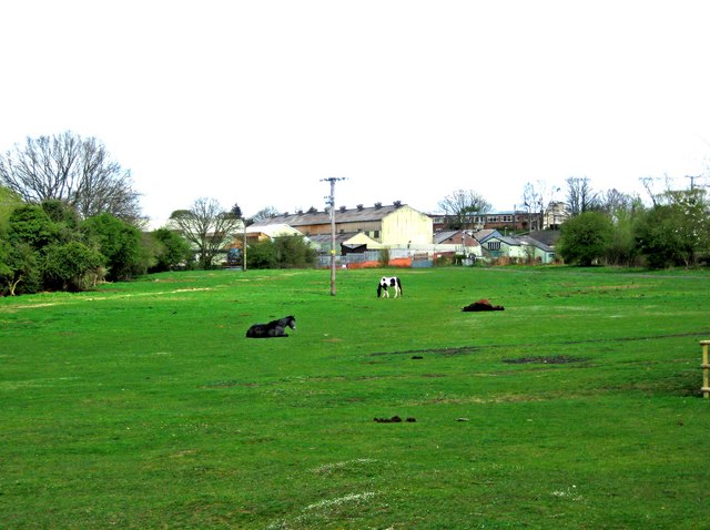
Solcum Coppice Images

Images are sourced within 2km of 52.422843/-2.2547947 or Grid Reference SO8280. Thanks to Geograph Open Source API. All images are credited.

Cookley Village Hall & Sports Club (1), Lea Lane, Cookley This £945,000 project was officially opened on the 5th February 2011. Over 300 people attended the opening. The facility replaced the old Parish Hall. The building comprises a sports club lounge, two meeting rooms with computers and internet, a kitchen, a snooker room and a 200 metre square hall, with a stage for performances.

<a href="https://www.geograph.org.uk/photo/2337173">SO8480 : Cookley Village Hall & Sports Club (2), Lea Lane, Cookley</a>.
Cookley Village Hall & Sports Club (1), Lea Lane, Cookley
This £945,000 project was officially opened on the 5th February 2011. Over 300 people attended the opening. The facility replaced the old Parish Hall. The building comprises a sports club lounge, two meeting rooms with computers and internet, a kitchen, a snooker room and a 200 metre square hall, with a stage for performances. SO8480 : Cookley Village Hall & Sports Club (2), Lea Lane, Cookley.
Cookley Village Hall & Sports Club (2), Lea Lane, Cookley Outside the new village hall are various sports facilities, a play area for children, and an area for BMX bikes etc and skateboarding, called the Wheels Area.

<a href="https://www.geograph.org.uk/photo/2337154">SO8480 : Cookley Village Hall & Sports Club (1), Lea Lane, Cookley</a>.
Cookley Village Hall & Sports Club (2), Lea Lane, Cookley
Outside the new village hall are various sports facilities, a play area for children, and an area for BMX bikes etc and skateboarding, called the Wheels Area. SO8480 : Cookley Village Hall & Sports Club (1), Lea Lane, Cookley.
Lea Lane, Cookley At the approach to the village of Cookley. On the left is the new Village Hall.

<a href="https://www.geograph.org.uk/photo/2337154">SO8480 : Cookley Village Hall & Sports Club (1), Lea Lane, Cookley</a>.
Lea Lane, Cookley
At the approach to the village of Cookley. On the left is the new Village Hall. SO8480 : Cookley Village Hall & Sports Club (1), Lea Lane, Cookley.
Former Lock Keeper's Cottage, Debdale Lock, Staffs & Worcs Canal near Cookley In the long ago days of freight being carried on the canal, there would have been a resident lock keeper living here.

A different view:- <a href="https://www.geograph.org.uk/photo/3217505">SO8480 : Former Lock Keeper's Cottage, Debdale Lock, near Cookley</a>.
Former Lock Keeper's Cottage, Debdale Lock, Staffs & Worcs Canal near Cookley
In the long ago days of freight being carried on the canal, there would have been a resident lock keeper living here. A different view:- SO8480 : Former Lock Keeper's Cottage, Debdale Lock, near Cookley.
Debdale Lock, Staffs & Worcs Canal, near Cookley A footpath continues from the bridge up to Cookley Playing Fields. In the other direction it goes to Kingsford Forest Park.
Debdale Lock, Staffs & Worcs Canal, near Cookley
A footpath continues from the bridge up to Cookley Playing Fields. In the other direction it goes to Kingsford Forest Park.
Boat in Debdale Lock, Staffs & Worcs Canal, near Cookley There is a cavern beside this lock, which apparently used to be used as a stables for horses pulling boats along the canal. There is room for about four horses to lie down.
Boat in Debdale Lock, Staffs & Worcs Canal, near Cookley
There is a cavern beside this lock, which apparently used to be used as a stables for horses pulling boats along the canal. There is room for about four horses to lie down.
Plaque at Debdale Bridge (No. 22), Staffs & Worcs Canal, near Cookley The small bridge at Debdale Lock is, not surprisingly, called Debdale Bridge, and numbered 22. Usually these plaques are affixed to the bridge, but this one is attached to the lock wall under the bridge. The style of the plaque would seem to indicate it is probably a replacement, rather than an original.

<a href="https://www.geograph.org.uk/photo/2340638">SO8480 : Debdale Lock, Staffs & Worcs Canal, near Cookley</a>.
Plaque at Debdale Bridge (No. 22), Staffs & Worcs Canal, near Cookley
The small bridge at Debdale Lock is, not surprisingly, called Debdale Bridge, and numbered 22. Usually these plaques are affixed to the bridge, but this one is attached to the lock wall under the bridge. The style of the plaque would seem to indicate it is probably a replacement, rather than an original. SO8480 : Debdale Lock, Staffs & Worcs Canal, near Cookley.
Debdale Lock, Staffs & Worcs Canal, near Cookley A narrowboat can be seen approaching the lock. The former lock keeper's cottage is on the left.

<a href="https://www.geograph.org.uk/photo/2340591">SO8480 : Former Lock Keeper's Cottage, Debdale Lock, Staffs & Worcs Canal near Cookley</a>.
Debdale Lock, Staffs & Worcs Canal, near Cookley
A narrowboat can be seen approaching the lock. The former lock keeper's cottage is on the left. SO8480 : Former Lock Keeper's Cottage, Debdale Lock, Staffs & Worcs Canal near Cookley.
Debdale Lock, Staffs & Worcs Canal, near Cookley Another view of the lock:- <a href="https://www.geograph.org.uk/photo/2340721">SO8480 : Debdale Lock, Staffs & Worcs Canal, near Cookley</a>, and <a href="https://www.geograph.org.uk/photo/2340638">SO8480 : Debdale Lock, Staffs & Worcs Canal, near Cookley</a>.
Debdale Lock, Staffs & Worcs Canal, near Cookley
Narrowboat west of Debdale Lock, Staffs & Worcs Canal, near Cookley The narrowboat has just left Debdale Lock. The canal is particularly narrow at this point, and it wouldn't be much fun meeting another boat around here. Photographed from Debdale Bridge.

<a href="https://www.geograph.org.uk/photo/2340658">SO8480 : Boat in Debdale Lock, Staffs & Worcs Canal, near Cookley</a>.
Narrowboat west of Debdale Lock, Staffs & Worcs Canal, near Cookley
The narrowboat has just left Debdale Lock. The canal is particularly narrow at this point, and it wouldn't be much fun meeting another boat around here. Photographed from Debdale Bridge. SO8480 : Boat in Debdale Lock, Staffs & Worcs Canal, near Cookley.
Signpost by Debdale Bridge, Staffs & Worcs Canal, near Cookley The signpost points across a field, where there is a public footpath to Kingsford Forest Park, about a mile and a half away. Behind the signpost can be seen the canal and towpath.

<a href="https://www.geograph.org.uk/photo/2340826">SO8480 : Footpath across a field, near Cookley</a>.
Signpost by Debdale Bridge, Staffs & Worcs Canal, near Cookley
The signpost points across a field, where there is a public footpath to Kingsford Forest Park, about a mile and a half away. Behind the signpost can be seen the canal and towpath. SO8480 : Footpath across a field, near Cookley.
Footpath across a field, near Cookley There is a public footpath across this field, although it isn't immediately obvious quite where the footpath is. It leads to the popular Kingsford Forest Park, which is a nice place for walking, riding and other outdoor pursuits. In the distance can be seen some industrial buildings, which are on the edge of the village of Cookley.

<a href="https://www.geograph.org.uk/photo/2340802">SO8480 : Signpost by Debdale Bridge, Staffs & Worcs Canal, near Cookley</a>.
Footpath across a field, near Cookley
There is a public footpath across this field, although it isn't immediately obvious quite where the footpath is. It leads to the popular Kingsford Forest Park, which is a nice place for walking, riding and other outdoor pursuits. In the distance can be seen some industrial buildings, which are on the edge of the village of Cookley. SO8480 : Signpost by Debdale Bridge, Staffs & Worcs Canal, near Cookley.
Seat in Horseshoe Meadow, near Cookley Horseshoe Meadow is part of Cookley Playing Fields, which is an area open to the public to enjoy. There is a path from near the seat, which leads down to a path by the Staffs & Worcs Canal, on the opposite side to the towpath.
Seat in Horseshoe Meadow, near Cookley
Horseshoe Meadow is part of Cookley Playing Fields, which is an area open to the public to enjoy. There is a path from near the seat, which leads down to a path by the Staffs & Worcs Canal, on the opposite side to the towpath.
Footpath across Horseshoe Meadow, near Cookley The footpath goes to the Village Hall and car park, with a branch leading off and descending to Debdale Lock, on the nearby Staffs & Worcs Canal. The meadow, which is part of Cookley Playing Fields, is not treated with chemicals or artificial fertilisers. It supports more than fifty species of wildflowers, grasses and associated wildlife.
Footpath across Horseshoe Meadow, near Cookley
The footpath goes to the Village Hall and car park, with a branch leading off and descending to Debdale Lock, on the nearby Staffs & Worcs Canal. The meadow, which is part of Cookley Playing Fields, is not treated with chemicals or artificial fertilisers. It supports more than fifty species of wildflowers, grasses and associated wildlife.
Notice board, Cookley Playing Fields, Cookley Much of what is still on the board concerns the construction of a "natural play area", work on which was due to start on the 11th June 2009. It is now complete.

<a href="https://www.geograph.org.uk/photo/2341532">SO8480 : Natural Play Area, Cookley Playing Fields, Cookley</a>.
Notice board, Cookley Playing Fields, Cookley
Much of what is still on the board concerns the construction of a "natural play area", work on which was due to start on the 11th June 2009. It is now complete. SO8480 : Natural Play Area, Cookley Playing Fields, Cookley.
Natural Play Area, Cookley Playing Fields, Cookley This is part of the Natural Play Area, on which work started in June 2009.

<a href="https://www.geograph.org.uk/photo/2341513">SO8480 : Notice board, Cookley Playing Fields, Cookley</a>.
Natural Play Area, Cookley Playing Fields, Cookley
This is part of the Natural Play Area, on which work started in June 2009. SO8480 : Notice board, Cookley Playing Fields, Cookley.
Information board at Cookley Playing Fields, Cookley The board gives much information about the many facilities at the site.
Information board at Cookley Playing Fields, Cookley
The board gives much information about the many facilities at the site.
The zig-zag path to the Canalside Terrace, Cookley Playing Fields, Cookley This view is near the start of the zig-zag path, which gently slopes down to the Canalside Terrace. The terrace gives good views of the Staffs & Worcs Canal, and Debdale Lock.
The zig-zag path to the Canalside Terrace, Cookley Playing Fields, Cookley
This view is near the start of the zig-zag path, which gently slopes down to the Canalside Terrace. The terrace gives good views of the Staffs & Worcs Canal, and Debdale Lock.
Show me another place!

Solcum Coppice is located at Grid Ref: SO8280 (Lat: 52.422843, Lng: -2.2547947)

Administrative County: Worcestershire

District: Wyre Forest

Police Authority: West Mercia

What 3 Words

///sofas.servicing.trace. Near Kinvere, Staffordshire

Nearby Locations

Solcum Coppice

Related Wikis

Blakeshall

Blakeshall is a hamlet in Worcestershire, England. It is one of the ancient townships of the manor of Wolverley, whose extent was similar to that of the...

Wolverley Church of England Secondary School

Wolverley CofE Secondary School is located in the village of Wolverley, near Kidderminster in Worcestershire, England. The mixed gender school has approximately...

Drakelow Hillfort

Drakelow Hillfort, is a small multivallate Iron Age hillfort, located on a promontory (known as Drakelow Hill) at Drakelow at the southern end of Kinver...

Drakelow Tunnels

Drakelow Tunnels are a former underground military complex beneath the Blakeshall Estate north of Kidderminster, Worcestershire, covering 285,000 sq ft...

Kingsford, Worcestershire

Kingsford is a large hamlet in Worcestershire, England. == Location == Kingsford is located one mile (1.6 km) north of the village of Wolverley, Worcestershire...
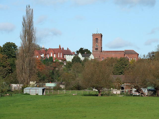
Wolverley

Wolverley is a village; with nearby Cookley (1 mi northeast), it forms a civil parish in the Wyre Forest District of Worcestershire, England. It is 2 miles...
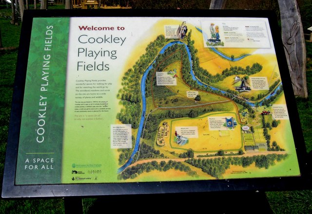
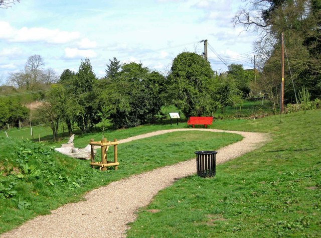
Cookley

Cookley is a village in the Wyre Forest District of Worcestershire, England, a few miles to the north of Kidderminster. Also, a few miles south-west of...
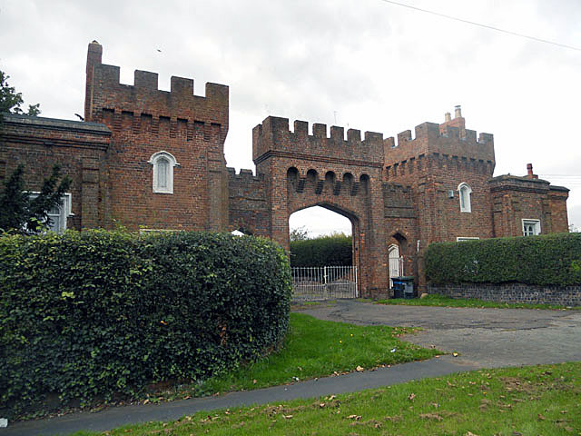
Lea Castle, England

Lea Castle is a ruined Grade II listed Neo Gothic mock castle mansion near Wolverley, England. == History == Lea Castle was built by Edward Knight in 1762...

Nearby Amenities

Located within 500m of 52.422843,-2.2547947
Barrier: stile
Source: survey
Lat/Long: 52.427162/-2.2567829
Barrier: kissing_gate
Source: survey
Lat/Long: 52.4264928/-2.2559914
The data included in this document is from www.openstreetmap.org. The data is made available under ODbL.

Have you been to Solcum Coppice?

Leave your review of Solcum Coppice below (or comments, questions and feedback).