New Coppice

Wood, Forest in Worcestershire Malvern Hills

England

New Coppice

Bridleway follows this access track
Bridleway follows this access track Credit: Sarah Charlesworth

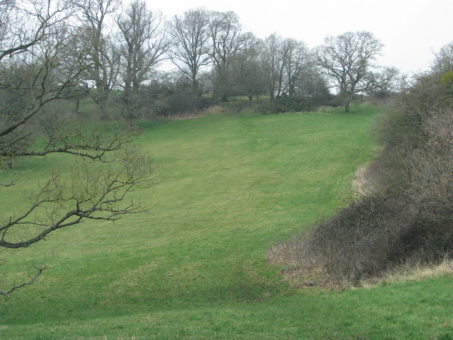
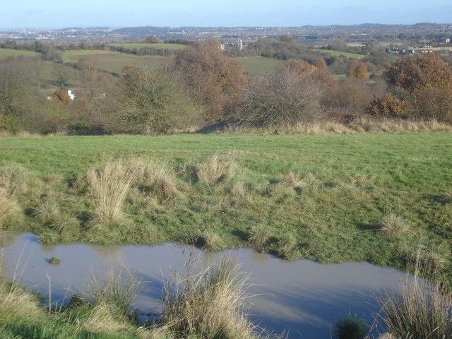
New Coppice is a picturesque woodland located in Worcestershire, England. Situated in the heart of the county, it covers an area of approximately 50 acres and is renowned for its natural beauty and diverse range of flora and fauna.

The woodland consists mainly of dense deciduous trees, including oak, beech, and ash, which create a stunning canopy of vibrant colors during the autumn months. The forest floor is adorned with a carpet of bluebells and wildflowers in the spring, making it a popular spot for nature enthusiasts and photographers.

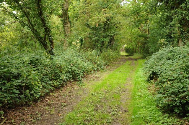
New Coppice offers a tranquil escape from the hustle and bustle of everyday life, providing visitors with the opportunity to immerse themselves in nature. The woodland is crisscrossed with well-maintained footpaths, enabling visitors to explore its hidden treasures. These paths lead to a variety of charming features, such as babbling brooks, small ponds, and ancient tree stumps, adding to the enchanting atmosphere of the forest.

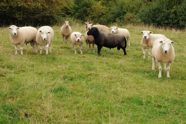
The woodland is also home to a wide range of wildlife, including deer, badgers, foxes, and a plethora of bird species. Birdwatchers can delight in spotting woodpeckers, owls, and various songbirds that inhabit the area.

New Coppice is a popular destination for outdoor activities such as walking, picnicking, and photography. It offers a peaceful and serene environment for individuals and families to escape into nature and enjoy its beauty. Whether visiting during the vibrant autumn or the blossoming spring, New Coppice is a must-visit destination for those seeking tranquility and a connection with the natural world.

If you have any feedback on the listing, please let us know in the comments section below.
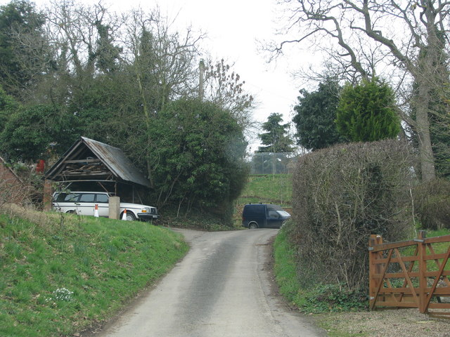
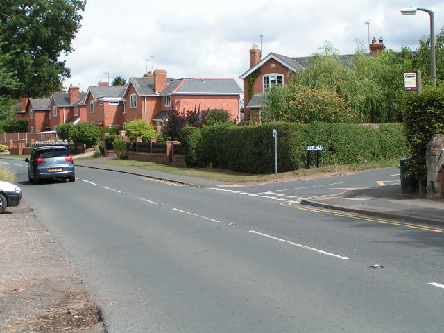
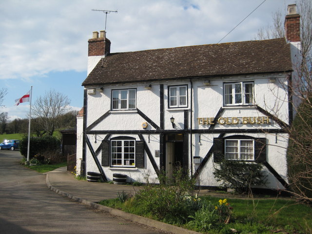
New Coppice Images

Images are sourced within 2km of 52.134969/-2.2615335 or Grid Reference SO8248. Thanks to Geograph Open Source API. All images are credited.
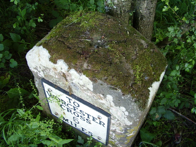
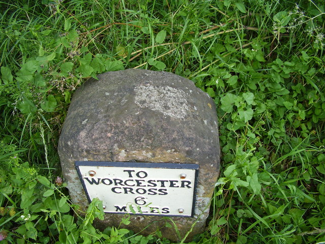
Bridleway follows this access track
Grassy field on the Old Hills
B4424 passing through Callow End
The Old Bush, Callow End Public house set back from the B4424 as it passes through the village of Callow End.
The Old Bush, Callow End
Public house set back from the B4424 as it passes through the village of Callow End.
Madresfield Court Viewed from Lady Howard De Walden's Drive on North Hill.
The court, currently covered in scaffolding, has been the ancestral home for several centuries of the Lygon family, whose eldest sons took the title of Earl Beauchamp from 1815 until 1979.
It is the real location for Evelyn Waugh's "Brideshead Revisited".
Madresfield Court
Viewed from Lady Howard De Walden's Drive on North Hill. The court, currently covered in scaffolding, has been the ancestral home for several centuries of the Lygon family, whose eldest sons took the title of Earl Beauchamp from 1815 until 1979. It is the real location for Evelyn Waugh's "Brideshead Revisited".
Meanders in the Severn
Madresfield Court
Madresfield Court
The Lime Arbour, Madresfield Court Gardens
Rock Garden, Madresfield Court
Bench mark on milestone This milestone is a Grade II listed structure, and the depression on top is probably the remains of a "pivot" bench mark established in 1844 during the First primary levelling of England & Wales, which was levelled with a height of 60.1740 feet [18.3410 metres] above mean sea level (Liverpool datum). It was included on the Manchester to Gloucester levelling line. The surveyor's description was "No. 393. Mark on top of the 4th milestone from Worcester, and 6th from Upton-on-Severn ; 2.54 ft. above centre of road." (Public Abstract p.35)
Bench mark on milestone
This milestone is a Grade II listed structure, and the depression on top is probably the remains of a "pivot" bench mark established in 1844 during the First primary levelling of England & Wales, which was levelled with a height of 60.1740 feet [18.3410 metres] above mean sea level (Liverpool datum). It was included on the Manchester to Gloucester levelling line. The surveyor's description was "No. 393. Mark on top of the 4th milestone from Worcester, and 6th from Upton-on-Severn ; 2.54 ft. above centre of road." (Public Abstract p.35)
OS bench mark on milestone This milestone is a Grade II listed structure, and the rivet on top was formerly an Ordnance Survey bench mark. A bench mark was originally established on this stone in 1844 during the First primary levelling of England & Wales, and levelled with a height of 124.008 feet above mean sea level (Liverpool datum). It was included on the Manchester to Gloucester levelling line. The surveyor's description was "No. 395. Mark on 5th milestone from Worcester ; 1.85 ft. above centre of road." (Public Abstract p.35)
OS bench mark on milestone
This milestone is a Grade II listed structure, and the rivet on top was formerly an Ordnance Survey bench mark. A bench mark was originally established on this stone in 1844 during the First primary levelling of England & Wales, and levelled with a height of 124.008 feet above mean sea level (Liverpool datum). It was included on the Manchester to Gloucester levelling line. The surveyor's description was "No. 395. Mark on 5th milestone from Worcester ; 1.85 ft. above centre of road." (Public Abstract p.35)
Milestone in layby This milestone (a Grade II listed structure) is on the east side of a bypassed portion of the old road, now a layby. A nineteenth-century benchmark on top, shown on old maps with a height of 66 ft above Ordnance Datum (Liverpool) appears to have been filled with cement at some stage. The 1904 map shows a north pointing arrow, which conforms to the shape of the cement fill.
Milestone in layby
This milestone (a Grade II listed structure) is on the east side of a bypassed portion of the old road, now a layby. A nineteenth-century benchmark on top, shown on old maps with a height of 66 ft above Ordnance Datum (Liverpool) appears to have been filled with cement at some stage. The 1904 map shows a north pointing arrow, which conforms to the shape of the cement fill.
Stubble fields and Frieze Wood Stubble fields and Frieze Wood viewed from a footpath to the north of Clevelode.
Stubble fields and Frieze Wood
Stubble fields and Frieze Wood viewed from a footpath to the north of Clevelode.
Tree and a headland footpath Tree and a headland footpath beside a stubble field near Clevelode.
Tree and a headland footpath
Tree and a headland footpath beside a stubble field near Clevelode.
Field edge footpath footpath along the side of an arable field near Clevelode.
Field edge footpath
footpath along the side of an arable field near Clevelode.
Arable field at Clevelode View across an arable field to the Malvern Hills from Clevelode.
Arable field at Clevelode
View across an arable field to the Malvern Hills from Clevelode.
Woodland path near Saint Cloud Woodland path near Saint Cloud, south of Callow End.
Woodland path near Saint Cloud
Woodland path near Saint Cloud, south of Callow End.
A handsome bunch A flock of rams, mainly Texells, awaiting this autumn's serving the ewes.
A handsome bunch
A flock of rams, mainly Texells, awaiting this autumn's serving the ewes.
Show me another place!

New Coppice is located at Grid Ref: SO8248 (Lat: 52.134969, Lng: -2.2615335)

Administrative County: Worcestershire

District: Malvern Hills

Police Authority: West Mercia

What 3 Words

///myth.extension.artist. Near Kempsey, Worcestershire

Nearby Locations

New Coppice Old Hills

Related Wikis

Old Hills

The Old Hills are an area of common land in Worcestershire, England. They are located around two miles to the east of Great Malvern and about a mile west...

Clevelode

Clevelode is a small village in Worcestershire, England. It is located around 5 miles south of Worcester just to the west of the River Severn. Clevelode...

Callow End

Callow End is a constituent village of the civil parish of Powick in the Malvern Hills District of Worcestershire, England. It is located on the B4424...
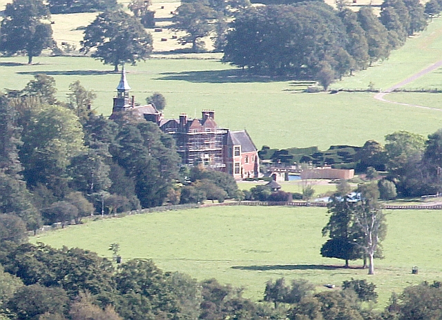
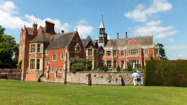
Madresfield Court

Madresfield Court is a country house in Malvern, Worcestershire, England. The home of the Lygon family for nearly six centuries, it has never been sold...

Madresfield

Madresfield is a village and civil parish in the administrative district of Malvern Hills in the county of Worcestershire, England. It is located about...
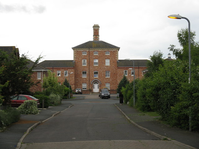
Powick Hospital

Powick Hospital, which opened in 1847 was a psychiatric facility located on 552 acres (223 ha) outside the village of Powick, near Malvern, Worcestershire...

Bowling Green, Worcestershire

Bowling Green is a village in Worcestershire, England.

Newland, Worcestershire

Newland is a village and civil parish on the north-eastern edge of Malvern Link, Worcestershire, England, on the A449 road. The village lies on the edge...

Nearby Amenities

Located within 500m of 52.134969,-2.2615335
Old Hills
Man Made: survey_point
Ref: S3791
Lat/Long: 52.1368141/-2.2554556
Barrier: stile
Foot: yes
Lat/Long: 52.135629/-2.2619923
Barrier: stile
Foot: yes
Lat/Long: 52.1328367/-2.2644417
Barrier: stile
Lat/Long: 52.139195/-2.2603351
Old Hills
Natural: peak
Lat/Long: 52.1368145/-2.2554232
Balls Hill Cottage
Power: pole
Transformer: distribution
Voltage Primary: 11000
Lat/Long: 52.1339606/-2.2609077
Old Hills Cottage - Trans
Power: pole
Transformer: distribution
Voltage Primary: 11000
Lat/Long: 52.1357123/-2.2576086
Old Hills Cottage
Power: pole
Transformer: distribution
Voltage Primary: 11000
Lat/Long: 52.1391019/-2.2604705
Location Transition: yes
Power: pole
Lat/Long: 52.139381/-2.2604182
The data included in this document is from www.openstreetmap.org. The data is made available under ODbL.

Have you been to New Coppice?

Leave your review of New Coppice below (or comments, questions and feedback).