Bogs Wood

Wood, Forest in Staffordshire Newcastle-under-Lyme

England

Bogs Wood

Trees at Keele Christmas Tree Farm
Trees at Keele Christmas Tree Farm Credit: Jonathan Hutchins

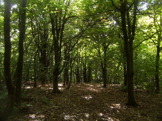
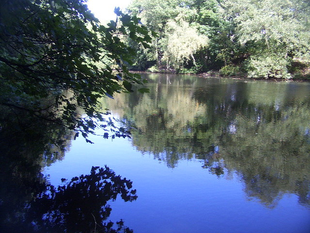
Bogs Wood is a woodland area located in Staffordshire, England. Covering an area of approximately 40 hectares, it is situated near the village of Abbots Bromley, in the East Staffordshire district. The wood is part of the wider Bagot Forest, which is managed by the Forestry Commission.

Bogs Wood is predominantly composed of deciduous trees, including oak, birch, and beech. These trees provide a rich habitat for various wildlife species, such as deer, badgers, and a variety of bird species. The wood is also home to a range of flora, including bluebells, wood anemones, and wild garlic, which create a vibrant and colorful landscape during the spring season.

Visitors to Bogs Wood can enjoy a network of well-maintained footpaths and trails, allowing them to explore the wood and appreciate its natural beauty. The woodland offers a peaceful and tranquil environment, making it a popular destination for walking, hiking, and nature enthusiasts.

Additionally, Bogs Wood has historical significance as it is believed to have been part of the ancient hunting grounds of the Bagot family, who were influential landowners in the area. The wood has been carefully managed over the years to maintain its ecological balance while preserving its historical value.

Overall, Bogs Wood is a picturesque woodland area in Staffordshire, offering a diverse range of flora and fauna, as well as providing a tranquil escape for visitors to enjoy nature and the great outdoors.

If you have any feedback on the listing, please let us know in the comments section below.
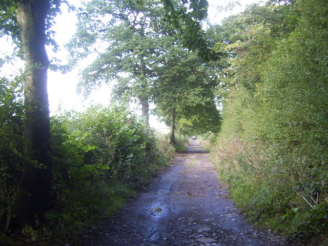
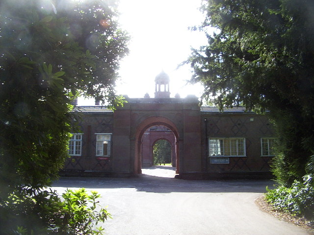
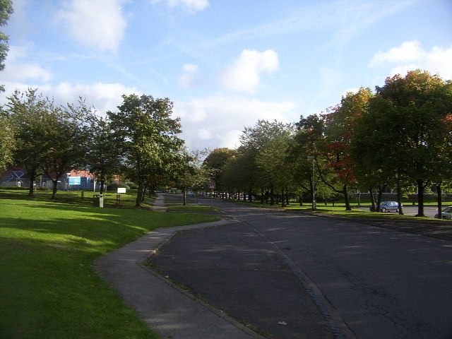
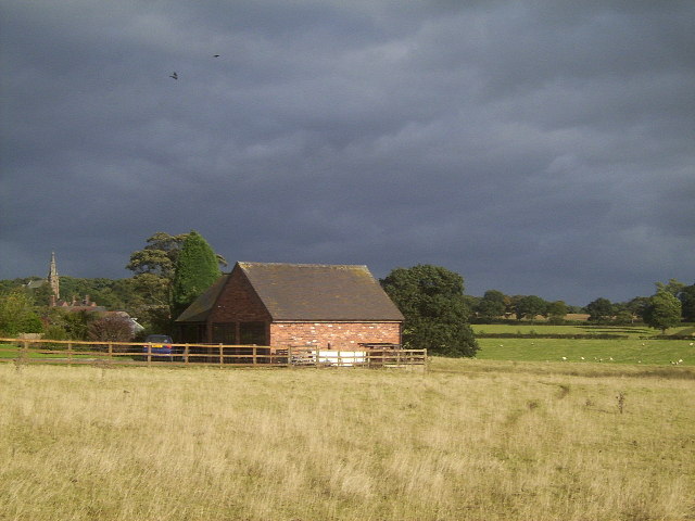
Bogs Wood Images

Images are sourced within 2km of 53.008001/-2.2727612 or Grid Reference SJ8145. Thanks to Geograph Open Source API. All images are credited.

Trees at Keele Christmas Tree Farm
Keele Christmas Tree Farm
Hedge Near Highway Farm Pasture land south-west of Keele
Hedge Near Highway Farm
Pasture land south-west of Keele
Keele Christmas Tree Farm A popular local source of Christmas trees from late November onwards <span class="nowrap"><a title="http://keelechristmastreefarm.co.uk" rel="nofollow ugc noopener" href="http://keelechristmastreefarm.co.uk">Link</a><img style="margin-left:2px;" alt="External link" title="External link - shift click to open in new window" src="https://s1.geograph.org.uk/img/external.png" width="10" height="10"/></span>
Keele Christmas Tree Farm
A popular local source of Christmas trees from late November onwards LinkExternal link
Disused Railway Lines between Silverdale Tunnel and Keele Station The first part of the line to be built required the private Silverdale & Newcastle Railway, built in 1850 by ironmaster Ralph Sneyd, to become public. This was enabled by an Act of 1859 and passenger services from Stoke to Newcastle began in 1862. Silverdale was reached in May 1863.

Meanwhile, the Great Western Railway was planning to reach Manchester and in an effort to block this, the Market Drayton extension was completed in February 1870.
The last traffic on the line was coal from Apedale and Silverdale collieries, which ceased in December 1998 when the latter was closed.

<span class="nowrap"><a title="https://en.wikipedia.org/wiki/Stoke_to_Market_Drayton_Line" rel="nofollow ugc noopener" href="https://en.wikipedia.org/wiki/Stoke_to_Market_Drayton_Line">Link</a><img style="margin-left:2px;" alt="External link" title="External link - shift click to open in new window" src="https://s1.geograph.org.uk/img/external.png" width="10" height="10"/></span>
Disused Railway Lines between Silverdale Tunnel and Keele Station
The first part of the line to be built required the private Silverdale & Newcastle Railway, built in 1850 by ironmaster Ralph Sneyd, to become public. This was enabled by an Act of 1859 and passenger services from Stoke to Newcastle began in 1862. Silverdale was reached in May 1863. Meanwhile, the Great Western Railway was planning to reach Manchester and in an effort to block this, the Market Drayton extension was completed in February 1870. The last traffic on the line was coal from Apedale and Silverdale collieries, which ceased in December 1998 when the latter was closed. LinkExternal link
Keele Hall, Keele This historic house now forms part of the campus of the University of Keele. Some of the grounds of the house still also survive.
Keele Hall, Keele
This historic house now forms part of the campus of the University of Keele. Some of the grounds of the house still also survive.
Keele Service Station The service station on the M6 very early in the morning.
Keele Service Station
The service station on the M6 very early in the morning.
Keele University Observatory The University observatory houses a 60cm telescope. Here a mount for another telescope can be seen in the foreground.
Keele University Observatory
The University observatory houses a 60cm telescope. Here a mount for another telescope can be seen in the foreground.
Woods near Keele University An early autumn day in the woods near Keele University. A lot of this square is open woodland that used to form the grounds of Keele Hall. Since the University took over the Hall and its 617 acre grounds, this area is now public access, with many footpaths among the trees and ponds.
Woods near Keele University
An early autumn day in the woods near Keele University. A lot of this square is open woodland that used to form the grounds of Keele Hall. Since the University took over the Hall and its 617 acre grounds, this area is now public access, with many footpaths among the trees and ponds.
Pool near Keele Hall This is the lowermost of the ponds that extend south-east from Keele Hall <a href="https://www.geograph.org.uk/photo/14295">SJ8144 : Keele Hall, Keele</a> towards Springpool Wood. There are many possible walks around the area.
Pool near Keele Hall
This is the lowermost of the ponds that extend south-east from Keele Hall SJ8144 : Keele Hall, Keele towards Springpool Wood. There are many possible walks around the area.
The Lymes Road More of The Lymes Road (see <a href="https://www.geograph.org.uk/gridref/SJ8243">SJ8243</a>), which runs between Keele village and The Lymes farm.
The Lymes Road
More of The Lymes Road (see SJ8243), which runs between Keele village and The Lymes farm.
The Clock House The Clock House, part of Keele University. It also houses the Music Department and has an attractive rock-cutting entrance.
The Clock House
The Clock House, part of Keele University. It also houses the Music Department and has an attractive rock-cutting entrance.
Keele University Campus Part of Keele University Campus, near Barnes Hall. This is effectively the "main street" of Keele Campus, which continues east into the next square.
Keele University Campus
Part of Keele University Campus, near Barnes Hall. This is effectively the "main street" of Keele Campus, which continues east into the next square.
Keele Suburbia There are many possible shots to take of Keele, but this one ended up being the best. Taken from Highway Lane, a set of "well-to-do" houses, it typifies the more upmarket side of having a university on your door and yet being surrounded by countryside. On the left of the image is Keele Parish Church.
Keele Suburbia
There are many possible shots to take of Keele, but this one ended up being the best. Taken from Highway Lane, a set of "well-to-do" houses, it typifies the more upmarket side of having a university on your door and yet being surrounded by countryside. On the left of the image is Keele Parish Church.
Chapel, Silverdale Cemetery
Silverdale Colliery
Silverdale Colliery
Roundabout on the A525 Not very many interesting things in this square, in my opinion! I figured this view down the A525 towards Newcastle-under-Lyme and Stoke is worth showing, though.
Roundabout on the A525
Not very many interesting things in this square, in my opinion! I figured this view down the A525 towards Newcastle-under-Lyme and Stoke is worth showing, though.
Show me another place!

Bogs Wood is located at Grid Ref: SJ8145 (Lat: 53.008001, Lng: -2.2727612)

Administrative County: Staffordshire

District: Newcastle-under-Lyme

Police Authority: Staffordshire

What 3 Words

///tune.class.amused. Near Keele, Staffordshire

Related Wikis

Keele University School of Medicine

Keele University School of Medicine is a medical school located in Newcastle-under-Lyme and Shrewsbury. The first two years of the school's MBChB degree...

Keele University Science & Business Park

Keele University Science and Innovation Park is a science and business development facility located on the campus of Keele University in North Staffordshire...

Keele University

Keele University, officially known as the University of Keele, is a public research university in Keele, approximately three miles (five kilometres) from...
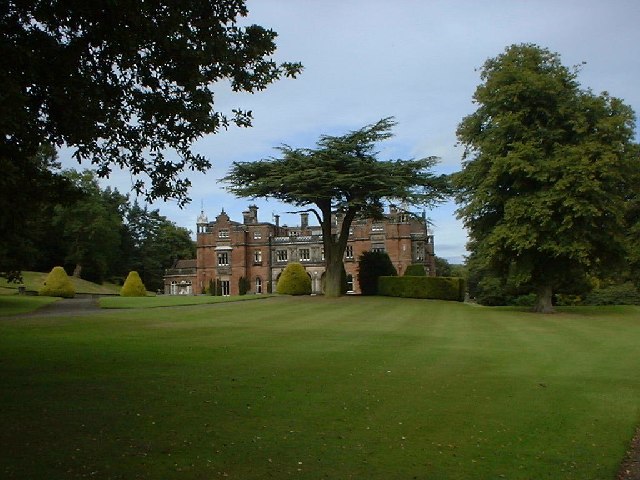
Keele Hall

Keele Hall is a 19th-century mansion house at Keele, Staffordshire, England, now standing on the campus of Keele University and serving as the university...

Nearby Amenities

Located within 500m of 53.008001,-2.2727612
Barrier: bollard
Lat/Long: 53.0072826/-2.2692502
Bus Stop
Barnes Hall
Naptan AtcoCode: 3800C502800
Naptan Bearing: NE
Naptan CommonName: Barnes Hall
Naptan Indicator: Adj
Naptan Landmark: Barnes Hall
Naptan PlusbusZoneRef: STOKEOT
Naptan Street: Main Road
Shelter: yes
Source: naptan_import;survey
Lat/Long: 53.0052668/-2.2691118
Bus Stop
Barnes Hall
Naptan AtcoCode: 3800C502801
Naptan Bearing: SW
Naptan CommonName: Barnes Hall
Naptan Indicator: Opp
Naptan Landmark: Barnes Hall
Naptan PlusbusZoneRef: STOKEOT
Naptan Street: Main Road
Source: naptan_import;survey;Bing
Lat/Long: 53.0053561/-2.2682329
Crossing
Crossing: traffic_signals
Lat/Long: 53.0073744/-2.2692069
Crossing
Crossing: zebra
Lat/Long: 53.0042746/-2.27257
Barnes Hall
Place: locality
Lat/Long: 53.0054742/-2.2710132
Post Box
Collection Times: Mo-Fr 16:30; Sa 11:15
Operator: Royal Mail
Post Box Type: pillar
Ref: ST5 583
Royal Cypher: EIIR
Royal Cypher Wikidata: Q33102113
Lat/Long: 53.0052802/-2.2690536
Crossing
Lat/Long: 53.0055617/-2.2676265
Restaurant
Lat/Long: 53.0050008/-2.2756878
Crossing
Crossing: zebra
Lat/Long: 53.004105/-2.2723457
Crossing
Crossing: zebra
Lat/Long: 53.0041694/-2.2724362
Crossing
Crossing: zebra
Lat/Long: 53.0043221/-2.2725975
Crossing
Crossing: zebra
Lat/Long: 53.0036189/-2.2719829
Crossing
Crossing: zebra
Lat/Long: 53.0036512/-2.2718839
Entrance: yes
Lat/Long: 53.0038124/-2.2739769
Bicycle Repair Station
Fee: no
Opening Hours: 24/7
Operator: Keele University
Lat/Long: 53.0048462/-2.2756607
Bicycle Parking
Bicycle Parking: covered_staple
Lat/Long: 53.0049035/-2.2757157
Bench
Source: survey
Lat/Long: 53.0087102/-2.2702383
Tourism: viewpoint
Lat/Long: 53.0088199/-2.271009
Barrier: bollard
Lat/Long: 53.0040814/-2.2749296
Recycling
Recycling Cans: yes
Recycling Cardboard: yes
Recycling Glass: yes
Recycling Glass Bottles: yes
Recycling Paper: yes
Recycling Plastic Bottles: yes
Recycling Waste: yes
Recycling Type: centre
Lat/Long: 53.0065975/-2.2674554
Bicycle Parking
Capacity: 12
Covered: yes
Lat/Long: 53.0064893/-2.2674874
Bicycle Parking
Capacity: 20
Covered: yes
Lat/Long: 53.0062258/-2.2705119
Recycling
Recycling Cans: yes
Recycling Cardboard: yes
Recycling Glass: yes
Recycling Glass Bottles: yes
Recycling Plastic: yes
Recycling Plastic Bottles: yes
Recycling Plastic Packaging: no
Recycling Waste: yes
Recycling Type: centre
Lat/Long: 53.0058887/-2.268492
Bicycle Parking
Capacity: 10
Lat/Long: 53.0055726/-2.268477
Charging Station
Capacity: 4
Lat/Long: 53.0064825/-2.2675316
Charging Station
Lat/Long: 53.0046982/-2.275784
Drinking Water
Bottle: yes
Lat/Long: 53.0040432/-2.2746096
Operator: Internet Central
Telecom: data_center
Lat/Long: 53.003893/-2.2699405
The data included in this document is from www.openstreetmap.org. The data is made available under ODbL.

Have you been to Bogs Wood?

Leave your review of Bogs Wood below (or comments, questions and feedback).