Grindon Wood
Wood, Forest in Northumberland
England
Grindon Wood
Grindon Wood is a picturesque woodland located in the county of Northumberland, England. Covering an area of approximately 200 acres, it is nestled within the North Pennines Area of Outstanding Natural Beauty. The wood is situated near the small village of Blanchland, adding to its charm and accessibility.
This ancient woodland is predominantly made up of native broadleaf trees, including oak, ash, and birch, which create a diverse and rich habitat for wildlife. The woodland floor is adorned with a carpet of bluebells during the springtime, adding a burst of vibrant color to the surroundings. Grindon Wood also boasts a variety of ferns, mosses, and fungi, further enhancing its natural beauty.
The wood is crisscrossed by a network of well-maintained footpaths, making it a popular destination for walkers and nature enthusiasts. These paths lead visitors through a variety of different habitats, including open glades, dense woodland, and babbling streams. Along the way, visitors may catch glimpses of the local wildlife, such as red squirrels, roe deer, and a variety of bird species.
Grindon Wood offers a peaceful and tranquil setting, inviting visitors to explore its hidden wonders and immerse themselves in nature. It is a fantastic location for photography, wildlife spotting, or simply enjoying a leisurely stroll. Whether visiting in the vibrant colors of spring or the rich hues of autumn, Grindon Wood is a delightful destination for all nature lovers.
If you have any feedback on the listing, please let us know in the comments section below.
Grindon Wood Images
Images are sourced within 2km of 55.019714/-2.2865243 or Grid Reference NY8169. Thanks to Geograph Open Source API. All images are credited.


Grindon Wood is located at Grid Ref: NY8169 (Lat: 55.019714, Lng: -2.2865243)
Unitary Authority: Northumberland
Police Authority: Northumbria
What 3 Words
///axed.acrobats.hails. Near Haydon Bridge, Northumberland
Nearby Locations
Related Wikis

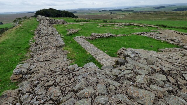
Hadrian's Wall
Hadrian's Wall (Latin: Vallum Hadriani, also known as the Roman Wall, Picts' Wall, or Vallum Aelium in Latin), is a former defensive fortification of the...
Milecastle 34
Milecastle 34 (Grindon) was a milecastle of the Roman Hadrian's Wall. There are no visible remains, but the site is within a small, tree-filled, walled...

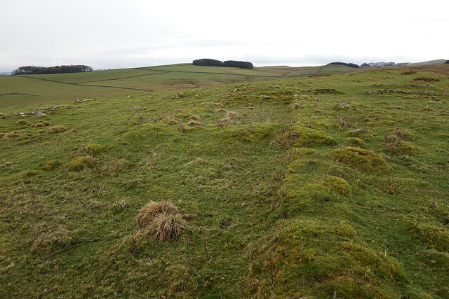
Milecastle 35
Milecastle 35 (Sewingshields) is one of the milecastles on Hadrian's Wall (grid reference NY80497018). The remains still exist as exposed masonry. ��2...
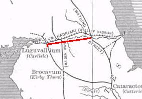
Stanegate
The Stanegate (meaning "stone road" in Northumbrian dialect) was an important Roman road built in what is now northern England. It linked many forts including...

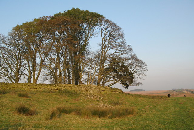
Milecastle 33
Milecastle 33 (Shield on the Wall) was a milecastle of the Roman Hadrian's Wall, one of a series of small fortlets built at intervals of approximately...

Milecastle 36
Milecastle 36 (King's Hill) was one of the milecastles on Hadrian's Wall (grid reference NY79726931). There is little to see on the ground as most of the...

Halleypike Lough
Halleypike Lough is an inland lake on Haughton Common at the southern edge of Northumberland National Park, northeast of Bardon Mill, and 1 mile (1.6 km...

Broomlee Lough
Broomlee Lough is an inland lake in Northumberland, England at the southern edge of Northumberland National Park. The lough lies immediately north of the...
Related Videos

Hadrian's Wall Path: 3 Day Hike
A 3 day hike taking in 65 miles of the Hadrian's Wall Path. Starting in Carlisle and ending in Newcastle.

Hadrian's Wall | Walking The Wall At Housesteads Roman Fort
In this Vlog, Global Gumboots visit Hadrian's Wall stopping at Heddon On The Wall and Houseteads Roman Fort. It's then off to ...

![Ep 37: Hadrian's Wall, UK [Newcastle, Parking, a wild goose chase to retake a vintage travel photo]](https://i.ytimg.com/vi/mtc76VSiitc/hqdefault.jpg)
Ep 37: Hadrian's Wall, UK [Newcastle, Parking, a wild goose chase to retake a vintage travel photo]
Hello everyone Will and Alex here, and today we're in Newcastle Upon Tyne in the northeast of England visiting friends and ...
Nearby Amenities
Located within 500m of 55.019714,-2.2865243Have you been to Grindon Wood?
Leave your review of Grindon Wood below (or comments, questions and feedback).