Brogden's Plantation

Wood, Forest in Westmorland Eden

England

Brogden's Plantation

Looking over Swindale The view from the bridleway at Helbeck looking over the wooded valley to the distant fells above Kirkby Stephen and Mallerstang.
Looking over Swindale Credit: Karl and Ali

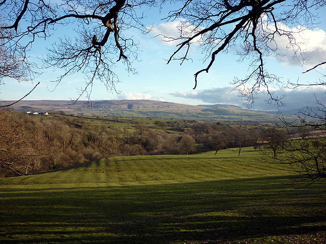
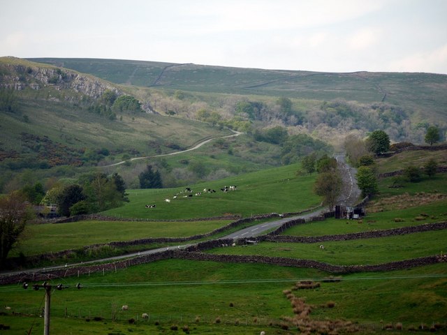
Brogden's Plantation is a charming and historic estate located in the picturesque district of Westmorland, known for its lush woodlands and stunning forests. Situated amidst the natural beauty of the area, the plantation covers a vast expanse of land, offering a serene and idyllic setting for visitors.

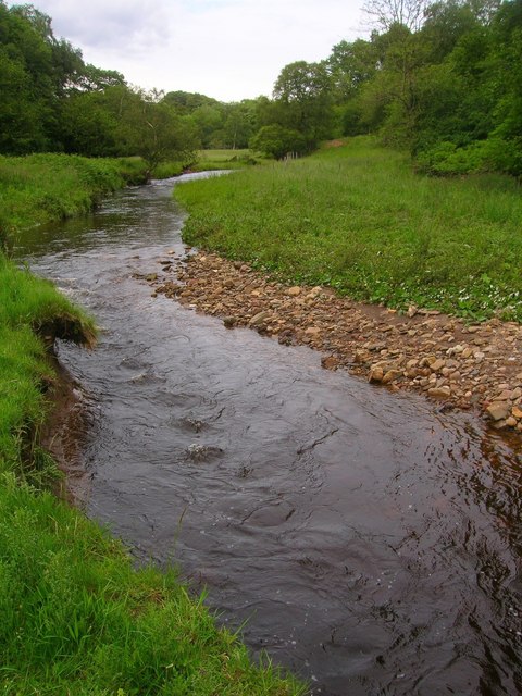
The plantation is renowned for its well-preserved woodlands, which are home to a diverse range of flora and fauna. Towering trees, including oak, maple, and pine, create a dense canopy overhead, providing shade and adding to the overall enchanting ambiance. The forest floor is carpeted with a variety of wildflowers, ferns, and mosses, creating a vibrant and colorful landscape.

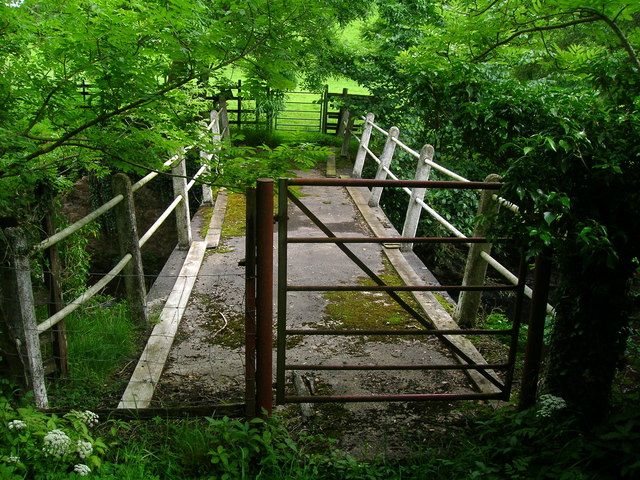
Brogden's Plantation is a haven for nature enthusiasts, offering numerous trails for hiking and exploring the natural surroundings. Visitors can immerse themselves in the peaceful atmosphere, enjoying the sights and sounds of the forest. Birdwatchers will be delighted by the abundance of avian species that call the plantation home, including woodpeckers, owls, and songbirds.

The estate also boasts a historic manor house, which dates back to the 18th century. The grand architecture and elegant interiors provide a glimpse into the plantation's rich history and heritage. Visitors can take guided tours of the house, learning about the fascinating stories of the Brogden family and their significant contributions to the region.

Whether it's a leisurely stroll through the woods, a visit to the manor house, or simply soaking in the tranquility of the surroundings, Brogden's Plantation offers a truly immersive and unforgettable experience for those seeking to connect with nature and history.

If you have any feedback on the listing, please let us know in the comments section below.

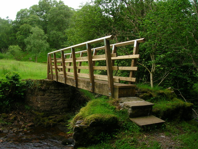
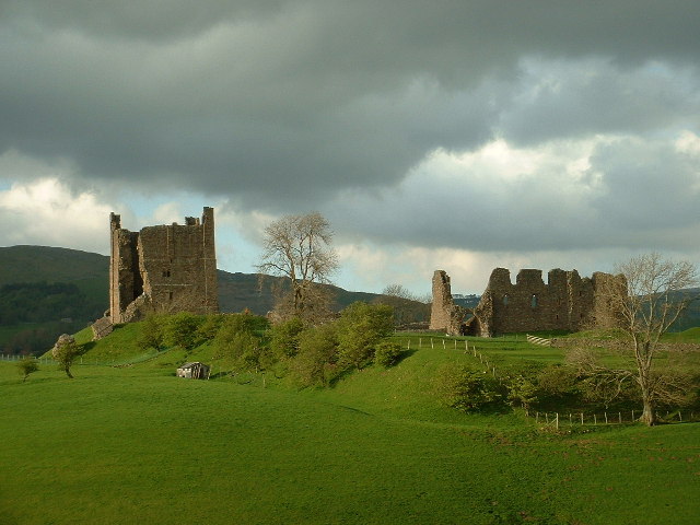
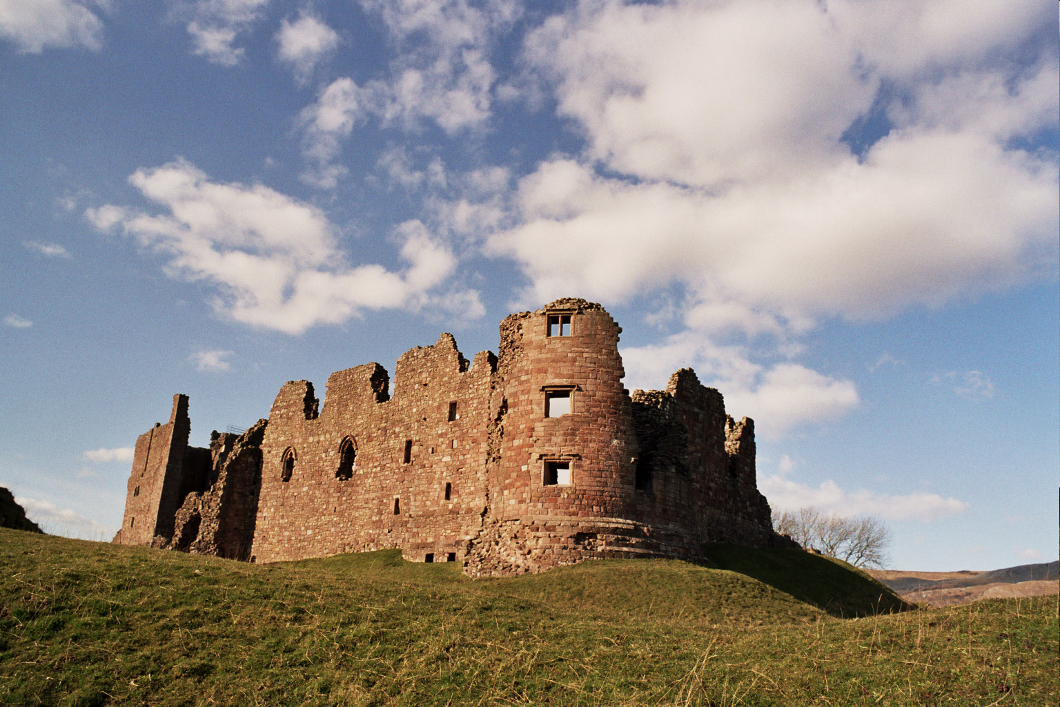
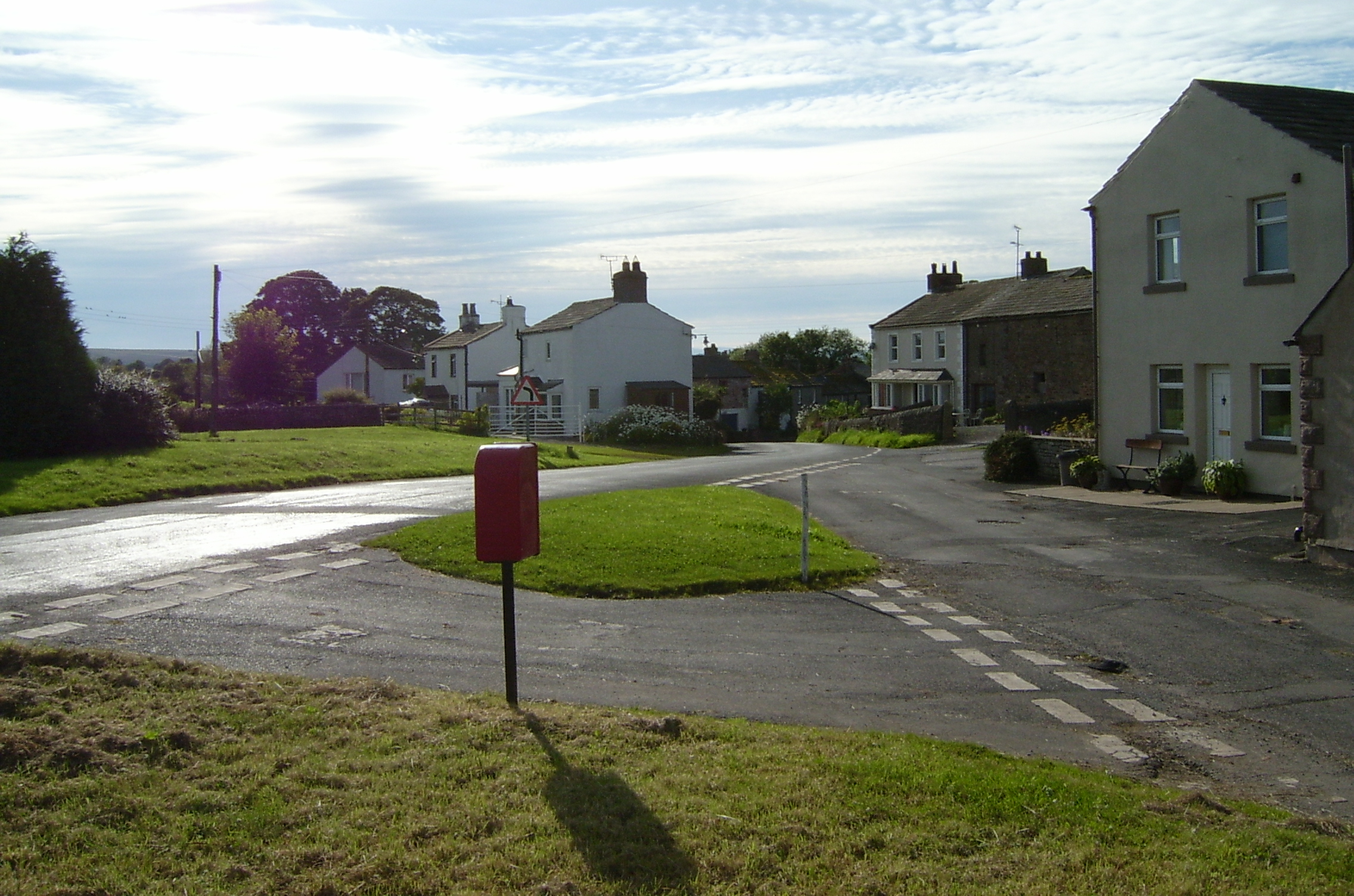
Brogden's Plantation Images

Images are sourced within 2km of 54.52189/-2.2854506 or Grid Reference NY8114. Thanks to Geograph Open Source API. All images are credited.

Looking over Swindale The view from the bridleway at Helbeck looking over the wooded valley to the distant fells above Kirkby Stephen and Mallerstang.
Looking over Swindale
The view from the bridleway at Helbeck looking over the wooded valley to the distant fells above Kirkby Stephen and Mallerstang.
Road from Brough to Middleton in Teesdale The wooded valley of the Swindale Beck can be seen beyond the road.
Road from Brough to Middleton in Teesdale
The wooded valley of the Swindale Beck can be seen beyond the road.
Footbridge over River Belah at Field Head
Farm track from Field Head
Argill Beck
Argill Beck
Footbridge over Argill Beck
A66 east of Brough The A66 is a major road in northern England running from near Middlesbrough to Workington. The section between Scotch Corner and Penrith is a Trans-Pennine route between the A1 and M6, following an old Roman Road.
Wikipedia: <span class="nowrap"><a title="http://en.wikipedia.org/wiki/A66_road" rel="nofollow ugc noopener" href="http://en.wikipedia.org/wiki/A66_road">Link</a><img style="margin-left:2px;" alt="External link" title="External link - shift click to open in new window" src="https://s1.geograph.org.uk/img/external.png" width="10" height="10"/></span>
A66 east of Brough
The A66 is a major road in northern England running from near Middlesbrough to Workington. The section between Scotch Corner and Penrith is a Trans-Pennine route between the A1 and M6, following an old Roman Road. Wikipedia: LinkExternal link
Pennistone Green Farm
Woodland south of the A66 near Augill Bridge
Ordnance Survey Triangulation Pillar Plaque This plaque can be found on the trig pillar at Limes Head.
Ordnance Survey Triangulation Pillar Plaque
This plaque can be found on the trig pillar at Limes Head.
Ordnance Survey Cut Mark This mark can be found on a gatepost beside the road to Limes Head.
For more detail see : <span class="nowrap"><a title="http://www.bench-marks.org.uk/bm43338" rel="nofollow ugc noopener" href="http://www.bench-marks.org.uk/bm43338">Link</a><img style="margin-left:2px;" alt="External link" title="External link - shift click to open in new window" src="https://s1.geograph.org.uk/img/external.png" width="10" height="10"/></span>
Ordnance Survey Cut Mark
This mark can be found on a gatepost beside the road to Limes Head. For more detail see : LinkExternal link
A66 from eastbound exit from Brough
A66 west of North Stainmore junction Heading east the junction is signposted
A66 west of North Stainmore junction
Heading east the junction is signposted
A66 at North Stainmore junction
Minor road off the A66, North Stainmore
Pennistone Green Farm
South of the A66 at Newton Garth
A66 east of Brough The A66 is a major road in northern England running from near Middlesbrough to Workington. The section between Scotch Corner and Penrith is a Trans-Pennine route between the A1 and M6, following an old Roman Road.
Wikipedia: <span class="nowrap"><a title="http://en.wikipedia.org/wiki/A66_road" rel="nofollow ugc noopener" href="http://en.wikipedia.org/wiki/A66_road">Link</a><img style="margin-left:2px;" alt="External link" title="External link - shift click to open in new window" src="https://s1.geograph.org.uk/img/external.png" width="10" height="10"/></span>
A66 east of Brough
The A66 is a major road in northern England running from near Middlesbrough to Workington. The section between Scotch Corner and Penrith is a Trans-Pennine route between the A1 and M6, following an old Roman Road. Wikipedia: LinkExternal link
Show me another place!

Brogden's Plantation is located at Grid Ref: NY8114 (Lat: 54.52189, Lng: -2.2854506)

Administrative County: Cumbria

District: Eden

Police Authority: Cumbria

What 3 Words

///quieter.freezers.radically. Near Kirkby Stephen, Cumbria

Related Wikis

Stainmore

Stainmore is a remote geographic area in the Pennines on the border of Cumbria, County Durham and North Yorkshire. The name is used for a civil parish...

A66 road

The A66 is a major road in Northern England, which in part follows the course of the Roman road from Scotch Corner to Penrith. It runs from east of Middlesbrough...

Verterae

Verterae was a Roman fort in the modern-day village of Brough, Cumbria, England. Occupied between the 1st and 5th centuries AD, it protected a key Roman...

Brough, Cumbria

Brough (), sometimes known as Brough under Stainmore, is a village and civil parish in the Westmorland and Furness unitary authority of Cumbria, England...

Brough Castle

Brough Castle is a ruined castle in the village of Brough, Cumbria, England. The castle was built by William Rufus around 1092 within the old Roman fort...

Helbeck

Helbeck is a settlement and civil parish near the village of Brough, in the Eden district, in the county of Cumbria, England. There is a wood called Helbeck...

Brough Sowerby

Brough Sowerby is a village and civil parish in the Eden district of Cumbria, England. It is located 22.3 miles south east of the town Penrith. According...

Kaber, Cumbria

Kaber is a village and civil parish in the Eden District of Cumbria, England. == Location and topography == The village is located about 2 miles (3.2 km...

Nearby Amenities

Located within 500m of 54.52189,-2.2854506
Power: pole
Switch: mechanical
Lat/Long: 54.5257098/-2.2819816
Power: pole
Lat/Long: 54.5261389/-2.2831957
Power: pole
Lat/Long: 54.5262755/-2.2842991
Power: pole
Lat/Long: 54.5174926/-2.2859848
Power: pole
Lat/Long: 54.5183408/-2.287096
Power: pole
Lat/Long: 54.5190662/-2.2880966
Power: pole
Lat/Long: 54.5198627/-2.2891564
Power: pole
Lat/Long: 54.520642/-2.2902321
Power: pole
Lat/Long: 54.5200406/-2.2915352
Power: pole
Lat/Long: 54.5213202/-2.2887293
Power: pole
Lat/Long: 54.5219124/-2.287446
Power: pole
Lat/Long: 54.5225138/-2.2861113
Power: pole
Lat/Long: 54.5231197/-2.2848162
Power: pole
Lat/Long: 54.523752/-2.2833846
Power: pole
Lat/Long: 54.5239115/-2.2824671
Power: pole
Lat/Long: 54.524125/-2.2811956
Power: pole
Lat/Long: 54.5246265/-2.2804047
The data included in this document is from www.openstreetmap.org. The data is made available under ODbL.

Have you been to Brogden's Plantation?

Leave your review of Brogden's Plantation below (or comments, questions and feedback).