Cranmore

Settlement in Somerset Mendip

England

Cranmore

Old Milestone by A361, West of Cranmore, near quarry entrance The Milestone is located in the hedge beside the South side of the road.  Parish of Cranmore (Mendip District). Cast iron post, plated iron casting design, erected by the Shepton Mallet turnpike trust in the 19th Century, has been broken and welded back together (on back of top "BUCI") and repositioned. An earlier photograph can be found here: <a title="https://www.geograph.org.uk/photo/5324456" href="https://www.geograph.org.uk/photo/5324456">Link</a> 

Inscription reads:- 
SHEPTON / MALLET / 3 : : FROME / 9 : : LONDON / 112  

Milestone Society National ID: SO_SMFR03
Old Milestone by A361, West of Cranmore, near quarry entrance Credit: JR Dowding

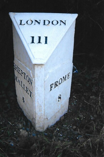
Cranmore is a small village located in the county of Somerset, England. Situated near the Mendip Hills, it forms part of the Mendip district and is approximately 3 miles southwest of the town of Shepton Mallet.

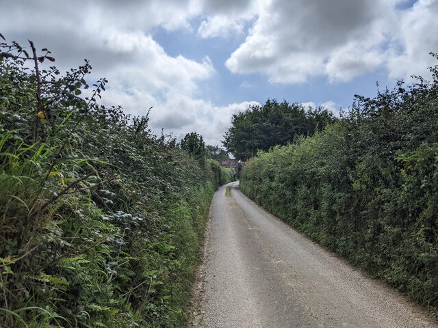
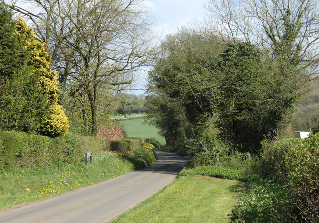
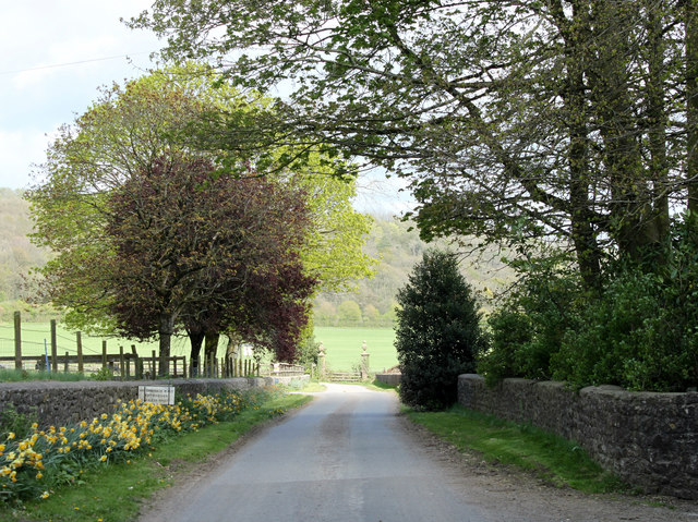
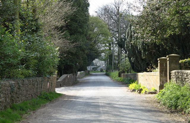
The village is known for its picturesque setting and rural charm. Surrounded by rolling hills and lush countryside, Cranmore offers a tranquil retreat for residents and visitors alike. It is an ideal destination for those seeking a peaceful escape from the hustle and bustle of city life.

Cranmore is home to a close-knit community, with a population of around 500 people. The village is known for its strong sense of community spirit, with various local events and activities organized throughout the year. The village hall serves as a hub for social gatherings, clubs, and meetings.

In terms of amenities, Cranmore offers some essential facilities, including a primary school, a post office, and a village shop. For further amenities and services, residents can easily access nearby towns such as Shepton Mallet and Wells, which provide a wider range of shops, supermarkets, and healthcare facilities.

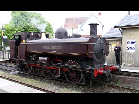
One notable attraction in Cranmore is the East Somerset Railway, a heritage railway that operates steam trains along a five-mile stretch of track. The railway attracts visitors from far and wide, offering a nostalgic trip through the picturesque Somerset countryside.

Overall, Cranmore is a charming village that offers a peaceful and idyllic lifestyle amidst stunning natural surroundings.

If you have any feedback on the listing, please let us know in the comments section below.

Cranmore Images

Images are sourced within 2km of 51.187129/-2.4758485 or Grid Reference ST6643. Thanks to Geograph Open Source API. All images are credited.
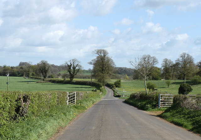
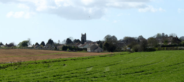
Old Milestone by A361, West of Cranmore, near quarry entrance The Milestone is located in the hedge beside the South side of the road.  Parish of Cranmore (Mendip District). Cast iron post, plated iron casting design, erected by the Shepton Mallet turnpike trust in the 19th Century, has been broken and welded back together (on back of top "BUCI") and repositioned. An earlier photograph can be found here: <a title="https://www.geograph.org.uk/photo/5324456" href="https://www.geograph.org.uk/photo/5324456">Link</a> 

Inscription reads:- 
SHEPTON / MALLET / 3 : : FROME / 9 : : LONDON / 112  

Milestone Society National ID: SO_SMFR03
Old Milestone by A361, West of Cranmore, near quarry entrance
The Milestone is located in the hedge beside the South side of the road.  Parish of Cranmore (Mendip District). Cast iron post, plated iron casting design, erected by the Shepton Mallet turnpike trust in the 19th Century, has been broken and welded back together (on back of top "BUCI") and repositioned. An earlier photograph can be found here: Link  Inscription reads:- SHEPTON / MALLET / 3 : : FROME / 9 : : LONDON / 112 Milestone Society National ID: SO_SMFR03
Old Milepost by A361, village of Dean The Milepost is located on the grass verge near houses on the South of the road.  Parish of Cranmore (Mendip District). Cast iron post, plated iron casting design, erected by the Shepton Mallet turnpike trust in the 19th Century. It has been broken and welded back together (on back of top "BUCI") and repositioned. A photograph before the repainting can be found here: <a title="https://www.geograph.org.uk/photo/6072295" href="https://www.geograph.org.uk/photo/6072295">Link</a> 

Inscription reads:-  
SHEPTON / MALLET / 4 : : FROME / 8 : : LONDON / 111 

Milestone Society National ID: SO_SMFR04
Old Milepost by A361, village of Dean
The Milepost is located on the grass verge near houses on the South of the road.  Parish of Cranmore (Mendip District). Cast iron post, plated iron casting design, erected by the Shepton Mallet turnpike trust in the 19th Century. It has been broken and welded back together (on back of top "BUCI") and repositioned. A photograph before the repainting can be found here: Link  Inscription reads:- SHEPTON / MALLET / 4 : : FROME / 8 : : LONDON / 111 Milestone Society National ID: SO_SMFR04
Farrington Lane, looking south
Ball Lane, not suitable for lorries
Temple House Farm
Temple House Farm
Newly Outshopped This photograph shows an Ex-BR Mk1 Buffet Restaurant Car standing in front of Cranmore Signal Box, having just emerged from the workshops after an extensive restoration in just over three months.  The Coach No.1674 is privately owned and will eventually be used at another railway in Southern England.
Newly Outshopped
This photograph shows an Ex-BR Mk1 Buffet Restaurant Car standing in front of Cranmore Signal Box, having just emerged from the workshops after an extensive restoration in just over three months. The Coach No.1674 is privately owned and will eventually be used at another railway in Southern England.
Cranmore Station and Signal Box, 1987 A "Black Eight Railtours" special train at Cranmore Station. This charter train used a Tyseley-based 4-car diesel multiple unit with an extra parcels car attached to provide additional power on the hills. The parcels car, M55993, is at the front of the train in this picture.
Cranmore Station and Signal Box, 1987
A "Black Eight Railtours" special train at Cranmore Station. This charter train used a Tyseley-based 4-car diesel multiple unit with an extra parcels car attached to provide additional power on the hills. The parcels car, M55993, is at the front of the train in this picture.
2011 : The former Church of St.James, East Cranmore "The origin of the name Cranmore comes from the Old English Crane Mere meaning 'Cranes/herons' pool'." 
Copied from <span class="nowrap"><a title="http://www.cranmore.org/" rel="nofollow ugc noopener" href="http://www.cranmore.org/">Link</a><img style="margin-left:2px;" alt="External link" title="External link - shift click to open in new window" src="https://s1.geograph.org.uk/img/external.png" width="10" height="10"/></span> a most interesting website.

Seen from the other side in <a href="https://www.geograph.org.uk/photo/485732">ST6843 : Former church at East Cranmore</a>
2011 : The former Church of St.James, East Cranmore
"The origin of the name Cranmore comes from the Old English Crane Mere meaning 'Cranes/herons' pool'." Copied from LinkExternal link a most interesting website. Seen from the other side in ST6843 : Former church at East Cranmore
2011 : Western Farm, Cranmore On the road between Cranmore and East Cranmore.
Farm land and buildings currently for sale.
2011 : Western Farm, Cranmore
On the road between Cranmore and East Cranmore. Farm land and buildings currently for sale.
2011 : Withy Wood Lane, Cranmore Heading away to almost nowhere, and very pleasant it is when you get there.
The road turning off to the right goes to pretty much the same place.
2011 : Withy Wood Lane, Cranmore
Heading away to almost nowhere, and very pleasant it is when you get there. The road turning off to the right goes to pretty much the same place.
2011 : Withy Wood Lane heading east The shrubs and trees are in the garden of a private house.
2011 : Withy Wood Lane heading east
The shrubs and trees are in the garden of a private house.
2011 : South of east from a bridle path off Withy Wood Lane Brickhouse Farm can be seen.
2011 : South of east from a bridle path off Withy Wood Lane
Brickhouse Farm can be seen.
2011 : Across Combe Bottom from the lane to Higher Alham Harwood Farm is partly hidden by the hill.
2011 : Across Combe Bottom from the lane to Higher Alham
Harwood Farm is partly hidden by the hill.
2011 : Quarry Way Business Park, For a list of its denizens see the board.
2011 : Quarry Way Business Park,
For a list of its denizens see the board.
2011 : Road to Wellington Farm, East Cranmore This is within half a mile of one of the largest quarries on the Mendips yet there is no sight and very little sound of it.
2011 : Road to Wellington Farm, East Cranmore
This is within half a mile of one of the largest quarries on the Mendips yet there is no sight and very little sound of it.
2011 : Main road through East  Cranmore The gateway on the right gives access to <a href="https://www.geograph.org.uk/photo/2357732">ST6843 : 2011 : The former Church of St.James, East Cranmore</a>
A little about East Cranmore in <span class="nowrap"><a title="http://www.francisfrith.com/east-cranmore/#utmcsr=bing.com&utmcmd=referral&utmccn=bing.com" rel="nofollow ugc noopener" href="http://www.francisfrith.com/east-cranmore/#utmcsr=bing.com&utmcmd=referral&utmccn=bing.com">Link</a><img style="margin-left:2px;" alt="External link" title="External link - shift click to open in new window" src="https://s1.geograph.org.uk/img/external.png" width="10" height="10"/></span>
2011 : Main road through East Cranmore
The gateway on the right gives access to ST6843 : 2011 : The former Church of St.James, East Cranmore A little about East Cranmore in LinkExternal link
2011 : Fields and view from the lane east of Cranmore Cranmore Tower [<a href="https://www.geograph.org.uk/gridref/ST6745">ST6745</a>] lifts its head above surrounding trees on the horizon.
A small beech wood begins showing its leaves, the foreground field looks a little sad, not sure what crop it contains.
2011 : Fields and view from the lane east of Cranmore
Cranmore Tower [ST6745] lifts its head above surrounding trees on the horizon. A small beech wood begins showing its leaves, the foreground field looks a little sad, not sure what crop it contains.
2011 : Over the fields to Cranmore Seen from the road between Cranmore and East Cranmore.
The Church of St. Bartholomew is outstanding.
2011 : Over the fields to Cranmore
Seen from the road between Cranmore and East Cranmore. The Church of St. Bartholomew is outstanding.
Show me another place!

Cranmore is located at Grid Ref: ST6643 (Lat: 51.187129, Lng: -2.4758485)

Administrative County: Somerset

District: Mendip

Police Authority: Avon and Somerset

What 3 Words

///invent.bandwagon.striving. Near Evercreech, Somerset

Nearby Locations

Cranmore

Related Wikis

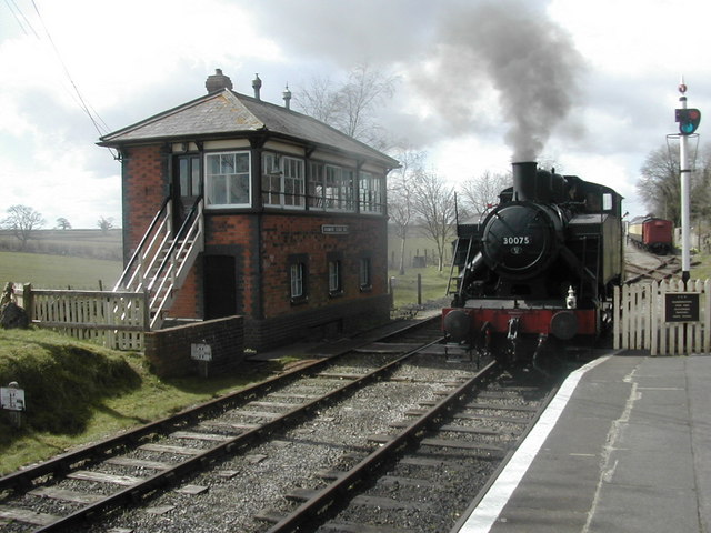
Cranmore railway station

Cranmore is the main railway station (and also the headquarters) of the preserved East Somerset Railway, in Somerset, England. == Services == Various services...

Cranmore, Somerset

Cranmore is a village and civil parish east of Shepton Mallet, in the Mendip district of Somerset, England. The parish includes the hamlets of Waterlip...

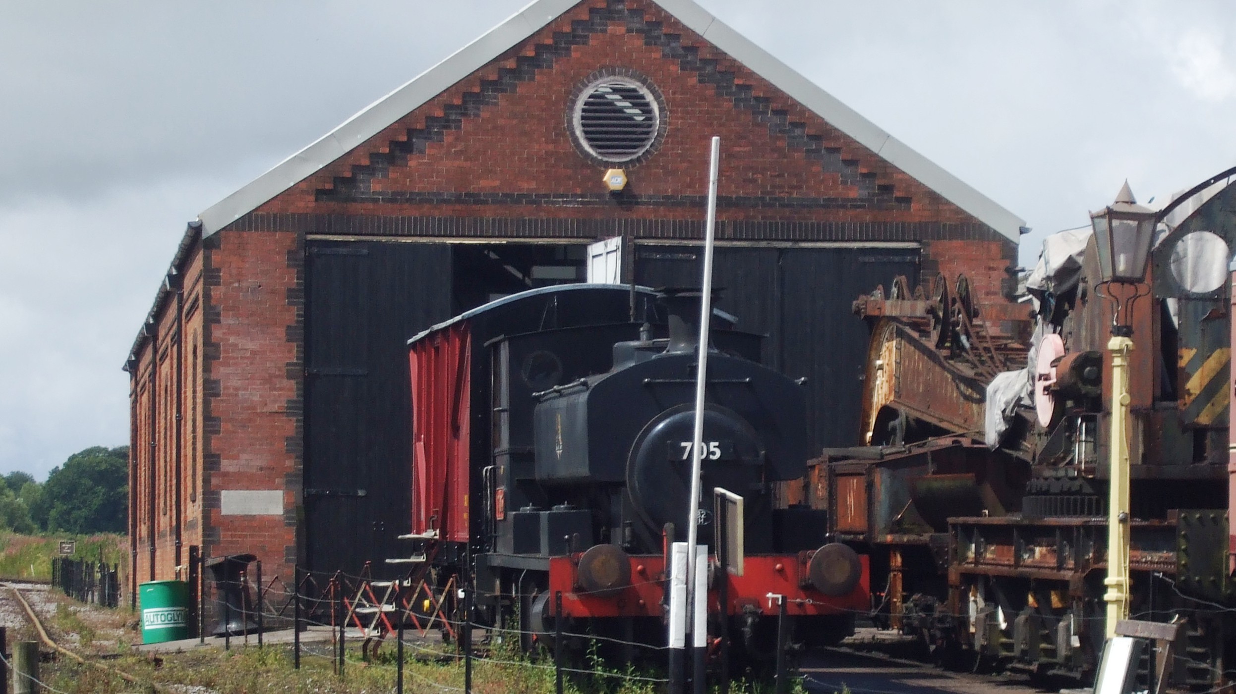
Cranmore West railway station

Cranmore West is a disused railway station on the East Somerset Railway. == Services == Services ceased calling at the beginning of the 2022 season, pending...

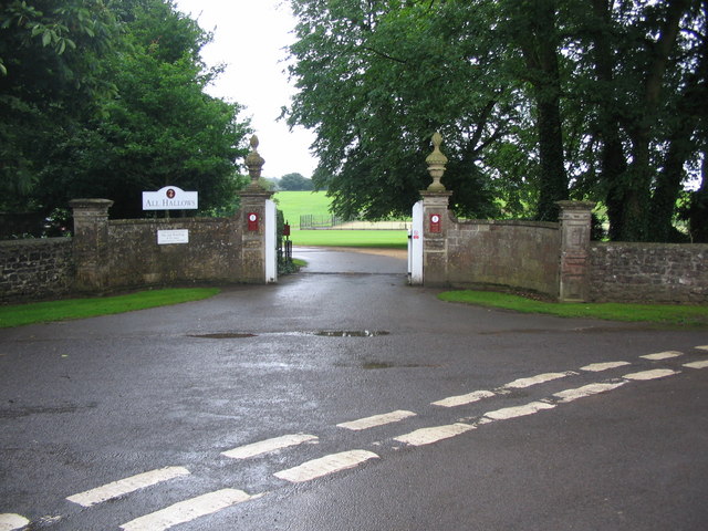
All Hallows Preparatory School

All Hallows School is a non-selective co-educational prep school that provides day and boarding facilities. A Christian School in the Catholic tradition...

St James' Church, East Cranmore

St James' Church is a former Church of England church in East Cranmore, Somerset, England. Designed by Thomas Henry Wyatt, it was built in 1846 to replace...

Merryfield Lane railway station

Merryfield Lane Halt is a railway station at the summit of the East Somerset Railway. It was built in 1981 and originally served as the terminus of the...

Doulting Stone Quarry

Doulting Stone Quarry (grid reference ST648436) is a limestone quarry at Doulting, on the Mendip Hills, Somerset, England. At present there are only three...

Cranmore Tower

The Cranmore Tower is a 45 metres (148 ft) tall 19th century folly in the parish of Cranmore, Somerset, England. The site is 280 metres (919 ft) above...

Related Videos

THE SILENT HILL, A FOGGY MORNING WALK │ ENGLAND

"October is in the UK the month of All Hallows, more widely known as Halloween. The people of old considered this a time that ...

EAST SOMERSET RAILWAY: AUGUST BANK HOLIDAY 1983 with 92203 & 47493 (NO SOUND)

A short silent movie of the East Somerset Railway (ESR) with steam trains in action on August Bank Holiday 29th August 1983.

EAST SOMERSET RAILWAY:4555 plus L92/dmu for May Bank Holiday

This is a video of the East Somerset Railway in the spring of 2022.The sequences containing Churchward 45xx Class Small ...

Nearby Amenities

Located within 500m of 51.187129,-2.4758485
Cranmore East Ground Frame
Railway: owner_change
Lat/Long: 51.1854301/-2.4754708
Railway: switch
Lat/Long: 51.1844941/-2.4813285
Railway: switch
Lat/Long: 51.1845218/-2.4806174
Railway: buffer_stop
Lat/Long: 51.1845365/-2.4807388
Railway: switch
Lat/Long: 51.1845638/-2.4808541
Railway: buffer_stop
Lat/Long: 51.1846732/-2.4803058
Railway: switch
Lat/Long: 51.1847691/-2.4793684
Railway: switch
Lat/Long: 51.1848842/-2.4789808
Railway: railway_crossing
Lat/Long: 51.1849695/-2.4787298
Railway: switch
Lat/Long: 51.185023/-2.4783666
Cranmore
Public Transport: station
Railway: station
Usage: tourism
Wikidata: Q5182230
Lat/Long: 51.1851655/-2.4774061
Railway: switch
Lat/Long: 51.1853677/-2.4759785
Railway: buffer_stop
Lat/Long: 51.1862814/-2.4763475
Railway: buffer_stop
Lat/Long: 51.18652/-2.4762078
Bus Stop
Piers Road
Bus: yes
Naptan AtcoCode: 3600SOB21682
Naptan Bearing: SW
Naptan CommonName: Piers Road
Naptan Indicator: SW-bound
Naptan NaptanCode: sotdjdpw
Naptan Street: A361
Naptan Verified: no
Public Transport: platform
Shelter: yes
Lat/Long: 51.1887494/-2.4816499
BT Cranmore Exchange - SSCRA
Addr City: Cranmore
Addr Housename: Cranmore Telephone Exchange
Addr Postcode: BA4 4QH
Addr Street: Piers Road
Office: telecommunication
Operator: BT
Ref: SSCRA
Telecom: exchange
Lat/Long: 51.1885596/-2.480875
Telephone
Booth: K4 Post Office
Covered: booth
Man Made: telephone_box
Note: This is a museum exhibit
Lat/Long: 51.1852681/-2.4772322
Post Box
Brand: Royal Mail
Brand Wikidata: Q638098
Brand Wikipedia: en:Royal Mail
Note: is part of phone box
Operator: Royal Mail
Operator Wikidata: Q638098
Post Box Type: phone_box
Ref: BA4 151
Royal Cypher: GR
Royal Cypher Wikidata: Q33102273
Lat/Long: 51.1852597/-2.4772724
Railway: level_crossing
Lat/Long: 51.1850719/-2.4784393
Cranmore 4/9 Level Crossing
Railway: crossing
Lat/Long: 51.1856742/-2.4720868
Cranmore
Old Name: West Cranmore
Place: village
Source: npe
Lat/Long: 51.1881298/-2.4750032
Access: private
Drinking Water: no
Man Made: water_tap
Operator: East Somerset Railway
Lat/Long: 51.1853691/-2.4757327
Railway: switch
Lat/Long: 51.1851367/-2.4783177
Booth: K6
Covered: booth
Man Made: telephone_box
Lat/Long: 51.1879986/-2.474768
Post Box
Post Box Type: wall
Lat/Long: 51.1879675/-2.4746723
Bench
Lat/Long: 51.1880014/-2.4748172
Advertising: board
Lat/Long: 51.1880008/-2.4748565
Defibrillator
Defibrillator Location: in porch of Cranmore Village Hall
Emergency: defibrillator
Indoor: no
Ref GB The Circuit: 026C53E8-83EF-4B35-B0DA-AD73009BEF19
Lat/Long: 51.1880011/-2.4747433
Cafe
The Station Cafe
Check Date: 2023-08-27
Email: contact.bristolcatering@gmail.com
Phone: +44 7778 572777
Website: https://www.bristolcatering.co.uk/the-station-cafe
Lat/Long: 51.1853743/-2.4769498
Bus Stop
Crossroads
Bus: yes
Naptan AtcoCode: 3600SOB21677
Naptan Bearing: N
Naptan CommonName: Crossroads
Naptan Indicator: N-bound
Naptan NaptanCode: sotdjdpt
Naptan Street: Tansey
Naptan Verified: no
Public Transport: platform
Lat/Long: 51.1891004/-2.4815197
Bus Stop
Piers Cottage
Bus: yes
Naptan AtcoCode: 3600SOA56818
Naptan Bearing: SE
Naptan CommonName: Piers Cottage
Naptan Indicator: SE-bound
Naptan NaptanCode: sotdpjwg
Naptan Street: Piers Road
Naptan Verified: no
Public Transport: platform
Lat/Long: 51.1888989/-2.4812554
Bus Stop
The Stores
Bus: yes
Naptan AtcoCode: 3600SOY38592
Naptan Bearing: NE
Naptan CommonName: The Stores
Naptan Indicator: NE-bound
Naptan NaptanCode: sotdjdtj
Naptan Street: East Cranmore Lane
Naptan Verified: no
Public Transport: platform
Lat/Long: 51.1876312/-2.4750908
Bus Stop
St Bartholomews Church
Bus: yes
Naptan AtcoCode: 3600SOA56819
Naptan Bearing: NE
Naptan CommonName: St Bartholomews Churc
Naptan Indicator: NE-bound
Naptan NaptanCode: sotdpjwj
Naptan Street: Cooks Lane
Naptan Verified: no
Public Transport: platform
Lat/Long: 51.1885543/-2.4761204
Railway: crossing
Lat/Long: 51.1850385/-2.4782995
Railway: crossing
Lat/Long: 51.184999/-2.47828
The data included in this document is from www.openstreetmap.org. The data is made available under ODbL.

Have you been to Cranmore?

Leave your review of Cranmore below (or comments, questions and feedback).