Pool Wood
Wood, Forest in Cheshire
England
Pool Wood

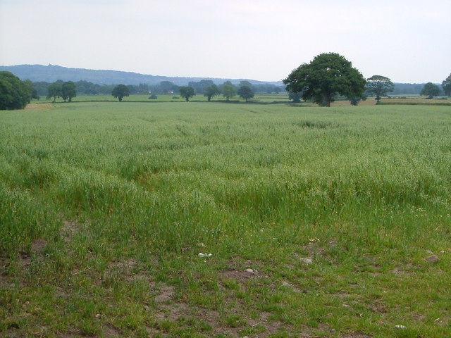
Pool Wood is a picturesque woodland located in the county of Cheshire, in the northwest of England. Covering an area of approximately 50 acres, it is a serene and idyllic setting for nature lovers and outdoor enthusiasts alike. The wood is nestled in the heart of the Cheshire countryside, surrounded by rolling hills and meandering streams.
The woodland is predominantly composed of native broadleaf trees, including oak, ash, beech, and birch, which provide ample shade and a rich habitat for a diverse range of flora and fauna. Bluebells carpet the forest floor in spring, creating a vibrant and enchanting display of color. Additionally, a variety of ferns, mosses, and fungi can be found throughout the wood.
Walking trails meander through the wood, allowing visitors to explore its beauty at their own pace. The tranquil atmosphere and peaceful surroundings make it an ideal spot for leisurely strolls, picnics, and nature photography. Birdwatchers will delight in the opportunity to spot a range of avian species such as woodpeckers, owls, and various songbirds.
The wood is managed by local conservation organizations, who work tirelessly to protect and preserve its natural beauty. They regularly organize educational events and guided walks to promote awareness and understanding of the woodland ecosystem.
Whether you are seeking solace in nature, looking to connect with the great outdoors, or simply want to enjoy a peaceful retreat from the hustle and bustle of everyday life, Pool Wood in Cheshire is a hidden gem waiting to be discovered.
If you have any feedback on the listing, please let us know in the comments section below.
Pool Wood Images
Images are sourced within 2km of 53.112403/-2.2830429 or Grid Reference SJ8157. Thanks to Geograph Open Source API. All images are credited.


Pool Wood is located at Grid Ref: SJ8157 (Lat: 53.112403, Lng: -2.2830429)
Unitary Authority: Cheshire East
Police Authority: Cheshire
What 3 Words
///outwards.copying.heat. Near Rode Heath, Cheshire
Nearby Locations
Related Wikis

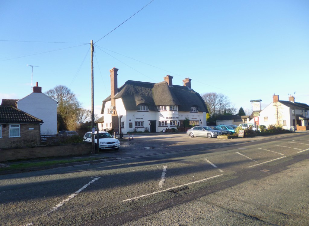
Rode Heath
Rode Heath is a small village in the civil parish of Odd Rode, near Alsager and within the unitary authority of Cheshire East and the ceremonial county...

Rode Hall
Rode Hall, a Georgian country house, is the seat of the Wilbraham family, members of the landed gentry in the parish of Odd Rode, Cheshire, England. The...
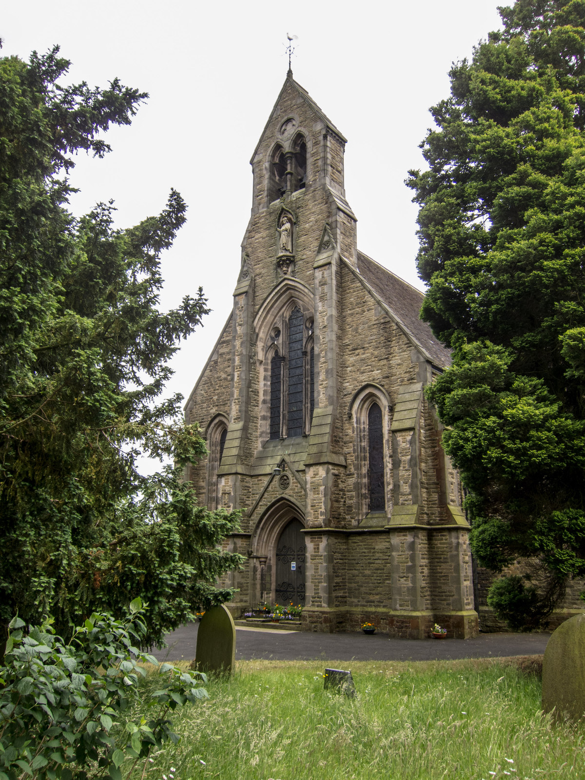
All Saints Church, Scholar Green
All Saints Church is in the village of Scholar Green in the parish of Odd Rode, Cheshire, England. It is an Anglican parish church in the deanery of Congleton...

Lawton railway station
Lawton railway station is a disused railway station in Cheshire, England. The station was situated on the North Staffordshire Railway (NSR) branch line...
Alsager Town F.C.
Alsager Town Football Club is a football club, based in Alsager, Cheshire, England. The club are currently members of North West Counties League Division...

All Saints Church, Church Lawton
All Saints’ Church stands on a mound close to Lawton Hall in the small village of Church Lawton, Cheshire, England. It is recorded in the National Heritage...
Church Lawton
Church Lawton is a village and located in the unitary authority of Cheshire East and the ceremonial county of Cheshire in England. Its location is such...
Odd Rode
Odd Rode is a civil parish in the unitary authority of Cheshire East and the ceremonial county of Cheshire, England. It borders the Staffordshire parish...
Related Videos

'Into the darkness... - Harecastle tunnel - Day 3 of 7 of our Holiday
So, a busy one today, started off in Stone after a lovely night then travelled too Harecastle tunnel for an amazing experience I'll ...

Medieval manor England #england #shortsfeed #medieval
travel #explore #northwest This beautiful Medieval Manor House in Cheshire North west England is "lifted straight from a fairy ...


Walk through a 500 year old timber-framed Tudor house…
Little Morton Hall, Cheshire, UK … #crooked #house #wonky #home #architecture #history #tudor #tour #walkthrough #traditional ...
Nearby Amenities
Located within 500m of 53.112403,-2.2830429Have you been to Pool Wood?
Leave your review of Pool Wood below (or comments, questions and feedback).