Bentilee Wood

Wood, Forest in Staffordshire Newcastle-under-Lyme

England

Bentilee Wood

Track near Stoney Low A pleasant walk on an autumn afternoon, this track forms part of a path that leads from the village of Madeley to Keele Service Station on the M6.
Track near Stoney Low Credit: Iain McDonald

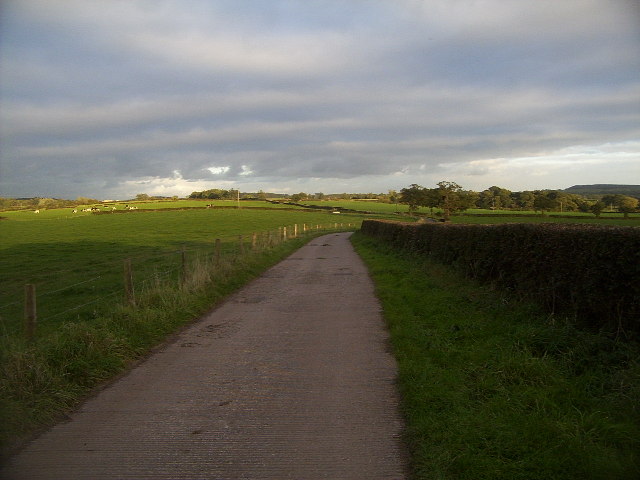
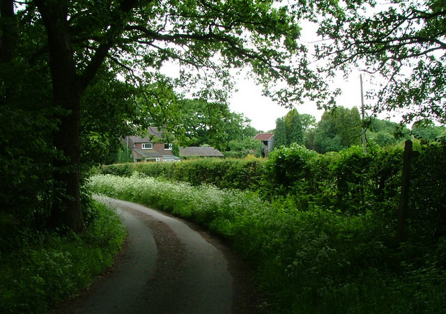
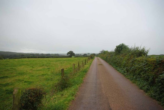
Bentilee Wood, located in Staffordshire, England, is a picturesque woodland area covering approximately 40 hectares. The wood is situated on the outskirts of the city of Stoke-on-Trent, making it easily accessible to both locals and visitors alike.

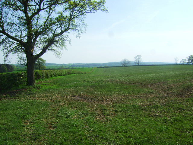
The woodland is predominantly made up of oak, silver birch, and beech trees, creating a diverse and vibrant ecosystem. These trees provide a dense canopy, allowing for a shaded and tranquil atmosphere within the wood. In addition to the impressive trees, Bentilee Wood is also home to a variety of wildlife, including squirrels, rabbits, and a multitude of bird species. This makes it a popular spot for nature enthusiasts and birdwatchers.

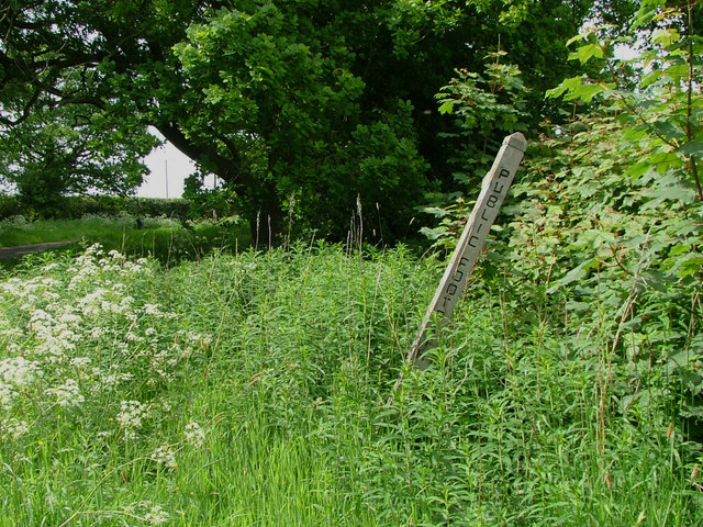
Within the wood, there are several well-maintained footpaths and trails, providing ample opportunities for walking, jogging, and cycling. The paths wind through the woodland, offering visitors the chance to explore and discover the natural beauty of the area. Along the trails, there are also designated picnic areas, allowing visitors to pause and enjoy a packed lunch amidst the serene surroundings.

Bentilee Wood is not only a haven for nature lovers but also serves as an important educational resource. Local schools often organize field trips to the wood, where students can learn about the different species of trees and wildlife that inhabit the area. The wood also plays a vital role in the conservation of local flora and fauna, with efforts made to maintain and protect the natural habitat.

Overall, Bentilee Wood offers a peaceful retreat from the hustle and bustle of city life, providing a space for recreation, relaxation, and appreciation of nature.

If you have any feedback on the listing, please let us know in the comments section below.

Bentilee Wood Images

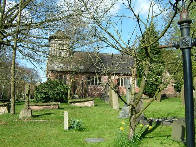
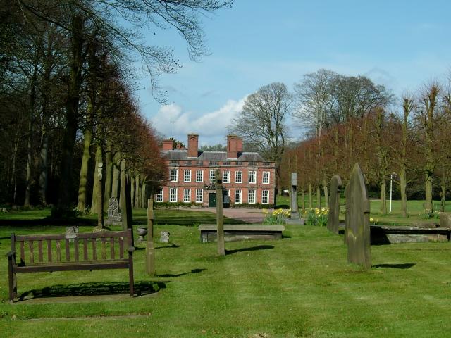
Images are sourced within 2km of 52.98689/-2.2822955 or Grid Reference SJ8143. Thanks to Geograph Open Source API. All images are credited.

Track near Stoney Low A pleasant walk on an autumn afternoon, this track forms part of a path that leads from the village of Madeley to Keele Service Station on the M6.
Track near Stoney Low
A pleasant walk on an autumn afternoon, this track forms part of a path that leads from the village of Madeley to Keele Service Station on the M6.
Dab Green Farm note the fingerpost  with no path on the right.
Dab Green Farm
note the fingerpost with no path on the right.
Another fingerpost with no apparent path.
Another fingerpost
with no apparent path.
Fields near Highway Farm The farmland near Highway farm.
Fields near Highway Farm
The farmland near Highway farm.
Field and fertiliser The field has recently been spread with manure,and chain harrowed.
Field and fertiliser
The field has recently been spread with manure,and chain harrowed.
The Drive to Highway Farm If you get this far you have missed the point where the bridleway leaves the farm track!
The Drive to Highway Farm
If you get this far you have missed the point where the bridleway leaves the farm track!
A damp morning on the way to Stoney Low The path runs from near Orchard Cottage on Three Mile Lane to Madeley.
A damp morning on the way to Stoney Low
The path runs from near Orchard Cottage on Three Mile Lane to Madeley.
Old Railway Bridge Near Stoney Low I can't understand why the O.S maps don't show the railway as disused or dismantled. A  look over the hedge into the deep cutting reveals large trees where the track should be. They have clearly not sprung up in a couple of years. Sadly the vegetation was far too dense to get a decent picture.

2013 Update... it seems The track is the remnant of the line between Market Drayton and Stoke. It was retained to serve the coal mine at Silverdale, but this pit closed in 1998. The link to the West Coast Main Line was severed by a derailed goods train in 2007."
Old Railway Bridge Near Stoney Low
I can't understand why the O.S maps don't show the railway as disused or dismantled. A look over the hedge into the deep cutting reveals large trees where the track should be. They have clearly not sprung up in a couple of years. Sadly the vegetation was far too dense to get a decent picture. 2013 Update... it seems The track is the remnant of the line between Market Drayton and Stoke. It was retained to serve the coal mine at Silverdale, but this pit closed in 1998. The link to the West Coast Main Line was severed by a derailed goods train in 2007."
Southbound M6 near Keele Services The M6 motorway runs from junction 19 of the M1 at the Catthorpe Interchange, near Rugby to the Gretna junction (J45). Here it becomes the A74(M) and M74 which continues to Glasgow.

The M6 is the longest motorway in the United Kingdom (232 miles) and one of the busiest. It incorporates the first length of motorway opened in the UK (the Preston bypass in 1958) and forms part of a motorway "Backbone of Britain", running north-south between London and Glasgow via the industrial north of England. It is also part of the east-west route between the Midlands and the east coast ports.
Southbound M6 near Keele Services
The M6 motorway runs from junction 19 of the M1 at the Catthorpe Interchange, near Rugby to the Gretna junction (J45). Here it becomes the A74(M) and M74 which continues to Glasgow. The M6 is the longest motorway in the United Kingdom (232 miles) and one of the busiest. It incorporates the first length of motorway opened in the UK (the Preston bypass in 1958) and forms part of a motorway "Backbone of Britain", running north-south between London and Glasgow via the industrial north of England. It is also part of the east-west route between the Midlands and the east coast ports.
Newcastle-under-Lyme District : The M6 Motorway The road heads northbound through Staffordshire.
Newcastle-under-Lyme District : The M6 Motorway
The road heads northbound through Staffordshire.
Standing traffic on the M6 An all-too-common experience on the M6.
Standing traffic on the M6
An all-too-common experience on the M6.
Whitmore : M6 Motorway Heading along the M6 motorway between Junction 16 and Junction 15.
Whitmore : M6 Motorway
Heading along the M6 motorway between Junction 16 and Junction 15.
Keele Park Station 1896 -1907 (disused) The nearby Keele estate had its own railway station called Keele, Keele Park Race station was added later on the Newcastle to Market Drayton railway line to make the racecourse more accessible to racegoers. Keele Park station opened in 1896 and closed in March 1907, coinciding with the operation of the racecourse.

The Market Drayton branch railway opened in sections, with Stoke on Trent to Newcastle-under-Lyme being the first to open on the 6th September 1852. This was followed eleven years later by the Newcastle to Silverdale section in May of 1863. It wasn't until the 1st of February 1870 that the connection to Market Drayton was completed, giving Madeley an east-west route. Although initially the line was double track, it was converted to single track in 1934. ‌‌‌

Passenger services were withdrawn on May 6th 1956 and the Silverdale to Stoke on Trent section closed on 2nd March 1964. Keele Station was closed in 1961. It was finally closed to goods trains on the 9th January 1967, although coal trains still ran from Silverdale colliery to Madeley Road and onto the former LNWR line. With the closure of Silverdale colliery in 1998, all traffic on this line ceased.

<span class="nowrap"><a title="https://www.keele.ac.uk/thekeeleoralhistoryproject/railwaysatkeele/" rel="nofollow ugc noopener" href="https://www.keele.ac.uk/thekeeleoralhistoryproject/railwaysatkeele/">Link</a><img style="margin-left:2px;" alt="External link" title="External link - shift click to open in new window" src="https://s1.geograph.org.uk/img/external.png" width="10" height="10"/></span>

<span class="nowrap"><a title="https://en.wikipedia.org/wiki/Stoke_to_Market_Drayton_Line" rel="nofollow ugc noopener" href="https://en.wikipedia.org/wiki/Stoke_to_Market_Drayton_Line">Link</a><img style="margin-left:2px;" alt="External link" title="External link - shift click to open in new window" src="https://s1.geograph.org.uk/img/external.png" width="10" height="10"/></span>
Keele Park Station 1896 -1907 (disused)
The nearby Keele estate had its own railway station called Keele, Keele Park Race station was added later on the Newcastle to Market Drayton railway line to make the racecourse more accessible to racegoers. Keele Park station opened in 1896 and closed in March 1907, coinciding with the operation of the racecourse. The Market Drayton branch railway opened in sections, with Stoke on Trent to Newcastle-under-Lyme being the first to open on the 6th September 1852. This was followed eleven years later by the Newcastle to Silverdale section in May of 1863. It wasn't until the 1st of February 1870 that the connection to Market Drayton was completed, giving Madeley an east-west route. Although initially the line was double track, it was converted to single track in 1934. ‌‌‌ Passenger services were withdrawn on May 6th 1956 and the Silverdale to Stoke on Trent section closed on 2nd March 1964. Keele Station was closed in 1961. It was finally closed to goods trains on the 9th January 1967, although coal trains still ran from Silverdale colliery to Madeley Road and onto the former LNWR line. With the closure of Silverdale colliery in 1998, all traffic on this line ceased. LinkExternal link LinkExternal link
Keele Park Station (disused) and Bridge The nearby Keele estate had its own railway station called Keele, Keele Park Race station was added later on the Newcastle to Market Drayton railway line to make the racecourse more accessible to racegoers. Keele Park station opened in 1896 and closed in March 1907, coinciding with the operation of the racecourse.

The Market Drayton branch railway opened in sections, with Stoke on Trent to Newcastle-under-Lyme being the first to open on the 6th September 1852. This was followed eleven years later by the Newcastle to Silverdale section in May of 1863. It wasn't until the 1st of February 1870 that the connection to Market Drayton was completed, giving Madeley an east-west route. Although initially the line was double track, it was converted to single track in 1934. ‌‌‌

Passenger services were withdrawn on May 6th 1956 and the Silverdale to Stoke on Trent section closed on 2nd March 1964. Keele Station was closed in 1961. It was finally closed to goods trains on the 9th January 1967, although coal trains still ran from Silverdale colliery to Madeley Road and onto the former LNWR line. With the closure of Silverdale colliery in 1998, all traffic on this line ceased.

<span class="nowrap"><a title="https://www.keele.ac.uk/thekeeleoralhistoryproject/railwaysatkeele/" rel="nofollow ugc noopener" href="https://www.keele.ac.uk/thekeeleoralhistoryproject/railwaysatkeele/">Link</a><img style="margin-left:2px;" alt="External link" title="External link - shift click to open in new window" src="https://s1.geograph.org.uk/img/external.png" width="10" height="10"/></span>

<span class="nowrap"><a title="https://en.wikipedia.org/wiki/Stoke_to_Market_Drayton_Line" rel="nofollow ugc noopener" href="https://en.wikipedia.org/wiki/Stoke_to_Market_Drayton_Line">Link</a><img style="margin-left:2px;" alt="External link" title="External link - shift click to open in new window" src="https://s1.geograph.org.uk/img/external.png" width="10" height="10"/></span>
Keele Park Station (disused) and Bridge
The nearby Keele estate had its own railway station called Keele, Keele Park Race station was added later on the Newcastle to Market Drayton railway line to make the racecourse more accessible to racegoers. Keele Park station opened in 1896 and closed in March 1907, coinciding with the operation of the racecourse. The Market Drayton branch railway opened in sections, with Stoke on Trent to Newcastle-under-Lyme being the first to open on the 6th September 1852. This was followed eleven years later by the Newcastle to Silverdale section in May of 1863. It wasn't until the 1st of February 1870 that the connection to Market Drayton was completed, giving Madeley an east-west route. Although initially the line was double track, it was converted to single track in 1934. ‌‌‌ Passenger services were withdrawn on May 6th 1956 and the Silverdale to Stoke on Trent section closed on 2nd March 1964. Keele Station was closed in 1961. It was finally closed to goods trains on the 9th January 1967, although coal trains still ran from Silverdale colliery to Madeley Road and onto the former LNWR line. With the closure of Silverdale colliery in 1998, all traffic on this line ceased. LinkExternal link LinkExternal link
Landslip and Bridge, Keele Park Station The nearby Keele estate had its own railway station called Keele, Keele Park Race station was added later on the Newcastle to Market Drayton railway line to make the racecourse more accessible to racegoers. Keele Park station opened in 1896 and closed in March 1907, coinciding with the operation of the racecourse.

The Market Drayton branch railway opened in sections, with Stoke on Trent to Newcastle-under-Lyme being the first to open on the 6th September 1852. This was followed eleven years later by the Newcastle to Silverdale section in May of 1863. It wasn't until the 1st of February 1870 that the connection to Market Drayton was completed, giving Madeley an east-west route. Although initially the line was double track, it was converted to single track in 1934. ‌‌‌

Passenger services were withdrawn on May 6th 1956 and the Silverdale to Stoke on Trent section closed on 2nd March 1964. Keele Station was closed in 1961. It was finally closed to goods trains on the 9th January 1967, although coal trains still ran from Silverdale colliery to Madeley Road and onto the former LNWR line. With the closure of Silverdale colliery in 1998, all traffic on this line ceased.

<span class="nowrap"><a title="https://www.keele.ac.uk/thekeeleoralhistoryproject/railwaysatkeele/" rel="nofollow ugc noopener" href="https://www.keele.ac.uk/thekeeleoralhistoryproject/railwaysatkeele/">Link</a><img style="margin-left:2px;" alt="External link" title="External link - shift click to open in new window" src="https://s1.geograph.org.uk/img/external.png" width="10" height="10"/></span>

<span class="nowrap"><a title="https://en.wikipedia.org/wiki/Stoke_to_Market_Drayton_Line" rel="nofollow ugc noopener" href="https://en.wikipedia.org/wiki/Stoke_to_Market_Drayton_Line">Link</a><img style="margin-left:2px;" alt="External link" title="External link - shift click to open in new window" src="https://s1.geograph.org.uk/img/external.png" width="10" height="10"/></span>
Landslip and Bridge, Keele Park Station
The nearby Keele estate had its own railway station called Keele, Keele Park Race station was added later on the Newcastle to Market Drayton railway line to make the racecourse more accessible to racegoers. Keele Park station opened in 1896 and closed in March 1907, coinciding with the operation of the racecourse. The Market Drayton branch railway opened in sections, with Stoke on Trent to Newcastle-under-Lyme being the first to open on the 6th September 1852. This was followed eleven years later by the Newcastle to Silverdale section in May of 1863. It wasn't until the 1st of February 1870 that the connection to Market Drayton was completed, giving Madeley an east-west route. Although initially the line was double track, it was converted to single track in 1934. ‌‌‌ Passenger services were withdrawn on May 6th 1956 and the Silverdale to Stoke on Trent section closed on 2nd March 1964. Keele Station was closed in 1961. It was finally closed to goods trains on the 9th January 1967, although coal trains still ran from Silverdale colliery to Madeley Road and onto the former LNWR line. With the closure of Silverdale colliery in 1998, all traffic on this line ceased. LinkExternal link LinkExternal link
West Coast Mainline bridge - M6 northbound
Whitmore Church Whitmore Church in the charming village of Whitmore.
Whitmore Church
Whitmore Church in the charming village of Whitmore.
Whitmore Hall Picture taken from the grounds of Whitmore church
Whitmore Hall
Picture taken from the grounds of Whitmore church
Show me another place!

Bentilee Wood is located at Grid Ref: SJ8143 (Lat: 52.98689, Lng: -2.2822955)

Administrative County: Staffordshire

District: Newcastle-under-Lyme

Police Authority: Staffordshire

What 3 Words

///status.cooks.film. Near Keele, Staffordshire

Related Wikis

Loggerheads and Whitmore (ward)

Loggerheads and Whitmore ward was a ward in the Borough of Newcastle-under-Lyme, in the county of Staffordshire, England. It covered, amongst others, the...

Keele services

Keele services is a motorway service station, between junctions 15 and 16 of the M6 motorway near Keele in England. Operated by Welcome Break, it was built...

Keele (ward)

Keele Ward is a local council ward in the borough of Newcastle-under-Lyme. It covers the village of Keele and the neighbouring University of Keele's campus...

Keele Hall

Keele Hall is a 19th-century mansion house at Keele, Staffordshire, England, now standing on the campus of Keele University and serving as the university...

Hollywood Music Festival

The Hollywood Music Festival was held at Leycett in an area called Hollywood on the grounds of Ted Askey's Lower (pig) Farm at Finney Green, between Silverdale...

Keele University Science & Business Park

Keele University Science and Innovation Park is a science and business development facility located on the campus of Keele University in North Staffordshire...

Keele University

Keele University, officially known as the University of Keele, is a public research university in Keele, approximately three miles (five kilometres) from...

Keele

Keele is a village and civil parish in the Borough of Newcastle-under-Lyme in Staffordshire, England. It is approximately 3 miles (4.8 km) west of Newcastle...

Nearby Amenities

Located within 500m of 52.98689,-2.2822955
The data included in this document is from www.openstreetmap.org. The data is made available under ODbL.

Have you been to Bentilee Wood?

Leave your review of Bentilee Wood below (or comments, questions and feedback).