Marley Wood
Wood, Forest in Dorset
England
Marley Wood

Marley Wood is a picturesque woodland located in the county of Dorset, England. Covering an area of approximately 100 acres, the wood is a haven for nature enthusiasts and outdoor lovers. It is situated near the village of Marley, nestled within the beautiful Dorset countryside.
The wood is predominantly made up of native tree species, including oak, beech, and birch, which provide a dense canopy and offer a tranquil setting for visitors to explore. The forest floor is carpeted with an array of wildflowers and ferns, adding to the wood's enchanting atmosphere.
Marley Wood is a haven for wildlife, providing a habitat for a diverse range of species. Birdwatchers can spot a variety of woodland birds, such as woodpeckers, owls, and thrushes. Small mammals, including squirrels, rabbits, and voles, can also be observed scurrying through the undergrowth.
For outdoor enthusiasts, the wood offers a network of walking trails, allowing visitors to immerse themselves in the natural beauty of the surroundings. These trails vary in length and difficulty, catering to both casual walkers and more experienced hikers.
The wood is managed by a local conservation group, which ensures its preservation and protection for future generations to enjoy. They organize regular guided walks and educational events to raise awareness about the importance of woodland conservation.
Overall, Marley Wood in Dorset is a captivating natural retreat, offering a peaceful escape from the hustle and bustle of everyday life. Its stunning scenery, diverse wildlife, and well-maintained trails make it a must-visit destination for nature enthusiasts and those seeking solace in the great outdoors.
If you have any feedback on the listing, please let us know in the comments section below.
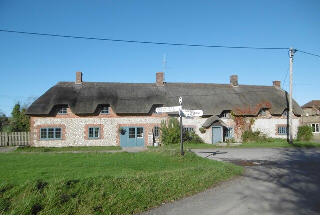
Marley Wood Images
Images are sourced within 2km of 50.64621/-2.2699185 or Grid Reference SY8182. Thanks to Geograph Open Source API. All images are credited.
![A short walk to Belhuish Farm [10] At this junction of tracks, the buildings of Belhuish Farm come into view.
From the B3071 road, the walk follows the long distance Hardy Way to the cluster of buildings at Belhuish Farm and returns the same way. Almost exactly 1 mile.](https://s2.geograph.org.uk/geophotos/07/26/07/7260770_bdd5c579.jpg)
![A short walk to Belhuish Farm [11] The track now nears Belhuish Farm.
From the B3071 road, the walk follows the long distance Hardy Way to the cluster of buildings at Belhuish Farm and returns the same way. Almost exactly 1 mile.](https://s0.geograph.org.uk/geophotos/07/26/07/7260772_6fa9b997.jpg)
![A short walk to Belhuish Farm [12] Tree planting has taken place on the slope of Lulworth Common. Seen from the track.
From the B3071 road, the walk follows the long distance Hardy Way to the cluster of buildings at Belhuish Farm and returns the same way. Almost exactly 1 mile.](https://s2.geograph.org.uk/geophotos/07/26/07/7260774_f3ac8cc1.jpg)
![A short walk to Belhuish Farm [13] Belhuish Cottage was built in the late 18th or early 19th century. Constructed of plastered rubble stone under a thatch roof. Listed, grade II, with details at: <span class="nowrap"><a title="https://historicengland.org.uk/listing/the-list/list-entry/1120433" rel="nofollow ugc noopener" href="https://historicengland.org.uk/listing/the-list/list-entry/1120433">Link</a><img style="margin-left:2px;" alt="External link" title="External link - shift click to open in new window" src="https://s1.geograph.org.uk/img/external.png" width="10" height="10"/></span>
From the B3071 road, the walk follows the long distance Hardy Way to the cluster of buildings at Belhuish Farm and returns the same way. Almost exactly 1 mile.](https://s1.geograph.org.uk/geophotos/07/26/07/7260777_fe9d45b4.jpg)
![A short walk to Belhuish Farm [14] Belhuish Farmhouse has 17th century origins but is mainly 19th century. Constructed partly of rubble stone, with brick quoins, some flint, partly rendered, all under a tile roof. Listed, grade II, with details at: <span class="nowrap"><a title="https://historicengland.org.uk/listing/the-list/list-entry/1120434" rel="nofollow ugc noopener" href="https://historicengland.org.uk/listing/the-list/list-entry/1120434">Link</a><img style="margin-left:2px;" alt="External link" title="External link - shift click to open in new window" src="https://s1.geograph.org.uk/img/external.png" width="10" height="10"/></span>
From the B3071 road, the walk follows the long distance Hardy Way to the cluster of buildings at Belhuish Farm and returns the same way. Almost exactly 1 mile.](https://s1.geograph.org.uk/geophotos/07/26/07/7260785_d1e4fe7b.jpg)
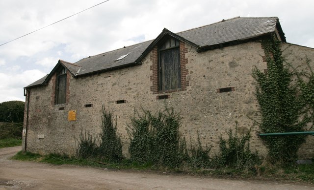
![A short walk to Belhuish Farm [15] The track, also a public footpath, continues southwards, past Belhuish Coppice towards West Lulworth. Belhuish Barn, seen in the distance, is 18th century. Built of stone and flint walls under a tile roof with stone eaves courses. There are various extensions. Listed, grade II, with details at: <span class="nowrap"><a title="https://historicengland.org.uk/listing/the-list/list-entry/1152427" rel="nofollow ugc noopener" href="https://historicengland.org.uk/listing/the-list/list-entry/1152427">Link</a><img style="margin-left:2px;" alt="External link" title="External link - shift click to open in new window" src="https://s1.geograph.org.uk/img/external.png" width="10" height="10"/></span>
From the B3071 road, the walk follows the long distance Hardy Way to the cluster of buildings at Belhuish Farm and returns the same way. Almost exactly 1 mile.](https://s2.geograph.org.uk/geophotos/07/26/07/7260790_60c8d722.jpg)
![A short walk to Belhuish Farm [16] One of the buildings of Belhuish Farm. Seen from the track.
From the B3071 road, the walk follows the long distance Hardy Way to the cluster of buildings at Belhuish Farm and returns the same way. Almost exactly 1 mile.](https://s0.geograph.org.uk/geophotos/07/26/07/7260792_406ef1d7.jpg)
![A short walk to Belhuish Farm [17] A look back to the junction of tracks. The one to the right leads to the B3071 road. The one to the left leads past Lulworth Common to Coombe Wood.
From the B3071 road, the walk follows the long distance Hardy Way to the cluster of buildings at Belhuish Farm and returns the same way. Almost exactly 1 mile.](https://s0.geograph.org.uk/geophotos/07/26/07/7260796_3360327e.jpg)


Marley Wood is located at Grid Ref: SY8182 (Lat: 50.64621, Lng: -2.2699185)
Unitary Authority: Dorset
Police Authority: Dorset
What 3 Words
///hiking.older.group. Near Wool, Dorset
Nearby Locations
Related Wikis
Winfrith Newburgh
Winfrith Newburgh (), commonly called just Winfrith, is a village and civil parish in Dorset, England. It is about 8 miles (13 km) west of Wareham and...

Chaldon Herring
Chaldon Herring or East Chaldon is a village and civil parish in the English county of Dorset, about 8 miles (13 km) south-east of the county town of Dorchester...

Bindon Liberty
Bindon Liberty was a liberty in the county of Dorset, England, containing the following parishes: Chaldon Herring Edmondsham (part) Moreton (part) Pulham...

Five Marys
The Five Marys is a group of Bronze Age round barrows near the village of Chaldon Herring, in Dorset, England. The site is a scheduled monument. ��2�...
Nearby Amenities
Located within 500m of 50.64621,-2.2699185Have you been to Marley Wood?
Leave your review of Marley Wood below (or comments, questions and feedback).