Tits Wood

Wood, Forest in Somerset Mendip

England

Tits Wood

Corsley Village from Cley Hill The village of Corsley to the North of Cley Hill taken from the trig point.
Corsley Village from Cley Hill Credit: Len Williams

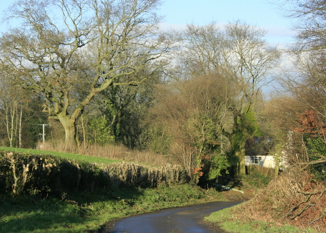
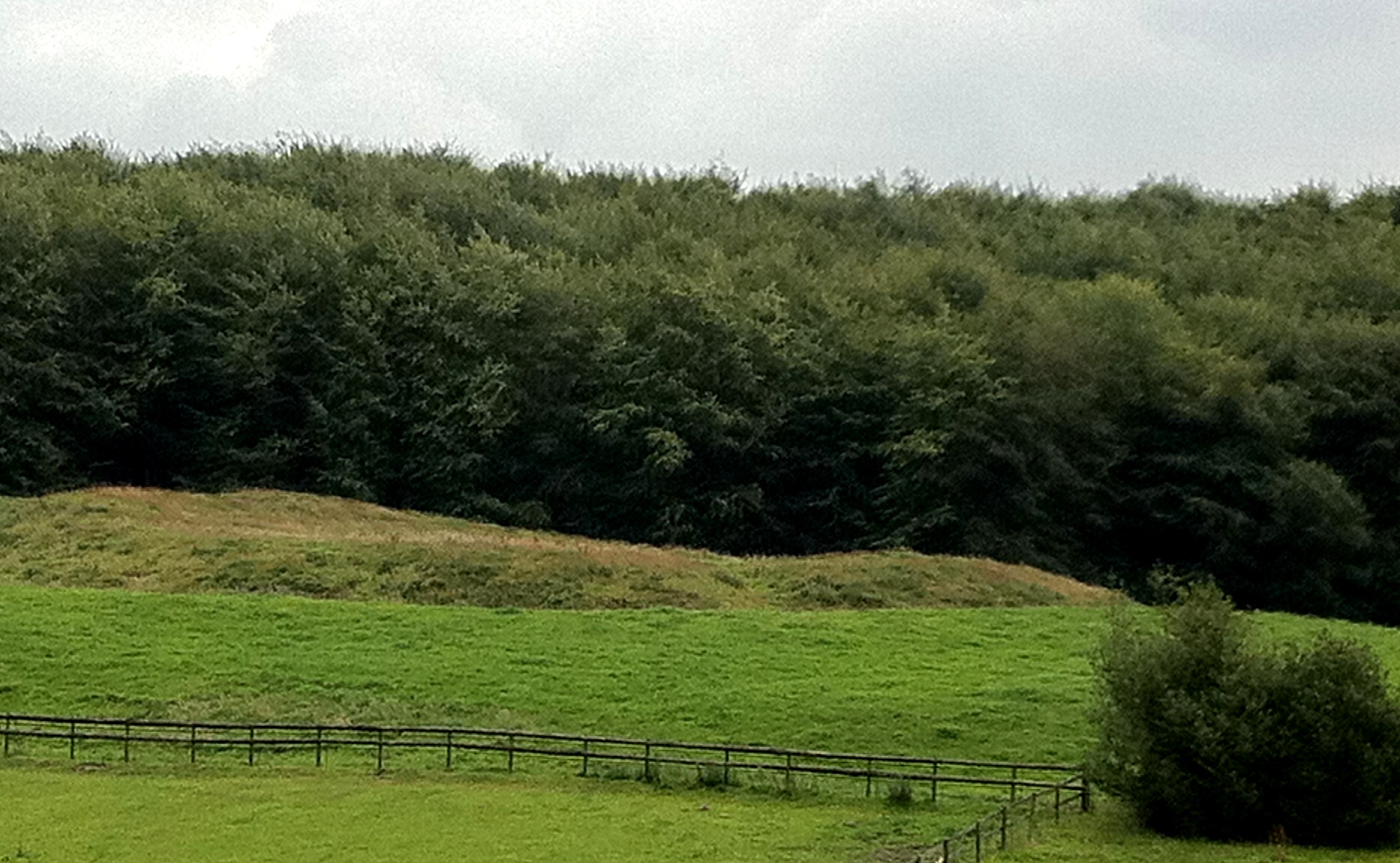
Tits Wood is a charming woodland located in the county of Somerset, England. Situated near the village of Pilton, this woodland is renowned for its natural beauty and diverse flora and fauna. Spanning approximately 20 acres, Tits Wood is a well-preserved ancient forest that offers a peaceful retreat for nature enthusiasts and avid hikers.

The woodland is predominantly composed of mixed deciduous trees, including oak, beech, and birch, creating a stunning mosaic of colors during the autumn months. The forest floor is carpeted with a rich variety of wildflowers and ferns, providing a haven for a range of wildlife.

Tits Wood is home to an array of bird species, making it a popular destination for birdwatchers. Visitors often spot woodpeckers, owls, and various songbirds throughout the woodland. Additionally, small mammals like foxes, badgers, and squirrels can be observed in their natural habitat.

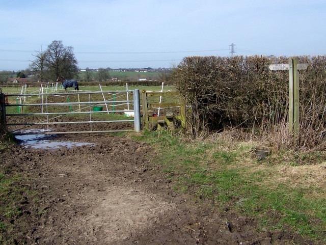
The woodland offers several walking trails that wind through its enchanting paths, allowing visitors to immerse themselves in its tranquility. These trails are well-maintained and suitable for all ages and fitness levels. Along the way, benches and picnic spots are scattered, providing opportunities for rest and relaxation amidst the serene surroundings.

Tits Wood is easily accessible, with a small car park located nearby. Visitors are encouraged to bring their own supplies, including food and water, as there are no facilities within the woodland itself. Dogs are also welcome, but owners are kindly reminded to keep them on a leash and clean up after them.

Overall, Tits Wood offers a delightful escape into nature, where visitors can connect with the countryside and experience the wonders of Somerset's woodlands.

If you have any feedback on the listing, please let us know in the comments section below.

Tits Wood Images

Images are sourced within 2km of 51.214924/-2.2737203 or Grid Reference ST8046. Thanks to Geograph Open Source API. All images are credited.

Corsley Village from Cley Hill The village of Corsley to the North of Cley Hill taken from the trig point.
Corsley Village from Cley Hill
The village of Corsley to the North of Cley Hill taken from the trig point.
Art Deco former motor showrooms, Corsley Heath, nr. Warminster, Wiltshire According to the estate agents, "Cavallino House is an Art Deco style building with significant motor racing history, previously accommodating a motor vehicle workshop and showroom". Cavallino Rampante is Italian for Prancing Horse and associated with Ferrari, so that may be the racing link. The building looks recently restore and maybe it previously had metal Crittall windows.
Art Deco former motor showrooms, Corsley Heath, nr. Warminster, Wiltshire
According to the estate agents, "Cavallino House is an Art Deco style building with significant motor racing history, previously accommodating a motor vehicle workshop and showroom". Cavallino Rampante is Italian for Prancing Horse and associated with Ferrari, so that may be the racing link. The building looks recently restore and maybe it previously had metal Crittall windows.
Friggle Towers  A view looking west across Friggle Street towards Friggle Towers.
Friggle Towers
A view looking west across Friggle Street towards Friggle Towers.
Lower Grange Farm A view looking to the northeast towards Lower Grange Farm at Elliotts Green.
Lower Grange Farm
A view looking to the northeast towards Lower Grange Farm at Elliotts Green.
Rodden Brook Photo taken close to west of field (dairy pasture) boundary facing SE
Rodden Brook
Photo taken close to west of field (dairy pasture) boundary facing SE
2008 : Looking north on Friggle Street At the entrance to Grandon Farm.
2008 : Looking north on Friggle Street
At the entrance to Grandon Farm.
2008 : Pasture on Friggle Street Near Elliots Green.
Cley Hill is on the skyline <a href="https://www.geograph.org.uk/gridref/ST8344">ST8344</a> with Lane End on the hill between
2008 : Pasture on Friggle Street
Near Elliots Green. Cley Hill is on the skyline ST8344 with Lane End on the hill between
2008 : Friggle Towers from the south Just off Friggle Street.
2008 : Friggle Towers from the south
Just off Friggle Street.
2008 : Pasture near Elliots Green Looking north west to the outskirts of Frome.
2008 : Pasture near Elliots Green
Looking north west to the outskirts of Frome.
2008 : Friggle Street, looking north Near the driveway to Grandon Manor.
2008 : Friggle Street, looking north
Near the driveway to Grandon Manor.
2009 : North east on Shepherd's Lane Shepherd's Wood is to the right.
2009 : North east on Shepherd's Lane
Shepherd's Wood is to the right.
Footpath, Friggle Street The footpath passes through the farmyard of Bollow Hill Farm on its way to Bollow Farm.
Footpath, Friggle Street
The footpath passes through the farmyard of Bollow Hill Farm on its way to Bollow Farm.
Footpath, Lower Grange Farm The footpath crosses paddocks on its way to Feltham Bridge.
Footpath, Lower Grange Farm
The footpath crosses paddocks on its way to Feltham Bridge.
Dertfords Ford This irish bridge ford on Redford Water is found on Mill Lane at Dertfords.
Dertfords Ford
This irish bridge ford on Redford Water is found on Mill Lane at Dertfords.
Manor Farmhouse, Corsley House reputedly built or rebuilt for Sir John Thynne, circa 1560, for use while Longleat House was being rebuilt.  Grade II* listed.  <span class="nowrap"><a title="https://www.historicengland.org.uk/listing/the-list/list-entry/1285731" rel="nofollow ugc noopener" href="https://www.historicengland.org.uk/listing/the-list/list-entry/1285731">Link</a><img style="margin-left:2px;" alt="External link" title="External link - shift click to open in new window" src="https://s1.geograph.org.uk/img/external.png" width="10" height="10"/></span>
Manor Farmhouse, Corsley
House reputedly built or rebuilt for Sir John Thynne, circa 1560, for use while Longleat House was being rebuilt. Grade II* listed. LinkExternal link
Church of St Margaret of Antioch, Corsley Church built in 1833.  Grade II listed.  <span class="nowrap"><a title="https://www.historicengland.org.uk/listing/the-list/list-entry/1285744" rel="nofollow ugc noopener" href="https://www.historicengland.org.uk/listing/the-list/list-entry/1285744">Link</a><img style="margin-left:2px;" alt="External link" title="External link - shift click to open in new window" src="https://s1.geograph.org.uk/img/external.png" width="10" height="10"/></span>
Church of St Margaret of Antioch, Corsley
Church built in 1833. Grade II listed. LinkExternal link
Church of St Margaret of Antioch, Corsley - part of churchyard Church built in 1833.  Grade II listed.  <span class="nowrap"><a title="https://www.historicengland.org.uk/listing/the-list/list-entry/1285744" rel="nofollow ugc noopener" href="https://www.historicengland.org.uk/listing/the-list/list-entry/1285744">Link</a><img style="margin-left:2px;" alt="External link" title="External link - shift click to open in new window" src="https://s1.geograph.org.uk/img/external.png" width="10" height="10"/></span>
Church of St Margaret of Antioch, Corsley - part of churchyard
Church built in 1833. Grade II listed. LinkExternal link
Rush hour in Corsley
Show me another place!

Tits Wood is located at Grid Ref: ST8046 (Lat: 51.214924, Lng: -2.2737203)

Administrative County: Somerset

District: Mendip

Police Authority: Avon and Somerset

What 3 Words

///void.completed.graph. Near Corsley, Wiltshire

Nearby Locations

Tits Wood

Related Wikis

Frome Hoard

The Frome Hoard is a hoard of 52,503 Roman coins found in April 2010 by metal detectorist Dave Crisp near Frome in Somerset, England. The coins were contained...

Church of All Saints, Rodden

The Anglican Church of All Saints in Rodden, Somerset, England, was built in 1640. It is a Grade II* listed building. == History == The church was built...

Corsley

Corsley is a hamlet and civil parish 3 miles (5 km) west of Warminster in Wiltshire, England. The parish is on the county border with Somerset; the Somerset...

St Margaret's, Corsley

St Margaret's, Corsley, is the Church of England parish church of Corsley in Wiltshire, England. In 1968 the church was designated as Grade II listed.The...

St Mary's Church, Temple, Corsley

The Church of St Mary at Temple, Corsley, Wiltshire, England is a chapel-of-ease dating from the very early 20th century. It was commissioned and paid...

Hales Castle

Hales Castle was a medieval castle that once stood overlooking the town of Frome in the Mendip district of Somerset, England. It has been scheduled as...

Frome Clay

The Frome Clay is a geological formation in England. It preserves fossils dating back to the Bathonian stage of the Middle Jurassic period. == See also... ==

Chapmanslade

Chapmanslade is a village and civil parish in the county of Wiltshire, in the southwest of England. The parish is on the county border with Somerset and...

Nearby Amenities

Located within 500m of 51.214924,-2.2737203
Woodcock Farm
Place: hamlet
Source: OS_OpenData_StreetView
Lat/Long: 51.2135081/-2.2761893
Power: pole
Lat/Long: 51.2111375/-2.2765345
Power: pole
Lat/Long: 51.2121361/-2.2787352
Power: pole
Lat/Long: 51.2116802/-2.277712
Power: pole
Lat/Long: 51.2107072/-2.27529
The data included in this document is from www.openstreetmap.org. The data is made available under ODbL.

Have you been to Tits Wood?

Leave your review of Tits Wood below (or comments, questions and feedback).