Bates Wood

Wood, Forest in Staffordshire Newcastle-under-Lyme

England

Bates Wood

Wild garlic along ditch Bateswood Country Park, north-west of Newcastle-under-Lyme in Staffordshire and adjacent to the village of Halmer End, is designated as a Local Nature Reserve (LNR). It was developed after the cessation of opencast mining in the 1990s, which left the area as a barren wasteland with poor quality soil. Birch reforestation and the creation of a lake have improved the habitat for wildlife, while a network of footpaths and a bridle path create access to most parts of the site. In 2012 managed fishing by a local angling club was permitted, in an attempt to curb illicit fishing.

The site is managed by Newcastle Borough Council in partnership with Halmer End Wildlife Trust, a group of volunteers.

This site is not to be confused with Staffordshire Wildlife Trust's reserve immediately to the south, also called Bateswood (see <a title="https://www.geograph.org.uk/snippet/12701)" href="https://www.geograph.org.uk/snippet/12701)">Link</a>.
Wild garlic along ditch Credit: Jonathan Hutchins

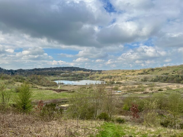
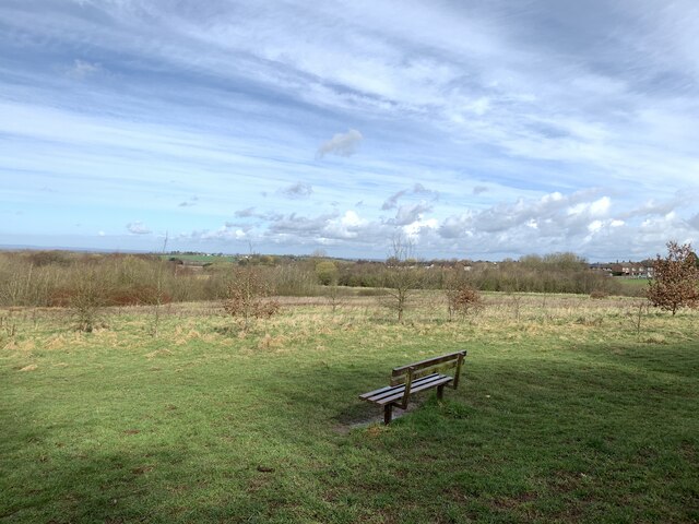
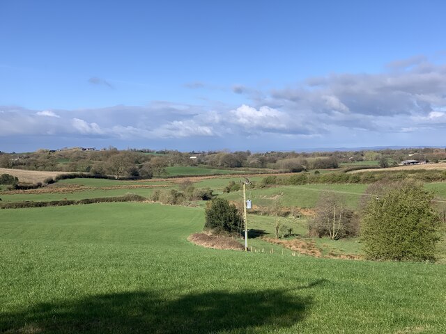
Bates Wood is a picturesque forest located in Staffordshire, England. Covering an area of approximately 80 hectares, it is a popular destination for nature lovers and outdoor enthusiasts. The wood is situated near the village of Yoxall and is easily accessible from major towns and cities in the region.

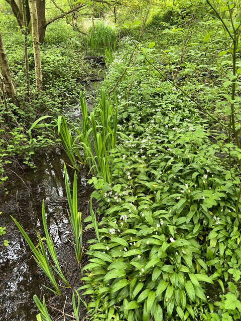
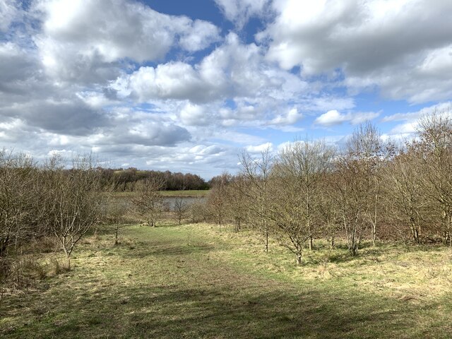
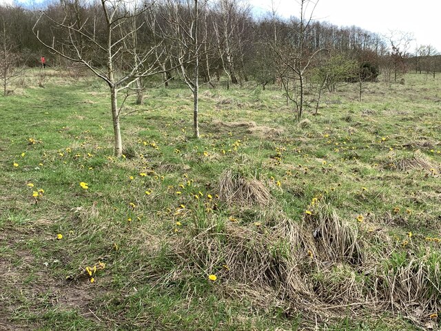
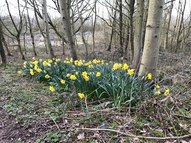
Bates Wood boasts a diverse range of tree species, including oak, beech, and silver birch. The forest floor is adorned with a variety of wildflowers, creating a vibrant and colorful environment. The wood is also home to an abundance of wildlife, including deer, squirrels, and a variety of bird species. Birdwatchers flock to the area to catch a glimpse of rare bird species that inhabit the forest.

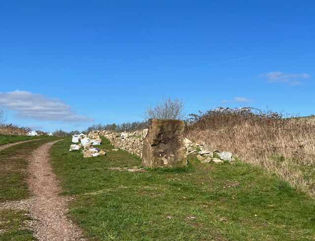
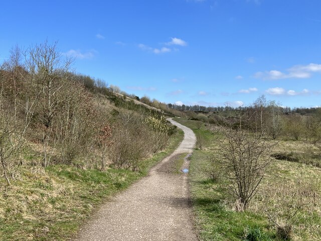
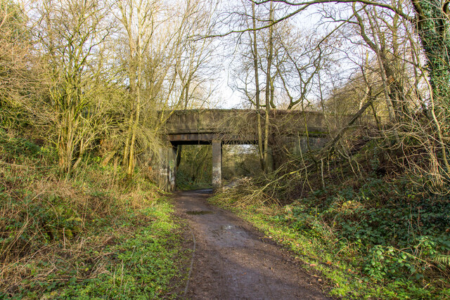
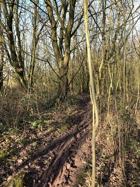
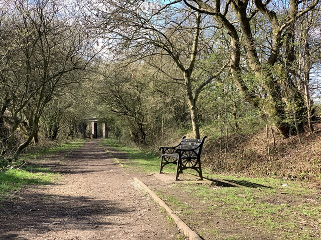
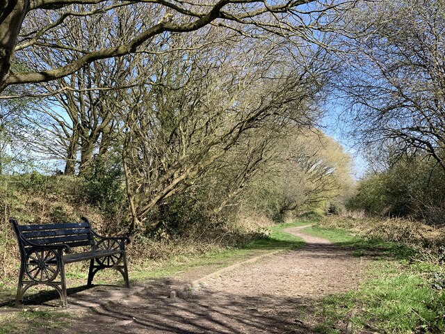
There are several well-maintained walking trails that wind through Bates Wood, offering visitors the opportunity to explore the natural beauty at their own pace. The paths are suitable for all fitness levels and are clearly marked for ease of navigation. Along the way, visitors can enjoy breathtaking views, tranquil streams, and peaceful picnic spots.

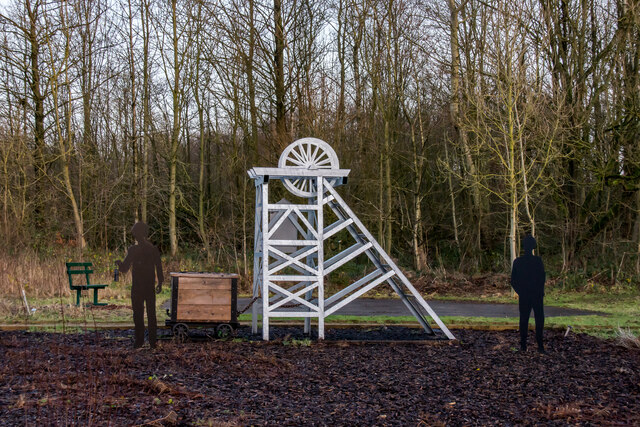
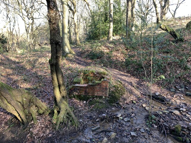
Bates Wood is not only a natural haven but also holds historical significance. It is believed to have been a hunting ground for the nobility in medieval times. Today, remnants of ancient structures and a medieval deer park can still be seen within the wood, adding to its charm and intrigue.

Overall, Bates Wood in Staffordshire is a captivating destination for those seeking a peaceful retreat amidst nature. With its stunning landscape, diverse wildlife, and rich history, it offers visitors a truly immersive experience in the heart of the English countryside.

If you have any feedback on the listing, please let us know in the comments section below.

Bates Wood Images

Images are sourced within 2km of 53.03036/-2.3014716 or Grid Reference SJ7948. Thanks to Geograph Open Source API. All images are credited.

Wild garlic along ditch Bateswood Country Park, north-west of Newcastle-under-Lyme in Staffordshire and adjacent to the village of Halmer End, is designated as a Local Nature Reserve (LNR). It was developed after the cessation of opencast mining in the 1990s, which left the area as a barren wasteland with poor quality soil. Birch reforestation and the creation of a lake have improved the habitat for wildlife, while a network of footpaths and a bridle path create access to most parts of the site. In 2012 managed fishing by a local angling club was permitted, in an attempt to curb illicit fishing.

The site is managed by Newcastle Borough Council in partnership with Halmer End Wildlife Trust, a group of volunteers.

This site is not to be confused with Staffordshire Wildlife Trust's reserve immediately to the south, also called Bateswood (see <a title="https://www.geograph.org.uk/snippet/12701)" href="https://www.geograph.org.uk/snippet/12701)">Link</a>.
Wild garlic along ditch
Bateswood Country Park, north-west of Newcastle-under-Lyme in Staffordshire and adjacent to the village of Halmer End, is designated as a Local Nature Reserve (LNR). It was developed after the cessation of opencast mining in the 1990s, which left the area as a barren wasteland with poor quality soil. Birch reforestation and the creation of a lake have improved the habitat for wildlife, while a network of footpaths and a bridle path create access to most parts of the site. In 2012 managed fishing by a local angling club was permitted, in an attempt to curb illicit fishing. The site is managed by Newcastle Borough Council in partnership with Halmer End Wildlife Trust, a group of volunteers. This site is not to be confused with Staffordshire Wildlife Trust's reserve immediately to the south, also called Bateswood (see Link.
Jubilee Stone and dry stone wall A professional dry stone waller has been progressively building a wall from the Jubilee Stone northwards along the edge of the plateau at Silverdale Country Park.
Jubilee Stone and dry stone wall
A professional dry stone waller has been progressively building a wall from the Jubilee Stone northwards along the edge of the plateau at Silverdale Country Park.
Path on Silverdale Country Park Silverdale Country Park was created on the site of former mineworkings. It is now owned by national charity The Land Trust, which manages the site as a public open space for people and wildlife. Day-to-day management of the site is vested in Groundwork West Midlands, which appointed a Ranger in April 2011 to oversee the site. 

There are two main areas. The Void is a vast deep bowl with sparse vegetation, a large lake and some smaller pools, which resulted after the cessation of opencast mining from 1987-1994. Waste Farm Meadows is a plateau created from colliery spoil tips, and consists of carefully managed grassland. The two are separated by a band of woodland called Miners Retreat Wood. A pond close to the road adjoining Silverdale village, known as Furnace Pool, is leased by the Silverdale Angling Society. Much of the site of Silverdale Colliery, i.e. the deep pit, in operation from 1830 right up to 1998, is now occupied by a new housing estate called 'Heritage Park', while the old furnace site is now an 'enterprise park' of commercial and light industrial units.

Silverdale Country Park website is at <span class="nowrap"><a title="http://www.silverdalecountrypark.org.uk/" rel="nofollow ugc noopener" href="http://www.silverdalecountrypark.org.uk/">Link</a><img style="margin-left:2px;" alt="External link" title="External link - shift click to open in new window" src="https://s1.geograph.org.uk/img/external.png" width="10" height="10"/></span>.
Path on Silverdale Country Park
Silverdale Country Park was created on the site of former mineworkings. It is now owned by national charity The Land Trust, which manages the site as a public open space for people and wildlife. Day-to-day management of the site is vested in Groundwork West Midlands, which appointed a Ranger in April 2011 to oversee the site. There are two main areas. The Void is a vast deep bowl with sparse vegetation, a large lake and some smaller pools, which resulted after the cessation of opencast mining from 1987-1994. Waste Farm Meadows is a plateau created from colliery spoil tips, and consists of carefully managed grassland. The two are separated by a band of woodland called Miners Retreat Wood. A pond close to the road adjoining Silverdale village, known as Furnace Pool, is leased by the Silverdale Angling Society. Much of the site of Silverdale Colliery, i.e. the deep pit, in operation from 1830 right up to 1998, is now occupied by a new housing estate called 'Heritage Park', while the old furnace site is now an 'enterprise park' of commercial and light industrial units. Silverdale Country Park website is at LinkExternal link.
Path onto Silverdale Country Park from Cannel Row Silverdale Country Park was created on the site of former mineworkings. It is now owned by national charity The Land Trust, which manages the site as a public open space for people and wildlife. Day-to-day management of the site is vested in Groundwork West Midlands, which appointed a Ranger in April 2011 to oversee the site. 

There are two main areas. The Void is a vast deep bowl with sparse vegetation, a large lake and some smaller pools, which resulted after the cessation of opencast mining from 1987-1994. Waste Farm Meadows is a plateau created from colliery spoil tips, and consists of carefully managed grassland. The two are separated by a band of woodland called Miners Retreat Wood. A pond close to the road adjoining Silverdale village, known as Furnace Pool, is leased by the Silverdale Angling Society. Much of the site of Silverdale Colliery, i.e. the deep pit, in operation from 1830 right up to 1998, is now occupied by a new housing estate called 'Heritage Park', while the old furnace site is now an 'enterprise park' of commercial and light industrial units.

Silverdale Country Park website is at <span class="nowrap"><a title="http://www.silverdalecountrypark.org.uk/" rel="nofollow ugc noopener" href="http://www.silverdalecountrypark.org.uk/">Link</a><img style="margin-left:2px;" alt="External link" title="External link - shift click to open in new window" src="https://s1.geograph.org.uk/img/external.png" width="10" height="10"/></span>.
Path onto Silverdale Country Park from Cannel Row
Silverdale Country Park was created on the site of former mineworkings. It is now owned by national charity The Land Trust, which manages the site as a public open space for people and wildlife. Day-to-day management of the site is vested in Groundwork West Midlands, which appointed a Ranger in April 2011 to oversee the site. There are two main areas. The Void is a vast deep bowl with sparse vegetation, a large lake and some smaller pools, which resulted after the cessation of opencast mining from 1987-1994. Waste Farm Meadows is a plateau created from colliery spoil tips, and consists of carefully managed grassland. The two are separated by a band of woodland called Miners Retreat Wood. A pond close to the road adjoining Silverdale village, known as Furnace Pool, is leased by the Silverdale Angling Society. Much of the site of Silverdale Colliery, i.e. the deep pit, in operation from 1830 right up to 1998, is now occupied by a new housing estate called 'Heritage Park', while the old furnace site is now an 'enterprise park' of commercial and light industrial units. Silverdale Country Park website is at LinkExternal link.
Silverdale Country Park Silverdale Country Park was created on the site of former mineworkings. It is now owned by national charity The Land Trust, which manages the site as a public open space for people and wildlife. Day-to-day management of the site is vested in Groundwork West Midlands, which appointed a Ranger in April 2011 to oversee the site. 

There are two main areas. The Void is a vast deep bowl with sparse vegetation, a large lake and some smaller pools, which resulted after the cessation of opencast mining from 1987-1994. Waste Farm Meadows is a plateau created from colliery spoil tips, and consists of carefully managed grassland. The two are separated by a band of woodland called Miners Retreat Wood. A pond close to the road adjoining Silverdale village, known as Furnace Pool, is leased by the Silverdale Angling Society. Much of the site of Silverdale Colliery, i.e. the deep pit, in operation from 1830 right up to 1998, is now occupied by a new housing estate called 'Heritage Park', while the old furnace site is now an 'enterprise park' of commercial and light industrial units.

Silverdale Country Park website is at <span class="nowrap"><a title="http://www.silverdalecountrypark.org.uk/" rel="nofollow ugc noopener" href="http://www.silverdalecountrypark.org.uk/">Link</a><img style="margin-left:2px;" alt="External link" title="External link - shift click to open in new window" src="https://s1.geograph.org.uk/img/external.png" width="10" height="10"/></span>.
Silverdale Country Park
Silverdale Country Park was created on the site of former mineworkings. It is now owned by national charity The Land Trust, which manages the site as a public open space for people and wildlife. Day-to-day management of the site is vested in Groundwork West Midlands, which appointed a Ranger in April 2011 to oversee the site. There are two main areas. The Void is a vast deep bowl with sparse vegetation, a large lake and some smaller pools, which resulted after the cessation of opencast mining from 1987-1994. Waste Farm Meadows is a plateau created from colliery spoil tips, and consists of carefully managed grassland. The two are separated by a band of woodland called Miners Retreat Wood. A pond close to the road adjoining Silverdale village, known as Furnace Pool, is leased by the Silverdale Angling Society. Much of the site of Silverdale Colliery, i.e. the deep pit, in operation from 1830 right up to 1998, is now occupied by a new housing estate called 'Heritage Park', while the old furnace site is now an 'enterprise park' of commercial and light industrial units. Silverdale Country Park website is at LinkExternal link.
Plateau on Silverdale Country Park Silverdale Country Park was created on the site of former mineworkings. It is now owned by national charity The Land Trust, which manages the site as a public open space for people and wildlife. Day-to-day management of the site is vested in Groundwork West Midlands, which appointed a Ranger in April 2011 to oversee the site. 

There are two main areas. The Void is a vast deep bowl with sparse vegetation, a large lake and some smaller pools, which resulted after the cessation of opencast mining from 1987-1994. Waste Farm Meadows is a plateau created from colliery spoil tips, and consists of carefully managed grassland. The two are separated by a band of woodland called Miners Retreat Wood. A pond close to the road adjoining Silverdale village, known as Furnace Pool, is leased by the Silverdale Angling Society. Much of the site of Silverdale Colliery, i.e. the deep pit, in operation from 1830 right up to 1998, is now occupied by a new housing estate called 'Heritage Park', while the old furnace site is now an 'enterprise park' of commercial and light industrial units.

Silverdale Country Park website is at <span class="nowrap"><a title="http://www.silverdalecountrypark.org.uk/" rel="nofollow ugc noopener" href="http://www.silverdalecountrypark.org.uk/">Link</a><img style="margin-left:2px;" alt="External link" title="External link - shift click to open in new window" src="https://s1.geograph.org.uk/img/external.png" width="10" height="10"/></span>.
Plateau on Silverdale Country Park
Silverdale Country Park was created on the site of former mineworkings. It is now owned by national charity The Land Trust, which manages the site as a public open space for people and wildlife. Day-to-day management of the site is vested in Groundwork West Midlands, which appointed a Ranger in April 2011 to oversee the site. There are two main areas. The Void is a vast deep bowl with sparse vegetation, a large lake and some smaller pools, which resulted after the cessation of opencast mining from 1987-1994. Waste Farm Meadows is a plateau created from colliery spoil tips, and consists of carefully managed grassland. The two are separated by a band of woodland called Miners Retreat Wood. A pond close to the road adjoining Silverdale village, known as Furnace Pool, is leased by the Silverdale Angling Society. Much of the site of Silverdale Colliery, i.e. the deep pit, in operation from 1830 right up to 1998, is now occupied by a new housing estate called 'Heritage Park', while the old furnace site is now an 'enterprise park' of commercial and light industrial units. Silverdale Country Park website is at LinkExternal link.
Bridge over the Audley Branch Line Bridge over the North Staffordshire Railway (NSR) Audley branch line. 
The line was opened 1870 and closed in 1962.
Bridge over the Audley Branch Line
Bridge over the North Staffordshire Railway (NSR) Audley branch line. The line was opened 1870 and closed in 1962.
Minnie Pit Disaster (1918) Heritage site The Minnie Pit disaster was a coal mining accident that took place on 12 January 1918 in Halmer End, Staffordshire, in which 155 men and boys died. The disaster, which was caused by an explosion due to firedamp, is the worst ever recorded in the North Staffordshire Coalfield.

<span class="nowrap"><a title="https://en.wikipedia.org/wiki/Minnie_Pit_Disaster" rel="nofollow ugc noopener" href="https://en.wikipedia.org/wiki/Minnie_Pit_Disaster">Link</a><img style="margin-left:2px;" alt="External link" title="External link - shift click to open in new window" src="https://s1.geograph.org.uk/img/external.png" width="10" height="10"/></span>
Minnie Pit Disaster (1918) Heritage site
The Minnie Pit disaster was a coal mining accident that took place on 12 January 1918 in Halmer End, Staffordshire, in which 155 men and boys died. The disaster, which was caused by an explosion due to firedamp, is the worst ever recorded in the North Staffordshire Coalfield. LinkExternal link
M6 Northbound near Red Hall Farm The M6 motorway runs from junction 19 of the M1 at the Catthorpe Interchange, near Rugby to the Gretna junction (J45). Here it becomes the A74(M) and M74 which continues to Glasgow.

The M6 is the longest motorway in the United Kingdom (232 miles) and one of the busiest. It incorporates the first length of motorway opened in the UK (the Preston bypass in 1958) and forms part of a motorway "Backbone of Britain", running north-south between London and Glasgow via the industrial north of England. It is also part of the east-west route between the Midlands and the east coast ports.
M6 Northbound near Red Hall Farm
The M6 motorway runs from junction 19 of the M1 at the Catthorpe Interchange, near Rugby to the Gretna junction (J45). Here it becomes the A74(M) and M74 which continues to Glasgow. The M6 is the longest motorway in the United Kingdom (232 miles) and one of the busiest. It incorporates the first length of motorway opened in the UK (the Preston bypass in 1958) and forms part of a motorway "Backbone of Britain", running north-south between London and Glasgow via the industrial north of England. It is also part of the east-west route between the Midlands and the east coast ports.
Rutted path in Bates Wood The deep ruts are caused by cycle wheels. The path is designated Audley FP 110.
Rutted path in Bates Wood
The deep ruts are caused by cycle wheels. The path is designated Audley FP 110.
Footings of former brick structure in Bates Wood This brick structure was presumably part of the mine workings which operated here.
Footings of former brick structure in Bates Wood
This brick structure was presumably part of the mine workings which operated here.
Bateswood Country Park in early spring Bateswood Country Park, north-west of Newcastle-under-Lyme in Staffordshire and adjacent to the village of Halmer End, is designated as a Local Nature Reserve (LNR). It was developed after the cessation of opencast mining in the 1990s, which left the area as a barren wasteland with poor quality soil. Birch reforestation and the creation of a lake have improved the habitat for wildlife, while a network of footpaths and a bridle path create access to most parts of the site. In 2012 managed fishing by a local angling club was permitted, in an attempt to curb illicit fishing.

The site is managed by Newcastle Borough Council in partnership with Halmer End Wildlife Trust, a group of volunteers.

This site is not to be confused with Staffordshire Wildlife Trust's reserve immediately to the south, also called Bateswood (see <a title="https://www.geograph.org.uk/snippet/12701)" href="https://www.geograph.org.uk/snippet/12701)">Link</a>.
Bateswood Country Park in early spring
Bateswood Country Park, north-west of Newcastle-under-Lyme in Staffordshire and adjacent to the village of Halmer End, is designated as a Local Nature Reserve (LNR). It was developed after the cessation of opencast mining in the 1990s, which left the area as a barren wasteland with poor quality soil. Birch reforestation and the creation of a lake have improved the habitat for wildlife, while a network of footpaths and a bridle path create access to most parts of the site. In 2012 managed fishing by a local angling club was permitted, in an attempt to curb illicit fishing. The site is managed by Newcastle Borough Council in partnership with Halmer End Wildlife Trust, a group of volunteers. This site is not to be confused with Staffordshire Wildlife Trust's reserve immediately to the south, also called Bateswood (see Link.
Coltsfoot at Bateswood Country Park Bateswood Country Park, north-west of Newcastle-under-Lyme in Staffordshire and adjacent to the village of Halmer End, is designated as a Local Nature Reserve (LNR). It was developed after the cessation of opencast mining in the 1990s, which left the area as a barren wasteland with poor quality soil. Birch reforestation and the creation of a lake have improved the habitat for wildlife, while a network of footpaths and a bridle path create access to most parts of the site. In 2012 managed fishing by a local angling club was permitted, in an attempt to curb illicit fishing.

The site is managed by Newcastle Borough Council in partnership with Halmer End Wildlife Trust, a group of volunteers.

This site is not to be confused with Staffordshire Wildlife Trust's reserve immediately to the south, also called Bateswood (see <a title="https://www.geograph.org.uk/snippet/12701)" href="https://www.geograph.org.uk/snippet/12701)">Link</a>.
Coltsfoot at Bateswood Country Park
Bateswood Country Park, north-west of Newcastle-under-Lyme in Staffordshire and adjacent to the village of Halmer End, is designated as a Local Nature Reserve (LNR). It was developed after the cessation of opencast mining in the 1990s, which left the area as a barren wasteland with poor quality soil. Birch reforestation and the creation of a lake have improved the habitat for wildlife, while a network of footpaths and a bridle path create access to most parts of the site. In 2012 managed fishing by a local angling club was permitted, in an attempt to curb illicit fishing. The site is managed by Newcastle Borough Council in partnership with Halmer End Wildlife Trust, a group of volunteers. This site is not to be confused with Staffordshire Wildlife Trust's reserve immediately to the south, also called Bateswood (see Link.
Daffodils at Bateswood Country Park Bateswood Country Park, north-west of Newcastle-under-Lyme in Staffordshire and adjacent to the village of Halmer End, is designated as a Local Nature Reserve (LNR). It was developed after the cessation of opencast mining in the 1990s, which left the area as a barren wasteland with poor quality soil. Birch reforestation and the creation of a lake have improved the habitat for wildlife, while a network of footpaths and a bridle path create access to most parts of the site. In 2012 managed fishing by a local angling club was permitted, in an attempt to curb illicit fishing.

The site is managed by Newcastle Borough Council in partnership with Halmer End Wildlife Trust, a group of volunteers.

This site is not to be confused with Staffordshire Wildlife Trust's reserve immediately to the south, also called Bateswood (see <a title="https://www.geograph.org.uk/snippet/12701)" href="https://www.geograph.org.uk/snippet/12701)">Link</a>.
Daffodils at Bateswood Country Park
Bateswood Country Park, north-west of Newcastle-under-Lyme in Staffordshire and adjacent to the village of Halmer End, is designated as a Local Nature Reserve (LNR). It was developed after the cessation of opencast mining in the 1990s, which left the area as a barren wasteland with poor quality soil. Birch reforestation and the creation of a lake have improved the habitat for wildlife, while a network of footpaths and a bridle path create access to most parts of the site. In 2012 managed fishing by a local angling club was permitted, in an attempt to curb illicit fishing. The site is managed by Newcastle Borough Council in partnership with Halmer End Wildlife Trust, a group of volunteers. This site is not to be confused with Staffordshire Wildlife Trust's reserve immediately to the south, also called Bateswood (see Link.
Bench seat on 'the Lines' 'The Lines' is the local term for the trackbed of the former Audley branch railway (closed 1963). It is not an official footpath but is regularly used by walkers, cyclists, dog-walkers, and schoolchildren going to and from Sir Thomas Boughey school in Halmer End.
Bench seat on 'the Lines'
'The Lines' is the local term for the trackbed of the former Audley branch railway (closed 1963). It is not an official footpath but is regularly used by walkers, cyclists, dog-walkers, and schoolchildren going to and from Sir Thomas Boughey school in Halmer End.
Audley Meadows from Wereton Road
Show me another place!

Bates Wood is located at Grid Ref: SJ7948 (Lat: 53.03036, Lng: -2.3014716)

Administrative County: Staffordshire

District: Newcastle-under-Lyme

Police Authority: Staffordshire

What 3 Words

///workers.cosmic.betrayed. Near Audley, Staffordshire

Nearby Locations

Bates Wood

Related Wikis

Alsagers Bank

Alsagers Bank is a village in the Borough of Newcastle-under-Lyme in Staffordshire. Population details at the 2011 census can be found under Audley Rural...

Halmer End

Halmer End is a small village in the Borough of Newcastle-under-Lyme in Staffordshire, neighbouring the small hamlet of Alsagers Bank and the larger village...

Minnie Pit Disaster

The Minnie Pit disaster was a coal mining accident that took place on 12 January 1918 in Halmer End, Staffordshire, in which 155 men and boys died. The...

Halmerend railway station

Halmerend railway station (sometimes referred to as Halmer End) is a disused railway station in Staffordshire, England. The station was situated on the...

Sir Thomas Boughey Academy

Sir Thomas Boughey Academy (formerly Sir Thomas Boughey High School) is a co-educational secondary school located in Halmer End (near Newcastle-under-Lyme...

Halmerend (ward)

Halmerend was a ward of the Borough of Newcastle-under-Lyme, in Staffordshire, England. The ward covered the villages of Alsagers Bank, Balterley, Betley...

Newcastle-under-Lyme (UK Parliament constituency)

Newcastle-under-Lyme is a constituency in northern Staffordshire created in 1354 and represented in the House of Commons of the UK Parliament since 2019...

Apedale

Apedale is a village in Staffordshire, England. The population at the 2011 census can be found under the Holditch (Ward) of Newcastle-under-Lyme. The village...

Nearby Amenities

Located within 500m of 53.03036,-2.3014716
Bus Stop
House No.
Bus: yes
Naptan AtcoCode: 3800C515701
Naptan Bearing: S
Naptan CommonName: House No.
Naptan Indicator: Adj
Naptan Street: Scot Hay Road 149
Naptan Verified: no
Public Transport: platform
Source: naptan_import
Lat/Long: 53.0299426/-2.295688
Barrier: stile
Foot: yes
Source: local knowledge
Stile: stepover
Lat/Long: 53.0324739/-2.2950975
Barrier: stile
Foot: yes
Source: local knowledge
Stile: stepover
Lat/Long: 53.0326638/-2.2957331
Barrier: stile
Foot: yes
Source: local knowledge
Stile: stepover
Lat/Long: 53.0326761/-2.2957743
Barrier: stile
Lat/Long: 53.0263933/-2.3041729
Barrier: stile
Lat/Long: 53.02614/-2.3039736
The data included in this document is from www.openstreetmap.org. The data is made available under ODbL.

Have you been to Bates Wood?

Leave your review of Bates Wood below (or comments, questions and feedback).