Hill Plantation

Wood, Forest in Staffordshire Stafford

England

Hill Plantation

North Lynn Manor Farm Vernacular and modern farm buildings at North Lynn Manor Farm
North Lynn Manor Farm Credit: P Gaskell

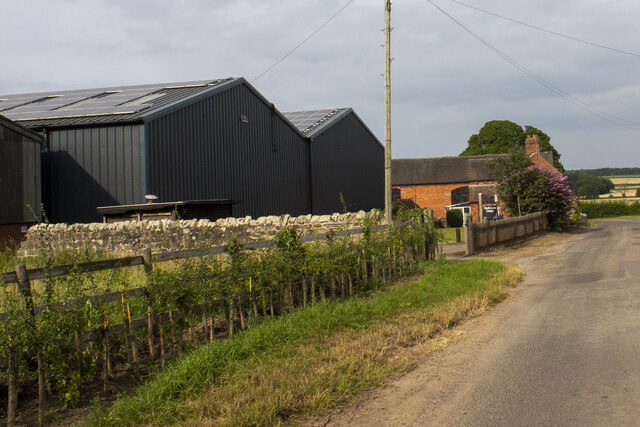
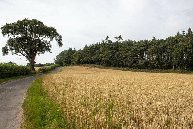
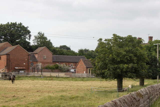
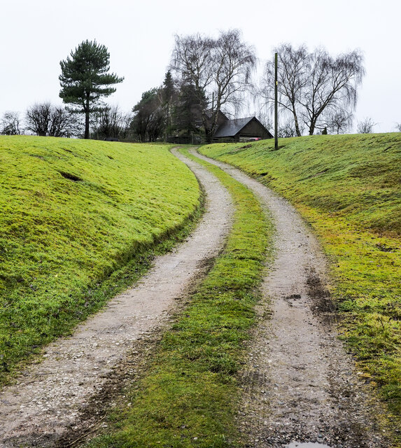
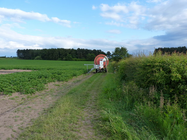
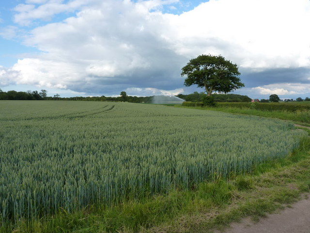
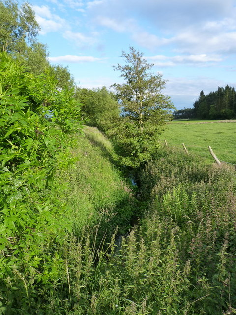
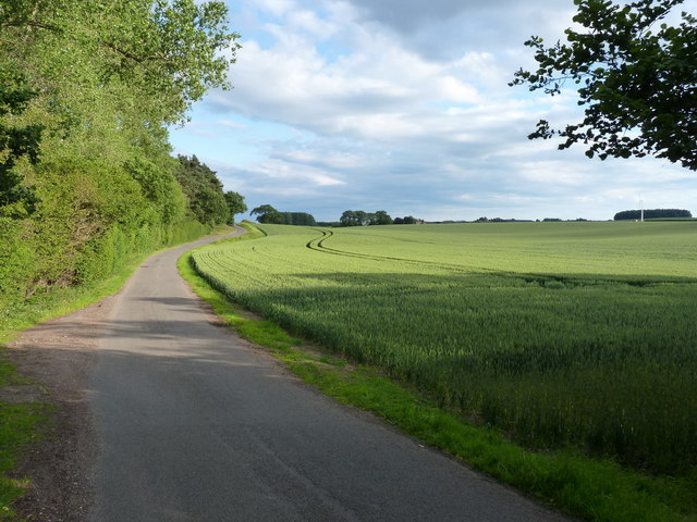
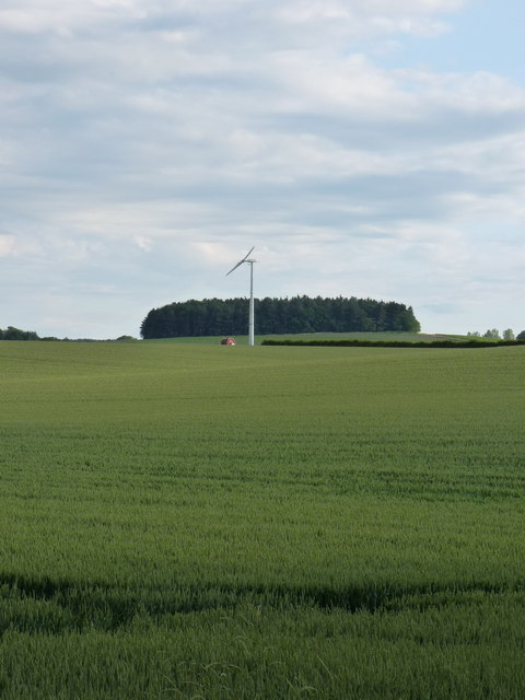
Hill Plantation, located in Staffordshire, England, is a picturesque woodland area known for its natural beauty and dense forest. Situated on a hill, the plantation offers breathtaking views of the surrounding countryside, making it a popular destination for nature enthusiasts and hikers.

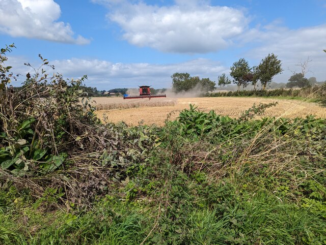
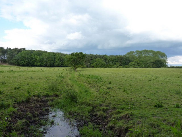
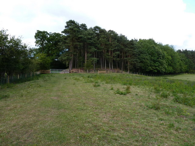
Covering an area of approximately 200 acres, Hill Plantation is home to a diverse range of flora and fauna. The woodland is primarily composed of broadleaf trees, including oak, beech, and birch, creating a vibrant and colorful canopy during the autumn months. Bluebells and wildflowers also bloom in abundance in the spring, adding to the plantation's charm and appeal.

The plantation offers several walking trails and pathways, allowing visitors to explore its enchanting landscape. These paths wind through the forest, meandering around ancient trees and babbling brooks. Along the way, visitors may encounter various wildlife species, such as squirrels, rabbits, and a rich variety of birdlife.

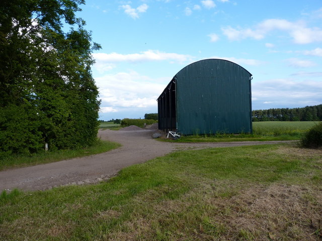
Hill Plantation is not only a place of natural beauty but also holds historical significance. The site was once part of an estate dating back to the 18th century, and remnants of old stone walls and structures can still be found within the woodland, providing a glimpse into its past.

Whether it's a leisurely stroll, a family picnic, or birdwatching, Hill Plantation offers a tranquil escape from the hustle and bustle of city life. Its serene atmosphere, coupled with its natural splendor, makes it a must-visit destination for those seeking solace in nature.

If you have any feedback on the listing, please let us know in the comments section below.

Hill Plantation Images

Images are sourced within 2km of 52.753974/-2.3045812 or Grid Reference SJ7917. Thanks to Geograph Open Source API. All images are credited.

North Lynn Manor Farm Vernacular and modern farm buildings at North Lynn Manor Farm
North Lynn Manor Farm
Vernacular and modern farm buildings at North Lynn Manor Farm
Wood and cereal field
Moreton road works
Moreton road works
Moreton Hall Farm Converted vernacular farm buildings at Moreton Hall Farm
Moreton Hall Farm
Converted vernacular farm buildings at Moreton Hall Farm
Tinwood Bank Woodland at Tinwood Bank
Tinwood Bank
Woodland at Tinwood Bank
Access road for Hilltop House Hilltop House is at the top of the drive, partly concealed by trees; it's not quite at the top of the hill - there's higher ground just beyond at the summit which has a trig point.
The road is also the route of a public footpath which bypasses the house on its left side.
Access road for Hilltop House
Hilltop House is at the top of the drive, partly concealed by trees; it's not quite at the top of the hill - there's higher ground just beyond at the summit which has a trig point. The road is also the route of a public footpath which bypasses the house on its left side.
Staffordshire Greenway Old abandoned railway, now a cycleway
Staffordshire Greenway
Old abandoned railway, now a cycleway
Harvesting the crops
The Orslow Brook at Coneygreaves Little more than a boggy ditch at this point, especially in near-drought conditions, it eventually runs into the Back Brook.
The Orslow Brook at Coneygreaves
Little more than a boggy ditch at this point, especially in near-drought conditions, it eventually runs into the Back Brook.
Bridleway at Coneygreaves Looking along the bridleway from Great Chatwell to Bromstead, towards the point where another splits off towards Moreton at the gate 100 yards away.
Bridleway at Coneygreaves
Looking along the bridleway from Great Chatwell to Bromstead, towards the point where another splits off towards Moreton at the gate 100 yards away.
A good attempt to block the bridleway A raingun was watering the potatoes just off shot to the left here; its hose reel had been left right across the bridleway, although a bike (or horse) could just about squeeze through against the hedge.
A good attempt to block the bridleway
A raingun was watering the potatoes just off shot to the left here; its hose reel had been left right across the bridleway, although a bike (or horse) could just about squeeze through against the hedge.
Mixed crops at Moreton Wheat in the foreground, potatoes under the raingun in the distance.
Mixed crops at Moreton
Wheat in the foreground, potatoes under the raingun in the distance.
Dutch barn at Sand Bank A large, isolated barn at the corner of Chapman's Wood.
Dutch barn at Sand Bank
A large, isolated barn at the corner of Chapman's Wood.
Lane junction near Moreton
The Moreton Brook Well overgrown after several weeks with very little rain; compare this with its normal may-time condition in <a href="https://www.geograph.org.uk/photo/421802">SJ7816 : Back Brook</a>
The Moreton Brook
Well overgrown after several weeks with very little rain; compare this with its normal may-time condition in SJ7816 : Back Brook
Along the lane to Lynn farm
Wind turbine at Lynn A small wind turbine in open fields north of Lynn Manor farms
Wind turbine at Lynn
A small wind turbine in open fields north of Lynn Manor farms
Lynn Manor Farm The farmyard at Lynn Manor - all the usual clutter of a busy working farm.
Lynn Manor Farm
The farmyard at Lynn Manor - all the usual clutter of a busy working farm.
Show me another place!

Hill Plantation is located at Grid Ref: SJ7917 (Lat: 52.753974, Lng: -2.3045812)

Administrative County: Staffordshire

District: Stafford

Police Authority: Staffordshire

What 3 Words

///typhoon.mouths.type. Near Woodcote, Shropshire

Nearby Locations

Moreton Hill Plantation

Related Wikis

Moreton, Staffordshire

Moreton is a small rural village in the borough of Stafford in Staffordshire, England, near the border with Shropshire. It lies 3.5 miles (5.6 km) south...

Beffcote

Beffcote is a village in Staffordshire, England. For the population taken at the United Kingdom Census 2011 see Gnosall.

Outwoods, Stafford

Outwoods is a hamlet in the English county of Staffordshire. Outwoods is located in the extreme west of the county near to the town of Newport, Shropshire...

Orslow

Orslow is an upland hamlet in Staffordshire, England, 0.75 miles (1.21 km) north-east of Great Chatwell. Its Anglo-Saxon name means 'Horsa's burial mound...

Great Chatwell

Great Chatwell is a small village within the civil parish of Blymhill and Weston-under-Lizard, in the South Staffordshire district of Staffordshire, England...

Back Brook, English Midlands

The Back Brook is a minor watercourse in the English counties of Shropshire and Staffordshire, in places forming the boundary between the two, and located...

Aqualate Hall

Aqualate Hall, a 20th-century country house, is located in Forton, Staffordshire, England, some 2 miles (3.2 km) east of the market town of Newport, Shropshire...

Coton, Staffordshire

Coton is a hamlet in the English county of Staffordshire.It lies on the A518 road some two miles west of Gnosall. == See also == Listed buildings in Gnosall...

Nearby Amenities

Located within 500m of 52.753974,-2.3045812
Bus Stop
The Green
Bus: yes
Naptan AtcoCode: 3800C706700
Naptan Bearing: NW
Naptan CommonName: The Green
Naptan Indicator: Adj
Naptan Landmark: Green
Naptan Street: Church Lane
Naptan Verified: no
Public Transport: platform
Source: naptan_import
Lat/Long: 52.7515072/-2.3028074
Bus Stop
The Green
Bus: yes
Naptan AtcoCode: 3800C706701
Naptan Bearing: S
Naptan BusStopType: CUS
Naptan CommonName: The Green
Naptan Indicator: Adj
Naptan Landmark: Green
Naptan Street: Church Lane
Naptan Verified: no
Public Transport: platform
Source: naptan_import
Lat/Long: 52.7513282/-2.302495
Moreton
Place: village
Wikidata: Q11785506
Lat/Long: 52.7523564/-2.3034352
Turning Loop
Lat/Long: 52.7561075/-2.2995725
Barrier: stile
Lat/Long: 52.75181/-2.3059678
Barrier: stile
Lat/Long: 52.7513863/-2.3060526
Generator Method: photovoltaic
Generator Output Electricity: yes
Generator Source: solar
Generator Type: solar_photovoltaic_panel
Location: roof
Power: generator
Lat/Long: 52.7506831/-2.3028561
Generator Method: photovoltaic
Generator Output Electricity: yes
Generator Source: solar
Generator Type: solar_photovoltaic_panel
Location: roof
Power: generator
Lat/Long: 52.7507838/-2.3026443
Generator Method: photovoltaic
Generator Output Electricity: yes
Generator Source: solar
Generator Type: solar_photovoltaic_panel
Location: roof
Power: generator
Lat/Long: 52.7518358/-2.3024619
Generator Method: photovoltaic
Generator Output Electricity: yes
Generator Source: solar
Generator Type: solar_photovoltaic_panel
Location: roof
Power: generator
Lat/Long: 52.7518845/-2.3025396
Generator Method: photovoltaic
Generator Output Electricity: yes
Generator Source: solar
Generator Type: solar_photovoltaic_panel
Location: roof
Power: generator
Lat/Long: 52.7533358/-2.3010725
Generator Method: photovoltaic
Generator Output Electricity: yes
Generator Source: solar
Generator Type: solar_photovoltaic_panel
Location: roof
Power: generator
Lat/Long: 52.7562043/-2.2995275
Defibrillator
Defibrillator Location: On outside wall of Moreton Millennium Community Centre, to the right of the main entrance.
Emergency: defibrillator
Ref GB The Circuit: C54BF0D9-D156-4406-BF53-6BC113F4C404
Lat/Long: 52.7533108/-2.301051
The data included in this document is from www.openstreetmap.org. The data is made available under ODbL.

Have you been to Hill Plantation?

Leave your review of Hill Plantation below (or comments, questions and feedback).