Three Cornered Wood

Wood, Forest in Worcestershire Wyre Forest

England

Three Cornered Wood

Londis Store & Areley Kings Post Office, 63 Areley Common, Areley Kings, Stourport-on-Severn Londis is the local convenience store for this area. It also includes the Areley Kings Post Office. This is one of the few post offices in the Stourport-on-Severn area to survive. In recent years the numbers have been savagely reduced by well over half.

Photographed on Boxing Day, with seasonal snow, the store was displaying four giant decorative holly wreaths on the outside.
Londis Store & Areley Kings Post Office, 63 Areley Common, Areley Kings, Stourport-on-Severn Credit: P L Chadwick

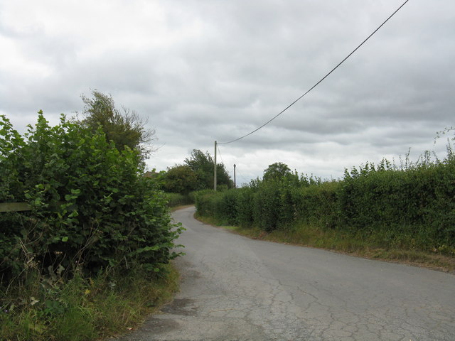
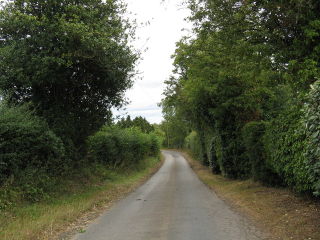
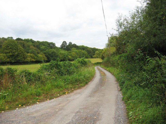
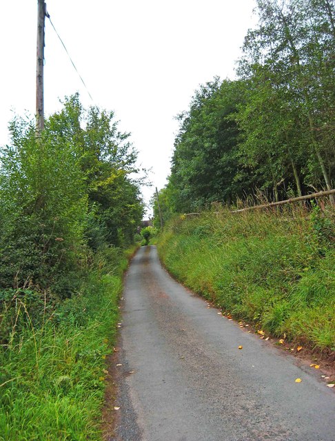
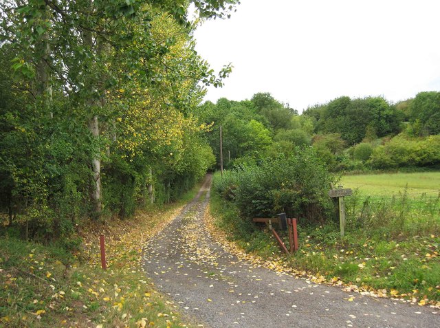
Three Cornered Wood is a dense forest located in the county of Worcestershire, England. Covering an area of approximately 500 acres, it is situated to the north of the town of Kidderminster and is easily accessible via local roads. The wood gets its name from its distinct triangular shape, which is noticeable when viewed from above.

The forest is predominantly composed of broadleaf trees, including oak, ash, beech, and birch, creating a rich and diverse ecosystem. Its dense canopy provides a habitat for numerous species of birds, mammals, and insects. Wildlife enthusiasts can spot various woodland creatures such as deer, foxes, badgers, and an array of bird species, including woodpeckers and owls.

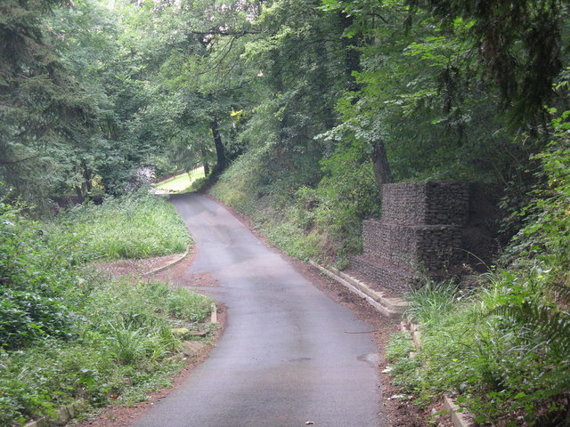
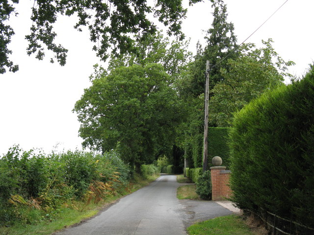
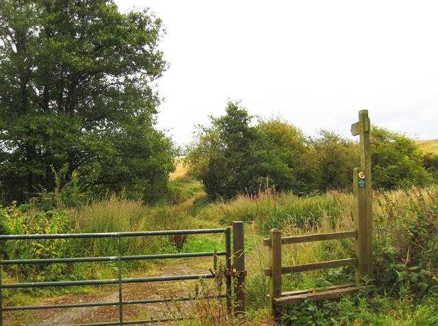
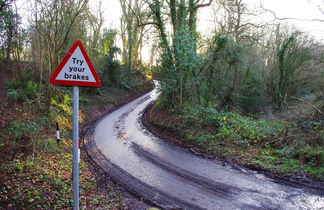
Three Cornered Wood is a popular destination for outdoor enthusiasts and nature lovers. It offers a network of well-maintained trails that wind through the forest, providing visitors with the opportunity to explore its natural beauty. These trails are suitable for both walking and cycling, making it an ideal location for a day out with family or friends.

The wood also has a designated picnic area, allowing visitors to enjoy a leisurely lunch amidst the serene surroundings. Additionally, there are information boards scattered throughout the forest, providing educational insights into the local flora and fauna.

Overall, Three Cornered Wood is a stunning natural gem in Worcestershire, offering a peaceful escape from the hustle and bustle of everyday life. Its abundant wildlife, well-marked trails, and picturesque scenery make it a must-visit destination for anyone seeking a tranquil woodland experience.

If you have any feedback on the listing, please let us know in the comments section below.

Three Cornered Wood Images

Images are sourced within 2km of 52.341541/-2.302324 or Grid Reference SO7971. Thanks to Geograph Open Source API. All images are credited.

Londis Store & Areley Kings Post Office, 63 Areley Common, Areley Kings, Stourport-on-Severn Londis is the local convenience store for this area. It also includes the Areley Kings Post Office. This is one of the few post offices in the Stourport-on-Severn area to survive. In recent years the numbers have been savagely reduced by well over half.

Photographed on Boxing Day, with seasonal snow, the store was displaying four giant decorative holly wreaths on the outside.
Londis Store & Areley Kings Post Office, 63 Areley Common, Areley Kings, Stourport-on-Severn
Londis is the local convenience store for this area. It also includes the Areley Kings Post Office. This is one of the few post offices in the Stourport-on-Severn area to survive. In recent years the numbers have been savagely reduced by well over half. Photographed on Boxing Day, with seasonal snow, the store was displaying four giant decorative holly wreaths on the outside.
St David's Close, Lickhill
Gabions on Jennings Wood Lane
Jennings Wood Lane
Jennings Wood Lane
Heightington Road, looking south from Jennings Wood Lane
Heightington Road, looking north from Jennings Wood Lane
Brunthorne Lane looking north, near Areley Kings A narrow country lane, west of the Areley Kings area of Stourport-on-Severn.
Brunthorne Lane looking north, near Areley Kings
A narrow country lane, west of the Areley Kings area of Stourport-on-Severn.
Brunthorne Lane looking south, near Areley Kings A rural lane which serves various farms.
Brunthorne Lane looking south, near Areley Kings
A rural lane which serves various farms.
Public footpath and access road to Bank Farm, near Areley Kings This private road is the access road to Bank Farm. There is a public footpath running over it, which eventually connects with a track or lane running to a junction with Jennings Wood Lane.
Public footpath and access road to Bank Farm, near Areley Kings
This private road is the access road to Bank Farm. There is a public footpath running over it, which eventually connects with a track or lane running to a junction with Jennings Wood Lane.
Public footpath from Burnthorne Lane to Ribbesford Road, near Areley Kings From Ribbesford Road, it is a short distance to the Areley Kings area of Stourport-on-Severn.
Public footpath from Burnthorne Lane to Ribbesford Road, near Areley Kings
From Ribbesford Road, it is a short distance to the Areley Kings area of Stourport-on-Severn.
Heightington Road south of Gladder Brook ford, near Ribbesford The road here has just left the ford across Gladder Brook.
Heightington Road south of Gladder Brook ford, near Ribbesford
The road here has just left the ford across Gladder Brook.
Footbridge over the Gladder Brook at its confluence with the River Severn, near Stourport-on-Severn Around Stourport-on-Severm there are public footpaths on both sides of the River Severn. In this view across the river, a footbridge takes the footpath on the other side of the river across the Gladder Brook, at the point of its confluence with the River Severn. There was still a carpet of snow on the adjacent field. The name Gladder apparently comes from Anglo-Saxon and means clear.
Footbridge over the Gladder Brook at its confluence with the River Severn, near Stourport-on-Severn
Around Stourport-on-Severm there are public footpaths on both sides of the River Severn. In this view across the river, a footbridge takes the footpath on the other side of the river across the Gladder Brook, at the point of its confluence with the River Severn. There was still a carpet of snow on the adjacent field. The name Gladder apparently comes from Anglo-Saxon and means clear.
Gate on the Severn Way by Lickhill Manor Caravan Park, near Stourport-on-Severn The notice is really a reminder that the path here is still on Lickhill Manor Caravan Park property, as the preceding field, behind the camera position, is also their land. The River Severn is on the left, out of view.
Gate on the Severn Way by Lickhill Manor Caravan Park, near Stourport-on-Severn
The notice is really a reminder that the path here is still on Lickhill Manor Caravan Park property, as the preceding field, behind the camera position, is also their land. The River Severn is on the left, out of view.
Two log seats overlooking the River Severn, near Stourport-on-Severn There seems to have been some clearance here fairly recently. These two seats give an excellent view of the river, but unfortunately it was not a day for sitting around!
Two log seats overlooking the River Severn, near Stourport-on-Severn
There seems to have been some clearance here fairly recently. These two seats give an excellent view of the river, but unfortunately it was not a day for sitting around!
Bewdley Road North entering Stourport
Lickhill Manor The impressive Georgian-style Lickhill Manor viewed from the Severn Way.  The house actually predates the Georgian period and was built around 1700.  During the Second World War the building was commandeered to take the overflow of expectant mothers from Birmingham.  On the 29 December 1941, it was the birthplace of Moody Blues band member Ray Thomas.  The building is Grade II* listed.

Historic England description:
Country house. c1700, but possibly built in 2 distinct phases. Brick with graded slate roof. Entrance front of 3 storeys and 7 bays, the upper storey a different brick and bond, possibly extending a house of the late C17, in the early C18. Central door with 6-fielded panels in shouldered architrave and segmentally arched pediment. Flush framed 12-pane sash windows with flat arched gauged brick heads with stuccoed key stones, and moulded stone sills, aligned on each floor. Sill band to first floor, modillion eaves cornice. Rear elevation similar, but superior quality of detailing suggests that this was intended as the principal front. Central doorway with shouldered architrave with keystone and segmentally arched pediment on consoles. 12-pane sash windows have flat arched brick heads with fluted stuccoed keystones and moulded sills. Doorway inserted in former window opening to lower right. Parapet wall across both gables, linking 2 parallel ridges. Gable end stacks with projecting capping. Internally, a series of panelled rooms, to ground and first floor, at least one of the early C18 with bolection moulding to fireplaces and door surrounds. Others may be later C18, and there was some later C19 remodelling by the Crane family, whose monograms appear in painted plaster in a ceiling. Floral fresco painting to ceiling in one ground floor room. Small room to front has C17-style panelling, either a good copy, or surviving from an earlier building. Early C18 staircase with moulded string and turned balusters. Late C19 armorial glass in stair windows. 
Source:<span class="nowrap"><a title="https://historicengland.org.uk/listing/the-list/list-entry/1209461" rel="nofollow ugc noopener" href="https://historicengland.org.uk/listing/the-list/list-entry/1209461">Link</a><img style="margin-left:2px;" alt="External link" title="External link - shift click to open in new window" src="https://s1.geograph.org.uk/img/external.png" width="10" height="10"/></span>
Lickhill Manor
The impressive Georgian-style Lickhill Manor viewed from the Severn Way. The house actually predates the Georgian period and was built around 1700. During the Second World War the building was commandeered to take the overflow of expectant mothers from Birmingham. On the 29 December 1941, it was the birthplace of Moody Blues band member Ray Thomas. The building is Grade II* listed. Historic England description: Country house. c1700, but possibly built in 2 distinct phases. Brick with graded slate roof. Entrance front of 3 storeys and 7 bays, the upper storey a different brick and bond, possibly extending a house of the late C17, in the early C18. Central door with 6-fielded panels in shouldered architrave and segmentally arched pediment. Flush framed 12-pane sash windows with flat arched gauged brick heads with stuccoed key stones, and moulded stone sills, aligned on each floor. Sill band to first floor, modillion eaves cornice. Rear elevation similar, but superior quality of detailing suggests that this was intended as the principal front. Central doorway with shouldered architrave with keystone and segmentally arched pediment on consoles. 12-pane sash windows have flat arched brick heads with fluted stuccoed keystones and moulded sills. Doorway inserted in former window opening to lower right. Parapet wall across both gables, linking 2 parallel ridges. Gable end stacks with projecting capping. Internally, a series of panelled rooms, to ground and first floor, at least one of the early C18 with bolection moulding to fireplaces and door surrounds. Others may be later C18, and there was some later C19 remodelling by the Crane family, whose monograms appear in painted plaster in a ceiling. Floral fresco painting to ceiling in one ground floor room. Small room to front has C17-style panelling, either a good copy, or surviving from an earlier building. Early C18 staircase with moulded string and turned balusters. Late C19 armorial glass in stair windows. Source:LinkExternal link
The River Severn View up the River Severn from near Lickhill Manor.
The River Severn
View up the River Severn from near Lickhill Manor.
The Severn Way near Lickhill The Severn Way near Lickhill to the north of Stourport-on-Severn.
The Severn Way near Lickhill
The Severn Way near Lickhill to the north of Stourport-on-Severn.
Show me another place!

Three Cornered Wood is located at Grid Ref: SO7971 (Lat: 52.341541, Lng: -2.302324)

Administrative County: Worcestershire

District: Wyre Forest

Police Authority: West Mercia

What 3 Words

///routine.fiery.smart. Near Stourport-on-Severn, Worcestershire

Nearby Locations

Three Cornered Wood

Related Wikis

Areley Hall

Areley Hall is a Grade II listed country house near Areley Kings in Stourport-on-Severn, Worcestershire, England. It is not to be confused with nearby...

Areley Kings

Areley Kings is a village on the River Severn in the Wyre District of Worcestershire, England. It is 10 miles north of Worcester and south of Stourport...

Stourport Boat Club

Stourport Boat Club is a rowing club on the River Severn, based at the Riverside, Dunley Road, Stourport-on-Severn, Worcestershire. == History == The club...

Burlish Halt railway station

Burlish Halt railway station was a station on the Severn Valley Railway in Stourport-on-Severn, Worcestershire, England. The halt opened on 31 March 1930...

Stourport Swifts F.C.

Stourport Swifts Football Club are a football team from Stourport-on-Severn, and one of the oldest non-league teams in the country. The Swifts currently...

Droitwich Spa F.C.

Droitwich Spa Football Club is a football club representing the town of Droitwich Spa, Worcestershire, England. They are currently members of the Midland...

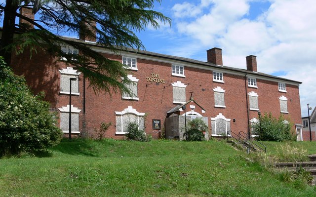
Tontine Buildings, Stourport

The Tontine Buildings is a former hotel in Stourport-on-Severn, Worcestershire, built in the late 18th century by the Staffordshire and Worcestershire...

Bewdley Town F.C.

Bewdley Town Football Club is a football club based in Bewdley, Worcestershire, England. They are currently members of the Midland League Premier Division...

Nearby Amenities

Located within 500m of 52.341541,-2.302324
Barrier: stile
Foot: yes
Lat/Long: 52.3403139/-2.2974846
Barrier: stile
Foot: yes
Lat/Long: 52.3415291/-2.3010102
Coney Green Farm (Campsite)
Place: farm
Lat/Long: 52.3398308/-2.3037461
Coney Green Farm
Place: farm
Lat/Long: 52.3393491/-2.3020161
The data included in this document is from www.openstreetmap.org. The data is made available under ODbL.

Have you been to Three Cornered Wood?

Leave your review of Three Cornered Wood below (or comments, questions and feedback).