Blackmore Wood
Wood, Forest in Worcestershire Malvern Hills
England
Blackmore Wood

Blackmore Wood is a picturesque forest located in Worcestershire, England. Covering an area of approximately 100 acres, this woodland is known for its natural beauty and diverse range of wildlife. It is situated near the village of Blackmore End, surrounded by rolling countryside and farmland.
The wood is predominantly made up of broadleaf trees, including oak, beech, and ash, which provide a dense canopy and create a tranquil atmosphere. The forest floor is covered in a carpet of bluebells during the springtime, adding a burst of color to the landscape.
Blackmore Wood is home to a variety of wildlife species, making it a popular spot for nature enthusiasts and birdwatchers. Visitors may be lucky enough to spot woodland birds such as woodpeckers, nuthatches, and thrushes, as well as mammals like foxes, badgers, and squirrels. The forest also provides a habitat for several species of bats, making it an important conservation area.
The wood is crisscrossed with a network of walking trails, allowing visitors to explore and enjoy the natural surroundings. These paths lead through dense woodland, alongside babbling streams, and up gentle slopes, providing stunning panoramic views of the surrounding countryside.
Blackmore Wood is a cherished natural gem in Worcestershire, offering visitors a chance to escape the hustle and bustle of daily life and immerse themselves in the tranquility of nature.
If you have any feedback on the listing, please let us know in the comments section below.
Blackmore Wood Images
Images are sourced within 2km of 52.085235/-2.3021199 or Grid Reference SO7943. Thanks to Geograph Open Source API. All images are credited.


Blackmore Wood is located at Grid Ref: SO7943 (Lat: 52.085235, Lng: -2.3021199)
Administrative County: Worcestershire
District: Malvern Hills
Police Authority: West Mercia
What 3 Words
///bands.vague.wounds. Near Great Malvern, Worcestershire
Nearby Locations
Related Wikis
Three Counties Showground
The Three Counties Showground is a showground site in Malvern, Worcestershire, England, covering 90 acres (36 ha) owned by the Three Counties Agricultural...
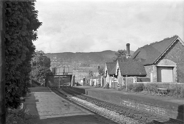
Malvern Hanley Road railway station
Malvern Hanley Road railway station was a Midland Railway (MR) station on the Malvern, Tewkesbury and Ashchurch line. The station was opened as Malvern...

Malvern Wells railway station
Malvern Wells railway station was a station on the Worcester and Hereford section of the Great Western Railway at Lower Wyche, between Great Malvern and...
HMS Duke (shore establishment)
HMS Duke was a Royal Naval shore establishment based in Great Malvern, off St Andrews Road. It was commissioned on 27 May 1941, and by May 1943 it was...
Nearby Amenities
Located within 500m of 52.085235,-2.3021199Have you been to Blackmore Wood?
Leave your review of Blackmore Wood below (or comments, questions and feedback).