Craigie

Settlement in Angus

Scotland

Craigie

Industrial unit, Port of Dundee
Industrial unit, Port of Dundee Credit: JThomas

Craigie is a small village located in the county of Angus, Scotland. Situated on the eastern coast of the country, it lies approximately 5 miles northeast of the town of Dundee. With a population of around 1,000 residents, Craigie is a close-knit community known for its peaceful and picturesque surroundings.

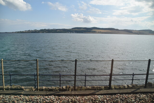
The village is surrounded by stunning natural landscapes, including rolling hills, fertile farmlands, and the nearby North Sea coastline. The area is known for its rich agricultural heritage, with farming being a significant part of the local economy.

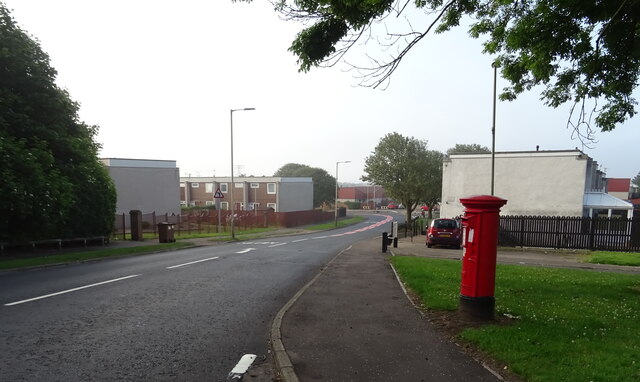
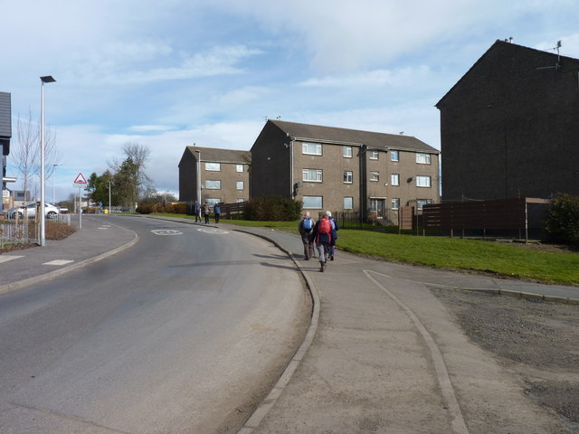
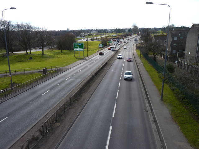
Craigie boasts a range of amenities, including a primary school, community hall, and a local pub. The village is well-connected to neighboring towns and cities through a network of roads, making it easily accessible for residents and visitors alike.

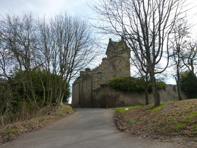
One of the notable landmarks in Craigie is the historic St. Stephen's Church, which dates back to the 12th century. This beautiful stone-built church is a testament to the village's long-standing history and architectural heritage.

The surrounding area offers plenty of opportunities for outdoor activities, with scenic walking trails, cycling routes, and fishing spots in close proximity. Additionally, golf enthusiasts can enjoy a round of golf at one of the nearby courses, including the prestigious Carnoustie Golf Links.

Overall, Craigie offers a peaceful and idyllic setting for those seeking a tranquil village lifestyle amidst Scotland's beautiful countryside.

If you have any feedback on the listing, please let us know in the comments section below.
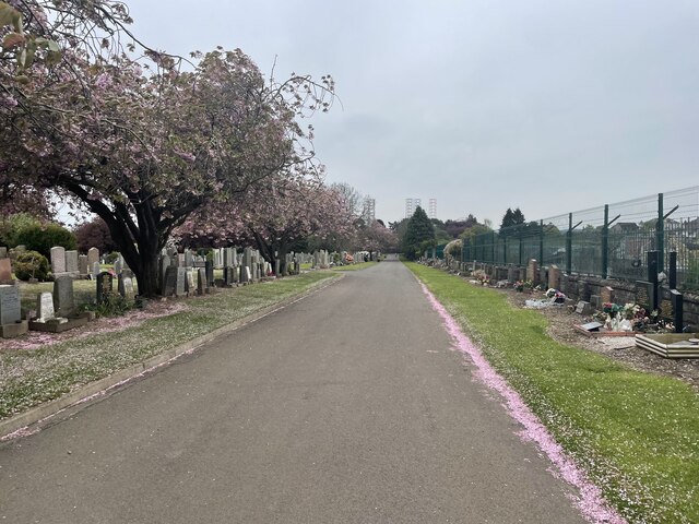
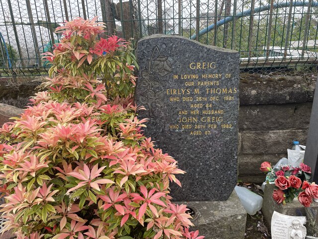
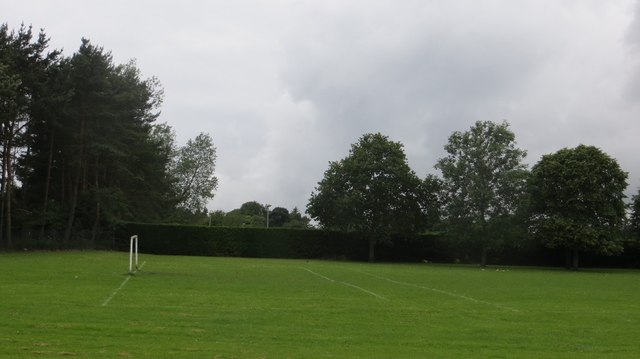
Craigie Images

Images are sourced within 2km of 56.477738/-2.9306725 or Grid Reference NO4232. Thanks to Geograph Open Source API. All images are credited.

Industrial unit, Port of Dundee
George VI postbox on Pitkerro Road, Dundee Postbox No. DD4 161.
George VI postbox on Pitkerro Road, Dundee
Postbox No. DD4 161.
Elizabethan postbox on Drumgeith Road, Dundee Postbox No. DD4 285.
Elizabethan postbox on Drumgeith Road, Dundee
Postbox No. DD4 285.
Elizabethan postbox on Whitfield Drive, Dundee Postbox No. DD4 284.

See <a href="https://www.geograph.org.uk/photo/6921736">NO4333 : Whitfield Drive, Dundee</a> for context.
Elizabethan postbox on Whitfield Drive, Dundee
Postbox No. DD4 284. See NO4333 : Whitfield Drive, Dundee for context.
Whitfield Drive, Dundee Showing position of Postbox No. DD4 284.

See <a href="https://www.geograph.org.uk/photo/6921734">NO4333 : Elizabethan postbox on Whitfield Drive, Dundee</a> for postbox.
Whitfield Drive, Dundee
Showing position of Postbox No. DD4 284. See NO4333 : Elizabethan postbox on Whitfield Drive, Dundee for postbox.
Tanks, Tay Road, Dundee
Cemetery in Dundee
Cemetery in Dundee
Family Grave The grave of Eirlys Greig (Thomas) and John Greig
Grandparents of the photographer Ralph Greig
Family Grave
The grave of Eirlys Greig (Thomas) and John Greig Grandparents of the photographer Ralph Greig
Railside Industry
Railside Industry
Port of Dundee
Port of Dundee
View out to the Tay Estuary
Football pitch Opposite Morrisons on Forfar Road (A90).
Football pitch
Opposite Morrisons on Forfar Road (A90).
Ships moored at Dundee waterfront A trio of large ships are moored alongside the quay at Dundee. The ship nearest the camera is Bourbon Topaz, behind is Island Valiant. The very large Rowan Stavanger is further behind, but such is its scale it dwarfs the nearer ships.
Ships moored at Dundee waterfront
A trio of large ships are moored alongside the quay at Dundee. The ship nearest the camera is Bourbon Topaz, behind is Island Valiant. The very large Rowan Stavanger is further behind, but such is its scale it dwarfs the nearer ships.
Rowan Stavanger at Dundee The large jack up ship Rowan Stavanger is stood alongside the quayside at Dundee. Looking closely at the photograph it is possible to see that the ship has been parked on its jacks and raised out of the water.
Rowan Stavanger at Dundee
The large jack up ship Rowan Stavanger is stood alongside the quayside at Dundee. Looking closely at the photograph it is possible to see that the ship has been parked on its jacks and raised out of the water.
Mains Castle A 16th cenrury castle now used mainly as a venue for weddings and other functions.
Mains Castle
A 16th cenrury castle now used mainly as a venue for weddings and other functions.
Hebrides Drive A council housing estate in Dundee which has nothing other than the street names to connect it with the islands of the Hebrides.
Hebrides Drive
A council housing estate in Dundee which has nothing other than the street names to connect it with the islands of the Hebrides.
A90 approaching Dundee The junction of A90 with Claverhouse Road.
A90 approaching Dundee
The junction of A90 with Claverhouse Road.
Show me another place!

Craigie is located at Grid Ref: NO4232 (Lat: 56.477738, Lng: -2.9306725)

Unitary Authority: City of Dundee

Police Authority: Tayside

What 3 Words

///season.tiger.cars. Near Dundee, Dundee City

Nearby Locations

Craigie

Related Wikis

A972 road

The A972 is a major road in Dundee, Scotland. It forms part of the dual carriageway known as the 'Kingsway', that runs through the northern part of Dundee...

A991 road

The A991 is a major road in Dundee, Scotland. It forms the Inner Ringroad that circles the perimeter of Dundee's city centre. == Route == The A991 previously...

East Craigie F.C.

East Craigie Football Club are a Scottish football club based in Dundee. Members of the Scottish Junior Football Association, they currently play in the...

Pitkerro

Pitkerro is an area in the eastern part of Dundee, Scotland, immediately west of Douglas and south of Fintry and Whitfield. Areas of Pitkerro include Kingsway...

Nearby Amenities

Located within 500m of 56.477738,-2.9306725
Power: tower
Source: Bing
Lat/Long: 56.4757166/-2.9248402
Bus Stop
Fishers Tours Depot
Naptan AtcoCode: 640014112
Naptan CommonName: Fishers Tours Depot
Naptan Indicator: at
Naptan NaptanCode: 36326253
Naptan Verified: no
Public Transport: platform
Lat/Long: 56.474841/-2.9356118
William Hill
Brand: William Hill
Brand Wikidata: Q4053147
Brand Wikipedia: en:William Hill (bookmaker)
Shop: bookmaker
Lat/Long: 56.4733574/-2.9296997
Fast Food
Papa John's
Brand: Papa John's
Brand Wikidata: Q2759586
Brand Wikipedia: en:Papa John's Pizza
Contact Website: https://www.papajohns.co.uk/stores/dundee%20-arbroath-rd/home.aspx
Cuisine: pizza
Takeaway: only
Lat/Long: 56.4736261/-2.9295092
Crossing
Lat/Long: 56.4772503/-2.9279021
Crossing
Lat/Long: 56.4771447/-2.9285778
Crossing
Crossing: marked
Lat/Long: 56.4766063/-2.9247677
Crossing
Crossing: marked
Lat/Long: 56.4765947/-2.9250359
Crossing
Crossing: marked
Lat/Long: 56.4765833/-2.925293
Crossing
Crossing: marked
Lat/Long: 56.4765735/-2.9255491
Crossing
Crossing: marked
Lat/Long: 56.4765651/-2.92582
Crossing
Crossing: marked
Lat/Long: 56.4765534/-2.9260731
Crossing
Crossing: marked
Lat/Long: 56.4765481/-2.9263342
Crossing
Crossing: traffic_signals
Crossing Island: no
Tactile Paving: yes
Lat/Long: 56.4776801/-2.9270838
Taxi
TELE-TAXIS TAXI RANK
Lat/Long: 56.4764788/-2.9246084
Bus Stop
Longtown Road
Bus: yes
Naptan AtcoCode: 6400PT1889
Naptan CommonName: Longtown Road
Naptan Indicator: opp
Naptan NaptanCode: 36324697
Public Transport: platform
Lat/Long: 56.4772453/-2.932687
Bus Stop
St Ninians Church
Bus: yes
Naptan AtcoCode: 64006809
Naptan CommonName: St Ninians Church
Naptan Indicator: at
Naptan NaptanCode: 36325763
Public Transport: platform
Lat/Long: 56.4773838/-2.9318864
Crossing
Crossing: traffic_signals
Crossing Island: no
Tactile Paving: yes
Lat/Long: 56.4776188/-2.924627
Bus Stop
Asda Milton
Bus: yes
Naptan AtcoCode: 6400PT1347
Naptan CommonName: Asda Milton
Naptan Indicator: adj
Naptan NaptanCode: 36324823
Public Transport: platform
Shelter: yes
Lat/Long: 56.4775619/-2.9237757
Bus Stop
Asda Milton
Bus: yes
Naptan AtcoCode: 6400PT1814
Naptan CommonName: Asda Milton
Naptan Indicator: near
Naptan NaptanCode: 36324824
Public Transport: platform
Shelter: yes
Lat/Long: 56.4776532/-2.9242756
Asda Opticians
Brand: Asda
Brand Wikidata: Q297410
Brand Wikipedia: en:Asda
Contact Phone: +44 1382 513707
Contact Website: https://storelocator.asda.com/scotland/dundee/milton-of-craigie-road/opticians
Fixme: Location not accurate
Operator: Asda Stores Ltd
Shop: optician
Lat/Long: 56.4772106/-2.9242259
Bus Stop
Keyline
Bus: yes
Naptan AtcoCode: 640016863
Naptan CommonName: Keyline
Naptan Indicator: at
Naptan NaptanCode: 36326395
Naptan Verified: no
Public Transport: platform
Lat/Long: 56.4756954/-2.9326804
Bus Stop
Keyline
Bus: yes
Naptan AtcoCode: 640016865
Naptan CommonName: Keyline
Naptan Indicator: opp
Naptan NaptanCode: 36326396
Naptan Verified: no
Public Transport: platform
Lat/Long: 56.4758383/-2.9325289
Bus Stop
Asda Milton Craigie
Bus: yes
Naptan AtcoCode: 640016844
Naptan CommonName: Asda Milton Craigie
Naptan Indicator: at
Naptan NaptanCode: 36326394
Naptan Verified: no
Public Transport: platform
Shelter: yes
Lat/Long: 56.4772308/-2.9247156
Bus Stop
Drumlanrig Drive
Bus: yes
Naptan AtcoCode: 6400PT1962
Naptan CommonName: Drumlanrig Drive
Naptan Indicator: opp
Naptan NaptanCode: 36325735
Naptan Verified: no
Public Transport: platform
Lat/Long: 56.4776922/-2.9295248
Bus Stop
Drumlanrig Drive
Bus: yes
Naptan AtcoCode: 6400PT1963
Naptan CommonName: Drumlanrig Drive
Naptan Indicator: at
Naptan NaptanCode: 36325736
Naptan Verified: no
Public Transport: platform
Lat/Long: 56.4777566/-2.9288127
Bus Stop
Bridgend Street
Bus: yes
Naptan AtcoCode: 6400PT1291
Naptan CommonName: Bridgend Street
Naptan Indicator: at
Naptan NaptanCode: 36324593
Naptan Verified: no
Public Transport: platform
Shelter: no
Lat/Long: 56.4821736/-2.9313862
Bus Stop
Craiglea Terrace
Bus: yes
Naptan AtcoCode: 6400S203
Naptan CommonName: Craiglea Terrace
Naptan Indicator: opp
Naptan NaptanCode: 36325268
Naptan Verified: no
Public Transport: platform
Lat/Long: 56.4792764/-2.9352486
Bus Stop
Valgreen Court
Bus: yes
Naptan AtcoCode: 6400S267
Naptan CommonName: Valgreen Court
Naptan Indicator: opp
Naptan NaptanCode: 36325269
Naptan Verified: no
Public Transport: platform
Shelter: yes
Lat/Long: 56.4796549/-2.9353827
Post Box
Collection Times: Mo-Fr 16:30; Sa 11:30
Operator: Royal Mail
Post Box Design: indoor_pillar
Post Box Type: pillar
Ref: DD4 41
Royal Cypher: scottish_crown
Source: survey
Lat/Long: 56.4766041/-2.9241314
Crossing
Crossing: traffic_signals
Lat/Long: 56.4820284/-2.9290355
Milton of Cragie
Place: suburb
Lat/Long: 56.4779909/-2.9274517
Post Box
Collection Plate Date: 2020-02-26
Collection Times: Mo-Fr 16:15; Sa 11:30
Manufacturer: Carron Company Stirlingshire
Operator: Royal Mail
Operator Wikidata: Q638098
Post Box Type: pillar
Ref: DD4 66
Royal Cypher: scottish_crown
Source: survey
Lat/Long: 56.4819761/-2.9299037
The data included in this document is from www.openstreetmap.org. The data is made available under ODbL.

Have you been to Craigie?

Leave your review of Craigie below (or comments, questions and feedback).