Ash Wood
Wood, Forest in Gloucestershire Stroud
England
Ash Wood

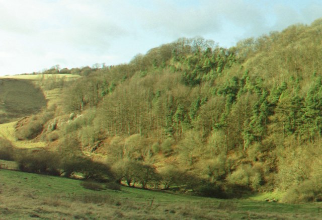
Ash Wood is a picturesque woodland located in the county of Gloucestershire, England. Covering an area of approximately 100 acres, it is situated on the eastern edge of the Forest of Dean, near the village of Blakeney. The wood is primarily composed of mature ash trees, hence its name.
As one of the largest woodlands in the area, Ash Wood offers a diverse range of habitats and wildlife. The dense canopy of ash trees provides a shady and tranquil environment, making it a popular destination for nature enthusiasts and walkers. The wood is home to a variety of bird species, including woodpeckers, owls, and various woodland songbirds. Additionally, mammals such as deer, foxes, and badgers can be spotted within the wood.
The wood is crisscrossed by a network of well-maintained footpaths, allowing visitors to explore its natural beauty. These paths lead to various points of interest, including a small pond and a meandering stream that adds to the charm of the woodland. In spring, the forest floor is carpeted with bluebells, creating a breathtaking display of vibrant colors.
Ash Wood is managed by the Gloucestershire Wildlife Trust, ensuring the preservation of its natural habitats and the sustainability of its wildlife. The trust organizes educational events and guided walks throughout the year, offering visitors the opportunity to learn more about the woodland's ecology and conservation efforts.
Overall, Ash Wood is a serene and enchanting location, offering a peaceful retreat from the hustle and bustle of everyday life.
If you have any feedback on the listing, please let us know in the comments section below.
Ash Wood Images
Images are sourced within 2km of 51.642155/-2.318008 or Grid Reference ST7893. Thanks to Geograph Open Source API. All images are credited.


Ash Wood is located at Grid Ref: ST7893 (Lat: 51.642155, Lng: -2.318008)
Administrative County: Gloucestershire
District: Stroud
Police Authority: Gloucestershire
What 3 Words
///panic.coining.pairings. Near Wotton-under-Edge, Gloucestershire
Nearby Locations
Related Wikis
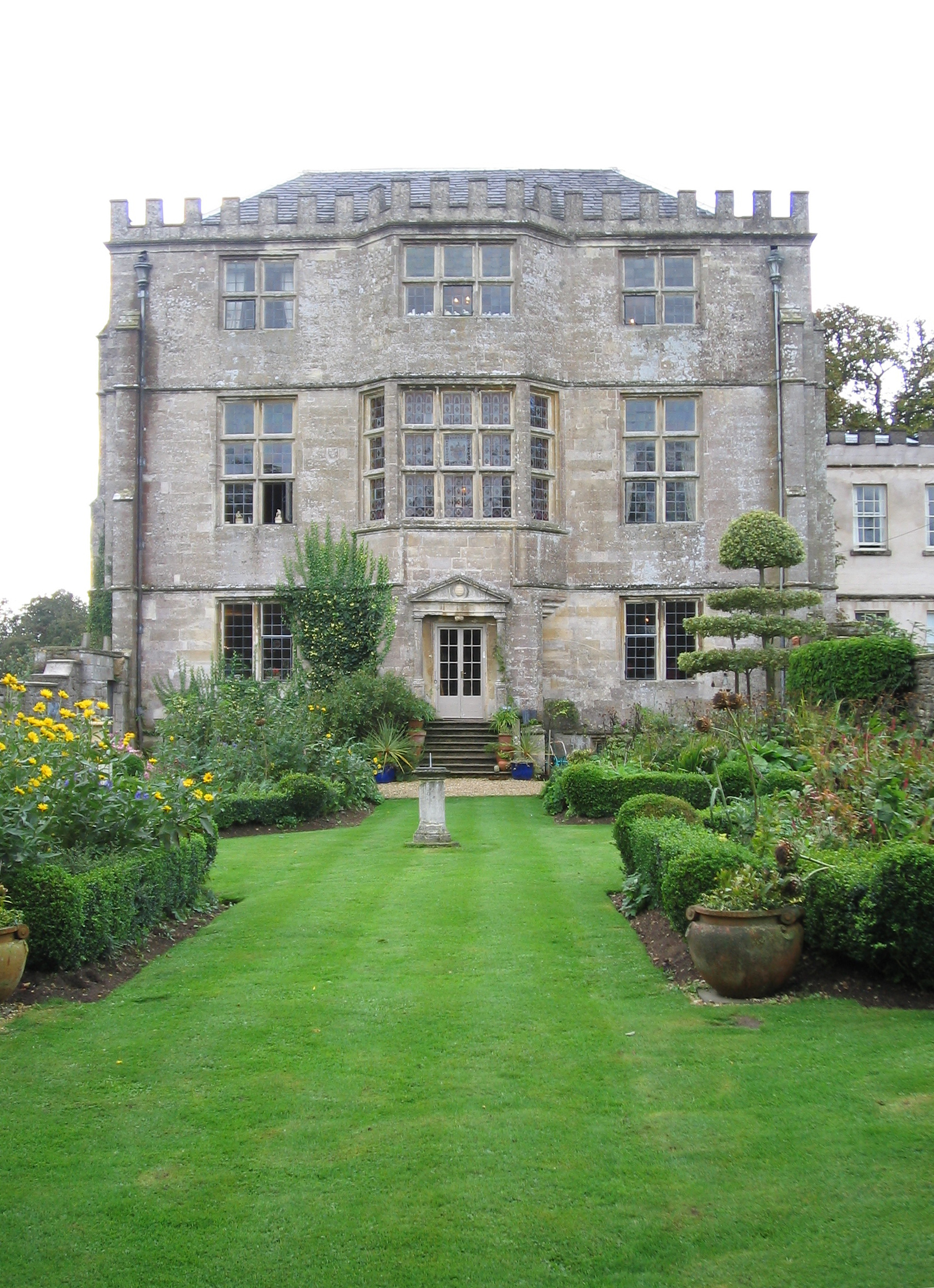
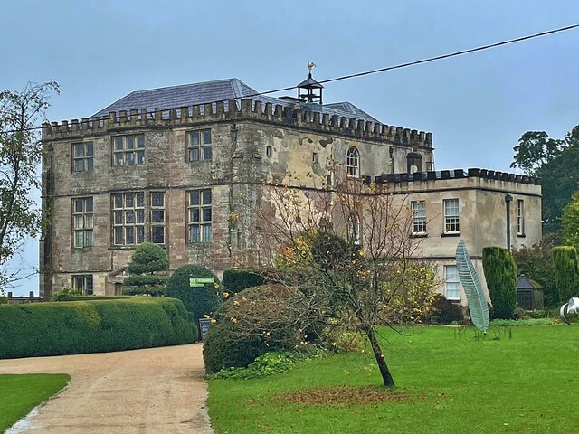
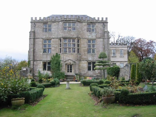
Newark Park
Newark Park is a Grade I listed country house of Tudor origins located near the village of Ozleworth, Wotton-under-Edge, Gloucestershire. The house sits...

Ozleworth
Ozleworth is a village and civil parish in Gloucestershire, England, approximately 30 km (19 mi) south of Gloucester. It lies in the Cotswolds, an Area...

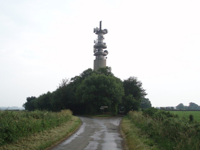
Wotton-under-Edge BT Tower
Wotton-under-Edge Tower is a 76.2 metres ( 250 ft) tall telecommunication tower built of reinforced concrete at Wotton-under-Edge in Gloucestershire, UK...

Coombe, Gloucestershire
Coombe is a settlement in the English county of Gloucestershire. It is adjacent to the town of Wotton-under-Edge. The town name can also be found spelled...

St Nicholas of Myra's Church, Ozleworth
St Nicholas of Myra's Church is a redundant Anglican church in the village of Ozleworth, Gloucestershire, England, in the care of The Churches Conservation...

Coombe Hill (Cotswolds)
Coombe Hill (grid reference ST765942) is a 15.4-hectare (38-acre) biological Site of Special Scientific Interest in Gloucestershire, notified in 1994.The...
St Mary the Virgin, Wotton-under-Edge
One of the oldest churches in its area, St Mary's was consecrated on 19 August 1283 by Bishop of Worcester, Godfrey Giffard. It is believed that most of...

Ancient Ram Inn
The Ancient Ram Inn is a Grade II* listed building and a former pub located in Wotton-under-Edge, a market town within the Stroud district of Gloucestershire...
Nearby Amenities
Located within 500m of 51.642155,-2.318008Have you been to Ash Wood?
Leave your review of Ash Wood below (or comments, questions and feedback).