Barcombe Plantation

Wood, Forest in Northumberland

England

Barcombe Plantation

Roman vicus at Vindolanda Vindolanda was a Roman auxiliary fort (castrum) just south of Hadrian's Wall in Northumberland. Located near the modern village of Bardon Mill, it guarded the Stanegate, the Roman road from the River Tyne to the Solway Firth. It is noted for the Vindolanda Tablets, among the most important finds of military and private correspondence (written with ink on wooden tablets) found anywhere in the Roman Empire.
Wikipedia: <span class="nowrap"><a title="http://en.wikipedia.org/wiki/Vindolanda" rel="nofollow ugc noopener" href="http://en.wikipedia.org/wiki/Vindolanda">Link</a><img style="margin-left:2px;" alt="External link" title="External link - shift click to open in new window" src="https://s1.geograph.org.uk/img/external.png" width="10" height="10"/></span> <span class="nowrap"><a title="http://en.wikipedia.org/wiki/Vindolanda_tablets" rel="nofollow ugc noopener" href="http://en.wikipedia.org/wiki/Vindolanda_tablets">Link</a><img style="margin-left:2px;" alt="External link" title="External link - shift click to open in new window" src="https://s1.geograph.org.uk/img/external.png" width="10" height="10"/></span>


The British Museum Top 10 British Treasures: <span class="nowrap"><a title="http://www.britishmuseum.org/explore/online_tours/britain/our_top_ten_british_treasures/the_vindolanda_tablets.aspx" rel="nofollow ugc noopener" href="http://www.britishmuseum.org/explore/online_tours/britain/our_top_ten_british_treasures/the_vindolanda_tablets.aspx">Link</a><img style="margin-left:2px;" alt="External link" title="External link - shift click to open in new window" src="https://s1.geograph.org.uk/img/external.png" width="10" height="10"/></span>
Vindolanda Tablets online: <span class="nowrap"><a title="http://vindolanda.csad.ox.ac.uk/index.shtml" rel="nofollow ugc noopener" href="http://vindolanda.csad.ox.ac.uk/index.shtml">Link</a><img style="margin-left:2px;" alt="External link" title="External link - shift click to open in new window" src="https://s1.geograph.org.uk/img/external.png" width="10" height="10"/></span>
Vindolanda Charitable Trust: <span class="nowrap"><a title="http://www.vindolanda.com/Home.htm" rel="nofollow ugc noopener" href="http://www.vindolanda.com/Home.htm">Link</a><img style="margin-left:2px;" alt="External link" title="External link - shift click to open in new window" src="https://s1.geograph.org.uk/img/external.png" width="10" height="10"/></span>
Vindolanda on BBC: <span class="nowrap"><a title="http://www.bbc.co.uk/history/ancient/romans/vindolanda_01.shtml" rel="nofollow ugc noopener" href="http://www.bbc.co.uk/history/ancient/romans/vindolanda_01.shtml">Link</a><img style="margin-left:2px;" alt="External link" title="External link - shift click to open in new window" src="https://s1.geograph.org.uk/img/external.png" width="10" height="10"/></span>
A Digger's Guide to Vindolanda: <span class="nowrap"><a title="http://s9.zetaboards.com/We_Dig_Vindolanda/pages/diggers_guide/" rel="nofollow ugc noopener" href="http://s9.zetaboards.com/We_Dig_Vindolanda/pages/diggers_guide/">Link</a><img style="margin-left:2px;" alt="External link" title="External link - shift click to open in new window" src="https://s1.geograph.org.uk/img/external.png" width="10" height="10"/></span>
Roman Britain: <span class="nowrap"><a title="http://www.roman-britain.org/places/vindolanda.htm" rel="nofollow ugc noopener" href="http://www.roman-britain.org/places/vindolanda.htm">Link</a><img style="margin-left:2px;" alt="External link" title="External link - shift click to open in new window" src="https://s1.geograph.org.uk/img/external.png" width="10" height="10"/></span>
Northumberland Tales: <span class="nowrap"><a title="http://www.northumberland-tales.com/Vindolanda.html" rel="nofollow ugc noopener" href="http://www.northumberland-tales.com/Vindolanda.html">Link</a><img style="margin-left:2px;" alt="External link" title="External link - shift click to open in new window" src="https://s1.geograph.org.uk/img/external.png" width="10" height="10"/></span>
Roman vicus at Vindolanda Credit: Sandy Gerrard

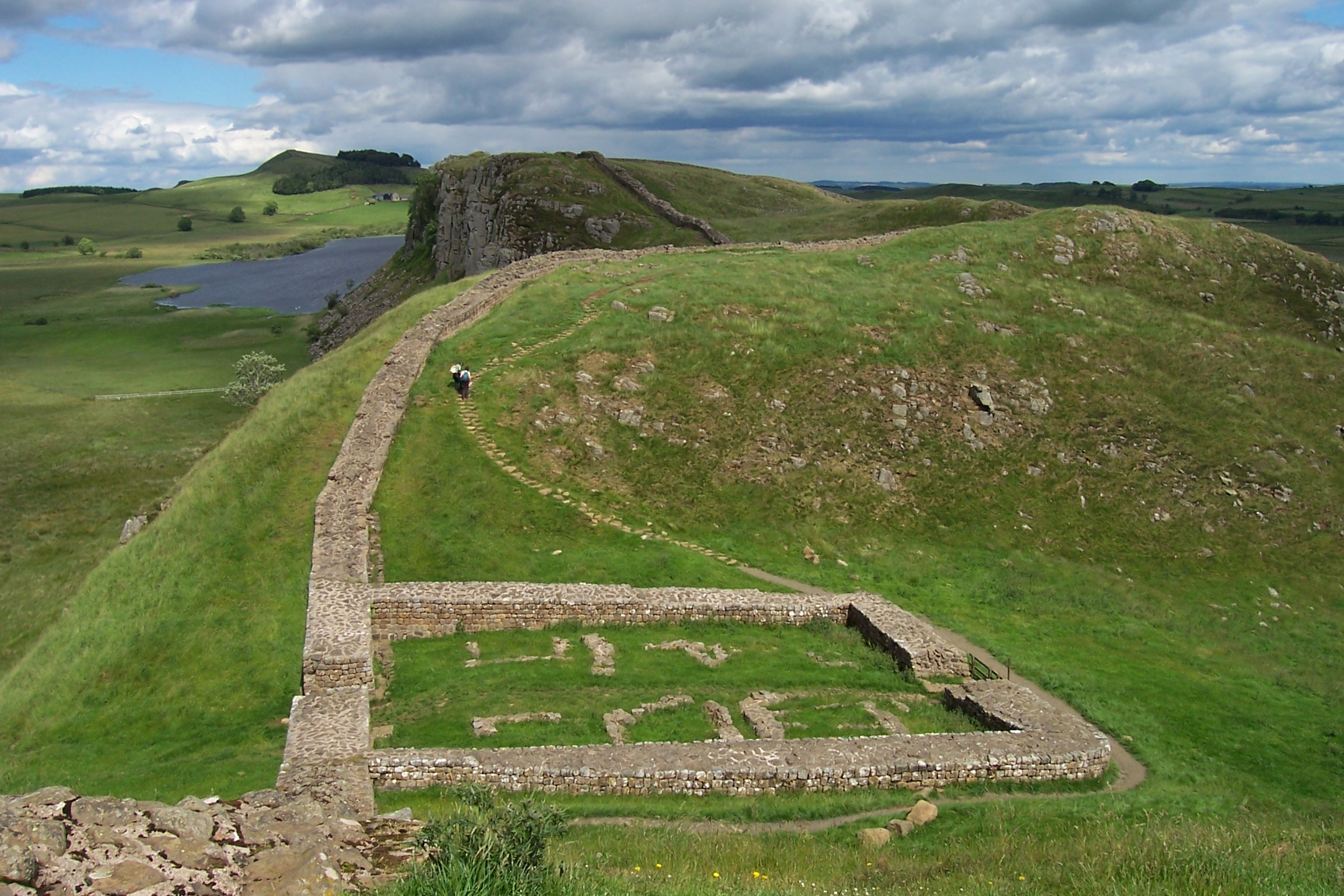
Barcombe Plantation is a picturesque woodland located in the county of Northumberland, England. Spanning across a vast area, it is known for its dense forest and diverse range of plant and animal species. The plantation is situated near the village of Barcombe, surrounded by rolling hills and offering breathtaking views of the surrounding countryside.

The woodland in Barcombe Plantation is predominantly composed of various species of trees, including oak, beech, and pine. These tall, majestic trees create a lush canopy, providing shade and shelter for the abundant wildlife that calls this place home. The forest floor is covered with a carpet of ferns, wildflowers, and moss, creating a vibrant and enchanting atmosphere.

The plantation is a haven for nature enthusiasts and hikers, with a network of well-maintained trails that wind through the woods. Visitors can explore the woodland on foot, admiring the beauty of nature and listening to the soothing sounds of birdsong. The trails are suitable for all levels of fitness, offering both gentle strolls and more challenging hikes.

Barcombe Plantation is not only a place of natural beauty but also a vital habitat for numerous species. The woodland is home to a diverse range of wildlife, including red squirrels, deer, foxes, and a wide variety of bird species. Birdwatchers can spot woodpeckers, owls, and various migratory birds throughout the year.

Overall, Barcombe Plantation is a treasure trove of natural wonders. Its tranquil atmosphere, stunning scenery, and abundant wildlife make it a must-visit destination for nature lovers and those seeking a peaceful escape in the heart of Northumberland.

If you have any feedback on the listing, please let us know in the comments section below.

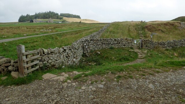
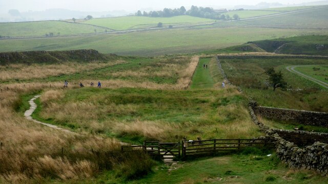
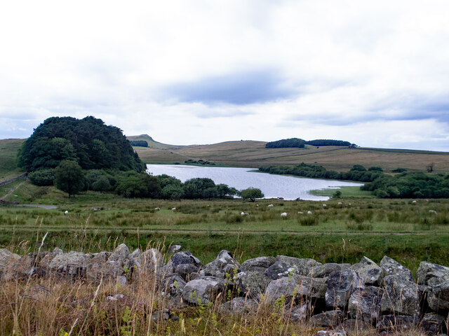
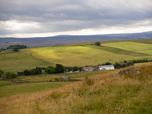
Barcombe Plantation Images

Images are sourced within 2km of 54.990968/-2.3481312 or Grid Reference NY7766. Thanks to Geograph Open Source API. All images are credited.

Roman vicus at Vindolanda Vindolanda was a Roman auxiliary fort (castrum) just south of Hadrian's Wall in Northumberland. Located near the modern village of Bardon Mill, it guarded the Stanegate, the Roman road from the River Tyne to the Solway Firth. It is noted for the Vindolanda Tablets, among the most important finds of military and private correspondence (written with ink on wooden tablets) found anywhere in the Roman Empire.
Wikipedia: <span class="nowrap"><a title="http://en.wikipedia.org/wiki/Vindolanda" rel="nofollow ugc noopener" href="http://en.wikipedia.org/wiki/Vindolanda">Link</a><img style="margin-left:2px;" alt="External link" title="External link - shift click to open in new window" src="https://s1.geograph.org.uk/img/external.png" width="10" height="10"/></span> <span class="nowrap"><a title="http://en.wikipedia.org/wiki/Vindolanda_tablets" rel="nofollow ugc noopener" href="http://en.wikipedia.org/wiki/Vindolanda_tablets">Link</a><img style="margin-left:2px;" alt="External link" title="External link - shift click to open in new window" src="https://s1.geograph.org.uk/img/external.png" width="10" height="10"/></span>


The British Museum Top 10 British Treasures: <span class="nowrap"><a title="http://www.britishmuseum.org/explore/online_tours/britain/our_top_ten_british_treasures/the_vindolanda_tablets.aspx" rel="nofollow ugc noopener" href="http://www.britishmuseum.org/explore/online_tours/britain/our_top_ten_british_treasures/the_vindolanda_tablets.aspx">Link</a><img style="margin-left:2px;" alt="External link" title="External link - shift click to open in new window" src="https://s1.geograph.org.uk/img/external.png" width="10" height="10"/></span>
Vindolanda Tablets online: <span class="nowrap"><a title="http://vindolanda.csad.ox.ac.uk/index.shtml" rel="nofollow ugc noopener" href="http://vindolanda.csad.ox.ac.uk/index.shtml">Link</a><img style="margin-left:2px;" alt="External link" title="External link - shift click to open in new window" src="https://s1.geograph.org.uk/img/external.png" width="10" height="10"/></span>
Vindolanda Charitable Trust: <span class="nowrap"><a title="http://www.vindolanda.com/Home.htm" rel="nofollow ugc noopener" href="http://www.vindolanda.com/Home.htm">Link</a><img style="margin-left:2px;" alt="External link" title="External link - shift click to open in new window" src="https://s1.geograph.org.uk/img/external.png" width="10" height="10"/></span>
Vindolanda on BBC: <span class="nowrap"><a title="http://www.bbc.co.uk/history/ancient/romans/vindolanda_01.shtml" rel="nofollow ugc noopener" href="http://www.bbc.co.uk/history/ancient/romans/vindolanda_01.shtml">Link</a><img style="margin-left:2px;" alt="External link" title="External link - shift click to open in new window" src="https://s1.geograph.org.uk/img/external.png" width="10" height="10"/></span>
A Digger's Guide to Vindolanda: <span class="nowrap"><a title="http://s9.zetaboards.com/We_Dig_Vindolanda/pages/diggers_guide/" rel="nofollow ugc noopener" href="http://s9.zetaboards.com/We_Dig_Vindolanda/pages/diggers_guide/">Link</a><img style="margin-left:2px;" alt="External link" title="External link - shift click to open in new window" src="https://s1.geograph.org.uk/img/external.png" width="10" height="10"/></span>
Roman Britain: <span class="nowrap"><a title="http://www.roman-britain.org/places/vindolanda.htm" rel="nofollow ugc noopener" href="http://www.roman-britain.org/places/vindolanda.htm">Link</a><img style="margin-left:2px;" alt="External link" title="External link - shift click to open in new window" src="https://s1.geograph.org.uk/img/external.png" width="10" height="10"/></span>
Northumberland Tales: <span class="nowrap"><a title="http://www.northumberland-tales.com/Vindolanda.html" rel="nofollow ugc noopener" href="http://www.northumberland-tales.com/Vindolanda.html">Link</a><img style="margin-left:2px;" alt="External link" title="External link - shift click to open in new window" src="https://s1.geograph.org.uk/img/external.png" width="10" height="10"/></span>
Roman vicus at Vindolanda
Vindolanda was a Roman auxiliary fort (castrum) just south of Hadrian's Wall in Northumberland. Located near the modern village of Bardon Mill, it guarded the Stanegate, the Roman road from the River Tyne to the Solway Firth. It is noted for the Vindolanda Tablets, among the most important finds of military and private correspondence (written with ink on wooden tablets) found anywhere in the Roman Empire. Wikipedia: LinkExternal link LinkExternal link The British Museum Top 10 British Treasures: LinkExternal link Vindolanda Tablets online: LinkExternal link Vindolanda Charitable Trust: LinkExternal link Vindolanda on BBC: LinkExternal link A Digger's Guide to Vindolanda: LinkExternal link Roman Britain: LinkExternal link Northumberland Tales: LinkExternal link
Vindolanda Roman Fort Prehistoric circular buildings overlain by a later Roman wall.
Vindolanda Roman Fort
Prehistoric circular buildings overlain by a later Roman wall.
Hadrian's Wall Path at Milking Gap
Hadrian's Wall Milecastle 38 at Hotbank Hadrian's wall or 'Vallum Aelium' is the remains of a large Roman fortification. The wall extended west from Segedunum at Wallsend on the River Tyne to the shore of the Solway Firth, ending a short but unknown distance west of the village of Bowness-on-Solway. Construction probably started sometime in AD 122 and was largely completed within six years.

The remains were made a UNESCO World Heritage Site in 1987.
Hadrian's Wall Milecastle 38 at Hotbank
Hadrian's wall or 'Vallum Aelium' is the remains of a large Roman fortification. The wall extended west from Segedunum at Wallsend on the River Tyne to the shore of the Solway Firth, ending a short but unknown distance west of the village of Bowness-on-Solway. Construction probably started sometime in AD 122 and was largely completed within six years. The remains were made a UNESCO World Heritage Site in 1987.
Houses on Millfield Court, Bardon Mill
Bardon Mill Station looking west
The Pennine Way & Hadrian's Wall Path near Crag Lough
The Pennine Way & Hadrian's Wall Path near Turret 38A
The Pennine Way & Hadrian's Wall Path near Hotbank
Hadrian's Wall : Crag Lough
Hadrian's Wall : view from to the south
Vindolanda : archaeologists' wheelbarrows
Vindolanda : archaeologists at work
Fountain and pool At the entrance to Vindolanda Roman fort.
Fountain and pool
At the entrance to Vindolanda Roman fort.
Robin Birley Archaeology Centre Newly opened base for staff and volunteers working on the Vindolanda site. The building is composed of five "pods" which were constructed off-site and assembled on an existing concrete base without foundations at the top of the Vindolanda estate. The centre which includes a sedum roof was opened in 2020.
Robin Birley Archaeology Centre
Newly opened base for staff and volunteers working on the Vindolanda site. The building is composed of five "pods" which were constructed off-site and assembled on an existing concrete base without foundations at the top of the Vindolanda estate. The centre which includes a sedum roof was opened in 2020.
Aqueduct at Vindolanda Roman Fort The aqueduct leads to the bath house. The newly opened Robin Birley Archaeology Centre can be seen in the background.
Aqueduct at Vindolanda Roman Fort
The aqueduct leads to the bath house. The newly opened Robin Birley Archaeology Centre can be seen in the background.
Archaeologists at work at Vindolanda Roman Fort Volunteers on the dig can be readily identified by their purple T-shirts. In the background, a replica Roman fort.
Archaeologists at work at Vindolanda Roman Fort
Volunteers on the dig can be readily identified by their purple T-shirts. In the background, a replica Roman fort.
Round houses at Vindolanda The remains of round houses dating from the early years of the fort, near the North Gate.
Round houses at Vindolanda
The remains of round houses dating from the early years of the fort, near the North Gate.
Show me another place!

Barcombe Plantation is located at Grid Ref: NY7766 (Lat: 54.990968, Lng: -2.3481312)

Unitary Authority: Northumberland

Police Authority: Northumbria

What 3 Words

///royal.rhino.dunk. Near Bardon Mill, Northumberland

Related Wikis

Nearby Amenities

Located within 500m of 54.990968,-2.3481312
Man Made: survey_point
Ref: S6580
Lat/Long: 54.9934898/-2.3423624
Long Stone
Archaeological Site: megalith
Historic: archaeological_site
Megalith Type: menhir
Source: https://www.megalithic.co.uk/article.php?sid=49967
Lat/Long: 54.9918201/-2.3476996
Give Way
Direction: forward
Lat/Long: 54.9910297/-2.3529381
Ele: 275
Natural: peak
Lat/Long: 54.9921076/-2.3462476
Ele: 275
Natural: peak
Lat/Long: 54.9935839/-2.3423452
Watering Place
Lat/Long: 54.9933358/-2.3506352
Natural: shrub
Lat/Long: 54.9932715/-2.3547051
Watering Place
Lat/Long: 54.9876303/-2.3493817
Power: pole
Lat/Long: 54.9895646/-2.3548964
Power: pole
Lat/Long: 54.9903856/-2.3557453
Power: pole
Lat/Long: 54.9900524/-2.3553202
Natural: shrub
Lat/Long: 54.9942525/-2.3472333
Natural: shrub
Lat/Long: 54.9930869/-2.3491041
Natural: shrub
Lat/Long: 54.9913535/-2.3521471
Natural: shrub
Lat/Long: 54.9911165/-2.3525843
Natural: shrub
Lat/Long: 54.9895523/-2.352756
Natural: shrub
Lat/Long: 54.990808/-2.3523134
Natural: shrub
Lat/Long: 54.9930946/-2.3467237
Natural: shrub
Lat/Long: 54.9931469/-2.3466137
The data included in this document is from www.openstreetmap.org. The data is made available under ODbL.

Have you been to Barcombe Plantation?

Leave your review of Barcombe Plantation below (or comments, questions and feedback).