Frith Wood

Wood, Forest in Gloucestershire Stroud

England

Frith Wood

Old Milestone, France Lane In the parish of Hawkesbury, in the village of Hawkesbury Upton. NW side of road, embedded in the earth bank. Mileage is measured to Wotton under Edge. Rivet Benchmark on top, 176.7 m ASL.

Inscription (was): Wotton 5

Milestone Society ID: GL_WEHU05
Old Milestone, France Lane Credit: Mr Red

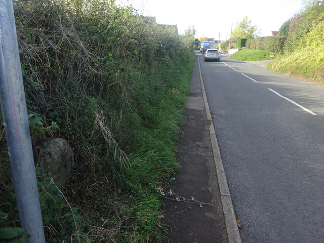
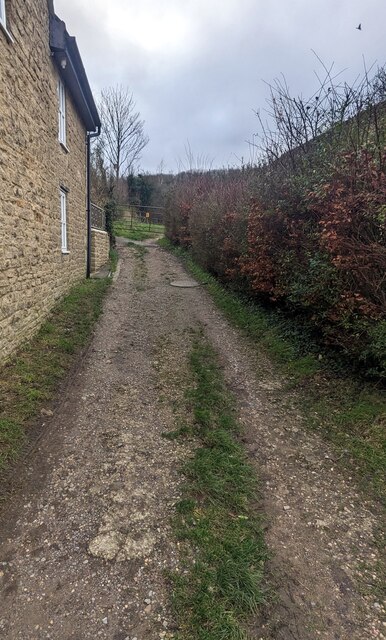
Frith Wood is a picturesque woodland located in Gloucestershire, England. Situated near the village of Frampton Mansell, the wood covers an area of approximately 150 acres and is a popular destination for nature enthusiasts and walkers alike.

The woodland is predominantly made up of a mixture of deciduous and coniferous trees, including oak, beech, and pine. This diverse range of tree species creates a rich habitat for a variety of wildlife, such as deer, badgers, and a wide array of bird species. The wood is also home to many rare and protected plants, adding to its ecological importance.

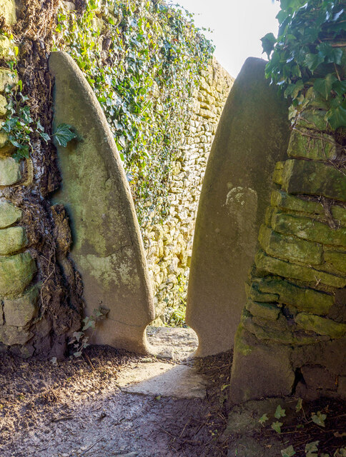
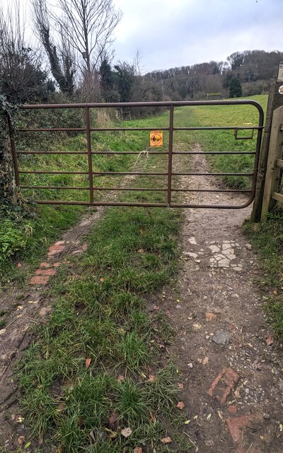
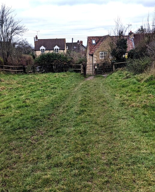
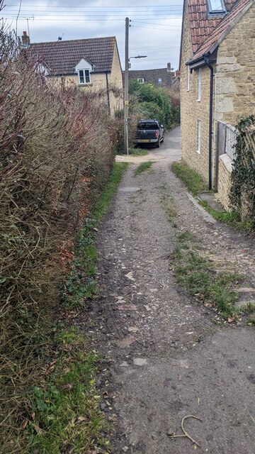
Frith Wood boasts a network of well-maintained footpaths, offering visitors the opportunity to explore its tranquil surroundings. These paths meander through the wood, leading to scenic viewpoints and clearings where visitors can take in the breathtaking views and enjoy a peaceful picnic amidst nature.

The wood is particularly renowned for its bluebell display in spring, when the forest floor transforms into a carpet of vibrant blue flowers. This annual spectacle attracts numerous visitors who come to witness the beauty of the woodland at this time of year.

Frith Wood is managed by a local conservation organization, which ensures its preservation and protection. The wood is open to the public all year round, with no admission fee, making it an accessible destination for individuals and families seeking a peaceful retreat in the heart of Gloucestershire's countryside.

If you have any feedback on the listing, please let us know in the comments section below.

Frith Wood Images

Images are sourced within 2km of 51.593957/-2.3233155 or Grid Reference ST7788. Thanks to Geograph Open Source API. All images are credited.

Old Milestone, France Lane In the parish of Hawkesbury, in the village of Hawkesbury Upton. NW side of road, embedded in the earth bank. Mileage is measured to Wotton under Edge. Rivet Benchmark on top, 176.7 m ASL.

Inscription (was): Wotton 5

Milestone Society ID: GL_WEHU05
Old Milestone, France Lane
In the parish of Hawkesbury, in the village of Hawkesbury Upton. NW side of road, embedded in the earth bank. Mileage is measured to Wotton under Edge. Rivet Benchmark on top, 176.7 m ASL. Inscription (was): Wotton 5 Milestone Society ID: GL_WEHU05
Stone Stile, St Mary's Church Curious cut-outs to let boots pass. There is a wider view showing the lychgate, see <a href="https://www.geograph.org.uk/photo/6493091">ST7686 : Lych gate, St Mary's, Hawkesbury</a>.
Stone Stile, St Mary's Church
Curious cut-outs to let boots pass. There is a wider view showing the lychgate, see ST7686 : Lych gate, St Mary's, Hawkesbury.
Hawkesbury, St Mary
Hawkesbury, St Mary
The Fleece Inn, Hillesley, Gloucestershire Viewed across Chapel Lane.
The Fleece Inn, Hillesley, Gloucestershire
Viewed across Chapel Lane.
The Fleece Inn name sign, Hillesley, Gloucestershire Hanging from a wall bracket here. <a title="https://www.geograph.org.uk/photo/7671003" href="https://www.geograph.org.uk/photo/7671003">Link</a>
The Fleece Inn name sign, Hillesley, Gloucestershire
Hanging from a wall bracket here. Link
Yellow box, Chapel Lane, Hillesley, Gloucestershire Defibrillator box at an entrance to the Fleece Inn. <a title="https://www.geograph.org.uk/photo/7671003" href="https://www.geograph.org.uk/photo/7671003">Link</a>
Yellow box, Chapel Lane, Hillesley, Gloucestershire
Defibrillator box at an entrance to the Fleece Inn. Link
Chapel Lane houses, Hillesley, Gloucestershire The Fleece Inn <a title="https://www.geograph.org.uk/photo/7671003" href="https://www.geograph.org.uk/photo/7671003">Link</a> is behind the camera.
Chapel Lane houses, Hillesley, Gloucestershire
The Fleece Inn Link is behind the camera.
Fleece Inn Car Park, Hillesley, Gloucestershire Accessed from Chapel Lane a few metres from the inn. <a title="https://www.geograph.org.uk/photo/7671003" href="https://www.geograph.org.uk/photo/7671003">Link</a>
Fleece Inn Car Park, Hillesley, Gloucestershire
Accessed from Chapel Lane a few metres from the inn. Link
Gate across a public footpath, Hillesley, Gloucestershire SE of Chapel Lane. Text on the small yellow notice on the gate includes
POOP SCOOP AREA and CLEAN IT UP.
Gate across a public footpath, Hillesley, Gloucestershire
SE of Chapel Lane. Text on the small yellow notice on the gate includes POOP SCOOP AREA and CLEAN IT UP.
Public footpath through a field,  Hillesley, Gloucestershire SE of this <a title="https://www.geograph.org.uk/photo/7671047" href="https://www.geograph.org.uk/photo/7671047">Link</a> gate.
Public footpath through a field, Hillesley, Gloucestershire
SE of this Link gate.
NW along a public footpath, Hillesley, Gloucestershire Ahead for Chapel Lane and the Fleece Inn. <a title="https://www.geograph.org.uk/photo/7671003" href="https://www.geograph.org.uk/photo/7671003">Link</a>
NW along a public footpath, Hillesley, Gloucestershire
Ahead for Chapel Lane and the Fleece Inn. Link
Stile access to a public footpath, Hillesley, Gloucestershire No need for walkers to use this stile today - the adjacent gate <a title="https://www.geograph.org.uk/photo/7671047" href="https://www.geograph.org.uk/photo/7671047">Link</a> is not locked.
Stile access to a public footpath, Hillesley, Gloucestershire
No need for walkers to use this stile today - the adjacent gate Link is not locked.
Public footpath notices, Hillesley, Gloucestershire Gloucestershire County Council information for dog walkers.
The notices are alongside this <a title="https://www.geograph.org.uk/photo/7671047" href="https://www.geograph.org.uk/photo/7671047">Link</a> gate
Public footpath notices, Hillesley, Gloucestershire
Gloucestershire County Council information for dog walkers. The notices are alongside this Link gate
ENE along Chapel Lane, Hillesley, Gloucestershire Ahead for the former Baptist Chapel <a title="https://www.geograph.org.uk/photo/3662562" href="https://www.geograph.org.uk/photo/3662562">Link</a>
ENE along Chapel Lane, Hillesley, Gloucestershire
Ahead for the former Baptist Chapel Link
From Chapel Lane towards a public footpath, Hillesley, Gloucestershire Looking to the SE from Chapel Lane towards this <a title="https://www.geograph.org.uk/photo/7671047" href="https://www.geograph.org.uk/photo/7671047">Link</a> gate.
From Chapel Lane towards a public footpath, Hillesley, Gloucestershire
Looking to the SE from Chapel Lane towards this Link gate.
Towards Chapel Lane from a public footpath, Hillesley, Gloucestershire This <a title="https://www.geograph.org.uk/photo/7671047" href="https://www.geograph.org.uk/photo/7671047">Link</a> gate is behind the camera.
Towards Chapel Lane from a public footpath, Hillesley, Gloucestershire
This Link gate is behind the camera.
Towards the village church,  Hillesley, Gloucestershire Looking across High Street towards the Church of St Giles.
Towards the village church, Hillesley, Gloucestershire
Looking across High Street towards the Church of St Giles.
Grade II Listed St Giles, Hillesley, Gloucestershire The church in the Church of England Diocese of Gloucester dates from 1851.
Grade II Listed in 1983.
Grade II Listed St Giles, Hillesley, Gloucestershire
The church in the Church of England Diocese of Gloucester dates from 1851. Grade II Listed in 1983.
Show me another place!

Frith Wood is located at Grid Ref: ST7788 (Lat: 51.593957, Lng: -2.3233155)

Administrative County: Gloucestershire

District: Stroud

Police Authority: Gloucestershire

What 3 Words

///monument.poet.converged. Near Wotton-under-Edge, Gloucestershire

Related Wikis

Lord Robert Somerset

General Lord Robert Edward Henry Somerset (19 December 1776 – 1 September 1842) was a British soldier who fought during the Peninsular War and the War...

Hawkesbury, Gloucestershire

Hawkesbury is a hamlet and civil parish in the area of the South Gloucestershire unitary authority in England. The hamlet, consisting of a few cottages...
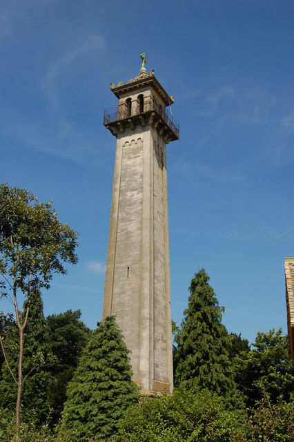
Somerset Monument

The Somerset Monument in Hawkesbury Upton, Gloucestershire, England was built in 1846 to commemorate Lord Robert Edward Somerset. It is a Grade II* listed...

Hawkesbury Quarry

Hawkesbury Quarry (grid reference ST771873) is a 0.25-hectare (0.62-acre) geological Site of Special Scientific Interest near the village of Hawkesbury...

Upton Coombe

Upton Coombe (grid reference ST789877) is a 7.4 hectare biological Site of Special Scientific Interest near the village of Hawkesbury Upton, South Gloucestershire...

Hillesley

Hillesley is a village in Gloucestershire, England. It was transferred from the county of Avon in 1991 and is now in Stroud District. The village forms...

Hawkesbury Upton

Hawkesbury Upton is a village in South Gloucestershire, England, east of the much smaller Hawkesbury. It lies north of Horton, east of Dunkirk and south...

Church of St Mary, Hawkesbury

The Church of St Mary in Hawkesbury, South Gloucestershire, England was built in the 12th century. It is a Grade I listed building. == History == The church...

Nearby Amenities

Located within 500m of 51.593957,-2.3233155
The data included in this document is from www.openstreetmap.org. The data is made available under ODbL.

Have you been to Frith Wood?

Leave your review of Frith Wood below (or comments, questions and feedback).