Lawkland Hall Wood

Wood, Forest in Yorkshire Craven

England

Lawkland Hall Wood

Ordnance Survey Cut Mark This mark can be found on the wall of the railway bride at Low Paley Green.
The benchmark has a recorded height of 166.2004 metres above sea level.
For more detail see : <span class="nowrap"><a title="https://www.bench-marks.org.uk/bm69901" rel="nofollow ugc noopener" href="https://www.bench-marks.org.uk/bm69901">Link</a><img style="margin-left:2px;" alt="External link" title="External link - shift click to open in new window" src="https://s1.geograph.org.uk/img/external.png" width="10" height="10"/></span>
Ordnance Survey Cut Mark Credit: Peter Wood

Lawkland Hall Wood is a picturesque woodland located in the county of Yorkshire, England. Situated near the village of Lawkland, this woodland stretches over an area of approximately 50 acres, making it a significant natural feature of the region.

The woodland is characterized by its dense canopy of trees, primarily consisting of native species such as oak, beech, and ash. These towering trees provide a habitat for a diverse range of wildlife, including birds, mammals, and insects. Bird enthusiasts can often spot species such as woodpeckers, owls, and various songbirds flitting among the branches.

Tranquil pathways wind through Lawkland Hall Wood, inviting visitors to explore its natural beauty. These trails lead to hidden clearings, where sunlight filters through the leaves and illuminates the forest floor, creating a serene and enchanting atmosphere. The wood is also home to a small stream, which adds to the overall charm of the landscape.

Lawkland Hall Wood has a rich history, with records dating back several centuries. It was once part of the extensive estate of Lawkland Hall, a historic manor house that has since been demolished. The woodland was likely used for timber production and hunting in the past, but now it serves as a recreational area for locals and visitors alike.

Nature lovers, hikers, and photographers are drawn to Lawkland Hall Wood for its untouched beauty and tranquil ambiance. The woodland offers a peaceful retreat from the hustle and bustle of everyday life, allowing visitors to immerse themselves in the wonders of nature.

If you have any feedback on the listing, please let us know in the comments section below.

Lawkland Hall Wood Images

Images are sourced within 2km of 54.084715/-2.3439208 or Grid Reference SD7765. Thanks to Geograph Open Source API. All images are credited.

Ordnance Survey Cut Mark This mark can be found on the wall of the railway bride at Low Paley Green.
The benchmark has a recorded height of 166.2004 metres above sea level.
For more detail see : <span class="nowrap"><a title="https://www.bench-marks.org.uk/bm69901" rel="nofollow ugc noopener" href="https://www.bench-marks.org.uk/bm69901">Link</a><img style="margin-left:2px;" alt="External link" title="External link - shift click to open in new window" src="https://s1.geograph.org.uk/img/external.png" width="10" height="10"/></span>
Ordnance Survey Cut Mark
This mark can be found on the wall of the railway bride at Low Paley Green. The benchmark has a recorded height of 166.2004 metres above sea level. For more detail see : LinkExternal link
Ordnance Survey Cut Mark This mark can be found on a field entrance gatepost to the east of Armitstead.
The benchmark has a recorded height of 180.9019 metres above sea level.
For more detail see : <span class="nowrap"><a title="https://www.bench-marks.org.uk/bm87547" rel="nofollow ugc noopener" href="https://www.bench-marks.org.uk/bm87547">Link</a><img style="margin-left:2px;" alt="External link" title="External link - shift click to open in new window" src="https://s1.geograph.org.uk/img/external.png" width="10" height="10"/></span>
Ordnance Survey Cut Mark
This mark can be found on a field entrance gatepost to the east of Armitstead. The benchmark has a recorded height of 180.9019 metres above sea level. For more detail see : LinkExternal link
Ordnance Survey Cut Mark This mark can be found on the wall of the railway bridge at Eldroth.
The benchmark has a recorded height of 152.08 metres above sea level.
For more detail see : <span class="nowrap"><a title="https://www.bench-marks.org.uk/bm152196" rel="nofollow ugc noopener" href="https://www.bench-marks.org.uk/bm152196">Link</a><img style="margin-left:2px;" alt="External link" title="External link - shift click to open in new window" src="https://s1.geograph.org.uk/img/external.png" width="10" height="10"/></span>
Ordnance Survey Cut Mark
This mark can be found on the wall of the railway bridge at Eldroth. The benchmark has a recorded height of 152.08 metres above sea level. For more detail see : LinkExternal link
The Courtyard Dairy - fabulous cheese shop At Austwick, near Settle, and very well worth a visit if you are in the area.  We were recommended to it by our hotel chef - never seen such a selection of cheeses!
The Courtyard Dairy - fabulous cheese shop
At Austwick, near Settle, and very well worth a visit if you are in the area. We were recommended to it by our hotel chef - never seen such a selection of cheeses!
Eldroth, farm track The benchmark is cut into the drystone wall on the north side of the track.
Eldroth, farm track
The benchmark is cut into the drystone wall on the north side of the track.
Eldroth, farm track There is a benchmark cut into the drystone wall on the north side of the track.
Eldroth, farm track
There is a benchmark cut into the drystone wall on the north side of the track.
Eldroth, farm track According to the OS benchmark database there is a rivet benchmark in a rock on the east side of the track. Lots of searching amongst the thick undergrowth, but nothing was found.
Eldroth, farm track
According to the OS benchmark database there is a rivet benchmark in a rock on the east side of the track. Lots of searching amongst the thick undergrowth, but nothing was found.
Eldroth, railway parapet The benchmark is cut into the western parapet of the railway bridge, and into the east face. The mark is centrally placed over the rail track.
Eldroth, railway parapet
The benchmark is cut into the western parapet of the railway bridge, and into the east face. The mark is centrally placed over the rail track.
Eldroth, railway bridge There is a benchmark cut into the western parapet of the railway bridge, and into the east face. The mark is centrally placed over the rail track.
Eldroth, railway bridge
There is a benchmark cut into the western parapet of the railway bridge, and into the east face. The mark is centrally placed over the rail track.
Eldroth, field gatepost The benchmark is cut into the inside face of the right hand gatepost on the north side of Paley Green Lane.
Eldroth, field gatepost
The benchmark is cut into the inside face of the right hand gatepost on the north side of Paley Green Lane.
Eldroth, gatepost There is a benchmark cut into the inside face of the right hand gatepost on the north side of Paley Green Lane.
Eldroth, gatepost
There is a benchmark cut into the inside face of the right hand gatepost on the north side of Paley Green Lane.
At Low Paley Green Looking towards the bridge across the railway.
At Low Paley Green
Looking towards the bridge across the railway.
Farmland near Lane End House Viewed from Paley Green Lane on a showery October afternoon.
Farmland near Lane End House
Viewed from Paley Green Lane on a showery October afternoon.
Towards Lawkland Hall An October view taken in showery weather.
Towards Lawkland Hall
An October view taken in showery weather.
At Lawkland Roadside buildings at Bank End Farm.
At Lawkland
Roadside buildings at Bank End Farm.
On Graystonber Lane Viewed on a showery October afternoon.
On Graystonber Lane
Viewed on a showery October afternoon.
Gateway near Armitstead, Giggleswick This gate is on a track to the farm, along the edge of a field, just the same as on the 1894 OS map. The 1851 six-inch map shows that the little wooded area to the right (partly hidden by a foreground tree in the image) was a sandstone quarry.
Gateway near Armitstead, Giggleswick
This gate is on a track to the farm, along the edge of a field, just the same as on the 1894 OS map. The 1851 six-inch map shows that the little wooded area to the right (partly hidden by a foreground tree in the image) was a sandstone quarry.
The railway past Armitstead, Giggleswick One can imagine that the owner of Armitstead was not happy when the railway company constructed this railway past his house and farm. This was before 1850 as the railway is shown on the 1851 six-inch map, which also shows that the little wood on the right was a sandstone quarry.
The railway past Armitstead, Giggleswick
One can imagine that the owner of Armitstead was not happy when the railway company constructed this railway past his house and farm. This was before 1850 as the railway is shown on the 1851 six-inch map, which also shows that the little wood on the right was a sandstone quarry.
Show me another place!

Lawkland Hall Wood is located at Grid Ref: SD7765 (Lat: 54.084715, Lng: -2.3439208)

Division: West Riding

Administrative County: North Yorkshire

District: Craven

Police Authority: North Yorkshire

What 3 Words

///analogy.pinging.amphibian. Near Settle, North Yorkshire

Nearby Locations

Lawkland Hall Wood

Related Wikis

Lawkland

Lawkland is a civil parish in North Yorkshire, England, near the A65 and 4 miles (6.4 km) west of Settle. It lies within the Forest of Bowland Area of...

Eldroth

Eldroth is a village in North Yorkshire, England. It is in the civil parish of Lawkland, part of the former Craven District, some 3.25 miles (5.23 km)...

Feizor

Feizor is a hamlet in the Yorkshire Dales National Park, England. The name means "Fech's summer pasture" probably in reference to a prominent local landowner...

Austwick

Austwick is a village and civil parish in the Craven district of North Yorkshire, England, about 5 miles (8 km) north-west of Settle. The village is on...
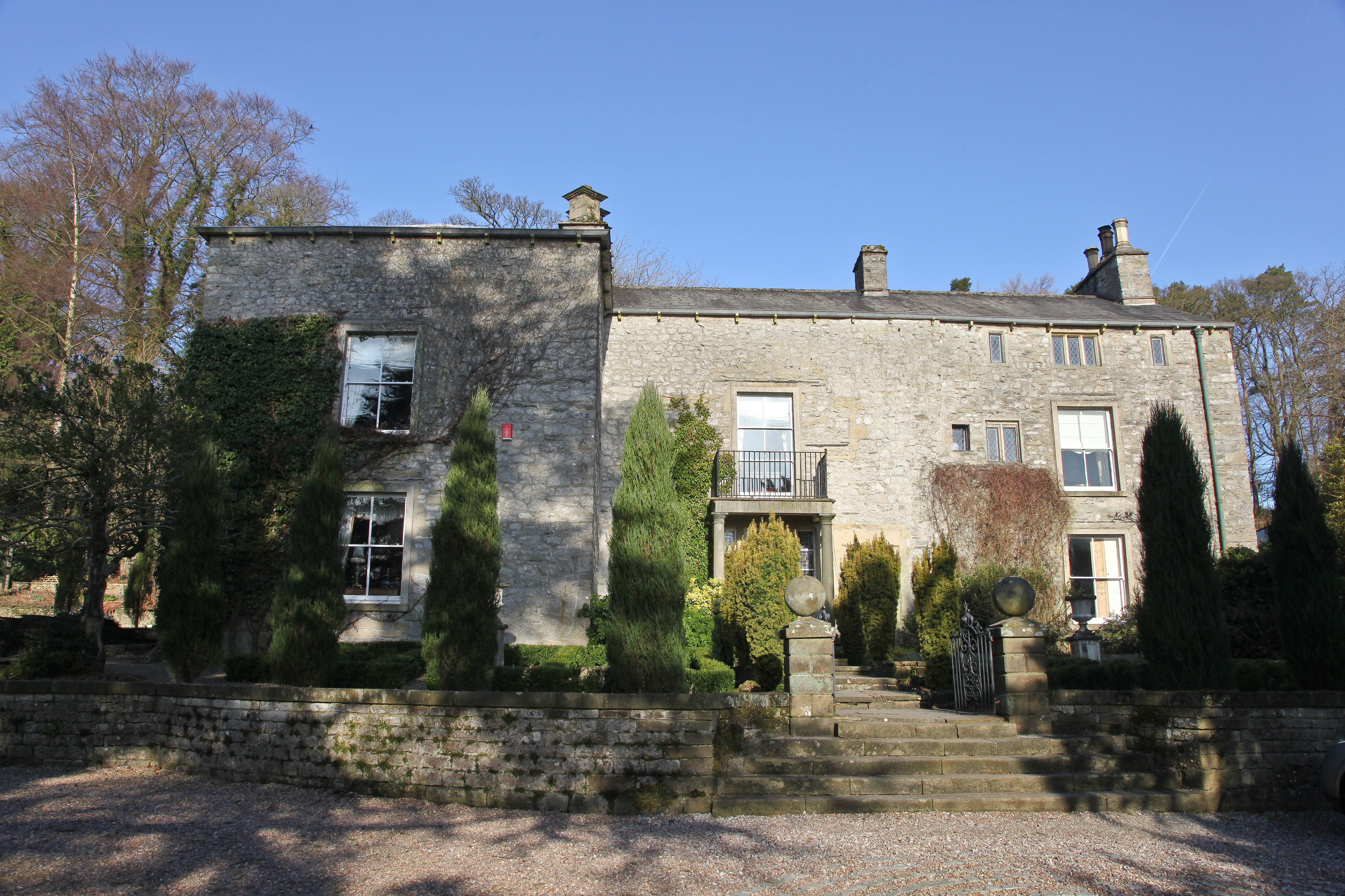
Austwick Hall

Austwick Hall is an historic manor house situated above the village of Austwick in North Yorkshire, England. The house is a Grade II listed building and...
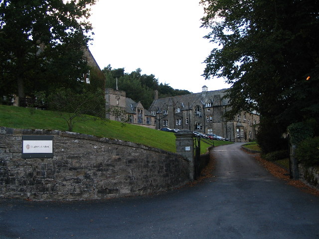
Giggleswick School

Giggleswick School is a public school (English private boarding and day school) in Giggleswick, near Settle, North Yorkshire, England. == Early school... ==

Giggleswick railway station

Giggleswick is a railway station on the Bentham Line, which runs between Leeds and Morecambe via Skipton. The station, situated 41+1⁄4 miles (66 km) north...

Giggleswick

Giggleswick, a village and civil parish in the Craven district of North Yorkshire, England, lies on the B6480 road, less than 1 mile (1.6 km) north-west...

Related Videos

Yorkshire Dales Walks. Feizor 6 mile circular via Dead Man's Cave

A circular walk through Feizor and little Stainforth taking in views of Pen Y Ghent and ending in some rock climbing at Giggleswick ...
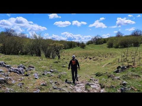
Feizor Woods walk

a walk around Feizor and Giggleswick Scar region, explored two caves .. Gully Cave and Spider Cave, then continuing towards ...

Smearsett Scar & Feizor Ramble.

A glorious 6 mile walk on a glorious high summer day. We heartily recommend Elaine's Tea Room upon reaching Feizor.

Cycling to Elaine's Tearooms in the Yorkshire Dales. I'm a cyclist and I live in the Pennines

On today's ride we were invited out by Gary Smith who is a viewer of the channel and a relatively local rider to us in the Pennines, ...

Nearby Amenities

Located within 500m of 54.084715,-2.3439208
The data included in this document is from www.openstreetmap.org. The data is made available under ODbL.

Have you been to Lawkland Hall Wood?

Leave your review of Lawkland Hall Wood below (or comments, questions and feedback).