Craichie

Settlement in Angus

Scotland

Craichie

Angus farmland from near Lownie Looking south over cereal stubble and potatoes still to be lifted.
Angus farmland from near Lownie Credit: M J Richardson

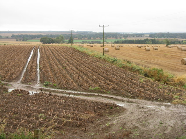
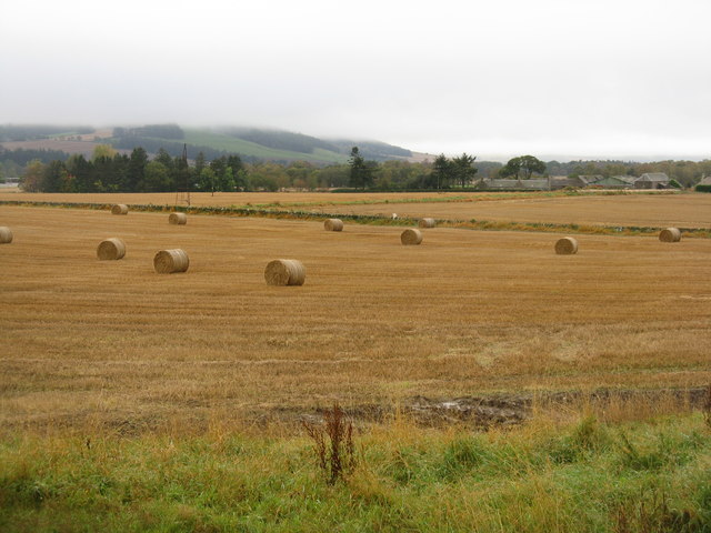
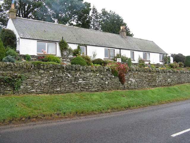
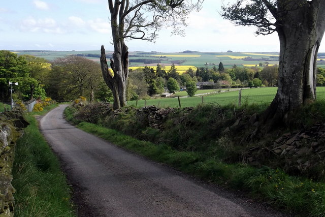
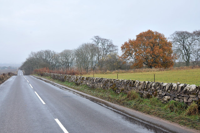
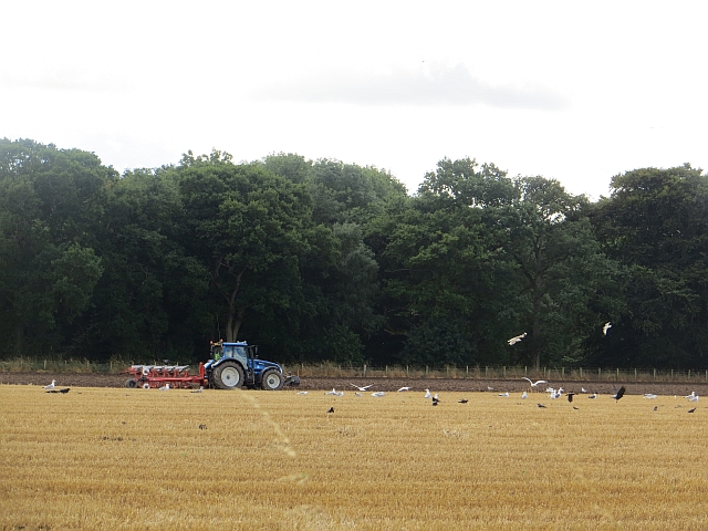
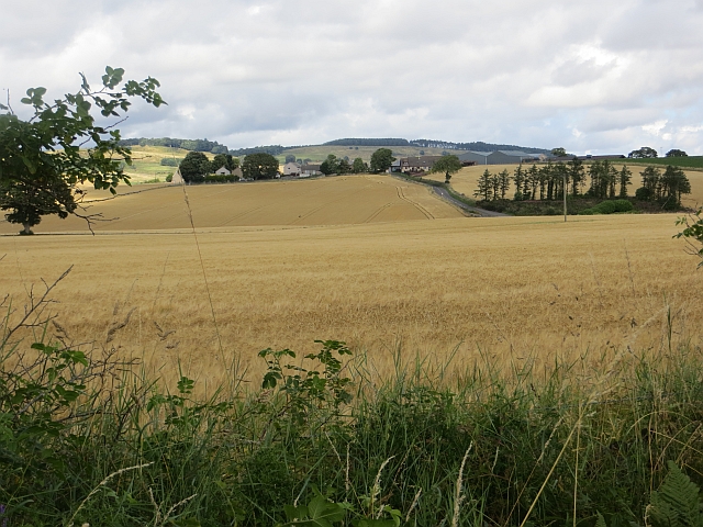
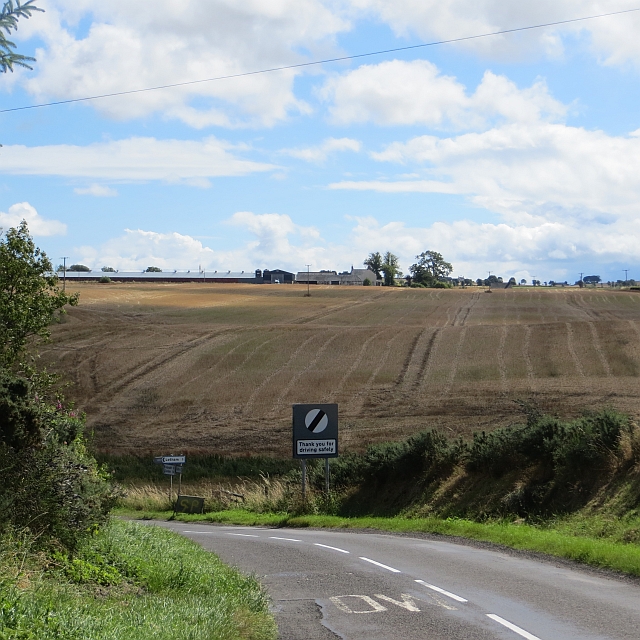
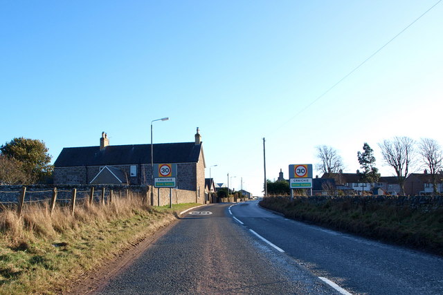
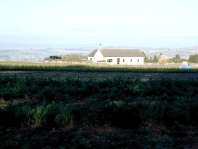
Craichie is a picturesque village located in Angus, Scotland. Situated about 4 miles southwest of Forfar, it is nestled amidst rolling hills and fertile farmland. With a population of around 250 residents, Craichie exudes a charming and tranquil ambiance that attracts visitors seeking a peaceful retreat.

The village is renowned for its stunning natural beauty. Surrounded by lush greenery and scenic landscapes, it offers breathtaking views of the Angus countryside. The area is dotted with numerous walking trails, making it a popular destination for hikers and nature enthusiasts. Visitors can enjoy leisurely strolls or more challenging hikes, taking in the fresh air and captivating scenery along the way.

In addition to the natural attractions, Craichie boasts a rich historical heritage. The village is home to several well-preserved ancient sites, including standing stones and burial cairns, which provide a glimpse into the region's past. History enthusiasts can explore these archaeological wonders and immerse themselves in the stories of the area's ancestors.

Although Craichie is a small village, it offers some amenities to cater to residents and visitors. There is a local pub where people can gather for a drink or a meal, providing a cozy and friendly atmosphere. Additionally, nearby Forfar offers a wider range of amenities, including shops, restaurants, and leisure facilities.

Overall, Craichie is a hidden gem in Angus, offering a peaceful escape from the bustling city life. With its natural beauty and historical significance, it is a place that appeals to those seeking tranquility and an appreciation for Scotland's rich heritage.

If you have any feedback on the listing, please let us know in the comments section below.

Craichie Images

Images are sourced within 2km of 56.614674/-2.811137 or Grid Reference NO5047. Thanks to Geograph Open Source API. All images are credited.

Angus farmland from near Lownie Looking south over cereal stubble and potatoes still to be lifted.
Angus farmland from near Lownie
Looking south over cereal stubble and potatoes still to be lifted.
Lownie Moor Angus farmland, looking southeast over stubbles towards Cotton of Lownie, and Fothringham Hill in low cloud.
Lownie Moor
Angus farmland, looking southeast over stubbles towards Cotton of Lownie, and Fothringham Hill in low cloud.
House at Lownie Hill On the road from Forfar to Dunnichen.
House at Lownie Hill
On the road from Forfar to Dunnichen.
View toward Tulloes from Dunnichen Hill near Letham, Angus I was intrigued by the greenery and patchwork effect of the oilseed rape crops.
View toward Tulloes from Dunnichen Hill near Letham, Angus
I was intrigued by the greenery and patchwork effect of the oilseed rape crops.
View of Letham, Angus and beyond from Dunnichen Hill The view shows the oilseed rape crops blooming, Letham Village and a reservoir in the foreground. Part of the road from Burnside Home Farm to Dunnichen Village can also be seen.
View of Letham, Angus and beyond from Dunnichen Hill
The view shows the oilseed rape crops blooming, Letham Village and a reservoir in the foreground. Part of the road from Burnside Home Farm to Dunnichen Village can also be seen.
Unclassified road near Tulloes
Road near Bractullo Mill
Grass field, Lour This field  was once larger before the railway was driven through it. The surrounding of trees predates the Dundee and Forfar Direct Line.
Grass field, Lour
This field was once larger before the railway was driven through it. The surrounding of trees predates the Dundee and Forfar Direct Line.
Dundee and Forfar Direct Line The trackbed is now wooded. The railway closed to passengers in 1955 and the tracks lifted in 1967 during the running down of freight services by British Rail.
Dundee and Forfar Direct Line
The trackbed is now wooded. The railway closed to passengers in 1955 and the tracks lifted in 1967 during the running down of freight services by British Rail.
Ploughing Nearby some spring crops are still green, but this field has been harvested and will soon be planted with winter cereals. Gibbs Wood in the background.
Ploughing
Nearby some spring crops are still green, but this field has been harvested and will soon be planted with winter cereals. Gibbs Wood in the background.
Barley, Craichie
Barley, Craichie
Milestone, Craichie On a road between Forfar (4) and Carnoustie (9½). Technically a milepost.
Milestone, Craichie
On a road between Forfar (4) and Carnoustie (9½). Technically a milepost.
Barley, Craichie
Barley, Craichie
Wheat, Dunnichen Under Dunnichen Hill.
Wheat, Dunnichen
Under Dunnichen Hill.
Bowriefauld The telephone box was still operational.
Bowriefauld
The telephone box was still operational.
Bowriefauld
Bowriefauld
Bractullo Across the Cur Den towards a stubble field.
Bractullo
Across the Cur Den towards a stubble field.
Cattle, Cur Den
Cattle, Cur Den
Show me another place!

Craichie is located at Grid Ref: NO5047 (Lat: 56.614674, Lng: -2.811137)

Unitary Authority: Angus

Police Authority: Tayside

What 3 Words

///deflated.corals.spared. Near Letham, Angus

Nearby Locations

Craichie

Related Wikis

Craichie

Craichie (Scots pronunciation: [ˈkrexe]) is a hamlet in the parish of Dunnichen, Angus, Scotland. Craichie is three miles south-east of Forfar and two...

Bowriefauld

Bowriefauld is a village in Angus, Scotland.

Dunnichen

Dunnichen (Scots pronunciation: [dəˈnɪxən]; Scottish Gaelic: Dùn Eachain) is a small village in Angus, Scotland, situated between Letham and Forfar. It...

Kingsmuir railway station

Kingsmuir railway station served the village of Kingsmuir, Angus, Scotland, from 1870 to 1955 on the Dundee and Forfar direct line. == History == The station...

Letham, Angus

Letham (Scots pronunciation: [ˈlɛθəm]) is a village in Angus, Scotland. Letham is the largest village in Angus, with a population of nearly 2,000. Situated...

Kingsmuir

Kingsmuir is a small village in Angus, one mile south-east of Forfar on the B9128 Carnoustie to Forfar road. == References ==

Caldhame

Caldhame is a village in Angus, Scotland. It lies approximately 1 mile to the south of Forfar. == References ==

Kirkbuddo railway station

Kirkbuddo railway station served the village of Kirkbuddo, Angus, Scotland, from 1870 to 1955 on the Dundee and Forfar direct line. == History == The station...

Nearby Amenities

Located within 500m of 56.614674,-2.811137
Bus Stop
High Rigg
Bench: no
Covered: no
Local Ref: opp
Naptan AtcoCode: 6490IM225
Naptan Bearing: NW
Naptan BusStopType: CUS
Naptan CommonName: High Rigg
Naptan Indicator: opp
Naptan Landmark: Shelter
Naptan NaptanCode: 26423973
Naptan Street: B9128
Naptan Verified: no
Operator: Stagecoach
Shelter: no
Source: naptan_import
Lat/Long: 56.6151171/-2.8122492
Bus Stop
High Rigg
Bench: yes
Covered: yes
Local Ref: at
Naptan AtcoCode: 6490IM444
Naptan Bearing: SE
Naptan CommonName: High Rigg
Naptan Indicator: at
Naptan Landmark: Shelter
Naptan NaptanCode: 26423972
Naptan Street: B9128
Naptan Verified: no
Operator: Stagecoach
Shelter: yes
Source: naptan_import
Lat/Long: 56.6149749/-2.8120857
Craichie
Traffic Sign: city_limit
Traffic Sign Direction: backward
Lat/Long: 56.6138439/-2.8111735
Craichie
Is In: Angus, Scotland, UK
Name Gd: Craichidh
Old Name: Craquhy;Old Craichie
Place: village
Wikidata: Q5180645
Wikipedia: en:Craichie
Lat/Long: 56.6146289/-2.8112338
Post Box
Collection Times: Mo-Fr 14:00; Sa 11:30
Operator: Royal Mail
Operator Wikidata: Q638098
Post Box Design: waggon_top
Post Box Type: lamp
Ref: DD8 12
Royal Cypher: GVIR
Royal Cypher Wikidata: Q33102169
Lat/Long: 56.6147955/-2.8107993
Give Way
Direction: forward
Lat/Long: 56.6146373/-2.8110256
Entrance: yes
Lat/Long: 56.6146367/-2.8114751
Entrance: yes
Lat/Long: 56.6146282/-2.8115982
Entrance: yes
Lat/Long: 56.6145414/-2.8118576
Entrance: yes
Lat/Long: 56.6144227/-2.811948
Addr City: Forfar
Addr Housename: Four Strong Winds
Addr Housenumber: 5
Addr Postcode: DD8 2DR
Addr Street: High Rigg
Addr Village: Craichie
Lat/Long: 56.6142947/-2.8124706
Addr City: Forfar
Addr Housenumber: 6
Addr Postcode: DD8 2DR
Addr Street: High Rigg
Addr Village: Craichie
Lat/Long: 56.6143474/-2.8124553
Addr City: Forfar
Addr Housenumber: 7
Addr Postcode: DD8 2DR
Addr Street: High Rigg
Addr Village: Craichie
Lat/Long: 56.6143918/-2.8124461
Addr City: Forfar
Addr Housenumber: 8
Addr Postcode: DD8 2DR
Addr Street: High Rigg
Addr Village: Craichie
Lat/Long: 56.614449/-2.8124341
Addr City: Forfar
Addr Housenumber: 9
Addr Postcode: DD8 2DR
Addr Street: High Rigg
Addr Village: Craichie
Lat/Long: 56.6145242/-2.8122684
Addr City: Forfar
Addr Housenumber: 10
Addr Postcode: DD8 2DR
Addr Street: High Rigg
Addr Village: Craichie
Lat/Long: 56.6145758/-2.8122579
Addr City: Forfar
Addr Housenumber: 11
Addr Postcode: DD8 2DR
Addr Street: High Rigg
Addr Village: Craichie
Lat/Long: 56.6146274/-2.8122468
Addr City: Forfar
Addr Housenumber: 12
Addr Postcode: DD8 2DR
Addr Street: High Rigg
Addr Village: Craichie
Lat/Long: 56.6147037/-2.8120822
Addr City: Forfar
Addr Housenumber: 13
Addr Postcode: DD8 2DR
Addr Street: High Rigg
Addr Village: Craichie
Lat/Long: 56.6147439/-2.8120726
Addr City: Forfar
Addr Housenumber: 14
Addr Postcode: DD8 2DR
Addr Street: High Rigg
Addr Village: Craichie
Lat/Long: 56.6147943/-2.8120651
Playground: climbingframe
Lat/Long: 56.6140504/-2.8125421
Baby: no
Playground: swing
Lat/Long: 56.6141212/-2.8126843
Playground: slide
Lat/Long: 56.6141803/-2.8128613
Baby: yes
Playground: swing
Lat/Long: 56.6140578/-2.8127299
Information: guidepost
Tourism: information
Lat/Long: 56.6146843/-2.8110463
Information: guidepost
Tourism: information
Lat/Long: 56.6145533/-2.8112045
Craichie
Traffic Sign: city_limit
Traffic Sign Direction: forward
Lat/Long: 56.6154005/-2.8131896
Street Lamp
Lat/Long: 56.6150659/-2.8120958
Street Lamp
Lat/Long: 56.6149063/-2.8119047
Street Lamp
Lat/Long: 56.6149061/-2.8116452
Street Lamp
Lat/Long: 56.614715/-2.8118008
Grit Bin
Lat/Long: 56.6147362/-2.8117231
Street Lamp
Lat/Long: 56.6145368/-2.8121253
Street Lamp
Lat/Long: 56.6143099/-2.8123838
Street Lamp
Lat/Long: 56.6147516/-2.8112398
Street Lamp
Lat/Long: 56.6145494/-2.8112278
Street Lamp
Lat/Long: 56.6144588/-2.8110078
Street Lamp
Lat/Long: 56.6146741/-2.8108
Street Lamp
Lat/Long: 56.6148806/-2.8105177
Street Lamp
Lat/Long: 56.6150494/-2.8098706
Street Lamp
Lat/Long: 56.6152569/-2.8095729
Street Lamp
Lat/Long: 56.6142149/-2.811203
Street Lamp
Lat/Long: 56.6139399/-2.8111124
Alliance Security Systems
Addr City: Forfar
Addr Housename: Auld Craichie Inn
Addr Place: Craichie
Addr Postcode: DD8 2LU
Alt Name: Alliance Electrical Services
Craft: electrician
Email: office@alliance-electrical.co.uk
Phone: +44 1307 819 000
Website: https://www.alliance-electrical.co.uk/
Lat/Long: 56.6143635/-2.8109085
Power: pole
Lat/Long: 56.6145926/-2.8109475
Power: pole
Lat/Long: 56.6143625/-2.810337
Power: pole
Lat/Long: 56.6141128/-2.8096931
Power: pole
Lat/Long: 56.6143291/-2.808309
Power: pole
Lat/Long: 56.6145224/-2.8071131
Power: pole
Lat/Long: 56.6147226/-2.8058566
Power: pole
Lat/Long: 56.6149043/-2.804736
Power: pole
Lat/Long: 56.6150873/-2.803607
The data included in this document is from www.openstreetmap.org. The data is made available under ODbL.

Have you been to Craichie?

Leave your review of Craichie below (or comments, questions and feedback).